geo.wikisort.org - Mountains
Kinder Scout is a moorland plateau and national nature reserve[4] in the Dark Peak of the Derbyshire Peak District in England. Part of the moor, at 636 metres (2,087 ft) above sea level, is the highest point in the Peak District, the highest point in Derbyshire, and the highest point in the East Midlands.[1] This summit is sometimes simply called the Peak.[5] In excellent weather conditions the city of Manchester and the Greater Manchester conurbation can be seen, as well as Winter Hill near Bolton, and the mountains of Snowdonia in North Wales.
| Kinder Scout | |
|---|---|
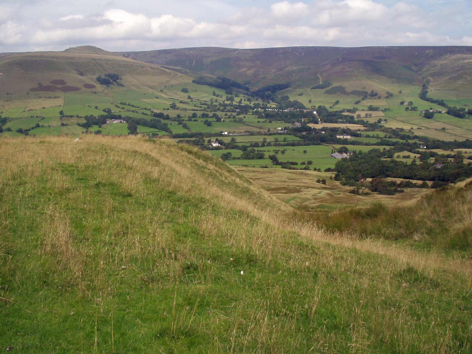 The Kinder plateau seen from the south | |
| Highest point | |
| Elevation | 636 m (2,087 ft)[1][2] |
| Prominence | 496.6 m (1,629 ft)[3] |
| Parent peak | Cross Fell |
| Listing | Marilyn, Hewitt, Hardy, county top, Nuttall |
| Coordinates | 53°23′0″N 1°52′2″W |
| Naming | |
| Language of name | Old Norse |
| Pronunciation | /ˈkɪndər ˈskaʊt/ |
| Geography | |
 Kinder Scout Location of Kinder Scout in Derbyshire | |
| Location | Derbyshire, England |
| Parent range | Peak District |
| OS grid | SK084875 |
| Topo map | OS Landranger 110 |
To the north across the Snake Pass lie the high moors of Bleaklow and Black Hill, which are of similar elevation.
Kinder Scout featured on the BBC television programme Seven Natural Wonders (2005) as one of the wonders of the Midlands, though it is considered by many to be in Northern England, lying between the cities of Manchester and Sheffield. In chronostratigraphy, the British sub-stage of the Carboniferous period, the "Kinderscoutian", derives its name from Kinder Scout.
Etymology
The name "Kinder" was first recorded in the Domesday Survey of 1086 as Chendre,[6] and is of obscure meaning.[7] It is believed to be pre-English in origin.[7] "Scout" is an old word for a high, overhanging rock (derived from the Norse skúte),[8] and refers to the cliffs on the western side of the plateau.[7]
Public access
Kinder Scout is accessible from the villages of Hayfield and Edale in the High Peak of Derbyshire. It is a popular hiking location and the Pennine Way crosses Kinder Scout and the moors to the north. This has resulted in the erosion of the underlying peat, prompting work by Derbyshire County Council and the Peak District National Park Authority to repair it, in conjunction with the landowner, the National Trust.[9] The Four Inns Walk, a competitive hiking event crosses over Kinder Scout.
The plateau was the location of the mass trespass in 1932. From the National Park's inception, a large area of the high moorland north of Edale was designated as 'Open Country'. In 2003, the "right to roam" on uncultivated land was enshrined into law, and this area of open country has been significantly extended.
Parts of the Kinder Scout plateau (except legal rights of way) are still occasionally closed for conservation, public safety, grouse shooting or fire prevention reasons, but prior notice is generally given on the Peak District National Park Authority's website.[10]
Landmarks
Kinder Downfall
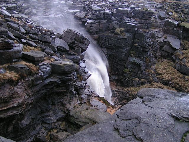
Kinder Downfall is the tallest waterfall in the Peak District, with a 30-metre fall. It lies on the River Kinder, where it flows west over one of the gritstone cliffs on the plateau edge. Although usually little more than a trickle in summer, in spate conditions it is impressive. In certain wind conditions (notably when there is a strong westerly wind), the water is blown back on itself, and the resulting cloud of spray can be seen from several miles away. In cold winters the waterfall freezes providing local mountaineers with an icy challenge that can be climbed with ice axes, ropes and crampons. Below the Downfall the River Kinder flows into Kinder Reservoir.

The gritstone edges
Some of Kinder's many gritstone cliffs were featured in the first rock-climbing guide to the Peak District, Some Gritstone Climbs, published in 1913 and written by John Laycock.
Edale Cross

The Edale Cross lies immediately south of Kinder Scout, under Kinder Low and on the former Hayfield to Edale road. It marks the former junction of the three wards of the Forest of Peak: Glossop and Longdendale, Hopedale and Campagna. The first cross on the site may have been set up by the Abbots of Basingwerk Abbey to mark the southern boundary of their land, granted in 1157. The date of the current cross is unknown, although an adjoining plaque[11] and its listing as a Scheduled Monument[12] date it to the mediaeval period. At some point it fell down, and was re-erected in 1810, when the date and initials JG, WD, GH, JH and JS were carved into it. These stand for John Gee, William Drinkwater, George and Joseph Hadfield and John Shirt, local farmers of the day who raised the cross.[13]
Mermaid's Pool
Mermaid's Pool, a small pool below Kinder Downfall, is said, according to legend, to be inhabited by a mermaid who will grant immortality upon whoever sees her on Easter Eve.[14]
Kinder Low
Kinder Low at 633 metres (2,077 ft) above sea level is a subsidiary summit at the south west corner of the plateau. Surmounted by a trig point and with steep slopes to south and west it is often mistaken as the highest point. The true summit, which is 3 metres (9.8 ft) higher, is an unmarked point on the flat plateau 900 metres (3,000 ft) to the north east.[15] Low is an old dialect word meaning 'hill top'.
Kinderlow bowl barrow
A bowl barrow, thought to be unexcavated and to date from the Bronze Age, stands on Kinder Low, a western projection of the main massif above Hayfield.[16]
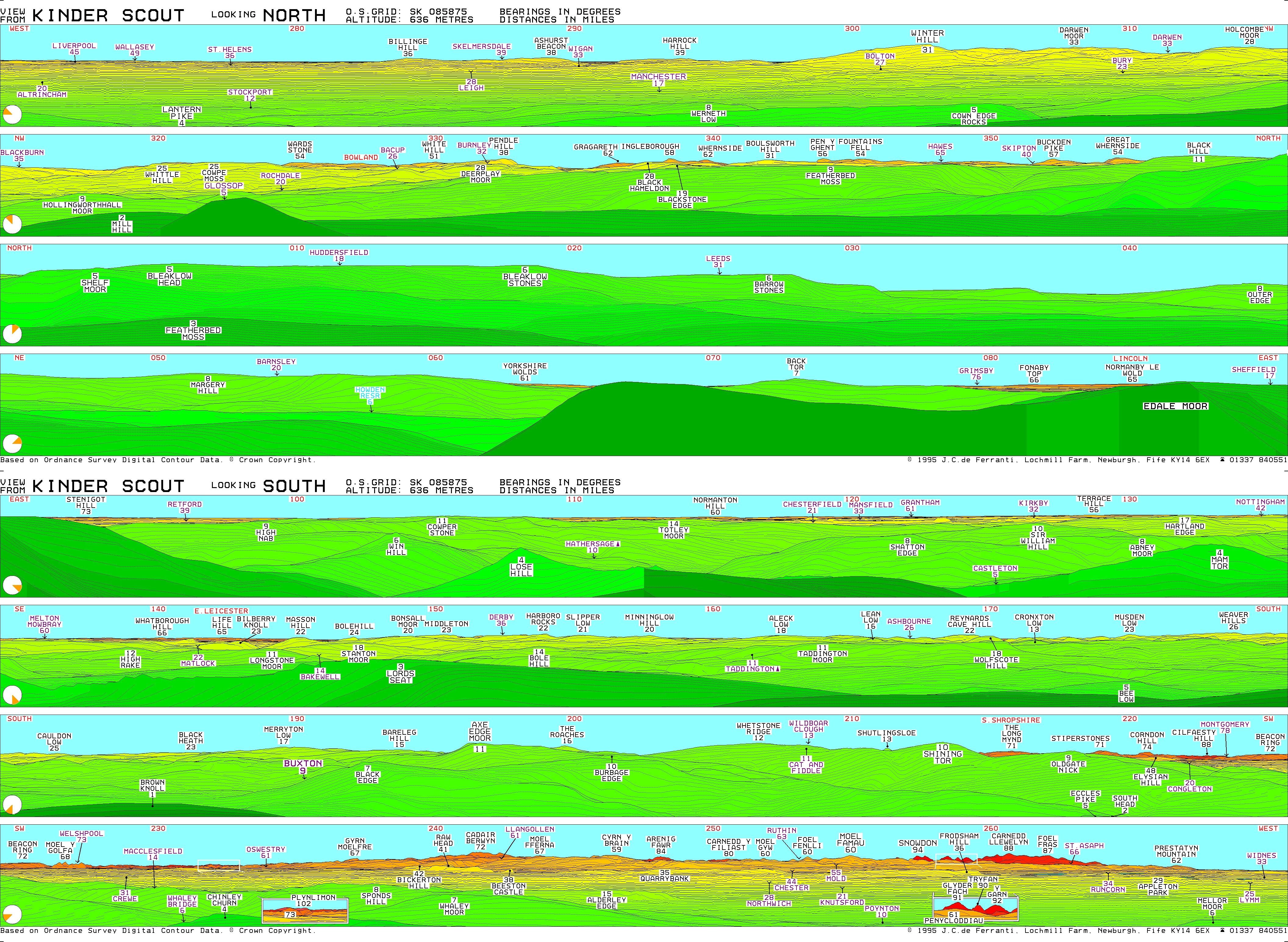
View
Major English and Welsh peaks visible (in ideal conditions) from Kinder Scout include (clockwise from west) Winter Hill (50 km, 31 mi), Pendle Hill (61 km, 38 mi), Ingleborough (93 km, 58 mi), Whernside (100 km, 62 mi), Pen-y-ghent (90 km, 56 mi), Fountains Fell (87 km, 54 mi), Buckden Pike (92 km, 57 mi), Great Whernside (87 km, 54 mi), Bleaklow (8 km, 5 mi), Margery Hill (13 km, 8 mi), the Weaver Hills (42 km, 26 mi), Axe Edge (18 km, 11 mi), The Roaches (26 km, 16 mi), Shutlingsloe (21 km, 13 mi), Shining Tor (16 km, 10 mi), the Long Mynd (114 km, 71 mi), Stiperstones (114 km, 71 mi), Corndon Hill (119 km, 74 mi), Cilfaesty Hill (142 km, 88 mi), Moel y Golfa (109 km, 68 mi), Plynlimon (164 km, 102 mi), Cadair Berwyn (116 km, 72 mi), Beeston Castle (61 km, 38 mi), Alderley Edge (24 km, 15 mi), Arenig Fawr (135 km, 84 mi), Moel Famau (97 km, 60 mi), Snowdon (151 km, 94 mi), Glyder Fach (146 km, 91 mi), Tryfan (145 km, 90 mi), Y Garn (148 km, 92 mi), Carnedd Llewelyn (142 km, 88 mi) and Foel-fras (140 km, 87 mi).[17]
Tone poem
The orchestral sketch Kinder Scout was composed by Patrick Hadley, written for the Buxton Spa Orchestra and its occasional director George Cathie. It was first performed in Buxton in September 1923. Hadley had an emotional attachment to the Derbyshire peaks, which are also celebrated in his later cantata The Hills (1943).[18]
See also
- Pennines
- Rambling
References
- Bathurst, David (2012). Walking the county high points of England. Chichester: Summersdale. pp. 234–241. ISBN 978-1-84-953239-6.
- Nuttall, J.; Nuttall, A. (1990). The Mountains of England & Wales – Volume 2: England. Milnthorpe: Cicerone. ISBN 1-85284-037-4. Retrieved 23 August 2009.
- Kinder Scout at www.hill-bagging.co.uk. Retrieved 11 March 2016.
- Anon. "Kinder Scout NNR". Natural England:Our work. Natural England. Retrieved 1 August 2014.
-
Bartholomew, John (1887). "Diagram Showing Comparative Heights of Mountains, Places, etc. in the British Isles". Gazetteer of the British Isles, statistical and topographical. Edinburgh: Adam and Charles Black. Plate 2 after text.
- "Review of The Scenery and Geology of the Peak of Derbyshire by Elizabeth Dale". Nature. 63 (1621): 80. November 1900. doi:10.1038/063080a0. ISSN 1476-4687. S2CID 26892266. Retrieved 4 April 2022.
- Robertson, Jake. "The Summit of Kinder Scout via The Cloughs — Peak District Walk". Walking Britain. Retrieved 4 April 2022.
- Ekwall, Eilert (1947). The Concise Oxford Dictionary of English Place-Names. Oxford: Clarendon Press. p. 264.
- Hey, David (2011). "Kinder Scout and the legend of the Mass Trespass" (PDF). Agricultural History Review. 59 (2): 199.
- "Scout". Oxford English Dictionary (Online ed.). Oxford University Press. (Subscription or participating institution membership required.)
- Peak District National Park Authority, Landscape Strategy and Action Plan, September 2009 (section on Dark Peak)
- "Access land restrictions". www.peakdistrict.gov.uk. Peak District National Park Authority. Retrieved 31 January 2017.
- Bennet, Roger (Winter 2019). "Edale Cross". Peak & Northern Footpaths Society. Signpost 63 (Winter 2019). Retrieved 16 December 2019.
- Historic England. "Wayside and boundary cross known as Edale Cross (1008615)". National Heritage List for England. Retrieved 16 December 2019.
- Sharpe, Neville T. (2002). Crosses of the Peak District. Landmark Collectors Library. ISBN 978-1843060444.
- Hope, Robert Charles (1893). The Legendary Lore of the Holy Wells of England. London: Elliot Stock.
- "TP4216 - Kinder Low". Hill Explorer. Hill Explorer. Retrieved 5 December 2020.
- Historic England. "Kinderlow bowl barrow (1008068)". National Heritage List for England. Retrieved 16 December 2019.
- de Ferranti, J. C. (1995). "View from Kinder Scout". viewfinderpanoramas.org. Retrieved 10 August 2016.
- Foreman, Lewis. Notes to British Tone Poems, Volume 2, Chandos Records (2019)
Bibliography
- Douglas, Ed; Beatty, John (2018). Kinder Scout: The People's Mountain (1st ed.). Vertebrate Publishing. ISBN 978-1911342502.
- Smith, Roly, ed. (2001). Kinder Scout: Portrait of a Mountain (1st ed.). Derbyshire County Council Libraries and Heritage Department. ISBN 0903463687.
Picture gallery
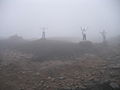 Poor visibility near the summit
 Kinder Downfall
 Kinder Downfall in strong westerly wind
 Head of Grindsbrook
 Panoramic view over Kinder Reservoir from Kinder
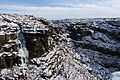 Ice climbers on Kinder Downfall
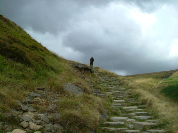
 Ascending Jacob's Ladder towards Kinder Low trigpoint
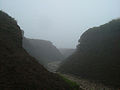 Hags and groughs on the Kinder plateau
 North flank of Kinder Scout taken from grid reference SK075900


External links
- Kinder Scout Computer-generated summit panoramas. Note: the panorama shown is not all visible from the summit. There is a large summit plateau; to see the entire panorama shown, it is necessary to walk around the summit but nearer the perimeter of the plateau.
Places of Interest in Derbyshire | ||
|---|---|---|
| Castles and military sites |
|  |
| Churches and religious sites |
| |
| Museums and cultural sites |
| |
| Natural landmarks and outdoor spaces |
| |
| Prehistoric landmarks |
| |
| Stately homes |
| |
| Transport and industry |
| |
| See also |
| |
Peaks of the Peak District of England | ||
|---|---|---|
| Marilyns | 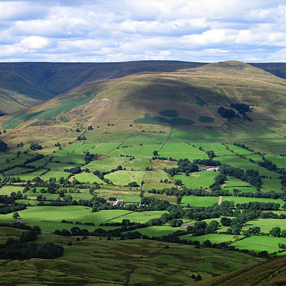 | |
| Other peaks |
| |
List of peaks of the Peak District | ||
Authority control | |
|---|---|
| General | |
| National libraries | |
На других языках
[de] Kinder Scout
Kinder Scout ist ein Berg und ein Plateau im Peak District und mit 636 Metern dessen höchster Punkt sowie der höchste Berg in Derbyshire und der gesamten East Midlands in England.- [en] Kinder Scout
[fr] Kinder Scout
Kinder Scout est un sommet du Royaume-Uni culminant à 636 mètres d'altitude dans la chaîne des Pennines, dans le comté de Derbyshire, dont il constitue le point culminant, en Angleterre. C'est également le plus haut sommet du Peak District. Il présente la forme d'un vaste plateau entouré de parois verticales d'où se précipitent quelques cascades. Prisé des randonneurs et des grimpeurs, il a joué un rôle important dans l'ouverture de droits de passage et la création de parcs nationaux en Angleterre. Il fait également partie d'une réserve de nature et de différentes zones protégées.Другой контент может иметь иную лицензию. Перед использованием материалов сайта WikiSort.org внимательно изучите правила лицензирования конкретных элементов наполнения сайта.
WikiSort.org - проект по пересортировке и дополнению контента Википедии