geo.wikisort.org - Mountains
Pumlumon (historically anglicised in various ways including Plynlimon, Plinlimon and Plinlimmon) is the highest point of the Cambrian Mountains in Wales (taking a restricted definition of the Cambrian Mountains, excluding Snowdonia, the Berwyns and the Brecon Beacons), and the highest point in Mid Wales. It is a massif that dominates the surrounding countryside and is the highest point (county top) of Ceredigion (both the modern council area, and the historic county, also known as Cardiganshire).
| Pen Pumlumon Fawr | |
|---|---|
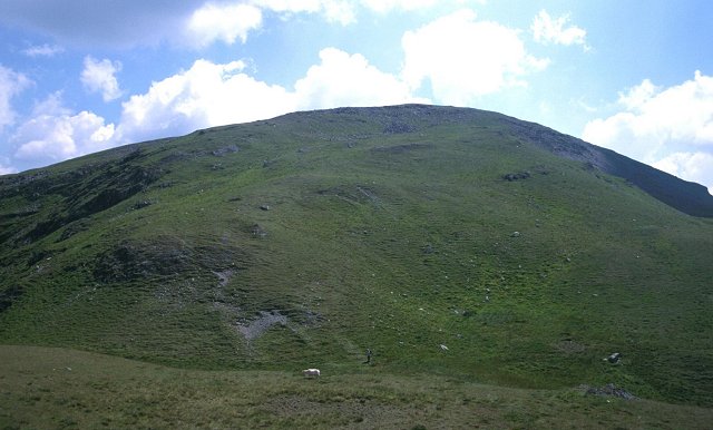 The northern slopes of Pumlumon Fawr | |
| Highest point | |
| Elevation | 752 m (2,467 ft) |
| Prominence | 526 m (1,726 ft) |
| Parent peak | Pen y Fan |
| Listing | Marilyn, Hewitt, Council top, Nuttall |
| Coordinates | 52.4675°N 3.7828°W |
| Naming | |
| English translation | five tops, five beacons |
| Language of name | Welsh |
| Pronunciation | Welsh: [ˈpɛn pɪmˈlɪmɔn ˈvauɾ] |
| Geography | |
| Location | Ceredigion, Wales |
| Parent range | Cambrian Mountains |
| OS grid | SN789869 |
| Topo map | OS Landranger 135 |
| Listed summits of Plynlimon | ||||
| Name | Grid ref | Height | Status | |
|---|---|---|---|---|
| Pen Pumlumon Arwystli | SN815877 | 741 m | Hewitt, Nuttall | |
| Pen Pumlumon Llygad-bychan | SN799871 | 727 m | Hewitt, Nuttall | |
| Y Garn | SN775851 | 684 m | Hewitt, Nuttall | |
| Pumlumon Fach | SN787874 | 664 m | Nuttall | |
| Pumlumon Cwmbiga | SN830899 | 620 m | Deleted Nuttall | |
| Carnfachbugeilyn | SN826903 | 622 m | Unclassified | |
The highest point of the massif itself is Pen Pumlumon Fawr, which is 752 metres (2,467 ft) above ordnance datum. Its other important peaks are Pen Pumlumon Arwystli, Y Garn, Pen Pumlumon Llygad-bychan and Pumlumon Fach.
The longest river in Britain, the River Severn, has its source on the mountain, as do the rivers Wye and Rheidol.
Folklore says there is a sleeping giant in Pumlumon.
Etymology
Plynlimon is anglicized from the Welsh name Pumlumon,[1] which is thought to mean "five tops" or "five beacons".[1][2] The first element is Old Welsh pimp, meaning "five" (Modern Welsh pump),[2] and the second is llumon, "beacon",[2] an element whose Brittonic equivalent underlies the Scottish hill-names Lomond Hills and Ben Lomond.[2][3]
Habitat
The Pumlumon area is the source of the rivers Wye, Severn and Rheidol. Since 2007 the Wildlife Trusts of Wales have been working to improve the habitat as a "living landscape" project. This watershed area has been affected by loss of biodiversity, erosion of the peaty soils' structure, and accelerated drainage.[4] Some believe the drainage issues have contributed significantly to flooding in areas some distance downstream, though this cannot be clearly proved.
Like most of the uplands across Wales, intensive land use activities have resulted in many habitats being either lost or degraded. Over-grazing of sheep has induced soil compaction, which has resulted in increased flooding of the lowland areas. The principal land cover within the project area is dominated by a complex mosaic of locally, nationally and internationally important habitats and species, such as dry and wet dwarf-shrub heathland, blanket bog, unimproved acid grassland and a number of oligotrophic lakes. Agriculturally improved grassland, broadleaved woodlands and forestry plantation are also characteristic features of the area.
The Pumlumon area is also important for breeding, wintering and feeding bird fauna particularly hen harrier, merlin, short-eared owl and red and black grouse, and a number of Red Data Book and UK BAP invertebrates.[5] The red kite also frequents the area. Golden plovers have declined by 92% since 1992.[6]
Severn Way
The Severn Way runs for 210 miles (337 km) along the River Severn between the mouth of the Severn at Bristol, England, and its source at Plynlimon, Wales.
References
- Cleare, John (1990). Fifty Best Hill Walks of Britain. Webb & Bower (Publishers) Limited. p. 117. ISBN 9780863504051. Retrieved 19 January 2019.
- "The place-names of England and Wales". Retrieved 17 July 2017.
- James, Alan. "A Guide to the Place-Name Evidence" (PDF). SPNS - The Brittonic Language in the Old North. Archived from the original (PDF) on 13 August 2017. Retrieved 25 November 2018.
- The Pumlumon Project, 'A pioneering, science-based project to revive the ecology and economy of the Welsh uplands', Montgomeryshire Wildlife Trust www.montwt.co.uk, accessed 14 April 2022
- Nuttall, John & Anne (1999). The Mountains of England & Wales - Volume 1: Wales (2nd edition ed). Milnthorpe, Cumbria: Cicerone Press. ISBN 1-85284-304-7.
- Crisis in the hills 22 June 2012 Birdguides www.birdguides.com, accessed 3 July 2021
External links
- Computer generated summit panoramas Plynlimon index
- THE PUMLUMON PROJECT, Montgomeryshire Wildlife Trust
- www.geograph.co.uk ; photos of Plynlimon and surrounding area
Authority control | |
|---|---|
| General |
|
| National libraries | |
На других языках
- [en] Plynlimon
[fr] Plynlimon
Le Plynlimon (nom anglicisé depuis le mot gallois « Pumlumon » qui signifie « cinq pics ») est une montagne du pays de Galles, qui s'élève à 752 m d'altitude. Elle constitue le point culminant de la partie centrale des monts Cambriens et domine la région du Ceredigion.Другой контент может иметь иную лицензию. Перед использованием материалов сайта WikiSort.org внимательно изучите правила лицензирования конкретных элементов наполнения сайта.
WikiSort.org - проект по пересортировке и дополнению контента Википедии