geo.wikisort.org - Mountains
Gun is a hill at the southern end of the Peak District, overlooking the town of Leek in the Staffordshire Moorlands. The hill is mainly moorland with some small wooded areas. Neighbouring peaks to the east are The Roaches, Hen Cloud and Ramshaw Rocks. It is a nature reserve of the Staffordshire Wildlife Trust.
| Gun | |
|---|---|
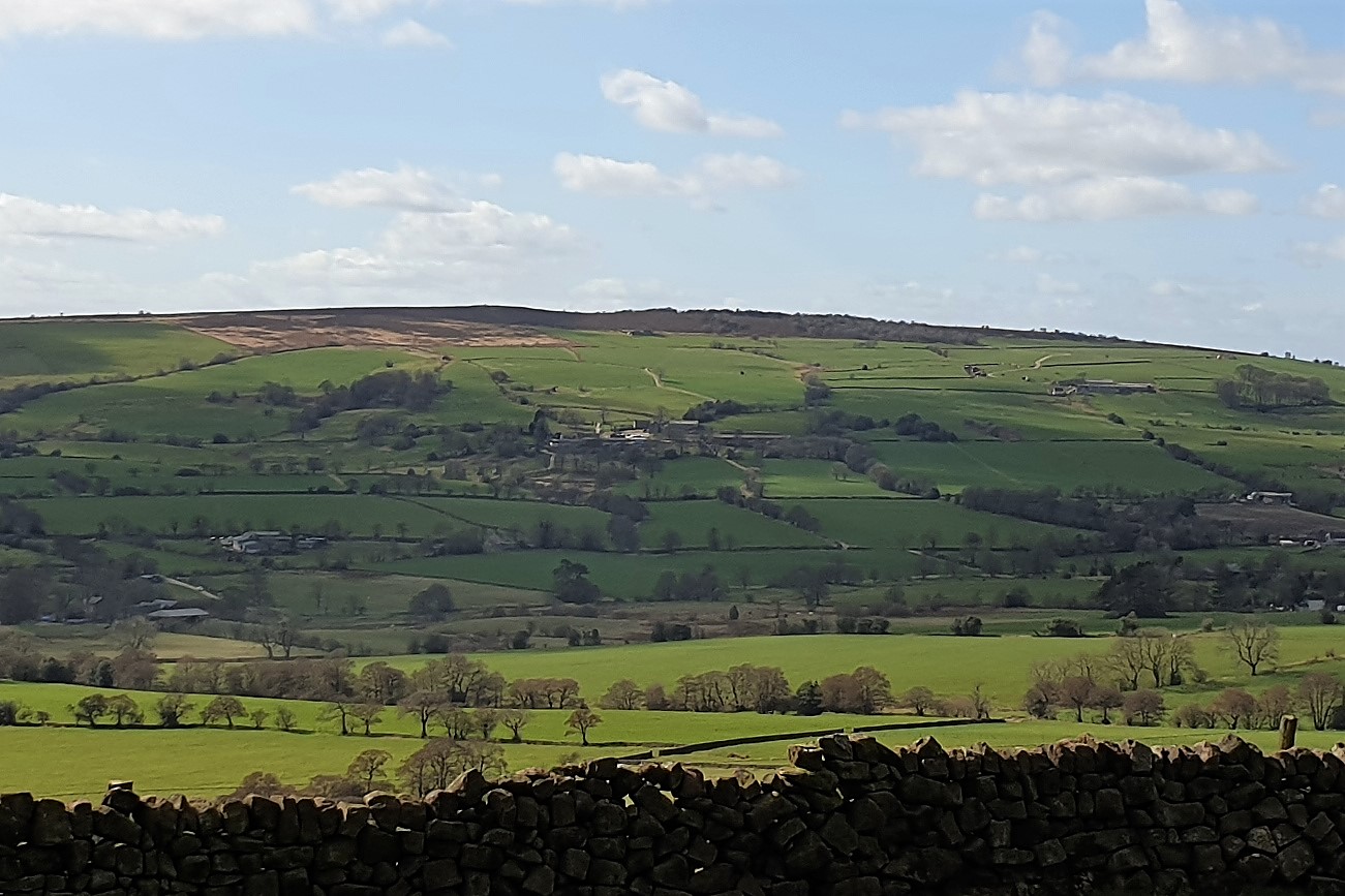 View from The Roaches | |
| Highest point | |
| Elevation | 385 m (1,263 ft) |
| Prominence | 168 m (551 ft) |
| Parent peak | Shining Tor |
| Listing | Marilyn |
| Coordinates | 53.150°N 2.046°W |
| Geography | |
| Location | Staffordshire, England |
| Parent range | Peak District |
| OS grid | SJ970615 |
| Topo map | OS Landranger 118 |
Description
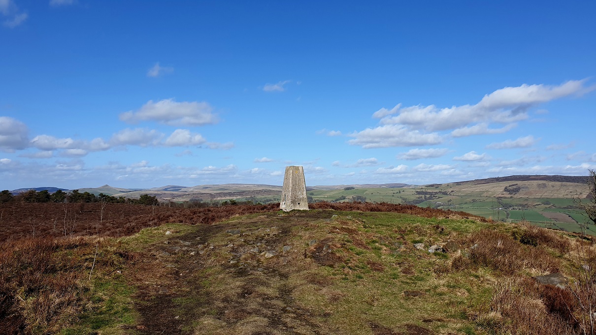
The hill has height 385 metres (1,263 ft), and there is a trig point at the summit. Having a prominence of 168 metres (551 ft), it is a Marilyn.[1]
Gun has the Summits on the Air reference G/SP-013.[2] The hill often features in the itinerary of the Tour of Britain cycle race.
Gun Moor
Gun Moor, area 78 hectares (190 acres), is a nature reserve of the Staffordshire Wildlife Trust. There is moorland, woodland and blanket bog. Uncommon species of bird such as lesser redpoll and cuckoo may be seen, and bog asphodel flowers in the summer. There is a circular walk, over hilly terrain, that takes 1½ to 2½ hours.[3][4]
Gun Moor was purchased when it came to the market in 2019. The Trust was aware that the moor was important and that it did not carry any protection; in order to secure the site, it was purchased by the Esmée Fairbairn Foundation, and the Trust agreed to buy the site within two years, at the original price. After donations from individuals and charitable trusts, this was achieved. Jeff Sim, Head of Nature Reserves and species recovery, said: "The habitat Gun Moor contains is what makes the Peak District Moors of international significance, so it is really important that the Trust was able to purchase and protect it."[4]
References
- "Gun" Hill Bagging. Retrieved 8 August 2021.
- "G/SP-013, Gun - 385m, 1 point" SOTA Summits. Retrieved 8 August 2021.
- "Gun Moor". Staffordshire Wildlife Trust. Retrieved 7 February 2022.
- "Trust secures future of Gun Moor". Staffordshire Wildlife Trust. Retrieved 7 February 2022.
Peaks of the Peak District of England | ||
|---|---|---|
| Marilyns |  | |
| Other peaks |
| |
List of peaks of the Peak District | ||
Другой контент может иметь иную лицензию. Перед использованием материалов сайта WikiSort.org внимательно изучите правила лицензирования конкретных элементов наполнения сайта.
WikiSort.org - проект по пересортировке и дополнению контента Википедии