geo.wikisort.org - Mountains
Kaʻala or Mount Kaʻala (pronounced [kəˈʔɐlə] in Hawaiian) is the highest mountain on the island of Oahu, at 1,227 metres (4,026 ft). It is a part of the Waianae Range, an eroded shield volcano on the west side of the island. The FAA maintains an active tracking station at the summit, which is closed to the general public and secured by the US Army which is stationed at the base of the mountain, at Schofield Barracks. The tracking station can be clearly seen from afar as a white domed shaped structure.
This article needs additional citations for verification. (March 2013) |
| Kaʻala | |
|---|---|
 Mt. Kaʻala, as seen from near Dole Plantation. | |
| Highest point | |
| Elevation | 4,025 ft (1,227 m)[1] |
| Prominence | 4,025 ft (1,227 m) |
| Coordinates | 21°30′25″N 158°08′34″W[2] |
| Naming | |
| Language of name | Hawaiian |
| Pronunciation | Hawaiian pronunciation: [kəˈʔɐlə] |
| Geography | |
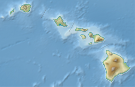 Kaʻala Hawaiian Islands | |
| Location | Oahu, Hawaii, US |
| Parent range | Waianae Range |
| Topo map | USGS Haleiwa |
| Geology | |
| Age of rock | 3.9 Ma |
| Mountain type | Plateau |
| Volcanic arc/belt | Hawaiian-Emperor seamount chain |
See also
- List of mountain peaks of the United States
- List of volcanoes of the United States
- Evolution of Hawaiian volcanoes
- Hawaii hotspot
- Hawaiian–Emperor seamount chain
References
- "Mt. Mount Ka'ala". Department of Forestry and Wildlife. State of Hawaii. Retrieved 2013-02-21.
- "Ka'ala". Geographic Names Information System. United States Geological Survey. Retrieved 2009-12-23.
Hawaiian volcanism topics (list) | ||
|---|---|---|
| Windward Isles |
| |
| Leeward Isles | ||
| Emperor Seamounts |
| |
| Notable eruptions and vents |
| |
| Topics |
| |
На других языках
[de] Kaʻala
Der Kaʻala ([.mw-parser-output .IPA a{text-decoration:none}kəˈʔɐlə]) ist die höchste Erhebung der Insel Oʻahu im Archipel von Hawaii. Er liegt zwischen den Orten Haleʻiwa und Waiʻanae.- [en] Kaʻala
[it] Monte Kaʻala
Il monte Kaʻala è il rilievo più elevato dell'isola di Oahu nell'arcipelago della Hawaii. Parte della catena dei Waiʻanae, relitto di un antico vulcano a scudo della parte occidentale dell'isola, la sua cima culmina a 1 227 metri s.l.m.[1]Текст в блоке "Читать" взят с сайта "Википедия" и доступен по лицензии Creative Commons Attribution-ShareAlike; в отдельных случаях могут действовать дополнительные условия.
Другой контент может иметь иную лицензию. Перед использованием материалов сайта WikiSort.org внимательно изучите правила лицензирования конкретных элементов наполнения сайта.
Другой контент может иметь иную лицензию. Перед использованием материалов сайта WikiSort.org внимательно изучите правила лицензирования конкретных элементов наполнения сайта.
2019-2026
WikiSort.org - проект по пересортировке и дополнению контента Википедии
WikiSort.org - проект по пересортировке и дополнению контента Википедии