geo.wikisort.org - Mountains
Ha Ling Peak is a peak at the northwestern end of Mount Lawrence Grassi — a mountain located immediately south of the town of Canmore just east of the Spray Lakes road in Alberta's Canadian Rockies. It was previously named Chinaman's Peak but the name was changed to be less offensive.[4] It was the subject of a 2018 CBC Documentary titled 'Ha Ling Peak' that follows the controversy and renaming of the mountain .[5]
| Ha Ling Peak | |
|---|---|
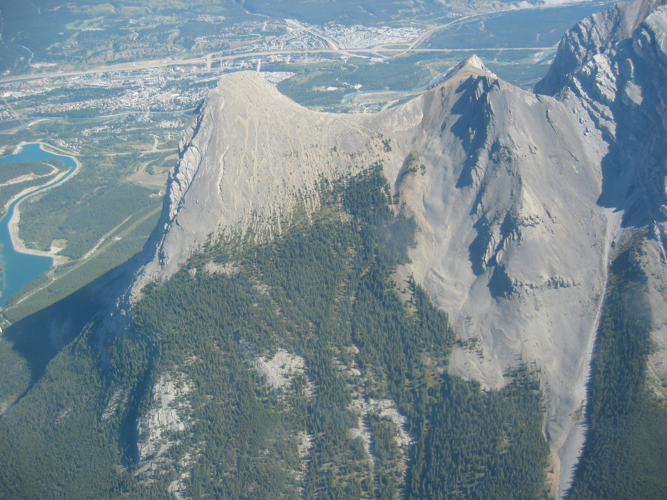 Ha Ling Peak (leftmost), Miner's Col (middle), a section of Mount Lawrence Grassi (rightmost), and the town of Canmore viewed from the south. (Sept. 2006) | |
| Highest point | |
| Elevation | 2,407 m (7,897 ft)[1] |
| Prominence | 31 m (102 ft)[2] |
| Listing | Mountains of Alberta |
| Coordinates | 51°03′51.6″N 115°23′57″W[2] |
| Geography | |
Ha Ling Peak Alberta, Canada | |
| Parent range | Canadian Rockies |
| Topo map | NTS 82O3 Canmore |
| Climbing | |
| Easiest route | easy scramble[3] |

Origin of the name
The name of the mountain has been subject to much controversy. Originally, the mountain was referred to locally as The Beehive.[6] In 1896 Ha Ling, a Chinese cook for the Canadian Pacific Railway (some say the Okaloosa Hotel in Canmore) was bet 50 dollars that he could not climb the peak and plant a flag on the summit in less than 10 hours. According to the Medicine Hat News of October 22, 1896, he started the ascent at 7:00 am the previous Saturday morning and was back in time for lunch. As nobody believed his story, he led a party of doubters to the summit where he planted a much larger flag beside the original, this one visible to the naked eye from Canmore. The townsfolk referred to the mountain as Chinaman's Peak in his honour.[7]
The name Chinaman's Peak did not become official until 1980.[4] Later, in 1997 it was renamed Ha Ling Peak as the term Chinaman was viewed as derogatory.[8]
Climbing routes
There is a hiking route up the south side.[3][1] On the north side there are several technical climbing routes up the face and a difficult scrambling route up Canmore Couloir, located between Mount Lawrence Grassi and Miner's Col.[9]
See also
- Canmore Museum and Geoscience Centre
- Chinaman (term)
- List of mountains in the Canadian Rockies
- Negro Mountain
References
- "Ha Ling Peak". PeakFinder.com. Retrieved 2009-01-02.
- "Ha Ling Peak". Bivouac.com. Retrieved 2009-01-02.
- Kane, Alan (1999). "Ha Ling Peak". Scrambles in the Canadian Rockies. Calgary: Rocky Mountain Books. pp. 81–82. ISBN 0-921102-67-4.
- "Peak of Controversy". Alberta Online Encyclopedia. Alberta Heritage. Retrieved 2009-01-02.
- Meuse, Matt (Aug 18, 2018). "What's in a name? The (mostly) true story of Ha Ling Peak". CBC.
- Holt, Faye Reineberg (2010). Canada's Rocky Mountains: A History in Photographs. Victoria, B.C.: Heritage House Publishing Co. p. 99. ISBN 978-1-894974-99-8. Retrieved 2019-06-23.
- "Ha Ling Peak". Trails.com. Archived from the original on 2007-09-29. Retrieved 2009-01-02.
- "World News Briefs; Alberta's New Name For Peak in Rockies". New York Times. July 9, 1998. Retrieved 2013-09-08.
{{cite web}}: CS1 maint: url-status (link) - "Some Ha-Ling climbing routes". rockclimbing.com. Retrieved 2009-01-02.
External links
- Scramble description from www.scrambling.ca
- "Ha Ling Peak". Peakware.com. Archived from the original on 2016-03-04.
- Ha Ling Peak Hiking Trail from hikealberta.com
Другой контент может иметь иную лицензию. Перед использованием материалов сайта WikiSort.org внимательно изучите правила лицензирования конкретных элементов наполнения сайта.
WikiSort.org - проект по пересортировке и дополнению контента Википедии