geo.wikisort.org - Mountains
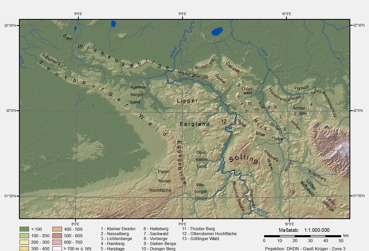
The Egge Hills (German: Eggegebirge, ![]() German pronunciation (help·info)), or just the Egge (die Egge) is a range of forested hills, up to 464 m above sea level (NN),[1] in the east of the German state of North Rhine-Westphalia.
German pronunciation (help·info)), or just the Egge (die Egge) is a range of forested hills, up to 464 m above sea level (NN),[1] in the east of the German state of North Rhine-Westphalia.
| Egge Hills (Eggegebirge) | |
|---|---|
 View from the Egge Tower on the Velmerstot looking south over the crest of the Egge Hills | |
| Highest point | |
| Peak | Preußische Velmerstot |
| Elevation | 468 m above NN |
| Dimensions | |
| Length | 50 km (31 mi) |
| Geography | |
| |
| Country | Germany |
| Region | Höxter, Paderborn, Lippe, North Rhine-Westphalia |
| Range coordinates | 51°44′00″N 8°58′00″E |
| Parent range | Lower Saxon Hills |
Geography
The Egge extends from the southern tip of the Teutoburg Forest range near Horn-Bad Meinberg and Steinheim, Westphalia southwards to the northern parts of the Sauerland near Marsberg. Its highest point is the Preußischer Velmerstot at an altitude of 468m. It is part of the Lower Saxon Hills and one of the two main lines of hills within the Teutoburg Forest / Egge Hills Nature Park.
It also constitutes part of the watershed between the rivers Rhine and Weser.
References
External links
![]() Media related to Egge Hills at Wikimedia Commons
Media related to Egge Hills at Wikimedia Commons

Authority control | |
|---|---|
| General |
|
| National libraries | |
This North Rhine-Westphalia location article is a stub. You can help Wikipedia by expanding it. |
На других языках
[de] Eggegebirge
Das Eggegebirge (auch kurz die Egge genannt) ist ein bis etwa 464 m ü. NHN[1] hoher Mittelgebirgszug des Niedersächsischen Berglandes in den Kreisen Höxter, Lippe und Paderborn im östlichen Nordrhein-Westfalen, Deutschland.- [en] Egge (Lower Saxon Hills)
Другой контент может иметь иную лицензию. Перед использованием материалов сайта WikiSort.org внимательно изучите правила лицензирования конкретных элементов наполнения сайта.
WikiSort.org - проект по пересортировке и дополнению контента Википедии