geo.wikisort.org - Mountains
The Auckland volcanic field is an area of monogenetic volcanoes covered by much of the metropolitan area of Auckland, New Zealand's largest city, located in the North Island. The approximately 53 volcanoes[1] in the field have produced a diverse array of maars (explosion craters), tuff rings, scoria cones, and lava flows. With the exception of Rangitoto, no volcano has erupted more than once,[2][3] but the other eruptions lasted for various periods ranging from a few weeks to several years.[4] Rangitoto erupted several times[3] and recently twice; in an eruption that occurred about 600 years ago, followed by a second eruption approximately 50 years later.[5] The field is fuelled entirely by basaltic magma, unlike the explosive subduction-driven volcanism in the central North Island, such as at Mount Ruapehu and Lake Taupō.[6] The field is currently dormant, but could become active again.[7]
| Auckland Volcanic Field | |
|---|---|
 Map of the field drawn by Hochstetter in 1859 and published in English in 1864 | |
| Highest point | |
| Elevation | 260 m (850 ft) |
| Coordinates | 36.877°S 174.764°E |
| Geography | |
 Location and extent of the Auckland volcanic field
| |
| Geology | |
| Age of rock | Pleistocene and Holocene |
| Mountain type | Volcanic field |
| Type of rock | Basalt |
| Last eruption | c. 1400 CE |
Features

The field ranges from Lake Pupuke and Rangitoto Island in the north to Matukutururu (Wiri Mountain) in the south, and from Mount Albert in the west to Pigeon Mountain in the east.
The first vent erupted at Pupuke 193,200 ± 2,800 years ago.[8] The most recent eruption (about 600 years ago[9] and within historical memory of the local Māori) was of Rangitoto, an island shield volcano just east of the city, erupting 0.7 cubic kilometres of lava. The last volcano to erupt was much bigger than all others, with Rangitoto making up 41 per cent of the field's entire volume of erupted material[10] with characteristics as to slope and symmetry around the eruptive vents seen in basaltic shield volcanoes as might be expected in a volcano, that may have buried other volcanoes, and now known to have a 1000 year odd eruptive history.[3][2] The field's other volcanoes are relatively small, with most less than 150 metres (490 ft) in height.
Lake Pupuke, on the North Shore near Takapuna, is a volcanic explosion crater. A few similar craters such as Ōrākei Basin are open to the sea.
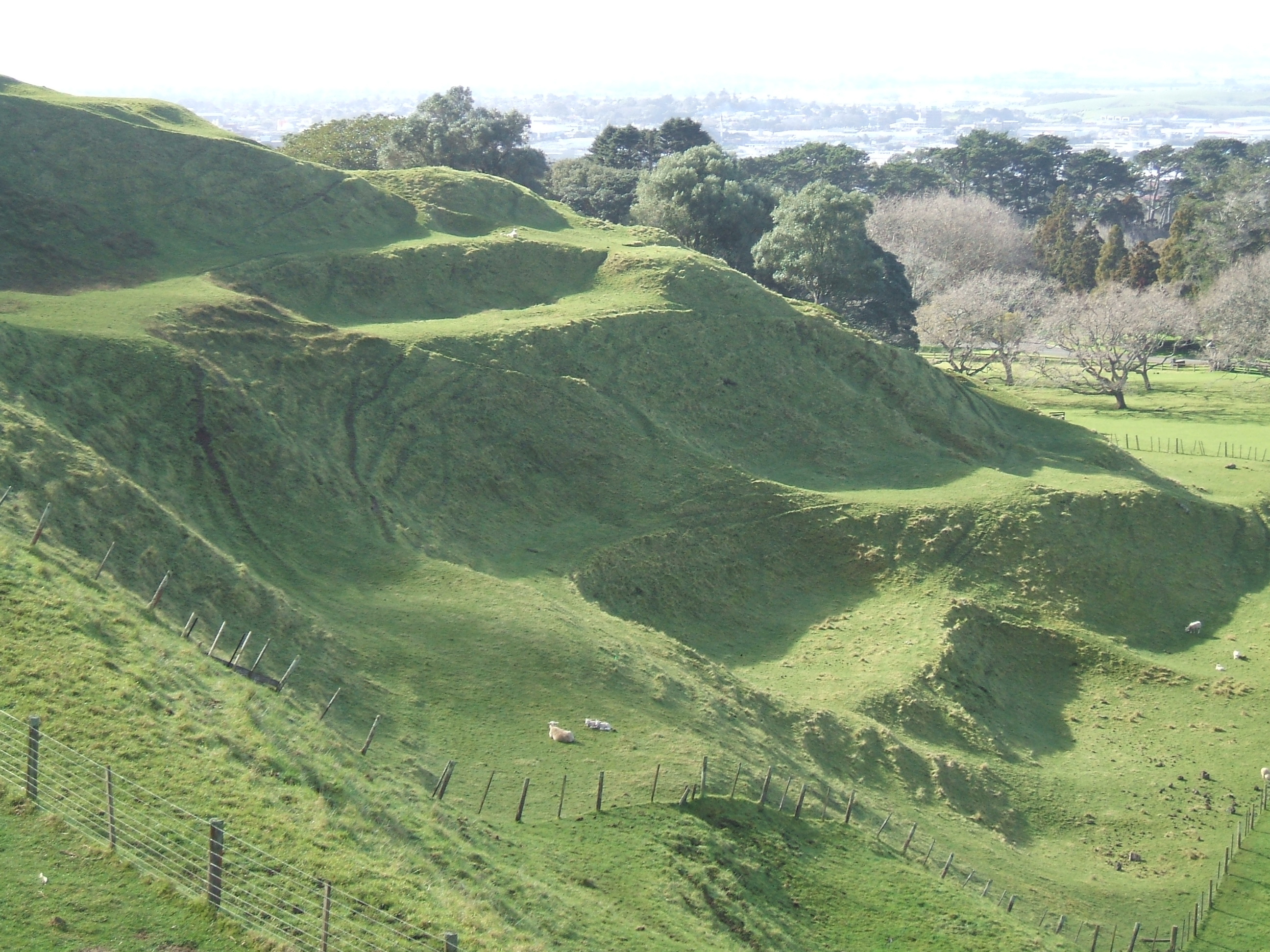
The field has produced voluminous lava flows that cover much of the Auckland isthmus. One of the longest runs from Mt Saint John northward, almost crossing the Waitematā Harbour to form Meola Reef.[11] More than 50 lava tubes and other lava caves have been discovered, including the 290-metre (950 ft)-long Wiri Lava Cave.[12] The second-longest individual cave in the Auckland field, some 270 metres (890 ft) in total length, is the Cave of a Thousand Press-ups to the east of Maungakiekie/One Tree Hill.[13] Two impressive depressions caused by lava cave collapses are the Puka Street Grotto and the nearby Hochstetter Pond, also known as Grotto Street Pond, in Onehunga.[14][15]
For most of the 200,000 years that the field has been erupting, the planet has been in glacial periods (ice ages) where sea levels were much lower due to water being locked up as ice, and the Waitemata and Manukau Harbours were dry land. All the volcanoes probably erupted on land except for Rangitoto, which erupted during the current interglacial (warmer) period.[16]
Tectonic relationships
The Auckland region lies within the Australian Plate, about 400 kilometres (250 mi) west of its plate boundary with the Pacific Plate.[17] The volcanoes are located south of a geological region called the Northland Allochthon, and with the northern volcanoes located over early Miocene sedimentary deposits of the Waitematā Group of rocks and the southern volcanoes over post Miocene sediments.[17] A large proportion of the volcanoes in the field, particularly those with cone structures, lie within 500 metres (1,600 ft) of inferred or known faults, with the qualification that these are inactive historic faults and unlike in many other volcanic fields it is rare for volcanoes to be actually on the fault line.[18] The structure of these Auckland regional faults and the resulting fault blocks is complex but like the volcanic field their locations can be postulated to be related to gravitational variations and where the Stokes Magnetic Anomaly passes through this section of the North Island.[17] The field is part of the Auckland Volcanic Province which comprises four volcanic fields with intra-plate basaltic volcanism starting in the south, at Okete, near Raglan in late Pliocene times (2.7-1.8 Ma).[19] Activity has since moved north through the Ngatutura, South Auckland and Auckland fields since then.[20]
Human context
Mythology
Tāmaki Māori myths describe the creation of the volcanic field as a creation of Mataaho (the guardian of the earth's secrets) and his brother Rūaumoko (the god of earthquakes and volcanoes), made as punishment against a tribe of patupaiarehe, supernatural beings living in the Waitākere Ranges, who used deadly magic from the earth to defeat a war party of patupaiarehe from the Hunua Ranges.[21][22] In some traditions, the fire goddess Mahuika creates the volcanic field as a way to warm Mataaho, after his wife leaves and takes his clothing.[23][24] Because of their close association to Mataaho, the volcanic features can be collectively referred to as Nga Maunga a Mataaho ("The Mountains of Mataaho"),[21] or Ngā Huinga-a-Mataaho ("the gathered volcanoes of Mataaho").[24] Many of the volcanic features of Māngere can be referred to as Nga Tapuwae a Mataoho ("The Sacred Footprints of Mataoho"), including Māngere Lagoon, Waitomokia, Crater Hill, Kohuora, Pukaki Lagoon and Robertson Hill.[23][25] Many of the Māori language names of volcanic features in the field refer to Mataaho by name, including Te Pane o Mataaho (Māngere Mountain), Te Tapuwae a Mataoho (Robertson Hill) and Te Kapua Kai o Mataoho (the crater of Maungawhau / Mount Eden).
Usage
Many of the maunga (mountains) were occupied by substantial Māori pā (fortifications) before Pākehā settlement, and many terraces and other archeological remnants are still visible.[26] Many of the cones have been levelled or strongly altered, in small part due to the historical Māori use, but mostly through relatively recent quarrying of construction materials (especially scoria). However many of the remaining volcanoes are now preserved as landmarks and parks.[9]
The warmer northern sides of the mountains were also popular among early Pākehā settlers for housing.[26] In the 1880s, Takarunga / Mount Victoria and Maungauika / North Head were developed as military installations due to fears of a Russian invasion.[26] The cones are also protected by a 1915 law, the Reserves and Other Lands Disposal and Public Bodies Empowering Act 1915, which was passed due to early concern that the distinctive landscape was being eroded, especially by quarrying. While often ignored until the late 20th century, it has amongst other things minimised severe changes to Mount Roskill proposed by Transit New Zealand for the Southwestern Motorway.[27]
In March 2007, New Zealand submitted the volcanic field, with several specifically named features, as a World Heritage Site candidate based on its unique combination of natural and cultural features.[9] At that time, only 2 per cent of more than 800 World Heritage Sites worldwide were in this "mixed" category.
For most of Auckland's post-1840 history, the mountains have been administered variously by the New Zealand Crown, the Auckland Council (or its former bodies including the Auckland City Council and Manukau City Council) or the Department of Conservation.[26]
In the 2014 Treaty of Waitangi settlement between the Crown and the Ngā Mana Whenua o Tāmaki Makaurau collective of 13 Auckland iwi and hapu (also known as the Tāmaki Collective), ownership of the 14 Tūpuna Maunga (ancestral mountains) of Tāmaki Makaurau / Auckland, was vested to the collective. The legislation specified that the land be held in trust "for the common benefit of Ngā Mana Whenua o Tāmaki Makaurau and the other people of Auckland". The Tūpuna Maunga o Tāmaki Makaurau Authority or Tūpuna Maunga Authority (TMA) is the co-governance organisation established to administer the 14 Tūpuna Maunga. Auckland Council manages the Tūpuna Maunga under the direction of the TMA.[26][28][29]
Dangers
Since the field is not extinct, new volcanic events may occur at any time, though the usual period between events is, on average, somewhere between hundreds to thousands of years. There has been at least one eruption in every 2,500 years over the last 50,000 years.[19] However, the effects of such an event—especially a full-scale eruption—would be substantial, ranging from pyroclastic surges to earthquakes,[30] lava bombs, ash falls, and the venting volcanic gas, as well as lava flows. These effects might continue for several months, potentially causing substantial destruction and disruption, ranging from the burial of substantial tracts of residential or commercial property, to the mid-to-long-term closures of major parts of the country's infrastructure such as the Port of Auckland, the State Highway network, or the Auckland Airport.[7] It is possible that several volcanoes could erupt simultaneously. There is strong evidence that eight erupted within a span of 3000 years or so, between 31,000 and 28,000 years ago.
Most eruptive events in the field have been small volume, very constrained in time, typically involving less than 0.005 km3 (0.0012 cu mi) of magma making its way to the surface.[19] However the same amount of magma can have an order of magnitude different impact. An underwater eruption which is more likely to be explosive resulted in the formation of the 0.7 km (0.43 mi) wide Ōrākei crater that destroyed an area of 3 km3 (0.72 cu mi) by crater formation and base surge impact. This contrasts with the about 0.5 km (0.31 mi) diameter cone produced by the same amount of upwelling magma that might be expected to destroy an area of 0.3 km3 (0.072 cu mi) if there is no ground water interaction.[19] Modelling has suggested that the next eruption in the volcanic field is likely to be associated with water and in the area extending from the central city to its north and northeast suburbs surrounding and including the Waitemata Harbour.[31] Within New Zealand the volcanic hazard of the field is graded below that of Taupo Volcanic Zone volcano's but is likely to be perceived by the population affected as a greater potential nuisance if it occurs[32]
Various operative structures, plans and systems have been set up to prepare responses to volcanic activity within the urban areas, mainly coordinated in the Auckland Volcanic Field Contingency Plan[33] of the Auckland Regional Council, which provides a framework for interaction of civil defence and emergency services during an eruption. Auckland also has a seismic monitoring network comprising six seismometers—including one 250 metres (820 ft) deep at Riverhead—and three repeaters within the region that will detect the small tremors likely to precede any volcanic activity.[34] This is likely to give between a few hours and several days' warning of an impending eruption, and its approximate location.[30]
Auckland War Memorial Museum, itself built on the crater rim of Pukekawa, has an exhibition on the field, including the "Puia Street multi-sensory visitor experience", which simulates a grandstand view of an eruption in Auckland.[35]
In 2013, scientists said new studies showed Rangitoto had been much more active in the past than previously thought, suggesting it had been active on and off for around 1000 years before the final eruptions around 550 years ago.[2] Civil Defence officials said the discovery did not make living in Auckland any more dangerous, but did change their view of how an evacuation might proceed.[36]
List of volcanoes
The volcanoes within the field are:[4][37][38]
| Volcanoes | Age (thousand years)[39] | Height | Location (Coordinates) | Refs | Images |
|---|---|---|---|---|---|
| Albert Park Volcano | 145.0 ± 4.0 | Unclear | 36.8486°S 174.7673°E | [40] |  |
| Ash Hill | 31.8 ± 0.4 | 30 metres (98 ft) | 37.002754°S 174.867545°E | ||
| Boggust Park Crater | 130+ | 5 metres (16 ft) | 36.955413°S 174.813552°E | [1] | |
| Cemetery Crater | Undated | 33 metres (108 ft) | 36.989828°S 174.841082°E | [1] | |
| Crater Hill | 30.4 ± 0.8 | 36.986546°S 174.827135°E | 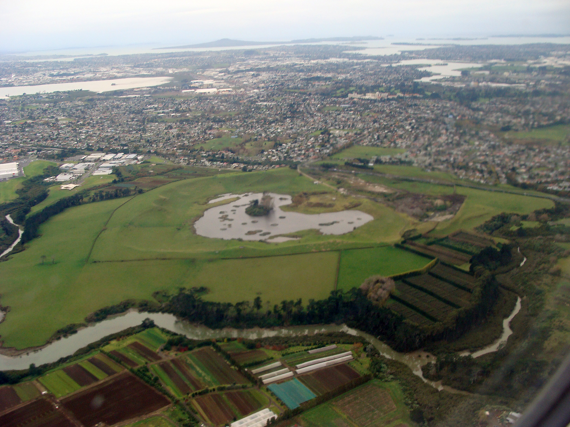 | ||
| Grafton Volcano | 106.5 | 36.858440°S 174.763624°E | |||
| Hampton Park | 57.0 ± 32.0 | 35 metres (115 ft) | 36.950925°S 174.89544°E | ||
| Kohuora | 33.7 ± 2.4 | 36.97873°S 174.842691°E | |||
| Māngere Lagoon | 59.5 | 36.95702°S 174.77763°E |  | ||
| Matanginui / Green Mount | 19.6 ± 6.6 | 78 metres (256 ft) | 36.939911°S 174.898267°E | ||
| Matukutureia / McLaughlins Mountain | 48.2 ± 6.4 | 73 metres (240 ft) | 37°00′49″S 174°50′46″E | ||
| Maungakiekie / One Tree Hill | 67.0 ± 12.0 | 182 metres (597 ft) | 36°54′0″S 174°46′59″E | 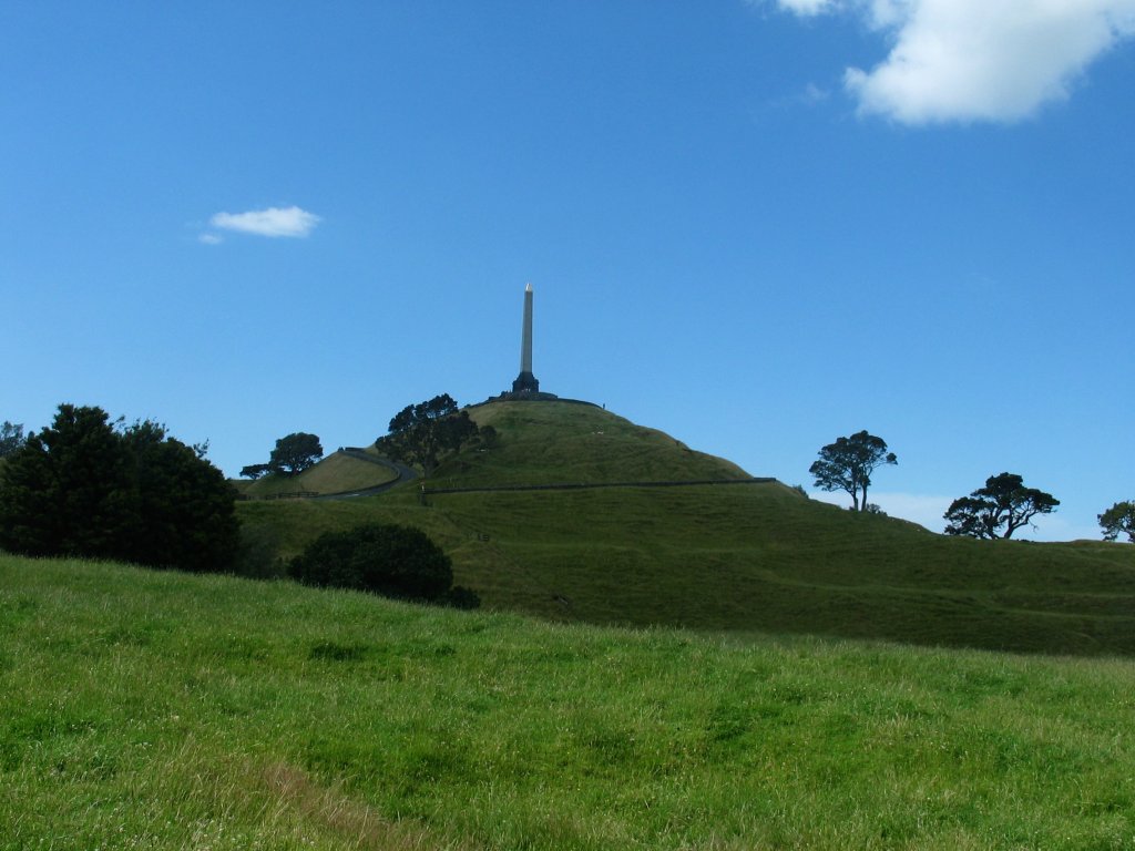 | |
| Maungarahiri / Little Rangitoto | 24.6 ± 0.6 | 75 metres (246 ft) | 36.875407°S 174.809636°E | ||
| Maungarei / Mount Wellington | 10.0 ± 1.0 | 135 metres (443 ft) | 36°53′35″S 174°50′47.6″E |  | |
| Maungataketake / Elletts Mountain | 88.9 ± 4.8 | 76 metres (249 ft) | 36.994635°S 174.747548°E | ||
| Maungauika / North Head | 87.5 ± 15.2 | 50 metres (160 ft) | 36.827751°S 174.81205°E |  | |
| Maungawhau / Mount Eden | 28.0 ± 0.6 | 196 metres (643 ft) | 36.877°S 174.764°E |  | |
| Motukorea / Browns Island | 24.4 ± 0.6 | 68 metres (223 ft) | 36.8306°S 174.8948°E |  | |
| Mount Robertson / Sturges Park | 24.3 ± 0.8 | 78 metres (256 ft) | 36.948477°S 174.841726°E | ||
| Ōhinerau / Mount Hobson | 34.2 ± 1.8 | 143 metres (469 ft) | 36.877814°S 174.786156°E |  | |
| Ohuiarangi / Pigeon Mountain | 23.4 ± 0.8 | 55 metres (180 ft) | 36.888846°S 174.903116°E | ||
| Ōrākei Basin | 126.0 ± 6.0 | Sea level | 36.867124°S 174.81308°E | ||
| Otahuhu / Mount Richmond | 30.2 ± 4.2 | 50 metres (160 ft) | 36°55′57″S 174°50′22″E |  | |
| Ōtuataua | 24.2 ± 1.8 | 64 metres (210 ft) | 36°59′10″S 174°45′15″E |  | |
| Ōwairaka / Te Ahi-kā-a-Rakataura / Mount Albert | 119.2 ± 5.6 | 135 metres (443 ft) | 36.890475°S 174.720097°E | ||
| Puhinui Craters | Undated | 22 metres (72 ft) | 37°00′53″S 174°49′59″E | [1] | |
| Pukaki Lagoon | 45+ | Sea Level | 36.982998°S 174.810226°E |  | |
| Pukeiti | 23.7 | 30 metres (98 ft) | 36.983756°S 174.757183°E | ||
| Pukekawa / Auckland Domain | 106.0 ± 8.0 | 36.859158°S 174.775808°E |  | ||
| Pukewīwī / Puketāpapa / Mount Roskill | 105.3 ± 6.2 | 110 metres (360 ft) | 36.912286°S 174.737371°E | ||
| Pukewairiki | 130+ | 30 metres (98 ft) | 36.944078°S 174.865887°E | ||
| Pupuke | 193.2 ± 5.6 | −57 metres (−187 ft) | 36.780115°S 174.766184°E | 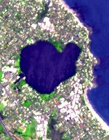 | |
| Rangitoto Island | 0.55 (first eruption) | 260 metres (850 ft) | 36.786742°S 174.860115°E | 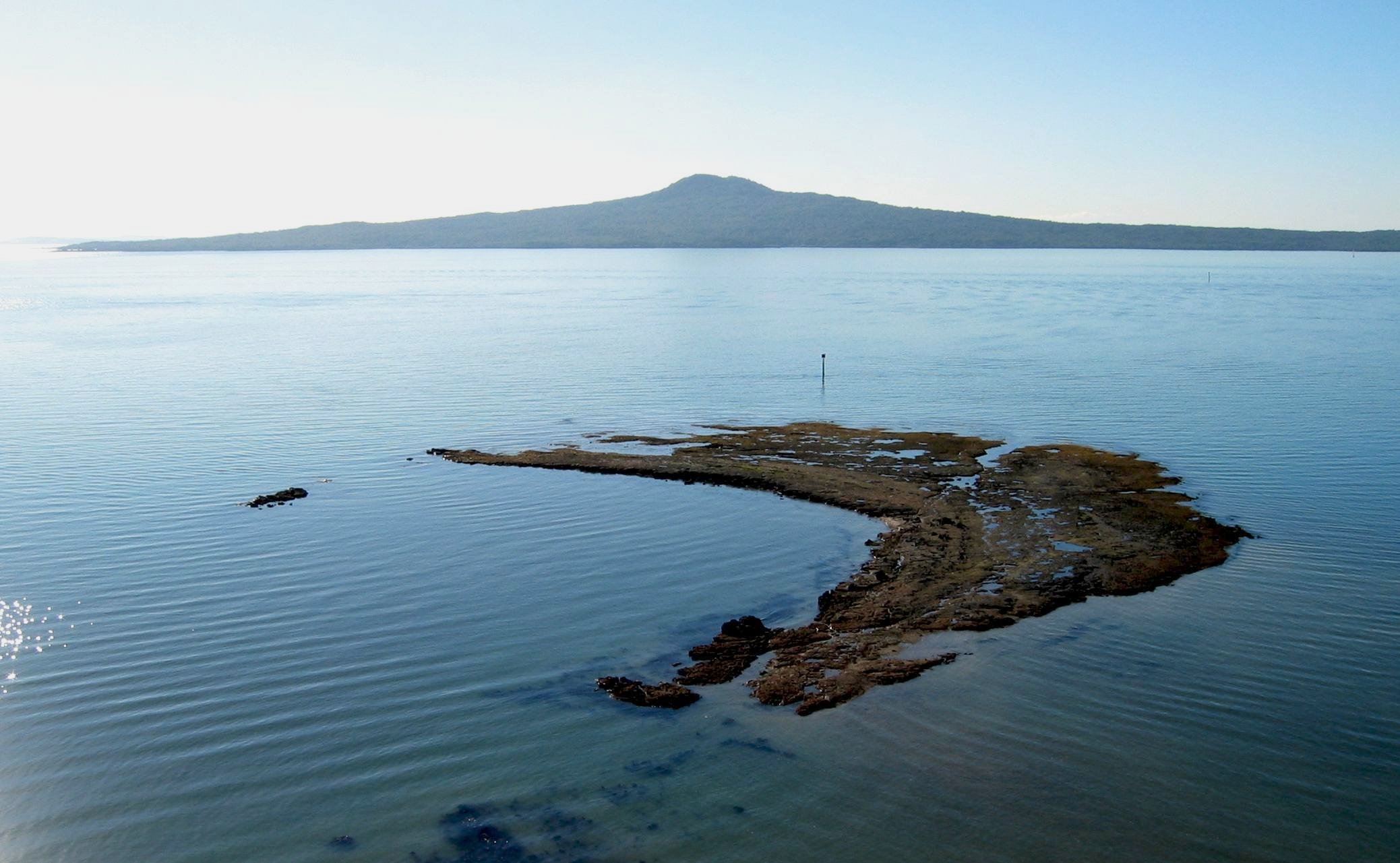 | |
| Rarotonga / Mount Smart | 20.1 ± 0.2 | 87 metres (285 ft) (quarried) | 36°55′6″S 174°48′45″E | ||
| Styaks Swamp | 19.1 | 36.936138°S 174.900155°E | |||
| Takaroro / Mount Cambria | 42.3 ± 22.0 | 30 metres (98 ft) (quarried) | 36.824444°S 174.801933°E | ||
| Takarunga / Mount Victoria | 34.8 ± 4.0 | 87 metres (285 ft) | 36.8266°S 174.7990°E |  | |
| Taurere / Taylors Hill | 30.2 ± 0.2 | 56 metres (184 ft) | 36.864223°S 174.869943°E | ||
| Te Apunga-o-Tainui / McLennan Hills | 41.3 ± 2.4 | 45 metres (148 ft) (quarried) | 36.929208°S 174.846468°E | ||
| Te Hopua-a-Rangi / Gloucester Park | 31.0 | Sea level (reclaimed) | 36.9295°S 174.784734°E | ||
| Te Kopua Kai-a-Hiku / Panmure Basin | 25.2 ± 1.8 | Sea level | 36.90495°S 174.849343°E | [41] |  |
| Te Kopua-o-Matakamokamo / Tank Farm | 181.0 ± 2.0 | 36.8020°S 174.7533°E | |||
| Onepoto | 187.6 | 36.80818°S 174.75085°E | |||
| Te Kōpuke / Tītīkōpuke / Mount St John | 75.3 ± 3.4 | 126 metres (413 ft) | 36.883431°S 174.780196°E |  | |
| Te Motu-a-Hiaroa / Puketutu | 29.8 ± 4.4 | 65 metres (213 ft) | 36.965186°S 174.747248°E | ||
| Te Pane-o-Mataaho / Māngere Mountain | 59.0 ± 20.0 | 106 metres (348 ft) | 36.9496°S 174.7831°E | [42] |  |
| Te Pou Hawaiki | 28.0+ | Quarried | 36.88247°S 174.766726°E | ||
| Te Puke ō Tara / Otara Hill | 56.5 | 89 metres (292 ft) (quarried) | 36.947105°S 174.898363°E | ||
| Te Tātua-a-Riukiuta / Three Kings | 31.0 ± 1.8 | 133 metres (436 ft) | 36.902926°S 174.754651°E |  | |
| Te Tauoma / Purchas Hill | 10.9 ± 0.2 | 50 metres (160 ft) (quarried) | 36.887138°S 174.847476°E | ||
| Waitomokia / Mt Gabriel | 20.3 ± 0.2 | 20 metres (66 ft) (quarried) | 36.976981°S 174.770336°E | ||
| Whakamuhu / Saint Heliers / Glover Park – see Achilles Point | 161.0 ± 36.0 | Sea level | 36.846911°S 174.867662°E |  | |
| Wiri Mountain / Matukutūruru | 30.1–31.0 | 80 metres (260 ft) (quarried) | 37°00′26″S 174°51′30″E |
See also
- Geology of the Auckland Region
- List of volcanoes in New Zealand
- Volcanism in New Zealand
- Stratigraphy of New Zealand
- South Auckland volcanic field
References
- Hayward, Bruce W.; Kenny, Jill A.; Grenfell, Hugh R. (2011). "More volcanoes recognised in Auckland Volcanic Field" (PDF). Geoscience Society of New Zealand Newsletter (5): 11–16. Retrieved 19 April 2013.[permanent dead link]
- Shane, Phil; Gehrels, Maria; Zawalna-Geer, Aleksandra; Augustinus, Paul; Lindsay, Jan; Chaillou, Isabelle (2013). "Longevity of a small shield volcano revealed by crypto-tephra studies (Rangitoto volcano, New Zealand): Change in eruptive behavior of a basaltic field". Journal of Volcanology and Geothermal Research. 257: 174–183. doi:10.1016/j.jvolgeores.2013.03.026. ISSN 0377-0273.
- Linnell, Tamzin; et al. (2016). "Long-lived shield volcanism within a monogenetic basaltic field: The conundrum of Rangitoto volcano, New Zealand". Geological Society of America Bulletin. 128 (7–8): 1160–1172. Bibcode:2016GSAB..128.1160L. doi:10.1130/B31392.1.
- Hayward, Bruce W.; Murdoch, Graeme; Maitland, Gordon (2011). Volcanoes of Auckland: The Essential Guide. Auckland University Press. ISBN 978-1-86940-479-6.
- Needham, A.J.; Lindsay, J.M.; Smith, I.E.M.; Augustinus, P.; Shane, P.A. (April 2011). "Sequential eruption of alkaline and sub-alkaline magmas from a small monogenetic volcano in the Auckland Volcanic Field, New Zealand". Journal of Volcanology and Geothermal Research. 201 (1–4): 126–142. doi:10.1016/j.jvolgeores.2010.07.017.
- Ian E.M. Smith and Sharon R. Allen. Auckland volcanic field geology. Volcanic Hazards Working Group, Civil Defence Scientific Advisory Committee. Retrieved 30 March 2013. Also published in print as Volcanic hazards at the Auckland volcanic field. 1993.
- Beca Carter Hollings & Ferner (2002). Contingency Plan for the Auckland Volcanic Field, Auckland Regional Council Technical Publication 165. Accessed 12 May 2008.
- Leonard, G. S., Calvert, A. T., Hopkins, J. L., Wilson, C. J., Smid, E. R., Lindsay, J. M., & Champion, D. E. (2017). High-precision 40Ar/39Ar dating of Quaternary basalts from Auckland Volcanic Field, New Zealand, with implications for eruption rates and paleomagnetic correlations. Journal of Volcanology and Geothermal Research 343:60-74
- Auckland Volcanic Fields submission (from the UNESCO World Heritage Centre, 30 March 2007. Accessed 4 May 2007)
- Kereszturi, G., Németh, K., Cronin, S. J., Agustín-Flores, J., Smith, I. E., & Lindsay, J. (2013). A model for calculating eruptive volumes for monogenetic volcanoes—Implication for the Quaternary Auckland Volcanic Field, New Zealand. Journal of Volcanology and Geothermal Research, 266:16-33.
- Hayward, Murdoch, Maitland (2011). pp. 134–135.
- David Lomas (Winter 2006). "Cave new world". Heritage New Zealand. Accessed 4 May 2007.
- Kermode, Les (March 1994). "New Zealand lava caves worth preserving for their geologic and geomorphic features" (PDF). Geoscience Reports of Shizuoka University. 20: 15–24. Archived from the original (PDF) on 3 August 2016. Retrieved 6 December 2011.
- Hayward, Murdoch, Maitland (2011). pp. 17–18.
- "Geology". The Onehunga Grotto. 9 May 2008. Retrieved 25 April 2013.
- Hayward, Murdoch, Maitland (2011). pp. 2–3.
- Kenny, A; Lindsay, JM; Howe, TM (2012). "Post-Miocene faults in Auckland:insights from borehole and topographic analysis". New Zealand Journal of Geology and Geophysics. 55 (4): 323–343. doi:10.1080/00288306.2012.706618.
- Stewart, John R. "GSNZ Conference 26 November 2015: Auckland's buried faults and their influence on its geology" (PDF). Retrieved 12 November 2022.
- Nemeth, Karoly; Kereszturi, Gabor; Agustín-Flores, Javier; Briggs, Roger Michael (2012). "Field Guide Monogenetic volcanism of the South Auckland and Auckland Volcanic Fields" (PDF). Retrieved 2 November 2022.
- Bischoff, Alan; Barriera, Andrea; Begg, Mac; Nicola, Andrew; Colea, Jim; Sahoo, Tusar (2020). "Magmatic and Tectonic Interactions Revealed by Buried Volcanoes in Te Riu-a-Māui/Zealandia Sedimentary Basins" (PDF). New Zealand Journal of Geology and Geophysics. pp. 378–401. doi:10.1080/00288306.2020.1773510.
- "Mataaho". maori.org.nz. Archived from the original on 1 December 2020. Retrieved 12 September 2021.
- Pegman, David M (August 2007). "The Volcanoes of Auckland" (PDF). Manukau City Council. Mangere Mountain Education Centre. Archived from the original (PDF) on 1 December 2020. Retrieved 6 October 2021.
- "The History of Our Marae". Makaurau Marae. Retrieved 1 September 2021.
- Taonui, Rāwiri (10 February 2015). "Tāmaki tribes". Te Ara: The Encyclopedia of New Zealand. Ministry for Culture and Heritage. Retrieved 15 September 2016.
- Graham, George (1979). "George Graham's Maori Place Names of Auckland". Records of the Auckland Institute and Museum. 16: 11–39.
- Tūpuna Maunga o Tāmaki Makaurau Authority (23 June 2016). "Integrated Management Plan" (PDF). Auckland Council. Retrieved 6 October 2021.
- "The volcanic hills are being destroyed..." – City of Fire, insert magazine in The New Zealand Herald, 15 February 2008
- "Ngā Mana Whenua o Tāmaki Makaurau Collective Redress Act 2014 No 52 (as at 12 April 2022), Public Act – New Zealand Legislation". www.legislation.govt.nz. Retrieved 18 July 2022.
- Council, Auckland. "Tūpuna Maunga significance and history". Auckland Council. Retrieved 18 July 2022.
- "When the earth starts to shake". City of Fire, insert magazine in The New Zealand Herald, 15 February 2008.
- Magill, C.; Blong, R (7 October 2004). "Volcanic risk ranking for Auckland, New Zealand. II: Hazard consequences and risk calculation". Bulletin of Volcanology. 67 (94)): 340–349. doi:10.1007/s00445-004-0375-5.
- Doherty, Angela Louise (2009). "Blue‐sky eruptions, do they exist? Implications for monitoring New Zealand's volcanoes" (pdf). University of Canterbury. Retrieved 7 June 2022.
- "Auckland Volcanic Field Contingency Plan" (PDF). Archived from the original (pdf) on 23 September 2015.
- New recorder boosts earthquake, volcano warnings, The New Zealand Herald, NZPA, 11 May 2008. Accessed 12 May 2008.
- "Volcanoes". Auckland War Memorial Museum. Retrieved 28 September 2017.
- "Officials downplay volcano danger". Newshub. 12 April 2013.
- Lindsay, J.M.; Leonard, G.S.; Smid, E.R.; Hayward, B.W. (December 2011). "Age of the Auckland Volcanic Field: a review of existing data". New Zealand Journal of Geology and Geophysics. 54 (4): 379–401. doi:10.1080/00288306.2011.595805. S2CID 129707270.
- Hayward, B.W. (2019). Volcanoes of Auckland. A Field Guide. Auckland University Press. p. 334. ISBN 978-1-86940-901-2.
- Hopkins, Jenni L.; Smid, Elaine R.; Eccles, Jennifer D.; Hayes, Josh L.; Hayward, Bruce W.; McGee, Lucy E.; van Wijk, Kasper; Wilson, Thomas M.; Cronin, Shane J.; Leonard, Graham S.; Lindsay, Jan M.; Németh, Karoly; Smith, Ian E. M. (3 July 2021). "Auckland Volcanic Field magmatism, volcanism, and hazard: a review". New Zealand Journal of Geology and Geophysics. 64 (2–3): 213–234. doi:10.1080/00288306.2020.1736102.
- Searle, E. J. (May 1962). "The volcanoes of Auckland city". New Zealand Journal of Geology and Geophysics. 5 (2): 193–227. doi:10.1080/00288306.1962.10423108.
- Hayward, Bruce William; Jamieson, Alastair (2019). "Volcanoes of Auckland : a field guide". Auckland University Press. ISBN 0-582-71784-1. Retrieved 30 October 2022.
- Mountain, Māngere. "Mangere Mountain History Formation | Mangere Mountain". Māngere Mountain. Retrieved 28 April 2019.
Further reading
- Lava and Strata: A guide to the volcanoes and rock formations of Auckland. Homer, Lloyd; Moore, Phil & Kermode, Les; Landscape Publications and the Institute of Geological and Nuclear Sciences, 2000. ISBN 0-908800-02-9.
- "Probabilistic assessment of future vent locations and eruption styles for the Auckland Volcanic Field, New Zealand". Magill, Christina R; McAneney, K.J.; Proceedings of the International Association for Mathematical Geology 2003, Portsmouth, UK, 7–12 September 2003.
- Volcanic risk ranking for Auckland, New Zealand. I: Methodology and hazard investigation. Magill, Christina R.; Blong, Russell; Bulletin of Volcanology, Volume 67, Issue 4, April 2005, Pages 331 – 339, DOI 10.1007/s00445-004-0374-6, accessed 2006-07-14.
- City of Volcanoes: A geology of Auckland. Searle, Ernest J.; revised by Mayhill, R.D.; Longman Paul, 1981. First published 1964. ISBN 0-582-71784-1.
- "Facies analysis of pyroclastic deposits within basaltic tuff-rings of the Auckland volcanic field, New Zealand (abstract)". Sharon R. Allen, Vivienne F. Bryner, Ian E. M. Smith, Peter F. Ballance, New Zealand Journal of Geology and Geophysics, 1996, Vol. 39: 309–327.
- Volcanoes of Auckland: A Field Guide. Hayward, B.W.; Auckland University Press, 2019, 335 pp. ISBN 0-582-71784-1.
External links
- Volcanic hazards, Auckland Council
- "Auckland field". Global Volcanism Program. Smithsonian Institution.
- "Volcanoes". Auckland War Memorial Museum. Retrieved 28 September 2017.
- Geology: Rocks and minerals, School of Geography, Geology and Environmental Science, University of Auckland (with interactive maps, requiring Apple QuickTime).
| |
| Major areas |
|
| Local board areas | |
| |
| Central Auckland |
|  |
|---|---|---|
| East Auckland |
| |
| South Auckland |
| |
| Waitematā Harbour and North Shore |
| |
На других языках
[de] Auckland Volcanic Field
Das Auckland Volcanic Field ist ein bis zu 250.000 Jahre altes monogenetisches Vulkanfeld im Stadtgebiet von Auckland in Neuseeland, auf dem sich nach letzten Erkenntnissen aus dem Jahr 2011 53 ehemals aktive Vulkane befinden.[1] Zuvor ging man noch von 49 Vulkanen aus.- [en] Auckland volcanic field
[ru] Окленд (вулканическое поле)
Окленд — вулканическое поле в Новой Зеландии, регион Окленд.Другой контент может иметь иную лицензию. Перед использованием материалов сайта WikiSort.org внимательно изучите правила лицензирования конкретных элементов наполнения сайта.
WikiSort.org - проект по пересортировке и дополнению контента Википедии