 Onetangi Beach
 Sandcastle on Oneroa Beach
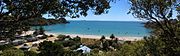 Palm Beach
geo.wikisort.org - Island
Waiheke Island (/waɪˈhɛkiː/; Māori: [ˈwaihɛkɛ]) is the second-largest island (after Great Barrier Island) in the Hauraki Gulf of New Zealand. Its ferry terminal in Matiatia Bay at the western end is 21.5 km (13.4 mi) from the central-city terminal in Auckland.
 Landsat image of the island, August 2002 | |
 | |
 Waiheke Island Location in New Zealand & Pacific Ocean  Waiheke Island Waiheke Island (Pacific Ocean) | |
| Geography | |
| Location | Hauraki Gulf |
| Coordinates | 36°48′S 175°06′E |
| Archipelago | New Zealand archipelago |
| Area | 92 km2 (36 sq mi) |
| Length | 19.3 km (11.99 mi) |
| Width | 0.64–9.65 km (0.40–6.00 mi) |
| Coastline | 133.5 km (82.95 mi) |
| Highest elevation | 231 m (758 ft) |
| Highest point | Maunganui |
| Administration | |
New Zealand | |
| Regional Council | Auckland Region |
| Demographics | |
| Demonym | Waihekean |
| Population | 9,390 (June 2022) |
| Pop. density | 102.1/km2 (264.4/sq mi) |
| Ethnic groups | European, Māori |
It is the most populated island in the gulf, with 9,390 permanent residents.[1] Another estimated 3,400 have second homes or holiday homes on the island.[2] It is New Zealand's most densely populated island,[citation needed] and the third most populated after the North and South Islands. It is the most accessible island in the gulf, with regular passenger and car-ferry services, a helicopter operator based on the island, and other air links.[3]
In November 2015, Lonely Planet rated Waiheke Island the fifth-best region in the world to visit in 2016.[4]
Geography
Overview
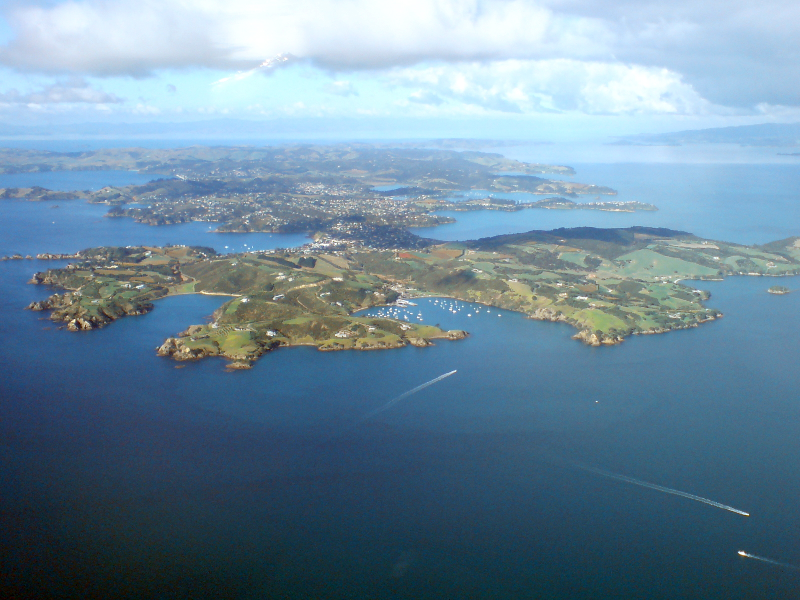
The island is off the coast of the North Island. It is 19.3 km (12.0 mi) in length from west to east, varies in width from 0.64 to 9.65 km (0.40 to 6.00 mi), and has a surface area of 92 km2 (36 sq mi). The coastline is 133.5 km (83.0 mi), including 40 km (25 mi) of beaches. The port of Matiatia at the western end is 17.7 km (11.0 mi) from Auckland and the eastern end is 21.4 km (13.3 mi) from Coromandel.[3] The much smaller Tarahiki Island lies 3 km (1.9 mi) to the east.
The island is very hilly with few flat areas, the highest point being Maunganui at 231 m (758 ft).[5] The climate is slightly warmer than Auckland, with less humidity and rain, and more sunshine hours.[3]
Approximately 17,000 years ago during the Last Glacial Maximum when sea levels were over 100 metres lower than present day levels, Waiheke Island was landlocked to the North Island, surrounded by a vast coastal plain where the Hauraki Gulf / Tīkapa Moana exists today. Sea levels began to rise 7,000 years ago, after which Waiheke became an island separated from the rest of New Zealand.[6]
Geology
Much of eastern Waiheke island is the remains of a Miocene volcano of the Kiwitahi Group, which erupted approximately 15 million years ago.[7] There are locations of interest to geologists: an argillite outcrop in Ōmiha, and a chert stack at the end of Pohutukawa Point, considered "one of the best exposures of folded chert in Auckland City".[8]
Beaches
There are many scenic beaches, including:
- Oneroa Beach – The main beach, on the northern side of the town of Oneroa. It has free BBQ facilities, public toilets and a swing for children.
- Little Oneroa Beach – A small secluded beach at the east end of Oneroa Beach, separated by a protruding cliff wall. It has free BBQ facilities, public toilets and a children's playground.
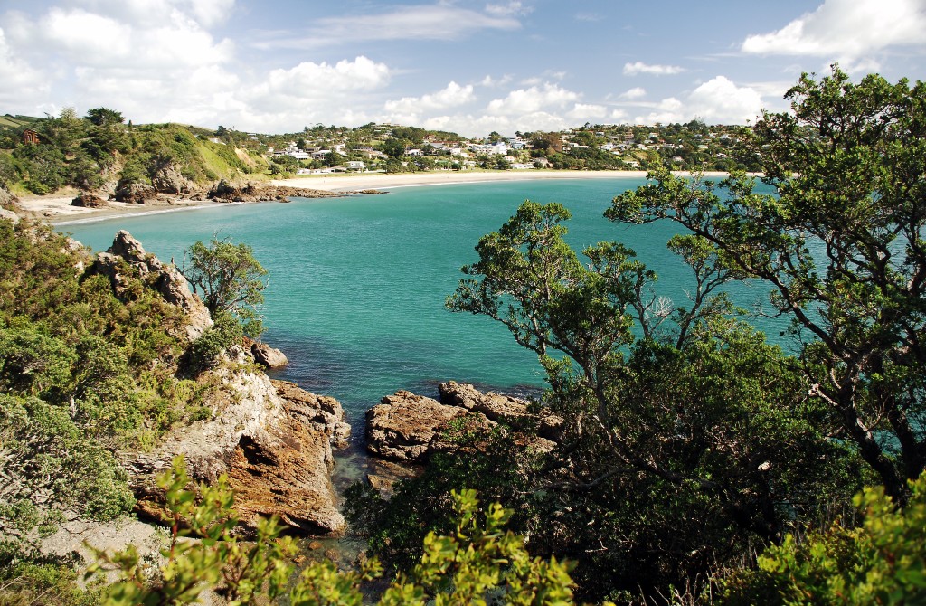
- Palm Beach – Similar in shape to Oneroa Beach (complete with protruding cliff wall at the east end that separates a small private beach in Boatshed Bay), it gets its name from the mature phoenix palms at the east end, where a public toilet and free BBQ facilities are also located. There is a children's playground in the middle section of the beach which also has a free BBQ area, public toilets and an outdoor public shower.
- Little Palm Beach – A small clothes-optional beach (by custom) at the west end of Palm Beach.[9][10] New Zealand has no official nude beaches, as public nudity is legal on any beach where it is "known to occur".[11]
- Blackpool Beach – The south-facing counterpart of Oneroa Beach, lining Blackpool and popular for kayaking and windsurfing.
- Surfdale Beach – A zoned-in beach on the southern side of Surfdale, separated from Blackpool Beach by a small protruding peninsula, which has a scenic unsealed route called The Esplanade linking the beaches. Popular for kitesurfing. Also has a free BBQ area and children's playground.
- Onetangi Beach – A 1.87-kilometre (1.16-mile) long, north-facing beach lining Onetangi, a Māori name meaning "weeping sands".[12] For many years it has been the site of the Onetangi Beach Horse Races. Its western end, often inaccessible at high tide, is clothes-optional. It has sandcastle-building contests annually; participants have a few hours to build their creations in soft sand that is free of shells and suitable for digging. Free BBQ and public facilities.
- Cactus Bay – Considered by many Waihekeans as the most perfect beach and, with nearby Garden Cove, a romantic place for picnicking. The beach is accessible only by boat or kayak, as its land access was blocked off by a private landowner.
- Shelly Beach – A small and well sheltered shell and stone beach located between Oneroa and Ostend. It has free BBQ facilities, a public toilet and a diving platform located just off shore. It is a popular choice with families as at high tide, it is often calm and flat – ideal for children (but not sandy).
Beaches on Waiheke Island


Climate

Waiheke, like Auckland, experiences a subtropical climate according to the Trewartha climate classification, and an oceanic climate according to the Köppen climate classification. The region lies 13° of latitude south of the Tropic of Capricorn, so tropical plants which are protected for the winter months will flower and fruit in the summer, and cold climate vegetables planted in autumn will mature in early spring. Summers tend to be warm and humid, while winters are relatively mild with frost being a rare event on Waiheke.
Rainfall is typically plentiful, though dry spells may occur during the summer months which can be problematic for many of the island residents, the vast majority of whom rely on rainwater harvesting from residential roofs for drinking and household use. During such dry periods (typically 3–4 months between December and March), the island's water-delivery trucks can be seen replenishing residential water tanks that have run dry.
It is often anecdotally said by locals that Waiheke has a different micro-climate from the Auckland isthmus. Though little data supports this, the following data from a NIWA report[13][14] suggests Waiheke receives over 100 hours more sunshine a year than other parts of Auckland.
| Annual mean temperature | Annual precipitation | Annual sunshine hours |
|---|---|---|
| 15.2c | 1461mm | 2100 |
History


The islands of the Hauraki Gulf have been settled since the archaic period of Māori history, and were visited by many of the migratory canoes such as Aotea, Tākitimu, and Mātaatua.[15] Only the largest islands such as Aotea / Great Barrier Island and Waiheke sustained permanent settlements.[15] The forests on the western side of Waiheke Island were likely heavily damaged in the 14th century eruptions of Rangitoto Island.[15] During 18th and early 19th centuries, the eastern side of Waiheke was forested by ancient kauri trees, while kānuka and mānuka bushes dominated the vegetation of the western side, suggesting relatively recent regeneration.[15] The original Māori name for Waiheke was apparently Te Motu-arai-roa, 'the long sheltering island',[16] but at the time the first European visitors arrived it was known as Motu-Wai-Heke, 'island of trickling waters'[16] — rendered as Motu Wy Hake by James Downie, master of the store ship HMS Coromandel, in his 1820 chart of the Tamaki Strait and the Coromandel coast.[16]
Waiheke Island has historically been settled by various tribes, especially the Marutūāhu collective tribes of Ngāti Maru and Ngāti Pāoa.[17] Waiheke Island was the site of many battles between Ngāti Pāoa and Ngāpuhi from the Bay of Islands, up until the late 18th century.[18] In the 1790s, sealing and whaling ships underwent repairs primarily on Waiheke Island.[19]
The island was briefly depopulated during the Musket Wars, when Ngāti Pāoa and other Tāmaki Māori sought refuge in areas such as the Waikato. When Ngāti Pāoa returned to Tāmaki Makaurau (Auckland), they primarily settled on Waiheke.[19] After the wars, the Ngāti Pāoa community of Waiheke were mostly based at Pūtiki Bay.[15]
In 1836, Thomas Maxwell established a shipyard at Man o'War Bay in eastern Waiheke, using local timber to build and repair ships.[15] Ngāti Pāoa quickly engaged with the emerging industries, helping to supply timber and food for European ships.[15] Ngāti Pāoa established wheat and vegetable plantations on the eastern bays of the island.[15] The shipbuilding industry remained on the island until the 1860s, after which the eastern farming plantations quickly became disused.[15] Ngāti Pāoa at Te Huruhi continued to supply produce to Auckland until the early 20th century.[15] Much of the firewood and building timber supplied to the growing city of Auckland was supplied by Waiheke Island forests, while shingle and sand from Owhanake and Hooks Bay was used for concrete manufacturing, up until the 1920s.[15] The island was also home to manganese mines between 1872 and 1900 (briefly first established in the 1840s).[15]
Large private land purchases occurred on Waiheke between 1836 and 1840s, followed by large crown land purchases in the 1850s.[15] By the 1850s, the only Ngāti Pāoa land that remained on the island was a 2,100 acre section at Te Huruhi (near the modern suburb of Blackpool).[15] Through a process of individualisation of land titled, the Māori Land Court split the Te Huruhi block between 65 individuals, and by 1914 most of the block had been sold to private interests.[19] By the end of the 19th century, the island was increasingly deforested, and land was increasingly used for cattle pastures.[15]
When shipping companies began offering occasional trips to the island in the 1880s, Waiheke emerged as a seaside resort. Day trips to Waiheke and Motutapu by steamers became a common recreational excursion, and boarding houses began to flourish at the south-eastern bays of the island.[15] In 1915, Aucklanders were offered the chance to buy affordable land at Ostend, the first subdivision of Waiheke. The naming of these new subdivisions reveal the central role of beach life to the identity of the island. The winner of a competition naming the Surfdale subdivision was awarded a parcel of land near the beach. A section of land could be bought for a small deposit on top of a cost of 8 pence a day and was promoted as a sound investment, however, a level of self sufficiency was required for life on the island as electricity only arrived in 1954.[20] These land offers were not open to Māori. Ostend and Surfdale were joined by additional subdivisions at Palm Beach, Rocky Bay and Oneroa in the 1920s.[15]
During World War II, three gun emplacements were built at Stony Batter on the eastern edge to protect Allied shipping in Waitematā Harbour, in the fear that Japanese ships might reach New Zealand. This mirrored developments at North Head and Rangitoto Island. The guns were never fired in anger. The empty emplacements can be visited seven days a week. The extensive tunnels below them have also opened as a tourist attraction.[21]
In 1999 Waiheke's community board voted Waiheke as a "genetic engineering free zone",[22] but this is a matter of principle rather than fact, as only national government controls exist over genetically engineered foods and grains.
Demographics
Population
Waiheke has a resident population of 9,390 people (June 2022) with most living close to the western end,[23] or near the isthmus between Huruhi Bay and Oneroa Bay, which at its narrowest is only 600 metres (2,000 feet) wide.[24] The settlements of Oneroa and Blackpool are the furthest west, followed by Palm Beach, Surfdale, and Ostend. Further east lies Onetangi, on the northern coast of the wide Onetangi Bay.[24] To the south of this on the opposing coast is Whakanewha Regional Park, Whakanewha, and Ōmiha (also called 'Rocky Bay'). Much of the eastern half of the island is privately owned farmland[24] and vineyards.[25]
Waiheke is a popular holiday spot, and during the main summer season, especially around Christmas and Easter, its population increases substantially due to the number of holiday homes being rented out, corporate functions and dance parties at vineyards and restaurants, the Wine Festival and the Jazz Festival and weekend trippers from around the country and the world. The population increases significantly, almost all homes and baches are full and a festive atmosphere exists.
Social composition
| Year | Pop. | ±% p.a. |
|---|---|---|
| 2006 | 7,797 | — |
| 2013 | 8,340 | +0.97% |
| 2018 | 9,063 | +1.68% |
| Source: [26] | ||
Waiheke had a population of 9,063 at the 2018 New Zealand census, an increase of 723 people (8.7%) since the 2013 census, and an increase of 1,266 people (16.2%) since the 2006 census. There were 3,648 households, comprising 4,461 males and 4,599 females, giving a sex ratio of 0.97 males per female. The median age was 46.5 years (compared with 37.4 years nationally), with 1,434 people (15.8%) aged under 15 years, 1,281 (14.1%) aged 15 to 29, 4,455 (49.2%) aged 30 to 64, and 1,896 (20.9%) aged 65 or older.
Ethnicities were 88.9% European/Pākehā, 11.4% Māori, 3.8% Pacific peoples, 4.0% Asian, and 4.7% other ethnicities. People may identify with more than one ethnicity.
The percentage of people born overseas was 32.0, compared with 27.1% nationally.
Although some people chose not to answer the census's question about religious affiliation, 62.0% had no religion, 23.9% were Christian, 0.8% had Māori religious beliefs, 0.4% were Hindu, 0.1% were Muslim, 1.1% were Buddhist and 3.5% had other religions.
Of those at least 15 years old, 2,337 (30.6%) people had a bachelor's or higher degree, and 921 (12.1%) people had no formal qualifications. The median income was $32,300, compared with $31,800 nationally. 1,533 people (20.1%) earned over $70,000 compared to 17.2% nationally. The employment status of those at least 15 was that 3,618 (47.4%) people were employed full-time, 1,350 (17.7%) were part-time, and 165 (2.2%) were unemployed.[26]
Māori–Pākehā relations
Relations between Māori and Pākehā are considered supportive by New Zealand standards. The local marae is on ancestral Māori land that had been promised to be set aside as Maori Reserve land and returned to Ngāti Pāoa, but remained owned by Waiheke County Council. The island's residents, Pākehā and Māori, got together, arranged for a long-term lease of council-owned land and built the marae. One of the earliest Māori land claims was driven by Waiheke citizens who at the time did not know who the tangata whenua Māori were for the island.[27]
Governance
Waiheke is part of the territorial authority of Auckland Council. The first local government on the island were the Ostend Road Board and Orapiu Road Board, which both formed in 1921 and were combined in 1947.[15] In 1970, the Waiheke County Council was formed, which administered the local government on Waiheke and the surrounding Hauraki Gulf islands.[15] Since 1989, when the county council merged with the Auckland City Council, there has been an elected community board with limited, mainly representational powers, in line with other neighbourhoods in Auckland. One member on the City Council represented all the inhabited Hauraki Gulf islands (i.e. Waiheke, Great Barrier and Rakino) plus the downtown area in the central business district.
Amalgamation with Auckland City, later Auckland Council
In 1989 Waiheke County Council was amalgamated with Auckland City Council as part of Local Government restructuring of that year.
In 1990 the Waiheke Community Board formally requested the right to de-amalgamate from the city. A 'De-amalgamation Committee' was established by Council to facilitate the Board's wish. However, this proved not to be to the liking of most of Auckland's citizens. In 1991, the city responded to a campaign run by a pro-union group, the Waiheke Island Residents & Ratepayers Association (Inc) by holding a democratic referendum. The de-amalgamation proposal sponsored by the Community Board was defeated.[28]
In 2008, the Royal Commission on Auckland Governance received 3,080 submissions (from a population of 1.2 million), 737 of which were made by Waihekeans (population 8,500), almost 1/4 of all submissions.[29] This exemplified the level of citizen involvement found on Waiheke. A public meeting of 150 residents on 29 March 2008 found a majority in favour of breaking away from Auckland City.[30] The Royal Commission[31] recommended that Waiheke Island retain its community board with enhanced powers. When Auckland Council was created in 2010 by amalgamating seven councils and territorial authorities and Auckland Regional Council, Waiheke was given its own local board.
The Waiheke Local Board was elected in the October 2010 Auckland local elections as part of the Auckland Council.[32]
The 2010 local elections resulted in Waiheke resident Mike Lee becoming the Councillor for the Waitemata and Gulf ward. Denise Roche, Faye Storer, Jo Holmes, Don McKenzie and Jim Hannan were elected to the new Local Board. After Roche's resignation after becoming a Member of Parliament for the Green Party of New Zealand in 2011, Paul Walden was elected in a by-election.
In 2013 Lee was re-elected. Paul Walden was re-elected to the Local Board, joined by Beatle Treadwell, Becs Ballard, John Meeuwsen and Shirin Brown.
In 2016, Lee was re-elected. Paul Walden, Shirin Brown and John Meeuwsen were re-elected to the Local Board. Newly elected were Cath Handley and Bob Upchurch.
In 2015–16, the subject of amalgamation remained a hot topic on the island with an application filed with the Local Government Commission from a group called Our Waiheke for a unitary authority.[33][34]
Lifestyle
Waiheke's lifestyle is largely influenced by the fact that it is surrounded by water – there are a number of beaches mentioned above, that are popular for a wide range of activities such as kite surfing, kayaking, stand-up-paddle boarding, boating, swimming and other typical beach pursuits.[25]
Arts and culture
Waiheke has a community-run cinema,[35] a theatre[36] that hosts a number of regular musicians, performances and local productions, and a library[37] that was rebuilt in 2014 at the cost of $6 million.[38] There are a large number of art galleries run by private individuals across the island, along with a community art gallery.[39]
Waiheke has become internationally known for the biennial exhibition Sculpture on the Gulf, an "outdoor sculpture exhibition set on a spectacular coastal walkway on Waiheke Island in Auckland’s Hauraki Gulf".[40] It takes place towards the end of January until approximately mid-March every second year. It was listed by the New York Times as number 35 in its list of 46 must-see places and events of 2013.[41] The sculpture walk attracts thousands of visitors to Waiheke; in 2013, there were more than 30,000 attendees.[42]
Sports
Waiheke has a number of sports teams and facilities on the island. Rugby union, cricket, rugby league, football and netball are widely played and followed.
There are three main sports facilities on the island:
- Onetangi Sports Park: surrounded by the Whakanewha Regional Park[43] several vineyards and the Waiheke golf course[44] lies the idyllic setting for the Onetangi Sports Park. It is home to multiple sports groups such as the Waiheke Tennis club, Waiheke United AFC,[45] Waiheke Rugby,[46] Waiheke Cricket, Waiheke Mountain Bike Club[47] and an 18-hole Frisbee (Disc) Golf[48] course.
- Ostend Sports Park: located in the centre of the urban area, it is home to the Waiheke Rams rugby club and the Waiheke Dolphins netball teams
- The Waiheke Recreation Centre: a large indoor multi-sports facility that is used by the High School during term time (days) and at nights and weekends offers a wide range of activities such as badminton, basketball, gymnastics, martial arts and other activities.[49]
Education
Waiheke Island has two primary schools and one secondary school. It is the only island in New Zealand, other than the North and South Islands, with a secondary school.
In 2016, the New Zealand Government Education Minister announced a $40 million school rebuild project for Waiheke.[50] This was made up of two project announcements: $23 million to Te Huruhi School rebuild project[51] to provide three new blocks with 22 new teaching spaces, a new administration area and library and targeted repairs to the existing school hall; and $17m was awarded to the Waiheke High School redevelopment project to build 10 new teaching spaces and improvement to existing facilities.[52]
Both rebuild project were started in 2019 with an expected completion date of late 2019 / early 2020.
- Te Huruhi Primary School[53] is a state contributing primary (Year 1–6) school in Surfdale, and has 280 students.[54] It opened in 1986 following the split of Waiheke Area School.
- Waiheke Primary School[55] is a state full primary (Year 1–8) school in Ostend, and has 265 students.[54] It opened in 2005.
- Waiheke High School[56] is a state Year 7–13 secondary school in Surfdale, and has 386 students.[54] It opened in 1986 following the split of Waiheke Area School.
Transport
Ferry

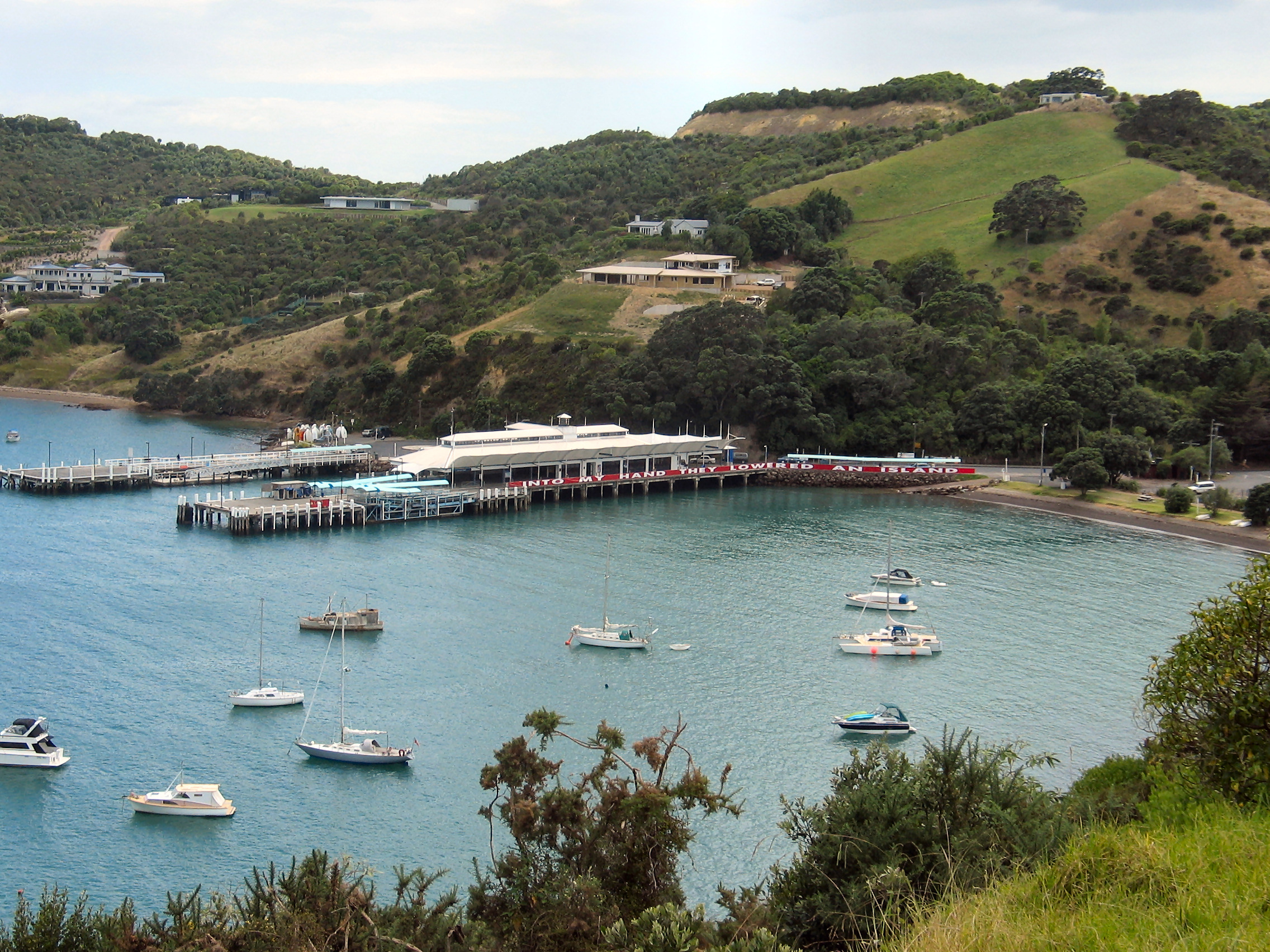
The ferry Baroona, built in Australia in 1904, was the main way to get to the island from the mainland for much of the twentieth century and was known for being a slow and noisy ferry. In 1987, the first of a fleet of new catamaran ferries began to provide more efficient access to and from the island. The 40 minute journey each way made a daily commute more viable.[20]
Scheduled ferry services regularly sail to and from Waiheke. Fullers operate passenger services from Downtown Auckland to Waiheke's Matiatia wharf, with trips taking approximately 40 minutes. Meanwhile, SeaLink provides passenger, car and freight services between Half Moon Bay in East Auckland and Waiheke's Kennedy Point, with trips taking around 50 minutes to an hour. SeaLink also offer a passenger and car "City Service" connecting Kennedy Point with Auckland's Wynyard Quarter.
There have been several attempts to provide alternative passenger ferry services from Matiatia. Most recently, New Zealand tour cruise company Explore Group provided a Matiatia to Downtown service from late 2014 until April 2016. The competition was welcomed by Waiheke residents, but ultimately proved unsustainable for the company.[57][58]
In recent years, there has been significant controversy with many of Waiheke's resident population who rely on the ferries "like buses" – and especially those who commute daily to work in Auckland – complaining of poor parking arrangements at Matiatia,[59] unfair price increases[60] and generally poor ferry services.[61] This led to the launch of a Ferry User's Group[62] (or FUG) and a "Fuller's Watch" group,[63] with the objective of giving a voice to the island's ferry passengers whilst lobbying local politicians and working with the ferry companies to improve the overall experience.
Buses
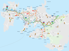
Waiheke has a reliable and fully timetabled public bus service (pdf) which is operated by Waiheke Bus Company[64] (owned by Fullers), and overseen by Auckland Transport.[65]
There are five routes operating in a new network from October 2019.[66] Most routes operate to and from the ferry terminal at Matiatia and span outwards across the island towards Palm Beach, Ostend, Rocky Bay and out to Onetangi Beach. There are no public bus routes towards the Eastern end of the island.
- 50A – Onetangi Beach West, Ostend, Surfdale, Oneroa, Matiatia Ferry Terminal
- 50B – Onetangi Beach East, Ostend, Surfdale (Jellicoe Parade, Wellington Road), Oneroa, Matiatia Ferry Terminal
- 501 - Kennedy Point Wharf to Matiatia Ferry Terminal
- 502 – Ōmiha (Rocky Bay), Ostend, Palm Beach, Blackpool, Oneroa, Matiatia Ferry Terminal
- 503 – Matiatia Ferry Terminal to Oneroa (one-way summer service)
As the island is within one fare zone, fares are flat, regardless of journey length.[67]
In July 2019, it was announced that Waiheke will get a fleet of electric buses on the island. This will start with six new electric buses in mid-2020, with an additional five to arrive later.[68]
Air service
There is one airport on the island, Waiheke Island Aerodrome, served via fixed-wing aircraft by Flight Hauraki and via helicopter by a number of operators.[69] Waiheke is also accessible via a regular seaplane service.[70]
Infrastructure
The island has less infrastructure than mainland Auckland.
Roads: The roads are mainly narrow and in many places unsealed and unlit, especially on the eastern half of the island. Except for the Onetangi Straight (60 km/h) and the rural eastern end, the island speed limit is 50 km/h, and many of the roads see traffic travelling at well under the limit due to their size. At the car ferry terminal at Kennedy Point, the highway department has posted a sign saying "Slow Down, You're here", which delivers the message to visitors about island life.
Transport: Primary transportation on the island is by privately owned used car or car-rental for visitors. The Waiheke Bus Company (owned by Fullers) services most inhabited parts of the island, linking to the ferry sailings from Matiatia. Numerous other taxi, shuttle, bus and boutique services cater to visitors. Due to the hills, bicycles on the island tended to be limited to the young and fit, including an active mountain bike group, until the advent of ebikes. With an ebike rental company in Oneroa that also sells ebikes, they are becoming a common feature on both local roads, and on the ferry boats to the mainland. Walking continues to be a popular means of island transport, both for access and recreation with many walking trails that are not along roads. Horse riding tends to be for recreation rather than transport, but the island does support both a pony club and adult riding club.
Power: Waiheke is connected to the North Island's electricity network via twin 33 kV undersea cables from Maraetai on the mainland, terminating on the island at a 33/11 kV substation in Ostend. The island's electricity network is operated by Auckland-based lines company Vector.[71]
Water and waste water: Each house must maintain its own water supply, most collecting rainwater in cisterns. Water delivery is available and tends to be very active during dry summers. Except for the Oneroa sewage district which discharges into the Owhanake Treatment plant, each residence and relevant commercial establishments must install a septic tank and septic field to handle sewage. This is a requirement in every building consent.[72]
Internet The fibre optic cable that runs from a bay on the southern side of the island connects it to the internet. Internet services were provided using VDSL and ADSL until central government introduced a national fibre optic rollout that included urban parts of Waiheke. Central government also forced the separation of the cable infrastructure from the ISPs, with the fibre backbone being maintained by Chorus which has contracts with numerous ISPs. The locally owned WISP continues to provided wireless internet and some islanders use both services to ensure system redundancy.[73]
Solid Waste: The community established a charitable trust which successfully tendered for Auckland City's contract for solid waste disposal. The recycling centre was implemented with such success that it soon had to be expanded to handle the volume.[74] However, when the contract term expired in 2009, the Council voted to disqualify incumbent tenderer Clean Stream Waiheke Ltd and granted Transpacific Industries Group Ltd a $22 million contract. The decision was political.[75]
Emergency Services: The Waiheke Volunteer Fire Brigade, part of the New Zealand Fire Service, serves the island. The brigade has two stations, at Oneroa[76] and at Onetangi.[77]
Media: The island has a lively press, with the long-established, independently owned weekly Waiheke Gulf News and until recently the Fairfax Media owned Waiheke Marketplace which closed down in 2018.[78] A community radio station, Waiheke Radio, is broadcasting on 88.3 FM and 107.4 FM after Beach FM lost its licence in a commercial bid in 2008.
Matiatia redevelopment
The gateway to Waiheke, where the main pedestrian ferry lands over one million passengers per year, is a valley and harbour called Matiatia. In 2000 it was purchased by three investors in Waitemata Infrastructure Ltd (WIL). In 2002 WIL proposed to change the Operative District Plan rules for their land to build a major shopping and hotel complex with 29,000 m2 (312,153 sq ft) of gross floor area on buildable land of approximately 3 hectares. This united the residents of the island in opposition. Over 1,500 adult residents of the island (out of perhaps 3,000) joined in an incorporated society, the Community and People of Waiheke Island (CAPOW),[79] to oppose the private plan change in court. Church Bay resident and former newsreader John Hawkesby became "the voice of the campaign" that included a showdown with then mayor, John Banks, when Hawkesby made a deputation to the city council hours after the press revealed that Banks was in business with two (of three) directors of WIL.[80]
In 2004, they won an interlocutory judgement in which the environment court ruled that Auckland City Council had erred in the rules, and the current rules limited controlled development to 5,000 m2 (53,820 sq ft) in what was called the Visitor Facility Precinct. In 2005, CAPOW won an interim judgement by the court which reduced the proposed redevelopment to about a third of what the investors had originally sought.[lower-alpha 1]
This set the stage for confidential negotiations between Auckland's mayor Dick Hubbard and the investors, who on 31 August 2005 (now known as 'Matiatia Day' on the island) sold the stock in WIL to the city for $12.5 million. The unanimous vote on 30 June 2005 of the City Council to approve the purchase was said to have come about because of the unity of the people of Waiheke Island. The court case finally was concluded with permitted development set at 10,000 m2 of mixed use gross floor development. The Court also found Auckland City Council and WIL liable for costs in relationship to the interlocutory judgement. Since WIL was now owned by Council, it had to write a cheque to CAPOW for $18,000, representing 75% of CAPOW's costs on that matter. This final cheque allowed CAPOW to pay all its debts and balance its books.
The Council organised a design competition in 2006 to find a suitable development plan and project for the Matiatia gateway. The competition winner's design (scheme 201) was available for comment on the Council website.[81] It attracted much criticism for the lack of car parking close to the ferry terminal, the transport hub function used by all islanders regularly and almost daily by around 850 commuters to Auckland.[82]
In 2013, Matiatia again became a hotspot for controversy as a group of residents proposes a private marina at the terminal. Some of the veterans of the protests a decade prior (led by local resident, retired newsreader John Hawkesby), re-emerged to oppose.[83] The Environment Court decided in favour of the residents.
Wine


Waiheke has become known as New Zealand's "island of wine," home to a dedicated group of winegrowers who have successfully matched the maritime climate and ancient soil structures to the selection of classical grape varieties to produce red and white wines with distinctive varietal character. The climate is well-suited to growing Bordeaux-type grapes, though some Chardonnay and Sauvignon blanc varieties are also considered to be good. Waiheke winegrowers regularly win awards for Syrah (Kennedy Point's 2007 Syrah won best Syrah in the world in 2009), proving the island's terroir suits the variety well. Wines produced on Waiheke are relatively expensive because of the limited size of many of the island's vineyards.[84]
Among the vineyards and wineries on Waiheke Island are:
- Awaroa Vineyard – The organic Awaroa vineyards lie on west-facing slopes among native bush in the middle of Waiheke Island. Syrah and Cabernet Sauvignon are the main varieties planted.
- Batch Winery – Waiheke's newest hi tech winery production is located at the highest vineyard with views from Coromandel to the Sky Tower. Batch wine portfolio includes Flora, Pinot Gris, Cabernet Sauvignon and Syrah. Batch Fizz sparkling wine, made and bottled on site, range includes Fizz Rose, Fizz Chardonnay and Fizz Riesling.
- Cable Bay Vineyards – Cable Bay Vineyards makes wines from grapes grown on Waiheke Island and in Marlborough. Varieties grown include Gewürztraminer, Sauvignon blanc, Pinot noir, Chardonnay, Five Hills Merlot/Malbec/Cabernet and Rosé.
- Destiny Bay Vineyards – Destiny Bay is Waiheke Island's only Cabernet blend specialist and first fully certified sustainable winery.[85] The 2007 Magna Praemia is New Zealand's highest rated wine by an international critic, and received 98/100 points by Anthony Dias Blue.[86][87] Magna Praemia is New Zealand's most expensive wine.[88]
- Edbrooke Vineyard – Jeremy Edbrooke has over 7 acres (28,000 m2) planted in Merlot, Cabernet Franc, Chardonnay and Pinot gris grapes which are supplied to Waiheke Island's Passage Rock Wines.
- Eventide Vineyard – Eventide is a boutique vineyard producing an annual Syrah. The vineyard was planted in 2012 and sits atop one of the highest points on Waiheke.[89] It is located next to EcoZip – a commercial flying fox. Visitors to ecozip can "fly" over the Eventide vines and down through 15 acres of spectacular native (Podocarp) rainforest that is jointly managed by the two enterprises[90]
- Fenton Estate – First planted in 1989, Fenton Twin Bays Vineyard is a north-facing property that spans two small bays separated by a peninsula.
- Goldwater Estate – Begun by pioneering Waiheke winemakers Kim and Jeanette Goldwater, Goldwater Estate was among the first wine making operations on Waiheke. Its awards[91] include being named winery of the year by Wines and Spirits Magazine in 2001.
- Jurassic Ridge – Jurassic Ridge is a small, family-owned vineyard and winery, named for the surrounding geology. It produces hand-crafted Syrah, Montepulciano, Pinot gris and Cabernet Franc. Jurassic greywacke is a major feature of the terroir.
- Kennedy Point Vineyard – Kennedy Point Vineyard is the only certified organic vineyard on Waiheke and can be found on the southwestern side and was established in 1996. It specializes in growing and producing Bordeaux and Syrah wines.
- Man O' War – Situated at Man O' War Bay, at the northern end of Waiheke Island, these vineyards are planted on numerous small sites on the 5,000-acre (20 km2) Man o'War farm.
- Miro Vineyard – Miro Vineyard produces two wines, both red Bordeaux blends. The vineyard overlooks the ocean at Onetangi Beach.
- Mudbrick Vineyard – Mudbrick is one of the island's best-known wineries, and has a Provence-style restaurant made of mudbrick. The vineyard produces Merlot, Chardonnay, Cabernet Sauvignon, and Syrah grapes.
- Obsidian Vineyard – Obsidian Vineyard in Onetangi. It is a 17-hectare property established in 1993. Obsidian, its flagship wine, is a blend of Cabernet Sauvignon, Merlot, Cabernet Franc and Malbec. Its label is "Weeping Sands" (the translation of "Onetangi"). In 2007 Obsidian won a trophy and gold medal[92] at the Romeo Bragato National Wine Competition for its first release of the Montepulciano variety.
- Passage Rock Wines – Passage Rock Vineyard is at the eastern end of Waiheke Island at the head of Te Matuku Bay. Its first vines were planted in 1994.
- Peacock Sky – Peacock Sky Vineyard is located in the centre of Waiheke Island with views across the Hauraki Gulf to Auckland.
- Peninsula Estate on Hakaimango Point was planted in 1986/87. These original plantings of Cabernet Sauvignon, Cabernet Franc, Merlot and Malbec, also now include Chardonnay and Syrah.
- Postage Stamp Wines
- Poderi Crisci Estate
- Stony Batter Estate – Stony Batter Estate, the island's largest vineyard, is at the north-eastern corner of the island
- Stonyridge Vineyard – Stonyridge was founded in 1981 in the Onetangi Valley. Specializing in Bordeaux-style reds, the vineyard's most famous wine is its Stonyridge Larose.
- Tantalus Estate
- Te Motu Vineyard – Te Motu Vineyard was established in the Onetangi Valley in 1989. The first vintage was produced in 1993.
- Te Whau Vineyard
- The Hay Paddock – This 12-acre (49,000 m2), stone-walled vineyard on Seaview Road is planted in Syrah vines sourced from the Hermitage AOC region of the Rhone Valley. Cellar-aged collector wines are released under the Harvest Man and Hay Paddock labels.
- Topknot Hill Vineyard
- View East Vineyard – A boutique vineyard on the south eastern corner of Waiheke Island specializing in Syrah.
- Woodside Hill – A boutique vineyard specializing in Merlot and Cabernet Franc.
See also
Notes
- See Decision A-055-2005.
References
- "Subnational population estimates (RC, SA2), by age and sex, at 30 June 1996-2022 (2022 boundaries)". Statistics New Zealand. Retrieved 25 October 2022. (regional councils); "Subnational population estimates (TA, SA2), by age and sex, at 30 June 1996-2022 (2022 boundaries)". Statistics New Zealand. Retrieved 25 October 2022. (territorial authorities); "Subnational population estimates (urban rural), by age and sex, at 30 June 1996-2022 (2022 boundaries)". Statistics New Zealand. Retrieved 25 October 2022. (urban areas)
- Waiheke Demographic Report Card 2011
- "Waiheke Island information". Tourism Auckland. Retrieved 19 April 2016.
- "Lonely Planet's Best in Travel 2017 list". Lonely Planet. Retrieved 17 October 2017.
- Waiheke & adjacent islands (map information from the DOC, via Craig Potton Publishing website)
- "Estuary origins". National Institute of Water and Atmospheric Research. Retrieved 3 November 2021.
- Hayward, Bruce W. (2017). Out of the Ocean, Into the Fire. Geoscience Society of New Zealand. pp. 134–147. ISBN 978-0-473-39596-4.
- Appendix 3 – Character statements for conservation areas (from the Auckland City District Plan – Hauraki Gulf Islands Section – Proposed 2006). Accessed 2008-02-12.
- Coates, Joe (28 January 2018). "The Best Nudist Beaches in New Zealand". Culture Trip. Retrieved 1 April 2021.
- "The 10 Best Nudist Beaches in New Zealand". newzealandguide. 23 October 2021. Retrieved 24 October 2021.
- Ceramalus v Police, AP No 76/91 (High Court of New Zealand 5 July 1991).
- Easther, Elisabeth (13 February 2014). "Kia ora: Onetangi". NZ Herald. ISSN 1170-0777. Retrieved 18 October 2017.
- "Auckland Climate" (PDF). NIWA. Retrieved 21 October 2015.
- "Statistics for the 2011 Annual Climate Summary" (PDF). NIWA. Retrieved 21 October 2015.
- "Auckland Council District Plan - Hauraki Gulf Islands Section - Operative 2013: The history of human settlement of the islands" (PDF). Auckland City Council. 2013. Retrieved 15 April 2022.
- Waiheke Museum
- Royal, Te Ahukaramū Charles (2 September 2011). "Marutūahu tribes". Te Ara - the Encyclopedia of New Zealand. Retrieved 15 April 2022.
- Ballara, Angela (2003). "Pēwhairangi (Bay of Islands)". Taua: 'musket wars', 'land wars' or tikanga?: warfare in Maori society in the early nineteenth century. Auckland: Penguin. pp. 177–179. ISBN 9780143018896.
- Ngāti Pāoa; The Trustees of the Ngāti Pāoa Iwi Trust; New Zealand Government (March 2021). "Deed of Settlement of Historical Claims" (PDF). New Zealand Government. Retrieved 10 November 2021.
- Groufsky, Jane (20 May 2020). "Changing Waiheke". Auckland War Memorial Museum. Retrieved 18 May 2021.
{{cite web}}: CS1 maint: url-status (link) - "Stony Batter". Retrieved 20 August 2009.
- "GE Free NZ Newsletter, December 1999 – Rage Inc" (PDF). p. Page 2.
- Stony Batter Historic Reserve, Waiheke Island. Department of Conservation.
- "Community". Tourism Auckland. Retrieved 13 November 2010.
- Noted. "Walking 'The Dog': Where to wander on Waiheke Island". Noted. Retrieved 19 June 2019.
- "Statistical area 1 dataset for 2018 Census". Statistics New Zealand. March 2020. Waiheke Local Board Area (CMB07609). 2018 Census place summary: Waiheke Local Board Area
- Report of the Waitangi Tribunal on the Waiheke Island Claim. Waitangi Tribunal. Accessed 2008-08-22. Archived 19 March 2012 at the Wayback Machine
- "NZ Herald 6 December 1991"
- "". Royal Commission on Auckland Governance Te Kōmihana a te Karauna mō te Mana Whakahaere o Tāmaki-makau-rau Report Volume 3: Summary of Submissions. March 2009 Page 5
- "A show of hands says it all". Waiheke Gulf News. 3 April 2008.
- Royal Commission Executive Summary report
- "Waiheke local board". Auckland Council. Retrieved 14 November 2010.
- "waiheke-application".
- "Our Waiheke".
- Waiheke Cinema
- Artworks Theatre
- Waiheke Library
- Stuff article
- Waiheke Art Gallery
- Headland: Sculpture on the Gulf, Waiheke Island http://sculptureonthegulf.co.nz/
- The 46 Places to Go in 2013, New York Times, 11 January 2013 https://www.nytimes.com/interactive/2013/01/10/travel/2013-places-to-go.html?_r=0
- Scoop Media, Tuesday, 12 February 2013 http://www.scoop.co.nz/stories/CU1302/S00332/record-numbers-at-sculpture-exhibition.htm
- Whakanewha Regional Park
- Waiheke Golf Club
- Waiheke United
- Waiheke Rugby
- Waiheke Mountain Bike Club
- Frisbee / Disc Golf
- Waiheke Recreation Centre
- $40 million school rebuild announcement
- "Our New School | te Huruhi Primary School".
- Just over $40 million awarded to schools
- Te Huruhi Primary School Website
- "New Zealand Schools Directory". New Zealand Ministry of Education. Retrieved 19 August 2022.
- Waiheke Primary School Website
- Waiheke High School Website
- Waiheke commuters hail ferry competitor
- "Explore No More". Archived from the original on 27 April 2016. Retrieved 30 June 2016.
- Matiatia parking concerns
- Fed up with ferry price hikes
- Ferry users make waves, company pledges change
- Ferry User's Group
- Fuller's Watch
- Waiheke Bus Company website
- Auckland Transport website
- "New Network for Waiheke".
- https://at.govt.nz/media/1966910/simpler-fares-zone-map-web-sept-2016.pdf [bare URL PDF]
- Waiheke to get electrified buses
- "Air Transport". Auckland Tourism, Events and Economic Development. Retrieved 15 April 2014.
- Bradley, Grant (6 December 2013). "Seaplane returns to Auckland skies". The New Zealand Herald.
- "Electricity Asset Management Plan 2018 – 2028" (PDF). Vector Limited. March 2018. p. 123. Retrieved 3 December 2018.
- Waiheke Island Bylaw: Part 29 – Waiheke Wastewater. Auckland City Council.
- "Our Network Capability Map". Chorus. Retrieved 5 August 2014.
- About the Trust Archived 14 October 2008 at the Wayback Machine. Waste Resource Trust Waiheke. Retrieved 10 August 2007.
- "Community Disregarded in Waiheke Waste Decision | Scoop News". scoop.co.nz. Retrieved 18 December 2016.
- "New Zealand Fire Service – Oneroa Volunteer Fire Brigade". Fire.org.nz. 27 November 2014. Retrieved 9 January 2017.
- "New Zealand Fire Service – Onetangi Volunteer Fire Brigade". Fire.org.nz. 27 November 2014. Retrieved 9 January 2017.
- Waiheke Marketplace closes
- Community and People of Waiheke Island (the organisation's official website)
- Orsman, Bernard (30 September 2004). "I've nothing to hide: Banks". NZ Herald. ISSN 1170-0777. Retrieved 18 October 2017.
- "Matiatia land development". Auckland City Council.
- 4.1 Parking Near Ferry Terminal At Matiatia (minutes of the Urban Strategy and Governance Committee of Thursday 1 March 2007, Auckland City Council)
- Wayne Thompson (6 January 2014). "Marina objectors prepare for fight". New Zealand Herald.
- "From Santa Cruz to Waiheke Archived 16 October 2008 at the Wayback Machine". wineoftheweek.com. 7 May 2005. Accessed 2008-02-12.
- The official website of New Zealand Wine. http://www.nzwine.com/winery/destiny-bay/waihekes-first-fully-certified-sustainable-4/
- "Blues Reviews, Tasting Panel" (PDF). June 2011.
- tastingpanelmag.com
- Wine-Searcher.com. , 20 November 2015
- eventide.co.nz/about
- ecozipadventures.co.nz
- "Goldwater vineyard". goldwater.co.nz. Retrieved 9 January 2017.
- "Waiheke Montepulciano Scoops Prestige Award | Scoop News". Scoop.co.nz. 27 August 2007. Retrieved 9 January 2017.
External links
Wikivoyage has a travel guide for Waiheke Island.
Wikimedia Commons has media related to Waiheke Island.
- Whakanewha Regional Park (nature reserve)
- Photographs of Waiheke Island held in Auckland Libraries' heritage collections.
| |
| Major areas |
|
| Local board areas | |
| |
На других языках
[de] Waiheke Island
Waiheke ist eine Insel in Neuseeland, knapp 18 km von Auckland entfernt. Sie ist nach Great Barrier Island die zweitgrößte Insel im Hauraki Gulf. Die stark gegliederte Insel ist 92 Quadratkilometer groß, ihre Ost-West-Ausdehnung beträgt 19,25 km, die Nord-Süd-Ausdehnung 9,65 km. Es gibt 19 Buchten, überwiegend mit feinkörnigen Sandstränden. Vorwiegend im westlichen Teil der Insel leben ständig etwa 8700 Einwohner (Stand 2011). In der Hochsaison können es durch die Nutzer von Ferienhäusern mehr als doppelt so viele sein. Es gibt auf der Insel mehrere Weingüter.- [en] Waiheke Island
[es] Isla Waiheke
La isla Waiheke se encuentra ubicada en el golfo de Hauraki, a 35 minutos de viaje por ferry hasta Auckland, en Nueva Zelanda.[fr] Île Waiheke
L'île Waiheke est une île néo-zélandaise, située dans le golfe de Hauraki. C'est la deuxième plus grande île du golfe, après l’île de la Grande Barrière.[it] Isola Waiheke
L'isola Waiheke (pronounciata ˈwaihɛkɛ in Lingua māori ma spesso anche waɪˈhɛkiː in inglese) è un'isola del golfo di Hauraki in Nuova Zelanda, che dista circa 17,7 km dalla città di Auckland.[1][ru] Уаихеке
Уаихеке (англ. Waiheke Island) — остров в Новой Зеландии. Административно входит в состав региона Окленд.Текст в блоке "Читать" взят с сайта "Википедия" и доступен по лицензии Creative Commons Attribution-ShareAlike; в отдельных случаях могут действовать дополнительные условия.
Другой контент может иметь иную лицензию. Перед использованием материалов сайта WikiSort.org внимательно изучите правила лицензирования конкретных элементов наполнения сайта.
Другой контент может иметь иную лицензию. Перед использованием материалов сайта WikiSort.org внимательно изучите правила лицензирования конкретных элементов наполнения сайта.
2019-2026
WikiSort.org - проект по пересортировке и дополнению контента Википедии
WikiSort.org - проект по пересортировке и дополнению контента Википедии