geo.wikisort.org - Island
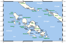
Vella Lavella is an island in the Western Province of the Solomon Islands. It lies to the west of New Georgia, but is considered one of the New Georgia Group. To its west are the Treasury Islands.
 | |
| Geography | |
|---|---|
| Location | Pacific Ocean Bu |
| Coordinates | 7°44′S 156°38′E |
| Archipelago | Solomon Islands |
| Area | 628.9 km2 (242.8 sq mi) |
| Highest elevation | 790 m (2590 ft) |
| Highest point | Mount Tambisala |
| Administration | |
Solomon Islands | |
| province | Western Province |
| Demographics | |
| Population | 9106 (1999) |
Environment
The island of Vella Lavella is located in the southwestern Pacific Ocean. To the north is the island of Choiseul, to the northwest is the island of Shortland, and to the southeast is the island of New Georgia. Vella Lavella is a volcanic island, surrounded in some places by a coral reef. The island contains volcanic cones and one thermal spring. The highest elevation is Mount Tambisala at 790 metres (2,590 ft). The volcano Nonda (the youngest volcano of the island), has an elevation of 750 meters and is considered active, although it has never erupted in modern times. The smaller rivers running from the mountains to the coast allow irrigated horticulture to the inhabitants who live almost exclusively on the coast. Vella Lavella is mainly vegetated with lowland rainforest. The climate is wet and tropical, and the island is prone to earthquakes and cyclones.
North-west Vella Lavella Important Bird Area
An area of 14,641 ha in the north-west of the island has been identified by BirdLife International as an Important Bird Area (IBA) because it supports populations of white-winged fantails, Kolombangara monarchs and endemic Vella Lavella white-eyes. The main threat facing the site is logging.[1]
History
Painted potshards found during excavations date back to an age of 2,000 to 3,000 years.
The Bilua language spoken on the island belongs to the Papuan languages, while the other languages of the Solomon Islands belong to the Austronesian languages. Therefore, archaeologists suspect the immigration of a people who did not come from the Melanesian settlement area.
On March 15, 1893 Vella Lavella was declared part of the British Solomon Islands protectorate.
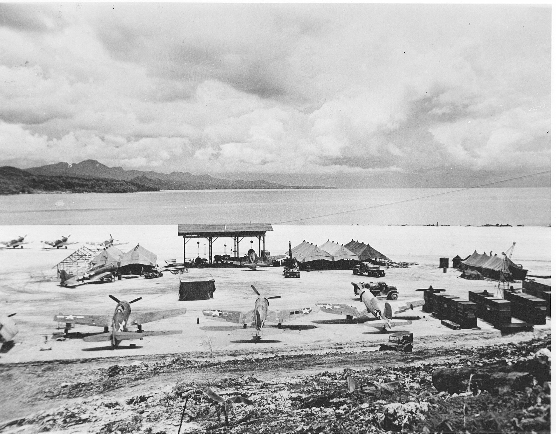
The island was occupied by the Empire of Japan in the early stages of the Pacific War. The Land Battle of Vella Lavella was fought between Allied and Japanese forces from 15 August – 6 October 1943. After a landing at Barakoma on 15 August, US troops advanced along the coasts, pushing the Japanese north. In September, New Zealand troops took over from the Americans and they continued to advance across the island, hemming the small Japanese garrison consisting of 250 Japanese personnel, who were a mix of soldiers evacuated from New Georgia and sailors who had been stranded on the island,[2] along the north coast. On 6 October, the Japanese began an evacuation operation to withdraw the remaining troops, during which the Naval Battle of Vella Lavella was fought. Following the capture of the island, the Allies developed it into an important airbase which was used in the reduction of main Japanese base at Rabaul. Subsequently, Barakoma Airfield on Vella Lavella was the home base for VMF-214 (the "Black Sheep," led by Gregory Boyington).[3]
Since 1978, the island has been part of the independent state of the Solomon Islands.
Notable local people
- Milna Tozaka was elected to the National Parliament of the Solomon Islands to represent the North Vella Lavella Constituency on 5 April 2006.[4] He is the current Foreign Minister in the cabinet of Prime Minister Rick Douglas Hou;[5] he has previously served as the Minister for Public Service.
Notes
- Footnotes
- "North-west Vella Lavella". BirdLife Data Zone. BirdLife International. 2010. Retrieved 8 October 2020.
- Rottman, Japanese Army in World War II, p. 68
- The TV series Baa, Baa, Black Sheep renamed the island "Vella La Cava."
- "The Hon. Milna Tozaka". National Parliament of Solomon Islands. Retrieved November 6, 2008.
- Gary Hatigeva (5 January 2015). "Malaita Island". Tozaka meets Fijian Counterpart. The Island Sun (Solomon Islands). Retrieved 22 March 2014.
- References
- McGee, William L. (2001). "Occupation of Vella Lavella". The Solomons Campaigns, 1942-1943: From Guadalcanal to Bougainville, Pacific War Turning Point, Volume 2 (Amphibious Operations in the South Pacific in WWII). Napa, CA, USA: BMC Publications. ISBN 978-0-9701678-7-3.
- Morison, Samuel Eliot (1958). "Chapter XIII: Vella Lavella". Breaking the Bismarcks Barrier, vol. 6 of History of United States Naval Operations in World War II. Castle Books. ISBN 0-7858-1307-1.
Gallery
 Taken on 10 December 1943, this photo shows Vought F4U-1 Corsair aircraft of VMF-123 and VMF-124, Grumman F6F-3 Hellcats, a Douglas SBD Dauntless, and RNZAF Curtiss Kittyhawk Mk.IV (P-40F) at Barakoma Airfield
 Vella Lavella girl with painted face and shell ear ornaments, c. 1900

External links
| Central | |
|---|---|
| Choiseul | |
| Guadalcanal | |
| Isabel | |
| Makira-Ulawa |
|
| Malaita | |
| Rennell and Bellona | |
| Temotu | |
| Western |
|
| Authority control |
|---|
На других языках
[de] Vella Lavella
Vella Lavella (auch Vella Lavelia) ist eine Insel des New-Georgia-Archipels in der Westprovinz der Salomonen. Als westlichstes dieser wenig besiedelten Eilande liegt sie etwa 350 Kilometer nordwestlich der Salomonen-Hauptinsel Guadalcanal. Vella Lavella misst etwa 45×20 km, ist 652 km² groß und fast vollständig von einem Riff umgeben.- [en] Vella Lavella
[es] Vella Lavella
Vella Lavella es una isla de las Islas Salomón, situadas en el océano Pacífico que pertenece a la provincia de Occidental. La isla forma parte del archipiélago de las islas Salomón siendo la más occidental de este grupo. Cerca de ella, al oeste, se encuentra la pequeña isla de Mbava (o Baga) y entre ellas se sitúa el islote de Turovilu. Tiene una extensión de 640 km² y su punto más alto tiene una altitud de 793 metros.[fr] Vella Lavella
Vella Lavella est une île de 652 km2 située dans la province occidentale des Salomon, au nord-ouest de l'île de Kolombangara de laquelle elle est séparée par le golfe de Vella.[it] Vella Lavella
Vella Lavella è un'isola del gruppo delle isole della Nuova Georgia, nell'arcipelago delle Salomone (Oceano Pacifico). Appartiene alla Provincia Occidentale dello Stato delle Isole Salomone. Ha una superficie complessiva di 652 km² ed è circondata quasi interamente da una scogliera.[ru] Велья-Лавелья
Велья-Лавелья (исп. Vella Lavella) — вулканический остров в группе островов Нью-Джорджия в архипелаге Соломоновы острова[1]. Административно входит в состав Западной провинции меланезийского государства Соломоновы Острова. Коренное название острова — Мбилуа[1].Другой контент может иметь иную лицензию. Перед использованием материалов сайта WikiSort.org внимательно изучите правила лицензирования конкретных элементов наполнения сайта.
WikiSort.org - проект по пересортировке и дополнению контента Википедии