geo.wikisort.org - Island
Simbo is an island in Solomon Islands; it is located in the Western Province. It was known to early Europeans as Eddystone Island.[2]
| Simbo | |
|---|---|
| Highest point | |
| Elevation | 335 m (1,099 ft) |
| Coordinates | 8°17′30″S 156°31′0″E |
| Geography | |
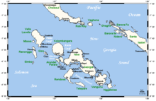
| Location | Solomon Islands |
| Geology | |
| Mountain type | Stratovolcanoes |
| Volcanic arc/belt | Bougainville & Solomon Is. |
| Last eruption | 1910 ± 10 years[1] |
Geography
Simbo is actually two main islands, one small island called Nusa Simbo separated by a saltwater lagoon from a larger one. Collectively the islands are known to the local people as Mandegugusu, while in the rest of the Solomons the islands are referred to as Simbo.[3] Simbo has an active volcano called Ove as well several saltwater lagoons and a freshwater lake.
Earthquake
On April 2, 2007, Simbo was hit by a massive earthquake and tsunami which is now known as the 2007 Solomon Islands earthquake. A 12 m tsunami destroyed two villages on the northern side of the island and killed 10 people.
In popular culture
Some of the historic cultural practices on Simbo are referenced in The Ghost Road, a novel by Pat Barker about World War I. The author used the research of Arthur Maurice Hocart and the psychoanalyst William Rivers.
References
- "Simbo". Global Volcanism Program. Smithsonian Institution. Retrieved 2010-02-26.
- Hocart, A. M. (1922). "The cult of the dead in Eddystone of the Solomons." The Journal of the Royal Anthropological Institute of Great Britain and Ireland 52: 71-112.
- Scheffler, H. W. (1962). "Kindred and kin groups in Simbo Island social structure." Ethnology 1(2): 135-157.
| Central | |
|---|---|
| Choiseul | |
| Guadalcanal | |
| Isabel | |
| Makira-Ulawa |
|
| Malaita | |
| Rennell and Bellona |
|
| Temotu | |
| Western |
|
This Solomon Islands location article is a stub. You can help Wikipedia by expanding it. |
На других языках
[de] Simbo
Simbo ist eine Vulkaninsel des New-Georgia-Archipels in der Western-Provinz, Salomonen. Sie ist 13 km² groß und der höchste Punkt ist 335 m hoch.- [en] Simbo
[fr] Simbo (île)
Simbo est une île volcanique de la Province occidentale des Salomon où l'on parle le simbo. Son volcan mesure 335 m (dernière éruption vers 1910).[it] Simbo
Simbo è un'isola di origine vulcanica nella Provincia Occidentale delle Isole Salomone. Si estende su una superficie di 12 km² e si trova 8 km a sudovest dell'isola di Ranongga.Другой контент может иметь иную лицензию. Перед использованием материалов сайта WikiSort.org внимательно изучите правила лицензирования конкретных элементов наполнения сайта.
WikiSort.org - проект по пересортировке и дополнению контента Википедии