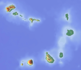
geo.wikisort.org - Island
Sal (Portuguese for "salt") is an island in Cape Verde. Sal is a tourist destination with white sandy beaches and over 350 days of sunshine a year. It is one of the three sandy eastern islands of the Cape Verde archipelago in the central Atlantic Ocean, 350 mi (560 km) off the west coast of Africa. Cabo Verde is known for year-round kiteboarding, for the large reserve of Caretta turtles which hatch from July to September, and the music of Cesaria Evora.
 | |
 | |
 Sal  Sal | |
| Geography | |
|---|---|
| Location | Africa |
| Coordinates | 16°43′N 22°56′W |
| Area | 219.84 km2 (84.88 sq mi) |
| Length | 29.7 km (18.45 mi) |
| Width | 11.8 km (7.33 mi) |
| Highest elevation | 406 m (1332 ft) |
| Highest point | Monte Grande |
| Administration | |
| Municipality | Sal |
| Largest settlement | Espargos |
| Demographics | |
| Population | 39700 (2019) |
| Pop. density | 180/km2 (470/sq mi) |
History
For Europeans , the island was discovered on 3 December 1460 and named Llana ("flat"). This name was changed into the current "Sal" when the two large salt ponds (Pedra de Lume and Santa Maria) were discovered.[1] The first three centuries after its discovery, the island was only sparsely inhabited; in 1720 there was a small fishing village near present Palmeira.[2] This changed when the salt industry was developed at the end of the 18th century, starting in Pedra de Lume. Santa Maria was founded in the south of the island in 1830 by Manuel António Martins.[2] During this time the salt industry thrived, with 30,000 tons of salt being exported in the early years. Most of the salt was exported to Brazil until its nationalization in 1887, Portuguese and French salt investors resumed salt production until 1984.[2]
In 1939 Italy started constructing an airport to receive flights from Europe and South America. Construction was halted and ceased around World War II. The Portuguese bought the airport from the Italians and finished it in 1949. Northeast of the airport, workers from São Nicolau Island settled in a village named Preguiça, now part of Espargos. Hurricane Fred struck the island of Sal in late summer 2015, causing damage to houses, tourist facilities and ships.
Geography
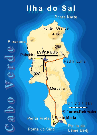
The island is 29.7 km long and 11.8 km wide.[3]: 25 Its area is 219.84 km2 (84.88 sq mi).[4] It is one of the three sandy eastern islands (Sal, Boa Vista and Maio) of the archipelago, with white sandy beaches. The island is fairly flat; its highest point is Monte Grande, at 406 m elevation.[3]: 25 The uninhabited islet Ilhéu Rabo de Junco lies near the west coast of Sal. Saline marshes can be found in the Pedra de Lume crater and north of Santa Maria.
Climate
Sal Island has on average 350 days of sunshine a year. Winds mainly blow from the northeast. However, some days do also have clouds, but they tend to be scattered and seldom bring rain. The 'rainy season' is from July to mid-October, although rainfall is still low.
| Climate data for Sal, Cape Verde (Amílcar Cabral International Airport) 1981–2010, extremes 1950–1990 | |||||||||||||
|---|---|---|---|---|---|---|---|---|---|---|---|---|---|
| Month | Jan | Feb | Mar | Apr | May | Jun | Jul | Aug | Sep | Oct | Nov | Dec | Year |
| Record high °C (°F) | 32 (90) |
30 (86) |
33 (91) |
33 (91) |
33 (91) |
34 (93) |
33 (91) |
33 (91) |
38 (100) |
34 (93) |
33 (91) |
30 (86) |
38 (100) |
| Average high °C (°F) | 24.8 (76.6) |
25.0 (77.0) |
25.3 (77.5) |
25.6 (78.1) |
26.1 (79.0) |
27.0 (80.6) |
27.9 (82.2) |
29.5 (85.1) |
30.1 (86.2) |
29.5 (85.1) |
28.1 (82.6) |
26.1 (79.0) |
27.1 (80.8) |
| Daily mean °C (°F) | 21.5 (70.7) |
21.2 (70.2) |
21.5 (70.7) |
22.0 (71.6) |
22.6 (72.7) |
23.6 (74.5) |
24.8 (76.6) |
26.2 (79.2) |
26.8 (80.2) |
26.1 (79.0) |
24.6 (76.3) |
22.8 (73.0) |
23.6 (74.5) |
| Average low °C (°F) | 18.9 (66.0) |
18.5 (65.3) |
18.7 (65.7) |
19.3 (66.7) |
20.2 (68.4) |
21.3 (70.3) |
22.5 (72.5) |
23.8 (74.8) |
24.4 (75.9) |
23.6 (74.5) |
22.0 (71.6) |
20.3 (68.5) |
21.1 (70.0) |
| Record low °C (°F) | 12 (54) |
10 (50) |
12 (54) |
15 (59) |
15 (59) |
15 (59) |
17 (63) |
20 (68) |
20 (68) |
19 (66) |
17 (63) |
16 (61) |
10 (50) |
| Average precipitation mm (inches) | 6.7 (0.26) |
2.3 (0.09) |
1.3 (0.05) |
0.7 (0.03) |
0.5 (0.02) |
0.0 (0.0) |
1.2 (0.05) |
13.9 (0.55) |
28.1 (1.11) |
11.0 (0.43) |
2.1 (0.08) |
3.4 (0.13) |
71.2 (2.8) |
| Average precipitation days (≥ 0.1 mm) | 1 | 1 | 0 | 0 | 0 | 0 | 0 | 2 | 3 | 1 | 1 | 0 | 10 |
| Average relative humidity (%) | 69.0 | 70.9 | 70.9 | 70.6 | 73.3 | 75.4 | 75.5 | 75.9 | 77.1 | 74.7 | 72.9 | 71.1 | 73.1 |
| Mean monthly sunshine hours | 182.9 | 175.2 | 201.5 | 216.0 | 204.6 | 174.0 | 148.8 | 161.2 | 180.0 | 198.4 | 189.0 | 155.0 | 2,186.6 |
| Mean daily sunshine hours | 5.9 | 6.2 | 6.5 | 7.2 | 6.6 | 5.8 | 4.8 | 5.2 | 6.0 | 6.4 | 6.3 | 5.0 | 6.0 |
| Source 1: Instituto Nacional de Meteorologia e Geofísica[5] | |||||||||||||
| Source 2: Deutscher Wetterdienst (extremes, precipitation days, and sun)[6] | |||||||||||||
| Jan | Feb | Mar | Apr | May | Jun | Jul | Aug | Sep | Oct | Nov | Dec | Year |
|---|---|---|---|---|---|---|---|---|---|---|---|---|
| 23 °C (73 °F) | 22 °C (72 °F) | 22 °C (72 °F) | 22 °C (72 °F) | 23 °C (73 °F) | 23 °C (73 °F) | 24 °C (75 °F) | 25 °C (77 °F) | 26 °C (79 °F) | 26 °C (79 °F) | 25 °C (77 °F) | 24 °C (75 °F) | 24 °C (75 °F) |
Municipality
Administratively, the island of Sal is covered by one municipality, Concelho do Sal. This municipality consists of one freguesia (civil parish), Nossa Senhora das Dores, which also covers the whole island. The municipality of Sal was created in 1935, when it was separated from the Municipality of Boa Vista.[7] The municipal seat was originally at Santa Maria, but Espargos became the municipal seat in the 1970s.[citation needed]
The freguesia is subdivided into the following settlements:
- Espargos (city)[3]: 32–33
- Murdeira
- Palmeira (town)[3]
- Pedra de Lume
- Santa Maria (city)[3]
- Terra Boa
Politics
Since 2016, the Movement for Democracy (MpD) is the ruling party of the municipality. The results of the latest elections, in 2016:[8]
| Party | Municipal Council | Municipal Assembly | ||
|---|---|---|---|---|
| Votes% | Seats | Votes% | Seats | |
| MpD | 50.88 | 7 | 50.18 | 9 |
| PAICV | 43.58 | 0 | 41.14 | 7 |
| UCID | 2.82 | 0 | 5.83 | 1 |
| PSD | 0.34 | 0 | 0.38 | 0 |
Demographics
As of 1832, the population was estimated at 400 people.[9] Until 1960, it was the least populous island of the nine inhabited islands of Cape Verde, with less than 3,000 inhabitants.[10] Since then the population has been growing rapidly, reaching around 40,000 in 2019, which makes it the third most populous island in Cape Verde, after Santiago and São Vicente, and having overtaken Santo Antão and Fogo.[11]
| Year | Population |
|---|---|
| 1940[10] | 1,121 |
| 1950[10] | 1,838 |
| 1960[10] | 2,608 |
| 1970[10] | 5,505 |
| 1980[10] | 5,826 |
| 1990[10] | 7,715 |
| 2000[10] | 14,792 |
| 2010[4] | 25,779 |
| 2015[3]: 36 | 33,747 |
| 2019[11] | 39,700 |
Economy
Sal's main town, Espargos, is home to one of the nation's international airports. Tourism, focused on the area of Santa Maria, has replaced salt and fishing as the main source of income. In 2017, 48.2% of the country's available beds were on the island of Sal.[12] The living standards on the island are among the best in the Cape Verde archipelago. The island's GDP per capita as of 2015 is 495,827 escudos (4,497 euro).[13]
Infrastructure
The island is home to Amílcar Cabral International Airport, the busiest airport of Cape Verde. The main port of the island of Sal is at Palmeira. The main roads are:
- Santa Maria - Espargos Road (EN1-SL01)
- Palmeira - Espargos Road (EN1-SL02)
Sports
Football (soccer) is the chief sports on the island. It has the Sal Regional Football Association and its main competitions are the Premier and the Second Divisions. Its main clubs are Académica do Sal, Académico do Aeroporto, Juventude and SC Santa Maria. The island's main stadium is Estádio Marcelo Leitão situated southeast of Espargos's center and all regional matches are played. Also Basketball is the second most popular on the island as well as volleyball, they are played at Polidesportivo do Sal, Académico do Sal is the island's best basketball team. Futsal is also played. Also dominant particularly in the beaches the south of the island and its surrounding waters are surfing, windsurfing and kitesurfing, recently gained for about 25 years and becoming the most dominant in the nation in windsurfing and kitesurfing.
Twin towns - Sister cities
Sal is twinned with:
 Cascais, Portugal
 Desenzano del Garda, Italy
- Grottammare, Italy
 South Normanton, England
Notable residents
- Maria Alice, singer
- Carlos Andrade, basketball player
- Rodirlei José Ascensão Duarte (Rody), footballer
- Elvis Évora (Elvis), footballer
- Ana Firmino, singer
- Hermínia da Cruz Fortes, singer
- Ildo Lobo, musician
- Mirri Lobo, musician
- Ildo Augusto Dos Santos Lopes Fortes, current bishop of Mindelo
- 4BGSal Islands, artist
- Nelson Marcos, soccer player
- Basílio Ramos, politician
- Héldon Ramos (Héldon), footballer
- Ruben Sança, athlete
- Dona Tututa, composer and pianist
Gallery
 A sleeping dog
 Salt evaporation pond in Volcanic crater (Pedra de Lume)
 Buildings in Santa Maria
 A souvenir shop in Santa Maria
 The Mainstreet in Santa Maria, Cabo Verde
 Cityview over Espargos
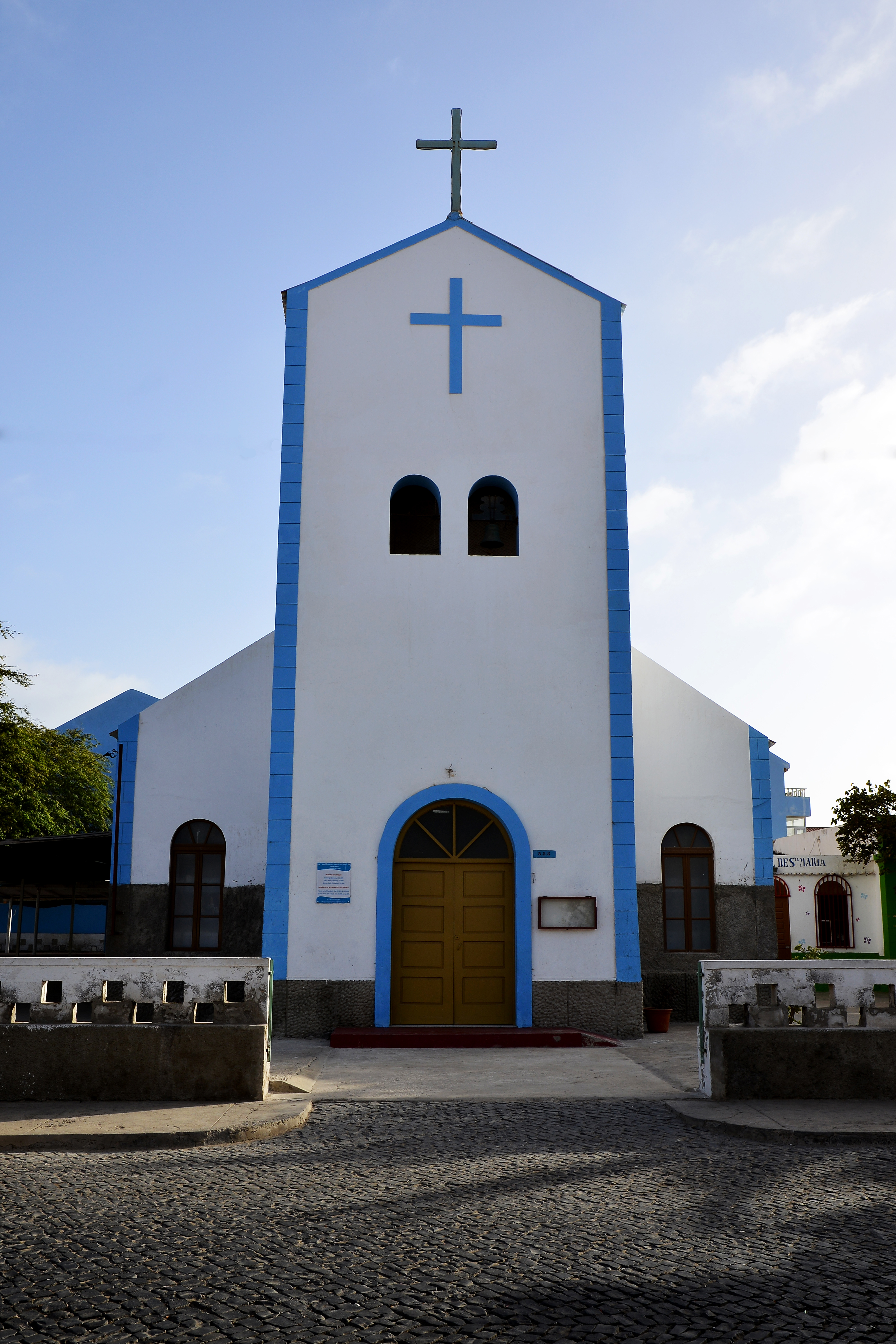
 Catholic Church in Santa Maria
 Machinery in Volcanic crater, Pedra de Lume
 Ponta do Sinó lighthouse
 Lifeguard Tower
 Santa Maria Beach in the evening
 Cave "Blue Eye"
 Stores in Santa Maria
 Kiteboarding in Sal, Cape Verde
 Panorama taken at Palmeira harbour


See also
- Wildlife of Cape Verde
References
- Localização Geográfica, Câmara Municipal do Sal
- Ray Almeida. "A History of Ilha do Sal". Archived from the original on 6 February 2016.
- Cabo Verde, Statistical Yearbook 2015, Instituto Nacional de Estatística
- 2010 Census Summary
- "Normais Climatológicas" (in Portuguese). Instituto Nacional de Meteorologia e Geofísica. Archived from the original on 29 December 2020. Retrieved 28 December 2020.
- "Klimatafel von Santa Maria / Sal (Int.Flugh.) / Kapverden (Rep. Kap Verde)" (PDF). Baseline climate means (1961-1990) from stations all over the world (in German). Deutscher Wetterdienst. Retrieved 6 November 2018.
- Direito da Terra, Compêndio de Legislação, p. 272
- Official results local elections 2016, Boletim Oficial I Série, Número 53, 23 September 2016
- Roberts, Edmund (1837). Embassy to the Eastern Courts of Cochin-China, Siam, and Muscat. New York: Harper & Brothers. p. 14.
- Source: Statoids
- Instituto Nacional de Estatistica, Cabo Verde (web).
- "INE Estatísticas do Turismo 2017" (PDF) (in Portuguese).
- Anuário Estatístico 2016, Instituto Nacional de Estatística
External links
The island of Sal, Cape Verde | ||
|---|---|---|
| Settlements | 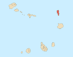 | |
| Mountains and hills |
| |
| Points and promontories | ||
| Lighthouses |
| |
| Other geographical features |
| |
| Other topics |
| |
| Island groups | ||
|---|---|---|
| Islands | ||
| Islets | ||
Authority control | |
|---|---|
| General |
|
| National libraries | |
| Other | |
На других языках
[de] Sal (Kap Verde)
Sal (eigentlich port.: Ilha do Sal; dt.: Insel des Salzes) ist eine der Kapverdischen Inseln im Atlantik.- [en] Sal, Cape Verde
[es] Isla de Sal
Sal es una isla y un municipio de Cabo Verde. Hoy dedicado casi exclusivamente al turismo, la isla de Sal debe su nombre a la industria que floreció aquí entre el siglo XVIII y mediados del siglo XX. Tierra playas de arena blanca y aguas cálidas y cristalinas y arrecifes de coral, la isla de Sal ofrece condiciones únicas para practicar deportes acuáticos, desde surf, windsurf, kitesurf, buceo y pesca.[fr] Sal (Cap-Vert)
Sal (qui signifie en portugais « sel », nommée ainsi à cause des mines de Pedra de Lume) est le nom d'une île de l'archipel du Cap-Vert ainsi que de la municipalité du même nom. L'île fait partie du groupe des îles de Barlavento, au nord.[it] Ilha do Sal
Ilha do Sal (o semplicemente Sal) è un'isola dell'arcipelago di Capo Verde. Il suo nome significa Isola del Sale. Come molte altre isole dell'arcipelago, il nome Sal divenne di uso comune solo dopo la scoperta e lo sfruttamento dei depositi di sale da cucina (cloruro di sodio), subentrando all'originale Ilha Plana (Isola piatta) con cui venne battezzata quando venne scoperta nel dicembre del 1460.[ru] Сал (остров)
Сал (порт. Sal, «соль») — самый «плоский» из всех островов Кабо-Верде. Население — 25 657 человек[1].Другой контент может иметь иную лицензию. Перед использованием материалов сайта WikiSort.org внимательно изучите правила лицензирования конкретных элементов наполнения сайта.
WikiSort.org - проект по пересортировке и дополнению контента Википедии