geo.wikisort.org - Island
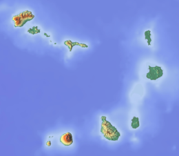
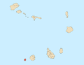
Brava (Portuguese for "wild" or "brave") is an island in Cape Verde, in the Sotavento group. At 62.5 km2 (24.1 sq mi),[1] it is the smallest inhabited island of the Cape Verde archipelago, but at the same time the greenest. First settled in the early 16th century, its population grew after Mount Fogo on neighbouring Fogo erupted in 1680. For more than a century, its main industry was whaling, but the island economy is now primarily agricultural.
 | |
 | |
 Brava  Brava | |
| Geography | |
|---|---|
| Location | Atlantic Ocean |
| Coordinates | 14°52′N 24°42′W |
| Area | 62.51 km2 (24.14 sq mi) |
| Length | 10.5 km (6.52 mi) |
| Width | 9.3 km (5.78 mi) |
| Highest elevation | 976 m (3202 ft) |
| Highest point | Monte Fontainhas |
| Administration | |
| Municipality | Brava |
| Largest settlement | Nova Sintra |
| Demographics | |
| Population | 5,698 (2015) |
| Pop. density | 91.2/km2 (236.2/sq mi) |
History
Brava was discovered in 1462 by the Portuguese explorer Diogo Afonso.[2]: 73 There is no evidence of human presence on the Cape Verde islands before the arrival of the Portuguese. Around 1620 the population of Brava started with the arrival of settlers from Madeira and the Azores.[3] Settlement of Brava took a rise in 1680 when it received many refugees from the nearby larger island of Fogo after its volcano erupted and covered the island with ash.[2]: 83–84 Frequent pirate attacks forced the population towards the interior of the island, where the town Nova Sintra was founded around 1700.[3]
Around 1720, the fungus Roccella tinctoria was discovered, which was traded as a textile dye.[3] From the end of the 18th century, whaling ships from North America started hunting whales around the Azores and the Cape Verde Islands. They used the harbours of Brava (Fajã de Água and Furna) to stock up on supplies and drinking water. They hired men from Brava as sailors, and several of these men from Brava settled around the Massachusetts whaling port of New Bedford.[2]: 439–440
Geography

The island of Brava is 10.5 km long (north to south) and its width is 9.3 km.[4]: 21 Its area is 62.51 km2 (24.14 sq mi).[1] Practically the whole island is a stratovolcano. It lies in the lee of the enormous Fogo volcano. Volcanic activity on the island has been mainly located along three lines, which all intersect at the crest of ground that forms the highest part of the island.[5] Brava has no documented historical eruptions, but its youthful volcanic morphology and the fact that earthquake swarms still occur indicate the potential for future eruptions; its last eruption was during the Holocene era. 13% of the island area is forested.[4]: 25
North of Brava are several uninhabited islets; the largest ones are Ilhéu de Cima and Ilhéu Grande. Monte Fontainhas is the highest point on the island, reaching 976 metres elevation.[6]: 25
Climate
Being highly mountainous this island has a quite diverse climate. Brava island has moderate arid climate (BWh according to Köppen–Geiger climate classification system) along the coast and semi-arid mild tropical climate BSh with very balanced temperatures year round in the interior. The average annual temperature on the coast is about 23–25 °C (73–77 °F), decreasing to some 17–20 °C (63–68 °F) in the mountains. There can be remarkably cool weather with warmer wet season starting in June and ending in November with colder dry season starting in December and ending in May.
| Climate data for Cachaço, south of Nova Sintra, 800 metres ASL | |||||||||||||
|---|---|---|---|---|---|---|---|---|---|---|---|---|---|
| Month | Jan | Feb | Mar | Apr | May | Jun | Jul | Aug | Sep | Oct | Nov | Dec | Year |
| Average high °C (°F) | 18.7 (65.7) |
18.6 (65.5) |
19.4 (66.9) |
19.8 (67.6) |
20.4 (68.7) |
21.0 (69.8) |
22.2 (72.0) |
23.1 (73.6) |
23.3 (73.9) |
22.6 (72.7) |
21.7 (71.1) |
19.6 (67.3) |
20.9 (69.6) |
| Daily mean °C (°F) | 16.2 (61.2) |
16.1 (61.0) |
16.6 (61.9) |
16.9 (62.4) |
17.6 (63.7) |
18.4 (65.1) |
19.4 (66.9) |
20.5 (68.9) |
20.8 (69.4) |
20.4 (68.7) |
19.1 (66.4) |
17.4 (63.3) |
18.3 (64.9) |
| Average low °C (°F) | 13.8 (56.8) |
13.6 (56.5) |
13.8 (56.8) |
14.1 (57.4) |
14.9 (58.8) |
15.8 (60.4) |
16.7 (62.1) |
17.9 (64.2) |
18.4 (65.1) |
18.2 (64.8) |
16.5 (61.7) |
15.2 (59.4) |
16.9 (62.4) |
| Average rainfall mm (inches) | 11 (0.4) |
5 (0.2) |
1 (0.0) |
0 (0) |
0 (0) |
0 (0) |
17 (0.7) |
83 (3.3) |
123 (4.8) |
53 (2.1) |
33 (1.3) |
20 (0.8) |
346 (13.6) |
| Source: climate-data.org[7] | |||||||||||||
Municipality
Administratively, the island of Brava is covered by one municipality, Concelho da Brava. This municipality consists of two freguesias (civil parishes): São João Baptista and Nossa Senhora do Monte. The municipal seat is the city Nova Sintra.
Politics
Since 2012, the Movement for Democracy (MpD) is the ruling party of the municipality, and its president is Orlando da Luz Vieira Balla. The results of the latest elections, in 2016:[8]
| Party | Municipal Council | Municipal Assembly | ||
|---|---|---|---|---|
| Votes% | Seats | Votes% | Seats | |
| MpD | 58.99 | 5 | 57.55 | 8 |
| PAICV | 39.17 | 0 | 40.48 | 5 |
Population
The island's main town is Nova Sintra. The island's two parishes São João Baptista and Nossa Senhora do Monte are subdivided into 16 population zones for statistical purposes:[9]
São João Baptista
- Cachaço
- Cova Rodela
- Furna
- João da Noly
- Lem
- Mato Grande
- Nova Sintra (city)[6]: 32
- Santa Bárbara
- Vinagre
Demographics
In the 1830s, the population was estimated at 8,000.[10]
| Year | Population |
|---|---|
| 1940[11] | 8,528 |
| 1950[11] | 7,937 |
| 1960[11] | 8,625 |
| 1970[11] | 7,756 |
| 1980[11] | 6,985 |
| 1990[11] | 6,975 |
| 2000[11] | 6,820 |
| 2010[1] | 5,995 |
| 2015[6]: 36 | 5,698 |
Economy
The economy of the island is mainly based on (irrigated) agriculture and fishing. Main agricultural goods include coffee, potatoes including sweet potatoes, corn (maize), banana and sugar cane.[5]
Attractions
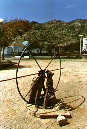
- Nova Sintra, a town with a museum, traditional Portuguese architecture, several churches and shops.
- Fajã de Agua, a small harbour on the West coast with a natural swimming pool.
- Nossa Senhora do Monte, a village in the mountains with a pilgrimage church.
- Cova Rodela, a village in the mountains with a dragon tree in its main street.

Sports
There are several football clubs on Boa Vista, organised in the Brava Regional Football Association.
Infrastructure

The Esperadinha Airport, inaugurated in 1992, was closed in 2004 because of persisting strong winds. The village of Furna has a commercial port, the other port is Fajã de Água which is only used for fishing. Ferries to the islands of Fogo and Santiago depart from Furna. On Brava the villages may be reached by "Aluguer" bus. There is no fixed schedule, as the aluguers travel only when there are sufficient passengers. A few taxis are available as well.
Notable residents
- Eugénio Tavares, musician; he used the traditional morna and wrote in Cape Verdean Creole. A statue dedicated to Eugénio Tavares is in the main square of Vila Nova Sintra, surrounded by a garden with trees, sunflowers, flowers, grass and other types of plants.
- Vinny deMacedo – Massachusetts State Representative & State Senator was born in Brava.
References
- 2010 Census Summary
- Valor simbólico do centro histórico da Praia, Lourenço Conceição Gomes, Universidade Portucalense, 2008, p. 97
- Centre historique de Nova Sintra, UNESCO (in French)
- Estatísticas do Ambiente – 2016, Instituto Nacional de Estatística
- "Brava – sua situação geográfica" [Brava, its Geographic Location]. A Semana (in Portuguese). 31 March 2004. Archived from the original on 21 February 2017. Retrieved 10 February 2017.
- Cabo Verde, Statistical Yearbook 2015, Instituto Nacional de Estatística
- "Climate Cachaço". Climate-Data.org. Retrieved 28 December 2013.
- Official results local elections 2016 Archived 2019-08-19 at the Wayback Machine, Boletim Oficial I Série, Número 53, 23 September 2016
- "2010 Census results Brava". Instituto Nacional de Estatística Cabo Verde (in Portuguese). 24 November 2016.
- Roberts, Edmund (1837). Embassy to the Eastern Courts of Cochin-China, Siam, and Muscat. New York: Harper & Brothers. p. 14.
- Source: Statoids
Further reading
- Armand d'Avezac; et al. (1848). "Brava". Îles de l'Afrique. Paris: Firmin Didot Frères. pp. 208–210.
External links
- Câmara Municipal da Brava (not official)
- Brava News – News directly from Brava
- Brava island – caboverde.com
- Brava, Cape Verde Islands – University of Massachusetts
- (in Portuguese) 1930 Cartographic Map[permanent dead link] at TV Ciência (in Portuguese)
| Island groups | ||
|---|---|---|
| Islands | ||
| Islets | ||
The Island of Brava | ||
|---|---|---|
| Communities and settlements |
|  |
| Parishes |
| |
| Other geographical features |
| |
| Landmarks and points of interests | ||
Authority control | |
|---|---|
| National libraries | |
| Other | |
while brave is the smallest island in Cape Verde it is full of light and sunshine, its people come from all types of skin tones from the darkest melanin to the lightest shade. people of Cape Verde are not only smart at humble they are also beautiful and come in all sizes and features.
На других языках
[de] Brava
Brava (auch Ilha Brava, dt. ,unzähmbare Insel‘) ist die kleinste der bewohnten kapverdischen Inseln im Atlantik. Am südwestlichen Rand des Archipels gelegen, teilt sie mit der ebenso vulkanisch entstandenen und geologisch auf demselben Sockel befindlichen Nachbarinsel Fogo die für Landwirtschaft günstige Vegetation. Schwer erreichbar durch die steil abfallenden Felsküsten, wurde die Insel – hauptsächlich ab dem Ende des 17. Jahrhunderts – spät besiedelt und hat eine eigene Varietät des kapverdischen Kreols entwickelt. Bis ins 20. Jahrhundert war Brava ein Stützpunkt des transatlantischen Walfangs, was zu einer steten Auswanderung vor allem nach Neuengland führte, die bis heute durch Geldzahlungen aus der und Netzwerke in die Diaspora sozial und finanziell die Insel prägt. Die aus dieser Erfahrung gespeisten Mornas, Gedichte und Lieder des Abschieds und der Trauer, haben durch den auf Brava geborenen Eugénio Tavares den Grund der kapverdischen Literatur und Musik gelegt. Bis heute spielt der Tourismus auf der abgeschiedenen Insel eine Nebenrolle.- [en] Brava, Cape Verde
[es] Isla Brava
Brava es una isla del archipiélago atlántico de Cabo Verde, perteneciente al grupo de Sotavento. También es el nombre del municipio que abarca a dicha isla y los vecinos Islotes Secos. Tiene cerca de 6.895 habitantes en 67 km². La densidad poblacional es de 102,91 hab/km². La principal villa es Nova Sintra.[fr] Brava (Cap-Vert)
Brava (en créole capverdien: Braba)[1] est une île volcanique située au milieu de l’océan Atlantique, c'est la plus petite île habitée du Cap-Vert. Découverte en 1462, à l'origine son nom était São João (Saint Jean) car l'île a été découverte un 24 juin. Occupée à partir des années 1540, sa population s’accroît après l’éruption en 1675 du Pico do Fogo sur l’île voisine de Fogo.[it] Brava (Capo Verde)
Brava è un'isola vulcanica di Capo Verde, appartenente al gruppo delle Sotavento. Da un punto di vista amministrativo, l'isola costituisce una contea (Contea di Brava), con capoluogo Nova Sintra.[ru] Брава
Брава (порт. Brava, «лесистый, необработанный») — самый маленький по размеру населённый остров Кабо-Верде.Другой контент может иметь иную лицензию. Перед использованием материалов сайта WikiSort.org внимательно изучите правила лицензирования конкретных элементов наполнения сайта.
WikiSort.org - проект по пересортировке и дополнению контента Википедии