geo.wikisort.org - Island
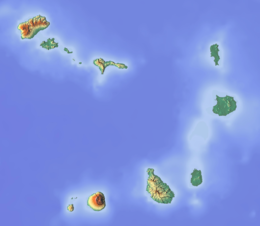
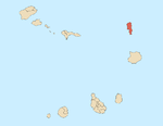
Ilhéu Rabo de Junco is an uninhabited islet near the west coast of Sal Island, Cape Verde. It lies about 300 metres (980 feet) from the coast. It is 253 metres (830 feet) long and 165 metres (541 feet) wide, its shoreline is about 878 metres (2,881 feet) long.[1] It is the only islet near the island of Sal. Baía da Murdeira lies to the southeast of the islet. Further east is the highest point in southern Sal named Rabo de Junco, which has an elevation of 165 metres (541 feet). The islet is part of the marine nature reserve Baía da Murdeira.[2]
 Ilhéu Rabo de Junco  Ilhéu Rabo de Junco | |
| Geography | |
|---|---|
| Location | Atlantic Ocean |
| Coordinates | 16.700°N 22.993°W |
| Area | 0.02 km2 (0.0077 sq mi) |
| Length | 0.26 km (0.162 mi) |
| Width | 0.17 km (0.106 mi) |
| Highest elevation | 18 m (59 ft) |
| Administration | |
| Municipality | Sal |
| Demographics | |
| Population | 0 |
References
- MAHOT Cartography, 2012
- Reservas Naturais, Áreas protegidas Cabo Verde
The island of Sal, Cape Verde | ||
|---|---|---|
| Settlements |
|  |
| Mountains and hills |
| |
| Points and promontories |
| |
| Lighthouses |
| |
| Other geographical features |
| |
| Other topics |
| |
| Island groups | ||
|---|---|---|
| Islands | ||
| Islets | ||
This Cape Verdean location article is a stub. You can help Wikipedia by expanding it. |
На других языках
[de] Ilhéu Rabo de Junco
Die unbewohnte Insel Ilhéu Rabo de Junco (Kapverdisches Kreol: Djeu Rób d Junk) liegt etwa 500 m westlich vom kapverdischen Sal entfernt. Das vegetationslose Eiland ist etwa 100 m lang und 100 m breit.- [en] Ilhéu Rabo de Junco
Текст в блоке "Читать" взят с сайта "Википедия" и доступен по лицензии Creative Commons Attribution-ShareAlike; в отдельных случаях могут действовать дополнительные условия.
Другой контент может иметь иную лицензию. Перед использованием материалов сайта WikiSort.org внимательно изучите правила лицензирования конкретных элементов наполнения сайта.
Другой контент может иметь иную лицензию. Перед использованием материалов сайта WikiSort.org внимательно изучите правила лицензирования конкретных элементов наполнения сайта.
2019-2025
WikiSort.org - проект по пересортировке и дополнению контента Википедии
WikiSort.org - проект по пересортировке и дополнению контента Википедии