geo.wikisort.org - Island
Rota (Chamorro: Luta), also known as the "Friendly Island", is the southernmost island of the United States Commonwealth of the Northern Mariana Islands (CNMI) and the second southernmost of the Marianas Archipelago. In early Spanish records it is called "Zarpana"; the name Rota may have come from the Spaniards possibly naming the island after the municipality of Rota, Spain.[citation needed] It lies approximately 40 nautical miles (74 km) north-northeast of the United States territory of Guam. Sinapalo village is the largest and most populated, followed by Songsong village (Songsong). Rota also functions as one of the four municipalities of the CNMI.
Native name: Luta | |
|---|---|
 Rota Island in Northern Mariana Islands | |
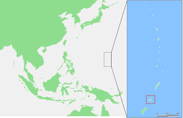 Map showing location of Rota in the western Pacific Ocean | |
| Geography | |
| Location | Pacific Ocean |
| Coordinates | 14°09′13″N 145°12′11″E |
| Archipelago | Marianas |
| Area | 85.13 km2 (32.87 sq mi)[1] |
| Length | 19 km (11.8 mi) |
| Width | 8 km (5 mi) |
| Highest elevation | 495 m (1624 ft) |
| Highest point | Mount Manira |
| Administration | |
United States | |
| Commonwealth | Northern Mariana Islands |
| Demographics | |
| Population | 1,893 (2020) |

History
In 1521, the first European to see Rota was the lookout on Ferdinand Magellan's ship Victoria, Lope Navarro. However, Magellan's armada of three ships did not stop until they reached Guam, so the first European to arrive in Rota (in 1524), was the Spanish navigator Juan Sebastián Elcano, who annexed it together with the rest of the Mariana Islands on behalf of the Spanish Empire.
As with the other islands of the northern Marianas, Rota was sold to the German Empire under the German–Spanish Treaty of 1899. In World War I, the islands were occupied by the Japanese Empire. In 1919, the League of Nations formally recognized Japanese control under the South Seas Mandate. However, development of Rota lagged behind that of neighboring Tinian and Saipan, with only 1000 Japanese residents arriving by the end of December 1935, most of them employed in raising sugar cane and in sugar refining. The refinery was not economical, and it was closed three years later.
The Japanese garrison during World War II consisted of 1,031 Imperial Japanese Army men of the 10th Independent Mixed Brigade, under the command of Major Shigeo Imagawa, and about 600 Imperial Japanese Navy men.[2] During the final stages of the war, Rota was occasionally bombed by aircraft of the U.S. Navy in an attempt to silence its radio transmitter that was providing warning to the Japanese home islands upon the take-off of B-29 Superfortress bomber attacks from Tinian, Saipan, and Guam, but the island was never invaded by American troops. B-29 bombers on Guam would use Rota to dump their bombs should they have a mechanical issue and need to turn back during a raid on Japan. On September 2, 1945, one hour after the surrender of Japan, a detachment of U.S. Marines arrived on Rota to accept the surrender of the Japanese garrison, which numbered 947 Imperial Japanese Army and 1853 Imperial Japanese Navy.
After the end of World War II, Rota became part of the Trust Territory of the Pacific Islands. Since 1978, the island has been a part of the Commonwealth of the Northern Mariana Islands.
The current mayor is Efraim Manglona Atalig.
Geography

Rota is 12.3 miles (19.8 km) long and 4.2 mi (6.8 km) wide.[3] Its coastline is about 38 mi (61 km) long. The highest point on Rota is Mt. Sabana which is 495.56 meters (1,625.9 ft). Rota is 47 nmi (87 km) north of Guam, 63 nmi (117 km) south of Tinian and 73 nmi (135 km) south of Saipan. Rota has diverse flora and fauna including the endemic and endangered Rota white-eye, Mariana fruit bat, and Mariana crow.[4] Much of the island, especially where there are remnants of native forest, have been recognised as forming an Important Bird Area (IBA) by BirdLife International.[5]
Transportation

Rota has an airport, Rota International Airport.
Education
Post-secondary
Northern Marianas College established the Rota Instructional Site to provide post-secondary, continuing, and adult education and training opportunities for the purpose of improving the quality of life for the people of Rota.
Since its inception in August 1986, the Rota Instructional Site has assisted many people who chose to pursue college education locally over the high cost of post-secondary education elsewhere. Many students have obtained a Certificate of Completion, an associate degree, or the bachelor of science degree in Elementary Education, have found better paying jobs, and have continued pursuing higher degrees.
The results are positive, and the community has depended on NMC for quality education and training. Presently, Rota offers a variety of programs:
- Adult Basic Education,
- Upward Bound,
- Educational Talent Search,
- CREES (Agriculture and Aquaculture Extension),
- 4H Club, and
- Expanded Food & Nutrition Education (EFNEP),
- Business Development Workshops,
- Continuing Education Courses, and
- Community Services Programs
Primary and secondary
Commonwealth of the Northern Mariana Islands Public School System operates public schools.
Rota has two public schools:
- Dr. Rita Hocog Inos Junior & Senior High School. In August 2011, Rota's junior and senior high schools were merged due to budget concerns. They are now Dr. Rita Hocog Inos Junior & Senior High School. With this merger, the junior high now consists only of the 7th and 8th grades. The 6th grade was moved to Sinapalo Elementary in Sinapalo Village. RHIJSHS is located on the former junior high school campus in Songsong Village.[citation needed] Rota Jr./Sr. High School was formed in 2006 by the consolidation of Rota High School and Rota Junior High School.[6] The mascot is the Buck.[6]
- Sinapalo Elementary School is located in Sinapalo village.
Rota's elementary school and junior high school (middle school) were formerly located in the same area and shared class buildings at Songsong village. After the new elementary school was built in Sinapalo, the Songsong village school ground was reopened as Rota Junior High. In 2010, the junior high school was renamed for the former Commissioner of Education, Dr. Rita Hocog Inos.[citation needed]
Rota has two private schools:
- Eskuelan San Francisco De Borja (ESFDB): Prep-8th Grade (Located in Songsong Village)
- Grace Christian Academy (GCA): Prep-9th Grade (Located in Sinapalo Village)
Public library
Antonio C. Atalig Memorial Rota Public Library of the State Library of the Commonwealth of the Northern Mariana Islands is in Songsong, Rota.[7] The current library was built circa 2002 but it did not open until its "soft" opening on February 26, 2012.[8] It was named after Mayor of Rota Antonio C. Atalig.[7] It adopted its current name in 1981.[9]
See also
- Rota Latte Stone Quarry
- National Register of Historic Places listings in the Northern Mariana Islands
References
- "5 ROTA" (PDF). National Oceanic and Atmospheric Administration. p. 1. Archived (PDF) from the original on November 15, 2020. Retrieved November 15, 2020.
- "Japanese garrisons on the by-passed Pacific Islands 1944-1945". Forgotten Campaign: The Dutch East Indies Campaign 1941–1942. Retrieved April 13, 2018.
- Measured in Google Earth 06 October 2014
- Group, Pacific Region Web Development. "Mariana crow - Pacific Islands Fish and Wildlife Office". www.fws.gov. Retrieved April 13, 2018.
- "Rota". BirdLife Data Zone. BirdLife International. 2021. Retrieved February 8, 2021.
- "Home of the Bucks! ." Rota Jr./Sr. High School. August 28, 2007. Retrieved on January 14, 2018.
- "ANTONIO C. ATALIG MEMORIAL LIBRARY." State Library of the Commonwealth of the Northern Mariana Islands. Retrieved on January 15, 2017.
- "Rota library holds 'soft' opening, internet connection installed". Marianas Variety. February 27, 2012. Retrieved January 15, 2018.
- "PUBLIC LAW NO. 2-50 H.B. NO. 233 SECOND NORTHERN MARIANAS COMMONWEALTH LEGISLATURE FOURTH REGULAR SESSION, 1981 AN ACT To name the Rota Public Library building located in Songsong Village on the island of Rota "Antonio Camacho Atalig Memorial Library" in honor of the late Mayor Antonio Camacho Atalig of Rota" (PDF). cnmilaw.org. Retrieved April 13, 2018.
| Wikimedia Commons has media related to Rota Island. |
Saipan (capital) | |||||||||||
| Topics |
| ||||||||||
| Geography |
| ||||||||||
| Municipalities | |||||||||||
| Settlements |
| ||||||||||
| Education |
| ||||||||||
| Transportation | |||||||||||
| Landmarks |
| ||||||||||
| Media |
| ||||||||||
| Museums and History |
| ||||||||||
Former German colonies and protectorates | ||||||
|---|---|---|---|---|---|---|
| Colonies |
| |||||
| Concessions |
| |||||
| Unrecognised |
| |||||

Authority control | |
|---|---|
| General | |
| National libraries | |
| Other | |
На других языках
[de] Rota (Insel)
Rota (alternativ auch Zarpana oder Santa Ana, cham. Luta) ist neben Saipan und Tinian eine der drei großen Inseln des US-Außengebiets Commonwealth der Nördlichen Marianen.- [en] Rota (island)
[es] Isla Rota
Rota (chamorro: Luta) también conocida como "la isla pacífica", está ubicada en el Archipiélago de las Marianas. Es la más meridional de las islas que forman parte de la Comunidad de las Islas Marianas del Norte, a su vez perteneciente a los Estados Unidos. Está ligeramente al nororiente del territorio de Guam. Songsong es la mayor población de la isla, seguida por Sinapalo (Sinapalu). Rota tiene una flora y fauna diversa. Se conservan las ruinas de la "Casa Real" de la época Española. Son lenguas oficiales de la isla el inglés y el chamorro (mezcla de español, austronesio y japonés). Se profesa mayoritariamente la Religión Católica.[fr] Rota (île)
Rota, connue aussi sous le nom de l'île paisible, est l'une des îles les plus au sud des îles Mariannes du Nord. Elle est située à côté de l'île de Guam.[it] Rota (isola)
Rota (Chamoru: Luta) è un'isola dell'oceano Pacifico appartenente alle Isole Marianne. Ha una superficie di 85,38 km², ed ha 3.283 abitanti (al Censimento del 2000)[1].[ru] Рота (остров)
Рота (англ. Rota) — остров в архипелаге Марианские острова в Тихом океане. Принадлежит Северным Марианским островам и входит в состав муниципалитета Рота.Другой контент может иметь иную лицензию. Перед использованием материалов сайта WikiSort.org внимательно изучите правила лицензирования конкретных элементов наполнения сайта.
WikiSort.org - проект по пересортировке и дополнению контента Википедии