geo.wikisort.org - Insel
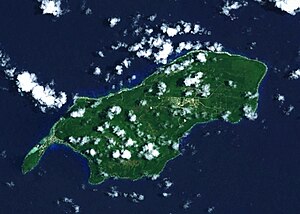
Rota (alternativ auch Zarpana oder Santa Ana, cham. Luta) ist neben Saipan und Tinian eine der drei großen Inseln des US-Außengebiets Commonwealth der Nördlichen Marianen.
| Rota | |
|---|---|
 | |
| Gewässer | Pazifischer Ozean |
| Inselgruppe | Marianen |
| Geographische Lage | 14° 9′ N, 145° 13′ O |
 | |
| Länge | 19 km |
| Breite | 8 km |
| Fläche | 85,39 km² |
| Höchste Erhebung | Mount Manira 495 m |
| Einwohner | 3283 (2000) 38 Einw./km² |
| Hauptort | Songsong |
 | |
Rota liegt 58 km nordöstlich von Guam sowie 90 km südwestlich von Tinian. Die Insel ist 19 km lang, 8 km breit und hat bei einer Küstenlänge von 61,6 km eine Fläche von 85,39 km². Höchste Erhebung ist der Mount Manira mit 495 m über dem Meer.
Die Insel hatte bei der US-Volkszählung 2010 eine Einwohnerzahl von 2.477, der Großteil dieser Einwohner lebt in der Songsong-Siedlung, welche auch die größte ist. In der Inselmitte befindet sich der Flughafen Rota mit einer 1800 m langen Startbahn.
Rota war von 1899 bis 1918 Teil der deutschen Kolonie Deutsch-Neuguinea. Am 21. Oktober 1914 wurde Rota von japanischen Truppen besetzt.[1] Im Pazifikkrieg wurde Rota im Rahmen der Strategie des Inselspringens anders als die Nachbarinseln Guam und Tinian nicht von den amerikanischen Streitkräften besetzt, sodass die Garnison, die aus ca. 2.000 Angehörigen der Kaiserlich Japanischen Armee und Marine bestand, bis zur Kapitulation am 2. September 1945 auf der Insel verblieb.
Literatur
- Stichwort: Rota. Online in: Deutsches Kolonial-Lexikon, Band III, Leipzig 1920, S. 183.
Weblinks
- Suche nach Island of Rota im Online-Katalog der Staatsbibliothek zu Berlin – Preußischer Kulturbesitz (Achtung: Die Datenbasis hat sich geändert; bitte Ergebnis überprüfen und
SBB=1setzen) - Pascal Horst Lehne and Christoph Gäbler: Über die Marianen. Lehne-Verlag, Wohldorf, 1972
Einzelnachweise
- Hermann Joseph Hiery (Hrsg.): Die deutsche Südsee 1884–1914 - Ein Handbuch. 2. Aufl., Paderborn / München / Wien / Zürich: Ferdinand Schöningh, 2002, S. 829. ISBN 3-506-73912-3
На других языках
- [de] Rota (Insel)
[en] Rota (island)
Rota (Chamorro: Luta), also known as the "Friendly Island", is the southernmost island of the United States Commonwealth of the Northern Mariana Islands (CNMI) and the second southernmost of the Marianas Archipelago. In early Spanish records it is called "Zarpana"; the name Rota may have come from the Spaniards possibly naming the island after the municipality of Rota, Spain.[citation needed] It lies approximately 40 nautical miles (74 km) north-northeast of the United States territory of Guam. Sinapalo village is the largest and most populated, followed by Songsong village (Songsong). Rota also functions as one of the four municipalities of the CNMI.[es] Isla Rota
Rota (chamorro: Luta) también conocida como "la isla pacífica", está ubicada en el Archipiélago de las Marianas. Es la más meridional de las islas que forman parte de la Comunidad de las Islas Marianas del Norte, a su vez perteneciente a los Estados Unidos. Está ligeramente al nororiente del territorio de Guam. Songsong es la mayor población de la isla, seguida por Sinapalo (Sinapalu). Rota tiene una flora y fauna diversa. Se conservan las ruinas de la "Casa Real" de la época Española. Son lenguas oficiales de la isla el inglés y el chamorro (mezcla de español, austronesio y japonés). Se profesa mayoritariamente la Religión Católica.[fr] Rota (île)
Rota, connue aussi sous le nom de l'île paisible, est l'une des îles les plus au sud des îles Mariannes du Nord. Elle est située à côté de l'île de Guam.[it] Rota (isola)
Rota (Chamoru: Luta) è un'isola dell'oceano Pacifico appartenente alle Isole Marianne. Ha una superficie di 85,38 km², ed ha 3.283 abitanti (al Censimento del 2000)[1].[ru] Рота (остров)
Рота (англ. Rota) — остров в архипелаге Марианские острова в Тихом океане. Принадлежит Северным Марианским островам и входит в состав муниципалитета Рота.Другой контент может иметь иную лицензию. Перед использованием материалов сайта WikiSort.org внимательно изучите правила лицензирования конкретных элементов наполнения сайта.
WikiSort.org - проект по пересортировке и дополнению контента Википедии