geo.wikisort.org - Isola
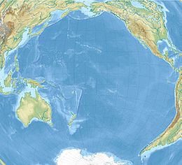
Rota (Chamoru: Luta) è un'isola dell'oceano Pacifico appartenente alle Isole Marianne. Ha una superficie di 85,38 km², ed ha 3.283 abitanti (al Censimento del 2000)[1].
| Rota | |
|---|---|
 | |
| Geografia fisica | |
| Localizzazione | Oceano Pacifico |
| Coordinate | 14°09′13″N 145°12′11″E |
| Arcipelago | Isole Marianne |
| Superficie | 85,38 km² |
| Altitudine massima | 495 m s.l.m. |
| Geografia politica | |
| Stato | |
| Centro principale | Songsong |
| Demografia | |
| Abitanti | 3.283 (2000) |
| Cartografia | |
| voci di isole presenti su Wikipedia | |
Storia
L'isola venne visitata dai primi occidentali nel 1524, quando il navigatore spagnolo Juan Sebastián Elcano prese possesso delle isole Marianne per la Corona di Spagna.
Amministrazione
Amministrativamente è una municipalità delle Isole Marianne Settentrionali, ed il principale centro abitato è il villaggio Songsong.
Trasporti
L'isola è dotata di un aeroporto internazionale.
Note
- 2000 Population: Counts for the Commonwealth of the Northern Mariana Islands Archiviato il 27 marzo 2010 in Internet Archive. - Census Bureau Releases - July 3, 2001
Voci correlate
Altri progetti
 Wikimedia Commons contiene immagini o altri file su Rota
Collegamenti esterni
- (EN) Factfinder, su factfinder.census.gov. URL consultato il 3 dicembre 2008 (archiviato dall'url originale il 16 febbraio 2020).
- (EN) Rota (JPG), su oceandots.com.
- (DE) Pascal Horst Lehne and Christoph Gäbler: Über die Marianen. Lehne-Verlag, Wohldorf in Germany 1972., su gaebler.info. URL consultato il 3 dicembre 2008 (archiviato dall'url originale il 27 aprile 2014).
- (DE) Rota, su gaebler.info. URL consultato il 3 dicembre 2008 (archiviato dall'url originale il 27 aprile 2014).
| Controllo di autorità | VIAF (EN) 259067027 · LCCN (EN) sh89006172 · GND (DE) 4303508-5 · NDL (EN, JA) 00629468 · WorldCat Identities (EN) viaf-259067027 |
|---|
На других языках
[de] Rota (Insel)
Rota (alternativ auch Zarpana oder Santa Ana, cham. Luta) ist neben Saipan und Tinian eine der drei großen Inseln des US-Außengebiets Commonwealth der Nördlichen Marianen.[en] Rota (island)
Rota (Chamorro: Luta), also known as the "Friendly Island", is the southernmost island of the United States Commonwealth of the Northern Mariana Islands (CNMI) and the second southernmost of the Marianas Archipelago. In early Spanish records it is called "Zarpana"; the name Rota may have come from the Spaniards possibly naming the island after the municipality of Rota, Spain.[citation needed] It lies approximately 40 nautical miles (74 km) north-northeast of the United States territory of Guam. Sinapalo village is the largest and most populated, followed by Songsong village (Songsong). Rota also functions as one of the four municipalities of the CNMI.[es] Isla Rota
Rota (chamorro: Luta) también conocida como "la isla pacífica", está ubicada en el Archipiélago de las Marianas. Es la más meridional de las islas que forman parte de la Comunidad de las Islas Marianas del Norte, a su vez perteneciente a los Estados Unidos. Está ligeramente al nororiente del territorio de Guam. Songsong es la mayor población de la isla, seguida por Sinapalo (Sinapalu). Rota tiene una flora y fauna diversa. Se conservan las ruinas de la "Casa Real" de la época Española. Son lenguas oficiales de la isla el inglés y el chamorro (mezcla de español, austronesio y japonés). Se profesa mayoritariamente la Religión Católica.[fr] Rota (île)
Rota, connue aussi sous le nom de l'île paisible, est l'une des îles les plus au sud des îles Mariannes du Nord. Elle est située à côté de l'île de Guam.- [it] Rota (isola)
[ru] Рота (остров)
Рота (англ. Rota) — остров в архипелаге Марианские острова в Тихом океане. Принадлежит Северным Марианским островам и входит в состав муниципалитета Рота.Текст в блоке "Читать" взят с сайта "Википедия" и доступен по лицензии Creative Commons Attribution-ShareAlike; в отдельных случаях могут действовать дополнительные условия.
Другой контент может иметь иную лицензию. Перед использованием материалов сайта WikiSort.org внимательно изучите правила лицензирования конкретных элементов наполнения сайта.
Другой контент может иметь иную лицензию. Перед использованием материалов сайта WikiSort.org внимательно изучите правила лицензирования конкретных элементов наполнения сайта.
2019-2025
WikiSort.org - проект по пересортировке и дополнению контента Википедии
WikiSort.org - проект по пересортировке и дополнению контента Википедии
