geo.wikisort.org - Island
Muldoanich is an uninhabited island in the Barra Isles archipelago at the southern extremity of the larger island chain of the Outer Hebrides in Scotland.
| Scottish Gaelic name | Maol Dòmhnaich |
|---|---|
| Meaning of name | Duncan's rounded hill |
| Location | |
 Muldoanich Muldoanich shown within the Outer Hebrides | |
| OS grid reference | NL688940 |
| Coordinates | 56.919°N 7.443°W |
| Physical geography | |
| Island group | Uist and Barra |
| Area | 78 ha (5⁄16 sq mi) |
| Area rank | 164= [1] |
| Highest elevation | Cruachan na h-àin, 153 m |
| Administration | |
| Sovereign state | United Kingdom |
| Country | Scotland |
| Council area | Comhairle nan Eilean Siar |
| Demographics | |
| Population | 0 |
| References | [2][3][4][5] |
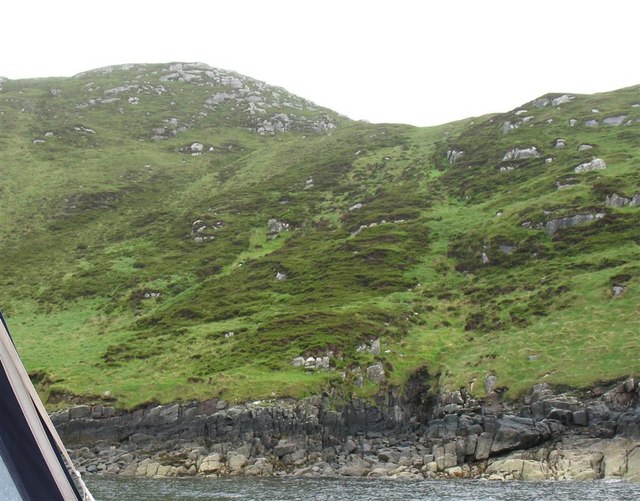
The island is 78 hectares (190 acres) in area and rises to a maximum height of 153 metres (502 ft) at the peak of Cruachan na h-àin ("midday hill").[3]
Muldoanich stands about 4 kilometres (2+1⁄2 mi) southeast of Castlebay, the main port on the island of Barra, and it is a prominent landmark for the approaching ferry and other craft. It has no level ground. There are no census records, but the southern headland of Vanish (meaning "headland of the house" or "sacred place" in Gaelic) may indicate habitation at some time in the past.[3]
Etymology
The name "Muldoanich" is probably the anglicised version of the Scottish Gaelic: Maol Dòmhnaich meaning[citation needed] "Duncan's rounded hill". It is shown with that name on Ordnance Survey maps. Mul Domhnach, meaning "Sunday island", is another possible derivation. Writing in the 16th century, Dean Munro referred to the island as "Scarp" and it appears as "Scarpa" on Blaeu's atlas of 1654.[3]

Martin Martin refers to "Muldonish" in his 1695 voyage around the Western Isles, stating "about a mile in circumference; it is high in the middle, covered over with heath and grass, and is the only forest here for maintaining the deer, being commonly about seventy or eighty in number."[6]
References
- Area and population ranks: there are c. 300 islands over 20 ha in extent and 93 permanently inhabited islands were listed in the 2011 census.
- "Occasional Paper No 10: Statistics for Inhabited Islands" Archived 2010-04-02 at archive.today (28 November 2003) General Register Office for Scotland. Edinburgh. Retrieved 15 September 2007.
- Haswell-Smith, Hamish (2004). The Scottish Islands. Edinburgh: Canongate. pp. 216–218. ISBN 978-1-84195-454-7.
- 1:50,000 (Map). Ordnance Survey.
- "Pàrlamaid na h-Alba placenames" (PDF). Retrieved 21 July 2007.
- Martin, Martin (1703) "A Description of The Western Islands of Scotland Archived 2007-03-13 at the Wayback Machine. Appin Regiment/Appin Historical Society. Retrieved 3 March 2007.

На других языках
- [en] Muldoanich
[es] Muldoanich
Muldoanich es una de las diez islas que componen las islas de Barra, en el archipiélago de las Hébridas Exteriores, en Escocia. La isla ocupa una superficie de 78 ha. Su punto más alto se encuentra a 153 msnm. El nombre de Muldoanich es un anglicismo de su nombre en gaélico escocés, Maol Domhnaich.[fr] Muldoanich
Muldoanich est une île inhabitée du Royaume-Uni située en Écosse, au sud des Hébrides extérieures.[ru] Мулдоанич
Мулдоанич (англ. Muldoanich) — остров в составе Внешних Гебридских островов у северо-западного побережья Шотландии. Один из группы островов Епископа.Другой контент может иметь иную лицензию. Перед использованием материалов сайта WikiSort.org внимательно изучите правила лицензирования конкретных элементов наполнения сайта.
WikiSort.org - проект по пересортировке и дополнению контента Википедии