geo.wikisort.org - Island
Eorsa is an uninhabited island in the Inner Hebrides of Scotland.
| Meaning of name | uncertain Jorulof-øy - Jorulf's island or from àrsaidh - ancient |
|---|---|
| Location | |
 Eorsa Eorsa shown within Argyll and Bute | |
| OS grid reference | NM481378 |
| Coordinates | 56.47°N 6.08°W |
| Physical geography | |
| Island group | Mull |
| Area | 122 ha (1⁄2 sq mi) |
| Area rank | 136= [1] |
| Highest elevation | 98 m (322 ft) |
| Administration | |
| Sovereign state | United Kingdom |
| Country | Scotland |
| Council area | Argyll and Bute |
| Demographics | |
| Population | 0 |
| References | [2][3][4] |
Geography
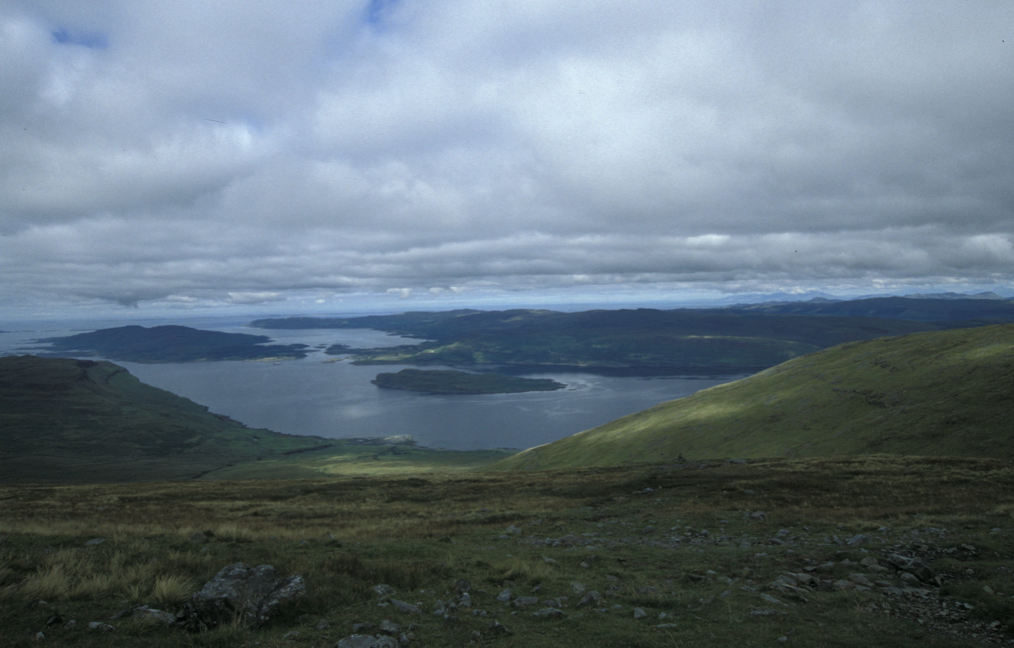
Eorsa lies in Loch na Keal on the west coast of the Isle of Mull, to the east of Ulva. It is part of the Loch Na Keal National Scenic Area, one of 40 in Scotland.[5]
History

Many of the nearby islands, including Inchkenneth, have early ecclesiastical connections. Eorsa may have done too. It once belonged to the Abbey of Iona, and became the property of the Duke of Argyll.[6]
During World War I, the island was used as a British naval anchorage.[7]
Cultural references
The island is the fictional setting of Nigel Tranter's 1952 novel Bridal Path, which was made into the film of the same name in 1959. As the comic novel takes the perils of island inbreeding as its theme, it is assumed that Tranter deliberately chose an unpopulated island to avoid giving offence.
Wildlife
Eorsa is separated from Mull by nearly a mile of water at the closest point so there are very few land animals. Locals on Mull joke that the island is "heaving with adders" although this may not be entirely true. Red deer are good swimmers and could easily make the crossing if they wanted. It is simply a question of whether there is anything the deer want there which can't be found on the mainland.
See also
Footnotes
- Area and population ranks: there are c. 300 islands over 20 ha in extent and 93 permanently inhabited islands were listed in the 2011 census.
- 2001 UK Census per List of islands of Scotland
- Haswell-Smith, Hamish (2004). The Scottish Islands. Edinburgh: Canongate. ISBN 978-1-84195-454-7.
- Ordnance Survey
- "National Scenic Areas" Archived 2017-03-11 at the Wayback Machine. SNH. Retrieved 30 Mar 2011.
- "Historical perspective for Eorsa". Gazetteer for Scotland. Retrieved 15 December 2007.
- "Overview of Eorsa". Gazetteer for Scotland. Retrieved 15 December 2007.
External links
| Main settlements |  | |
|---|---|---|
| Smaller settlements | ||
| Geographical features |
| |
| History and architecture |
| |
| Local culture and economy |
| |
| Surrounding islands | ||

This Argyll and Bute location article is a stub. You can help Wikipedia by expanding it. |
На других языках
[de] Eorsa
Eorsa ist eine an der Westküste von Schottland gelegene Felseninsel, die zu den Inneren Hebriden gehört. Die Herkunft des Namens ist unbekannt. Im 18. Jahrhundert hieß die Insel Orsay.[1]- [en] Eorsa
[es] Eorsa
Eorsa es una isla deshabitada, localizada en el archipiélago de las Hébridas Interiores, en Escocia. La isla se encuentra ubicada en el Loch na Keal, en la costa oeste de la Isla de Mull.[fr] Eorsa
Eorsa est une île du Royaume-Uni située en Écosse.Другой контент может иметь иную лицензию. Перед использованием материалов сайта WikiSort.org внимательно изучите правила лицензирования конкретных элементов наполнения сайта.
WikiSort.org - проект по пересортировке и дополнению контента Википедии