geo.wikisort.org - Island
Flodday (Scottish Gaelic: Flodaigh) is an uninhabited island, south west of Barra in the Western Islands of Scotland.
| Scottish Gaelic name | Flodaigh |
|---|---|
| Old Norse name | floti |
| Meaning of name | 'raft' or 'float' island |
| Location | |
 Flodday Flodday shown within the Outer Hebrides | |
| OS grid reference | NL612924 |
| Coordinates | 56.90°N 7.57°W |
| Physical geography | |
| Island group | Uists and Barra |
| Area | 23 ha (57 acres)[1] |
| Highest elevation | 43 m (141 ft) |
| Administration | |
| Sovereign state | United Kingdom |
| Country | Scotland |
| Council area | Na h-Eileanan Siar |
| Demographics | |
| Population | 0[2] |
| References | [3][4] |
Geography and geology
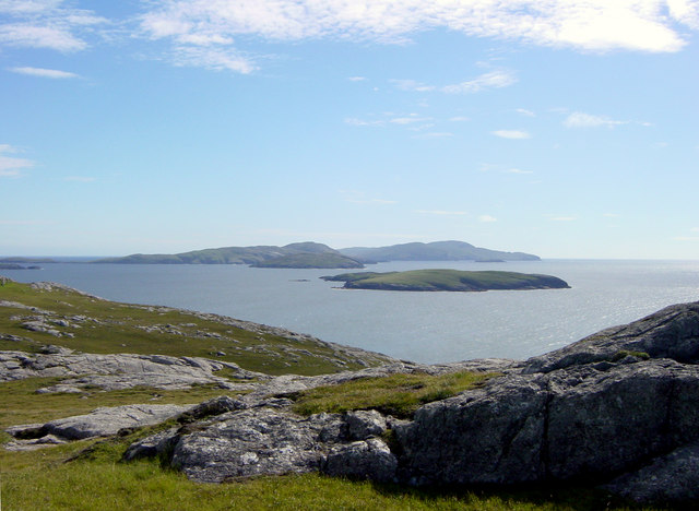
Flodday is one of the Barra Isles, lying one mile (1.5 kilometres) west of Sandray. It consists of three parts, with a natural rock arch between the larger two. Facing west there are black cliffs.[3]
Wildlife
The island has a small grey seal colony and is home to a subspecies of the dark green fritillary butterfly (Argynnis aglaja scotica).[3]
Notes and references
- Rick Livingstone’s Tables of the Islands of Scotland (pdf) Argyll Yacht Charters. Retrieved 12 Dec 2011.
- National Records of Scotland (15 August 2013). "Appendix 2: Population and households on Scotland's Inhabited Islands" (PDF). Statistical Bulletin: 2011 Census: First Results on Population and Household Estimates for Scotland Release 1C (Part Two) (PDF) (Report). SG/2013/126. Retrieved 14 August 2020.
- Haswell-Smith, Hamish (2004). The Scottish Islands. Edinburgh: Canongate. ISBN 978-1-84195-454-7.
- Ordnance Survey. OS Maps Online (Map). 1:25,000. Leisure.

This article about a location in the Western Isles is a stub. You can help Wikipedia by expanding it. |
На других языках
- [en] Flodday near Vatersay
[fr] Flodday (Vatersay)
Flodday est une île du Royaume-Uni située en Écosse.[ru] Флоддей (острова Барра)
Флоддей (англ. Flodday) — остров в составе Внешних Гебридских островов у северо-западного побережья Шотландии. Один из группы островов Барры. Площадь острова составляет 23 га (0,23 км2)[1]. Высшая точка — 43 метра[2].Текст в блоке "Читать" взят с сайта "Википедия" и доступен по лицензии Creative Commons Attribution-ShareAlike; в отдельных случаях могут действовать дополнительные условия.
Другой контент может иметь иную лицензию. Перед использованием материалов сайта WikiSort.org внимательно изучите правила лицензирования конкретных элементов наполнения сайта.
Другой контент может иметь иную лицензию. Перед использованием материалов сайта WikiSort.org внимательно изучите правила лицензирования конкретных элементов наполнения сайта.
2019-2025
WikiSort.org - проект по пересортировке и дополнению контента Википедии
WikiSort.org - проект по пересортировке и дополнению контента Википедии