geo.wikisort.org - Island
Killegray is an island in the Sound of Harris in the Outer Hebrides of Scotland.
| Scottish Gaelic name | Ceileagraigh |
|---|---|
| Old Norse name | kjallard-øy |
| Meaning of name | Old Norse: graveyard island |
| Location | |
 Killegray Killegray shown within the Outer Hebrides | |
| OS grid reference | NF976836 |
| Coordinates | 57.74°N 7.08°W |
| Physical geography | |
| Island group | Outer Hebrides |
| Area | 176 ha (11⁄16 sq mi) |
| Area rank | 117 [1] |
| Highest elevation | 45 m (148 ft) |
| Administration | |
| Sovereign state | United Kingdom |
| Country | Scotland |
| Council area | Comhairle nan Eilean Siar |
| Demographics | |
| Population | 0 |
| References | [2][3][4] |
Geography
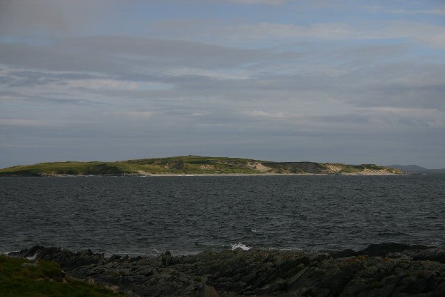
Situated in the Sound of Harris, a channel of water between North Uist and the Isle of Harris, Killegray is approximately 1+1⁄2 miles (2.5 kilometres) long.
The south end of the island is nearly all deep uncultivated moss. There is better cultivated land at the north.[5]
History
Rubha Claidhe in the north is the site of a ruined chapel, Teampull na h-Annait, which may be the origin of the island's name.[4]
Currently uninhabited, the island was occupied by a family of around three to five people from 1861 to 1931. Two people were temporarily living on the island when the 1971 census was taken.
The 19th-century Killegray House, the only house on the island was renovated as holiday accommodation in 1991.[5]
Wildlife
The shallow waters and reefs are a rich breeding ground for velvet crabs and lobsters.[4]
Possible development
Jacobs Babtie has investigated building a combination of bridges and causeways across the Sound of Harris.[6] Wind turbines and tidal generators could be incorporated in the scheme from Berneray via Killegray and Ensay to Harris.[7] The estimated cost of £75 million could rise to £145 million with the renewable energy devices.
Notes and references
- Area and population ranks: there are c. 300 islands over 20 ha in extent and 93 permanently inhabited islands were listed in the 2011 census.
- National Records of Scotland (15 August 2013). "Appendix 2: Population and households on Scotland's Inhabited Islands" (PDF). Statistical Bulletin: 2011 Census: First Results on Population and Household Estimates for Scotland Release 1C (Part Two) (PDF) (Report). SG/2013/126. Retrieved 14 August 2020.
- Ordnance Survey. OS Maps Online (Map). 1:25,000. Leisure.
- Haswell-Smith, Hamish (2004). The Scottish Islands. Edinburgh: Canongate. ISBN 978-1-84195-454-7.
- "Historical perspective for Killegray". Gazetteer for Scotland. Retrieved 10 December 2007.
- John Ross (19 August 2006). "Eco-power plan to boost islands link". The Scotsman. Archived from the original on 22 August 2006. Retrieved 10 December 2007.
- "Feasibility of Renewable Energy to fund Western Isles link" (pdf). Metoc. 30 November 2006. Retrieved 10 December 2007. [dead link]
| ||
| Inhabited islands |
| |
| Other islands | ||
| Settlements |
| |
| Districts | ||
| Geographical features |
| |
| Historical sites |
| |

На других языках
- [en] Killegray
[es] Killegray
Killegray es una isla localizada en el grupo de las Hébridas Exteriores, en Escocia. La isla presenta una forma alargada, de aproximadamente 2,5 km de largo.[fr] Killegray
Killegray, en gaélique écossais Ceileagraigh, est une île du Royaume-Uni située en Écosse.Другой контент может иметь иную лицензию. Перед использованием материалов сайта WikiSort.org внимательно изучите правила лицензирования конкретных элементов наполнения сайта.
WikiSort.org - проект по пересортировке и дополнению контента Википедии