geo.wikisort.org - Island
Eilean dà Mhèinn, is a small inhabited island in Loch Crinan and one of the Inner Hebrides of Scotland.
| Scottish Gaelic name | Eilean dà Mhèinn |
|---|---|
| Meaning of name | island of two mines |
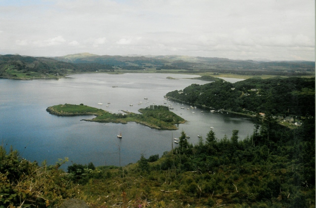 Eilean dà Mhèinn in Loch Crinan | |
| Location | |
 Eilean dà Mhèinn Eilean dà Mhèinn shown within Argyll and Bute | |
| OS grid reference | NR781944 |
| Coordinates | 56.091°N 5.567°W |
| Physical geography | |
| Island group | Islay |
| Area | c. 3 ha (7 acres) |
| Highest elevation | 16 m (52 ft) |
| Administration | |
| Sovereign state | United Kingdom |
| Country | Scotland |
| Council area | Argyll and Bute |
| Demographics | |
| Population | 1[1] |
| Population rank | 89= [2] |
| References | [3] |
It is about 100 metres (330 ft) to the west of the village of Crinan in Knapdale at high tide and only a fraction of that distance from the mainland shore at low tide.[3]
Although apparently not permanently inhabited in 2001[4] according to the 2011 census there was a single inhabitant at that time.[1] It has a landing stage on the eastern shore and a building near the centre of the island.[3] The crowded harbour at Crinan has so many moorings that "it is no longer possible to anchor to the south or east" of the island.[5]
Eilean dà Mhèinn is part of the Knapdale National Scenic Area, one of 40 in Scotland.[6]
Notes
- National Records of Scotland (15 August 2013). "Appendix 2: Population and households on Scotland's Inhabited Islands" (PDF). Statistical Bulletin: 2011 Census: First Results on Population and Household Estimates for Scotland Release 1C (Part Two) (PDF) (Report). SG/2013/126. Retrieved 14 August 2020.
- Area and population ranks: there are c. 300 islands over 20 ha in extent and 93 permanently inhabited islands were listed in the 2011 census.
- Ordnance Survey. OS Maps Online (Map). 1:25,000. Leisure.
- General Register Office for Scotland (28 November 2003) Scotland's Census 2001 – Occasional Paper No 10: Statistics for Inhabited Islands. Retrieved 26 February 2012.
- Haswell-Smith (2004) p. 31
- "National Scenic Areas" Archived 2017-03-11 at the Wayback Machine. SNH. Retrieved 6 September 2013.
References
- Haswell-Smith, Hamish (2004). The Scottish Islands. Edinburgh: Canongate. ISBN 978-1-84195-454-7.
|  | ||||||||||||||||
|
| |||||||||||||||||
| |||||||||||||||||
| |||||||||||||||||
| |||||||||||||||||
| |||||||||||||||||
| |||||||||||||||||
| |||||||||||||||||
This Argyll and Bute location article is a stub. You can help Wikipedia by expanding it. |
На других языках
- [en] Eilean dà Mhèinn
[it] Eilean dà Mhèinn
Eilean dà Mhèinn (in lingua gaelica scozzese: isola delle due miniere) è una piccola isola abitata situata nel Loch Crinan, e fa parte delle Ebridi Interne in Scozia.Другой контент может иметь иную лицензию. Перед использованием материалов сайта WikiSort.org внимательно изучите правила лицензирования конкретных элементов наполнения сайта.
WikiSort.org - проект по пересортировке и дополнению контента Википедии