geo.wikisort.org - Island
Aniwa is a small island in the southernmost province of Tafea, Vanuatu.[2]
Aniwa | |
|---|---|
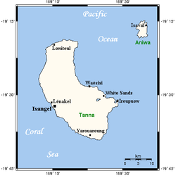 Map of Tanna and Aniwa, with Aniwa at the top right | |
 Aniwa Location in Vanuatu | |
| Coordinates: 19°15′10″S 169°35′59″E | |
| Country | |
| Province | Tafea Province |
| Area | |
| • Total | 8 km2 (3 sq mi) |
| [1] | |
| Elevation | 42 m (138 ft) |
| Population (2009) | |
| • Total | 341 |
| • Density | 43/km2 (110/sq mi) |
| Time zone | UTC+11 (VUT) |
As a coral island (a raised coral atoll), it rises a mere 42 m above sea level. In the northwest is Itcharo (Tiaro) lagoon, which is open to the sea. The nearest large island is Tanna, about 24 km to the southwest.
Population
Like the nearby West Futuna, it is a Polynesian outlier, and thus its inhabitants originally came from Samoa, and the Wallis and Futuna group instead of the Melanesians of other nearby islands, although there has been much intermarriage with Tanna over the generations. The language of both islands is Futunan, in the Futunic branch of Nuclear Polynesian languages, though the dialects between the two islands are distinct. Population is about 350[3] in five distinct villages:
- Itangutu
- Imalé
- Isavaï
- Ikaokao
- Namsafoura
The main village is Ikaokao, located in the centre of the south of the island, followed by Isavai in the islands' centre. The John Frum cargo cult exists in Ikaokao, and is unaffected by the touristic involvement that has modified the cult in Tanna.
Transportation
The island is served by Aniwa Airport, an air strip in the north with flights from Port Vila twice a week.
Anchorage is challenging in 20m on the west coast of the island, identifiable by a white square painted onto the coral face. Shipping of goods or passengers is by either the monthly interisland shipping service or the numerous small outboard motor boats operated by individuals.[4]
A road accessible to vehicles links almost all parts of the island.
References
- "Vanuatu". Haos Blong Volkeno. Archived from the original on 8 August 2018. Retrieved 8 August 2018.
- UNEP Islands Directory
- 2009 Census Summary release final Archived 2013-12-21 at the Wayback Machine - Government of Vanuatu
- Aniwa Drought Assessment, National Disaster Management Office 2013 via http://phtpacific.org Archived 2015-05-13 at the Wayback Machine
Islands of Vanuatu by province | |||||||||||||
|---|---|---|---|---|---|---|---|---|---|---|---|---|---|
| Provinces of Vanuatu |
|  | |||||||||||
| Islands and islets |
| ||||||||||||
| Authority control |
|
|---|
This Vanuatu location article is a stub. You can help Wikipedia by expanding it. |
На других языках
[de] Aniwa (Insel)
Aniwa ist eine Insel im Südosten des Inselstaats Vanuatu im Pazifischen Ozean und gehört zu den Neuen Hebriden.- [en] Aniwa Island
[fr] Aniwa (île)
Aniwa est une petite île de la mer de Corail située dans la province méridionale de Taféa au Vanuatu. C’est un atoll surélevé avec une altitude maximale de 42 m[1]. Au nord-ouest, se trouve le lagon Itcharo ou Tiaro, avec une passe vers l’océan.[it] Aniwa
Aniwa è un'isola situata nell'Oceano Pacifico ed appartenente all'arcipelago di Vanuatu. Fa parte della Polinesia periferica.[ru] Анива (остров)
Анива (англ. Aniwa) — остров в архипелаге Новые Гебриды в Тихом океане. Принадлежит Республике Вануату. Административно входит в состав провинции Тафеа.Другой контент может иметь иную лицензию. Перед использованием материалов сайта WikiSort.org внимательно изучите правила лицензирования конкретных элементов наполнения сайта.
WikiSort.org - проект по пересортировке и дополнению контента Википедии