geo.wikisort.org - Island
Tongoa Island is an inhabited island in Shefa Province of Vanuatu in the Pacific Ocean.[2]
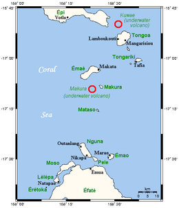 Map Showing Tongoa Island | |
| Geography | |
|---|---|
| Location | Pacific Ocean |
| Coordinates | 16°54′S 168°33′E |
| Archipelago | Vanuatu, Shepherd Islands |
| Area | 42[1] km2 (16 sq mi) |
| Highest elevation | 191 m (627 ft) |
| Administration | |
| Province | Shefa Province |
| Demographics | |
| Population | 2243 (2015) |
Geography
Tongoa is the largest island of Shepherd Islands archipelago. The island is heavily vegetated and shows geothermal activity. Tongoa is of recent volcanic origin but currently has no currently active volcano.[3] There are numerous volcanic cones on the island and some black sand beaches. The estimated terrain elevation above the sea level is some 191 metres.[4] There is an airport on the island – Tongoa Airport (TGH).[5]
Flora and fauna
The interior part of the island is dense rain forest. The island is named after the Tongoa plant which grows in the area. Megapodes nest on the island.[6] The only non-human mammals on the island are the Vanuatu flying fox and Tonga leather, or insular flying fox.
Important Bird Area
The island has been recognised as an Important Bird Area (IBA) by BirdLife International because it supports populations of Vanuatu megapodes, red-bellied fruit doves, grey-eared honeyeaters, cardinal myzomelas, Melanesian flycatchers, Vanuatu white-eyes and red-headed parrotfinches. The neighbouring islet of Laika to the north has a breeding colony of wedge-tailed shearwaters.[7]
Population
As of 2015, the official local population was 2243 people in 454 households, most of whom moved from Epi, Emae and Makira to Tongoa.[8] There are 14 villages on the island. Some natives speak Makura language (Na Makura) and North Efate language (Na Kanamanga).[9]
References
- "Vanuatu". Haos Blong Volkeno. Retrieved 8 August 2018.
- UNEP Islands Directory
- "Tongoa - Laika". Birdlife International. Retrieved 10 August 2018.
- "Tongoa Island". Mapcarta. Retrieved 8 August 2018.
- "Tongoa Airport (TGH)". World Airport Codes. Retrieved 8 August 2018.
- "Shepherd group of islands". Vanuatu Islands Travel Info. Retrieved 9 August 2018.
- "Tongoa – Laika". BirdLife Data Zone. BirdLife International. 2021. Retrieved 11 February 2021.
- "2015 Vanuatu National Population and Households Projections by Province and Islands" (PDF). Vanuatu National Statistics Office. Retrieved 8 August 2018.
- Coiffier, Christian (1988). Traditional Architecture in Vanuatu. p. 129. ISBN 9789820200470. Retrieved 10 August 2018.
Islands of Vanuatu by province | |||||||||||||
|---|---|---|---|---|---|---|---|---|---|---|---|---|---|
| Provinces of Vanuatu |
|  | |||||||||||
| Islands and islets |
| ||||||||||||
На других языках
[de] Tongoa
Tongoa ist eine Insel im Norden der Shepherd-Inseln im südpazifischen Inselstaat Vanuatu. Sie gehört der zentral-gelegenen vanuatuischen Provinz Shefa an.- [en] Tongoa
[fr] Tongoa
Tongoa est l’île la plus au nord des îles Shepherd, un archipel du Vanuatu. Avec une superficie de 42,0 km2, c’est aussi la plus grande île de l’archipel[1]. Elle est desservie par un aérodrome (code AITA : TGH).[it] Tongoa
Tongoa (o Kuwaé) è la più grande delle isole del gruppo delle Shepherd, nello Stato di Vanuatu. È ricoperta da una folta vegetazione, e mostra attività geotermica.[ru] Тонгоа
Тонгоа (англ. Tongoa) — остров в островной группе Шеперд (архипелаг Новые Гебриды) в Тихом океане. Принадлежит Республике Вануату и входит в состав провинции Шефа. Альтернативное название острова — Куваэ.Другой контент может иметь иную лицензию. Перед использованием материалов сайта WikiSort.org внимательно изучите правила лицензирования конкретных элементов наполнения сайта.
WikiSort.org - проект по пересортировке и дополнению контента Википедии