geo.wikisort.org - Coast
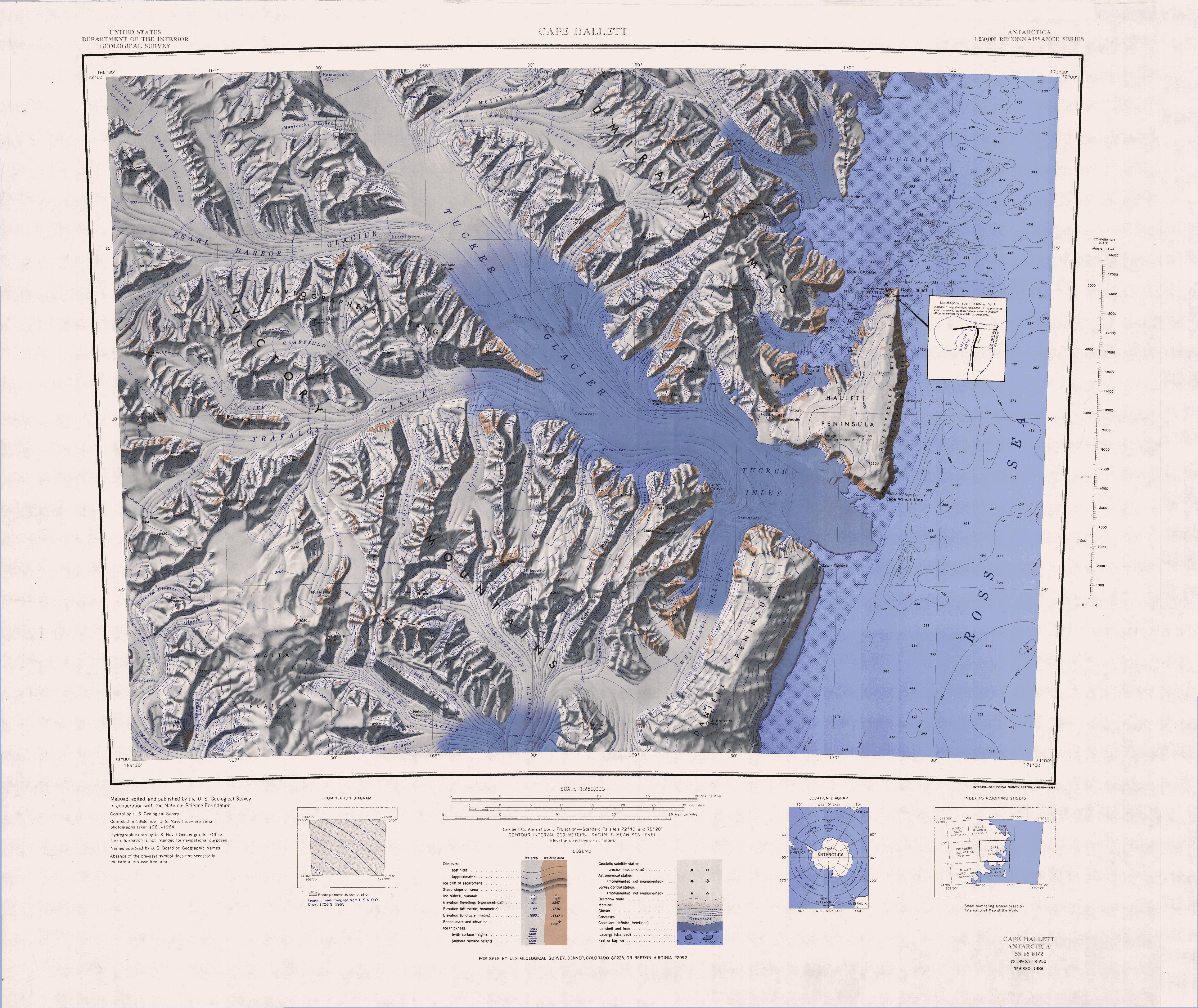
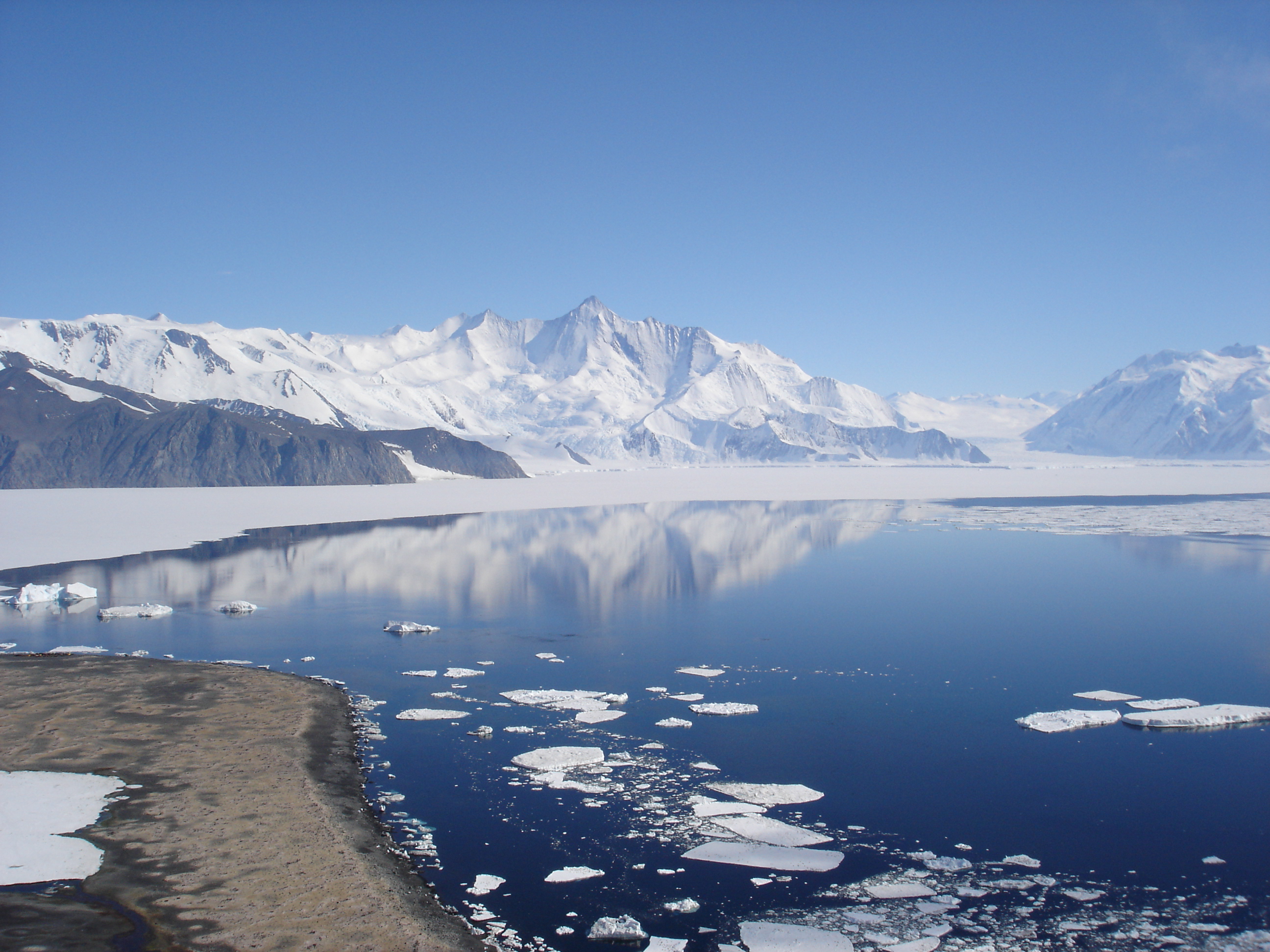
Cape Hallett is a snow-free area (Antarctic oasis) on the northern tip of the Hallett Peninsula on the Ross Sea coast of Victoria Land, East Antarctica. Cape Adare lies 100 km (62 mi) to the north.
History
In 1956, during Operation Deep Freeze II, USS Arneb was damaged by an ice floe at Cape Hallett.
Hallett Station
Hallett Station | |
|---|---|
Antarctic base | |
 Hallett Station Location of Hallett Station in Antarctica | |
| Coordinates: 72°19′S 170°16′E | |
| Country | |
| Location in Antarctica | Cape Hallett Hallett Peninsula |
| Administered by | International Geophysical Year |
| Established | 1956 |
| Evacuated | 1973 |
| Type | All-year round |
| Period | Annual until 1964 Summer until 1974 |
| Status | Dismantled |
The cape was the location of a joint scientific base, Hallett Station, between the United States and New Zealand during the International Geophysical Year of 1957, and was manned permanently until 1964, when there was a major fire. It was then used as a summer only base until 1973. The site is currently being remediated by removing hazardous materials: fuel, and oil stored in several large tanks. This is an ongoing project which will take several years to complete.
Antarctic Specially Protected Area
An area of 74 ha is protected under the Antarctic Treaty System as Antarctic Specially Protected Area (ASPA) No.106 because it contains habitats with a rich and diverse range of plant communities that are the most extensive and representative examples known at the northern end of the latitudinal gradient of Victoria Land and the Ross Sea. Surveys have recorded 18 species of lichens and five species of mosses, dominated by Bryum subrotundifolium. Animals found at the site include, as well as four species of mites and three of springtails, breeding colonies of south polar skuas and Adélie penguins.[1]
Adélie penguin colony
A large Adélie penguin colony occupies Seabee Hook, on the west side of Hallett Peninsula between Moubray Bay and Edisto Inlet. The history of human impact on the colony through the occupation of Hallett Station, and the subsequent closure of the station, together with the availability of reliable historical data on colony population size, make the site unique and ideal for the study of impacts on, and recovery of, the colony after substantial ecosystem disturbance.[1]
See also
- List of Antarctic field camps
- Brockton Station
- Byrd Station
- Ellsworth Station
- Little America V
- McMurdo Station
- Operation Deep Freeze
- Palmer Station
- Plateau Station
- Siple Station
- South Pole Station
References
- "Cape Hallett, Northern Victoria Land, Ross Sea" (PDF). Management Plan for Antarctic Specially Protected Area No. 106: Measure 1. Antarctic Treaty Secretariat. 2002. Retrieved 2013-03-10.
External links
| Wikimedia Commons has media related to Cape Hallett. |
Antarctica | ||||||||
|---|---|---|---|---|---|---|---|---|
| Geography |
|  | ||||||
| History |
| |||||||
| Politics |
| |||||||
| Society |
| |||||||
| Famous explorers |
| |||||||
| ||||||||
| Authority control |
|---|
На других языках
[de] Kap Hallett
Das Kap Hallett ist ein wuchtiges und hoch aufragendes Kap an der Borchgrevink-Küste des ostantarktischen Viktorialands. Auf halbem Weg zwischen dem Kap Adare und der Coulman-Insel bildet es am Fuß des Mount Geoffrey Markham und rund 16 km südlich des Kap Christie das nördliche Ende der Hallett-Halbinsel.- [en] Cape Hallett
[es] Cabo Hallett
El cabo Hallett es una zona libre de nieve, un oasis antártico en el extremo norte de la península Hallett en la costa del mar de Ross en la Tierra de Victoria, Antártida Oriental. El cabo Adare se encuentra a 100 km (unas 62 millas) al norte.Другой контент может иметь иную лицензию. Перед использованием материалов сайта WikiSort.org внимательно изучите правила лицензирования конкретных элементов наполнения сайта.
WikiSort.org - проект по пересортировке и дополнению контента Википедии