geo.wikisort.org - Mountains
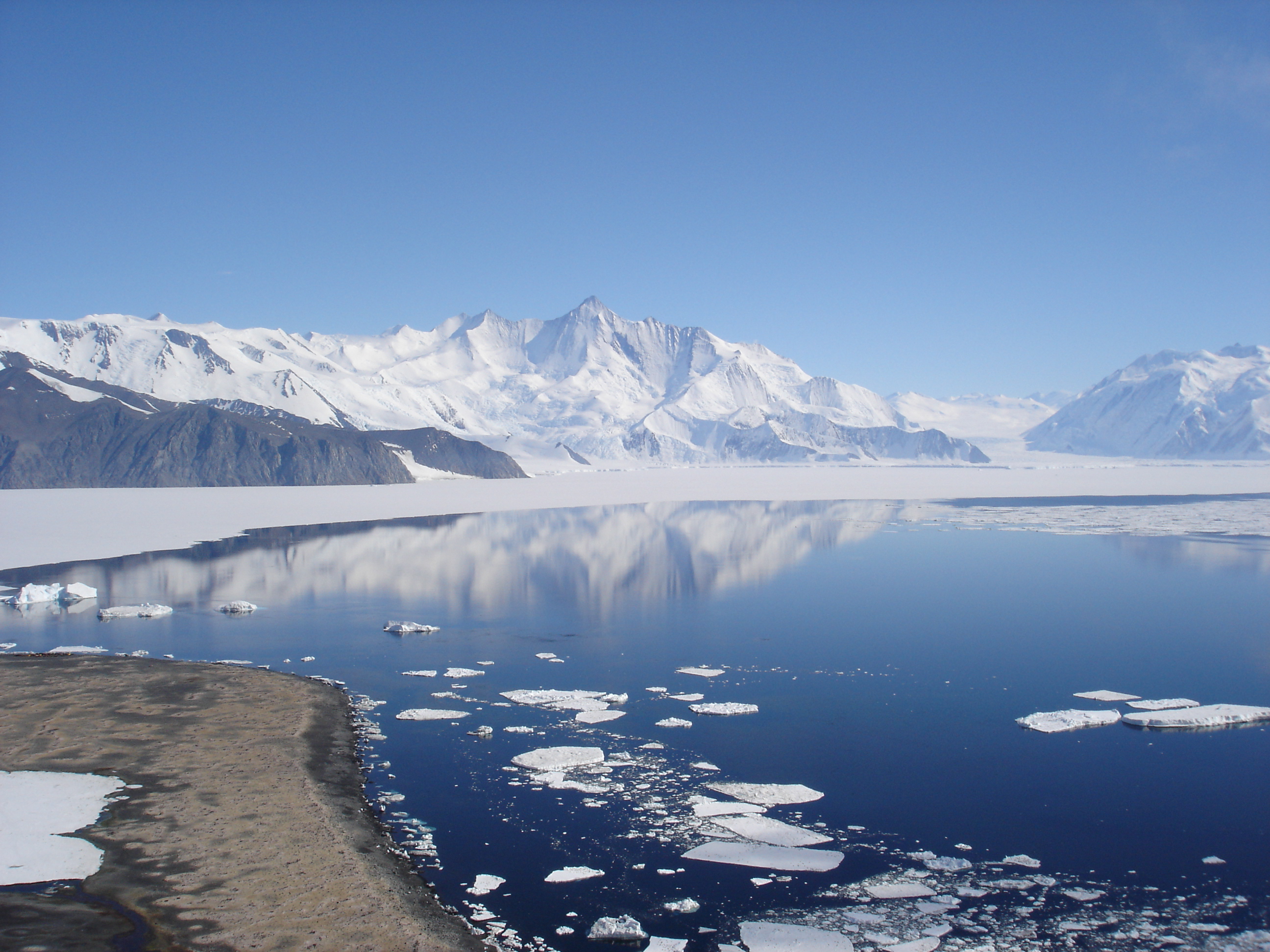
The Admiralty Mountains (alternatively Admiralty Range) is a large group of high mountains and individually named ranges and ridges in northeastern Victoria Land, Antarctica. This mountain group is bounded by the Ross Sea, the Southern Ocean, and by the Dennistoun, Ebbe, and Tucker glaciers.[1] The mountain range is situated on the Pennell Coast, a portion of Antarctica lying between Cape Williams and Cape Adare.
| Admiralty Mountains | |
|---|---|
 | |
| Highest point | |
| Peak | Mount Minto |
| Elevation | 4,165 m (13,665 ft) |
| Coordinates | 71°47′S 168°45′E |
| Geography | |
 | |
| Continent | Antarctica |
| Region | Victoria Land |
| Range coordinates | 71°45′S 168°30′E |
| Parent range | Transantarctic Mountains |
It was discovered in January 1841 by Captain James Ross, who named them for the Lords Commissioners of the Admiralty under whose orders he served.[1]
The Admiralty Mountains are divided into the Dunedin Range, Homerun Range, and Lyttelton Range.
Mountains and peaks
This range includes the following mountains and peaks:
| Mountain/Peak | metres | feet | coordinates |
|---|---|---|---|
| Mount Minto | 4,165 | 13,665 | 71°47′S 168°45′E |
| Mount Adam | 4,010 | 13,156 | 71°47′S 168°37′E |
| Mount Ajax | 3,770 | 12,369 | 71°48′S 168°27′E |
| Mount Sabine | 3,720 | 12,205 | 71°55′S 169°33′E |
| Mount Royalist | 3,640 | 11,942 | 71°47′S 168°30′E |
| Mount Bevin | 3,490 | 11,450 | 71°54′S 169°27′E |
| Mount Black Prince | 3,405 | 11,171 | 71°47′S 168°15′E |
| Mount Peacock | 3,210 | 10,531 | 72°13′S 169°27′E |
| Mount Gilruth | 3,160 | 10,367 | 71°44′S 168°48′E |
| Mount Achilles | 2,880 | 9,449 | 71°53′S 168°08′E |
| Mount Parker | 1,260 | 4,134 | 71°15′S 168°05′E |
Mount Achilles
Mount Achilles is a prominent pyramidal mountain rising from the divide between Fitch Glacier and Man-o-War Glacier. Named by New Zealand Geological Survey Antarctic Expedition (NZGSAE), 1957–58, after the former New Zealand cruiser HMNZS Achilles.[2]
Mount Adam
Mount Adam is situated 4 km (2.5 mi) WNW of Mount Minto. Discovered in January 1841 by Captain Ross who named this feature for Vice Admiral Sir Charles Adam, a senior naval lord of the Admiralty.[3]
Mount Ajax
Mount Ajax rises 1.5 km (1 mi) WSW of Mount Royalist. Named by the New Zealand GSAE, 1957–58, after HMNZS Ajax. The mountain is one of several in this area named for New Zealand ships.[4]
Mount Bevin
Mount Bevin is a prominent sharply pointed mountain at the western side of the head of Murray Glacier. The mountain stands 2 miles (3.2 km) west-northwest of Mount Sabine. Named by Advisory Committee on Antarctic Names (US-ACAN) (2004) after Anthony (Tony) J. Bevin, Surveyor-General of New Zealand, and Chairman of the New Zealand Geographic Board, 1996–2004, with responsibility for New Zealand surveying and place naming in Antarctica.[5]
Mount Black Prince
Mount Black Prince is composed of dark colored rock, which tends to create an imposing appearance. Located 6 km (3.7 mi) west of Mount Ajax. Named by the New Zealand Geological Survey Antarctic Expedition (NZ GSAE), 1957–58, for its appearance and also for the New Zealand Cruiser HMNZS Black Prince.[6]
Mount Gilruth
Mount Gilruth is a mostly ice-covered mountain (3,160 m) 4.5 nautical miles (8 km) east-northeast of Mount Adam. Mapped by United States Geological Survey (USGS) from surveys and U.S. Navy air photos, 1960-63. Named by Advisory Committee on Antarctic Names (US-ACAN) for Robert R. Gilruth of the National Aeronautics and Space Administration, a visitor at McMurdo Station, 1966-67.[7]

Mount Minto
Mount Minto is a lofty, mostly ice-free mountain located 4 km (2.5 mi) E of Mount Adam in the central portion of the range. Discovered in January 1841 by Captain James Ross, who named it for the Earl of Minto, then First Lord of the Admiralty.[8] The first ascent was made in 1988 by the Australian Bicentennial Antarctic Expedition led by Greg Mortimer and included Lincoln Hall.[9]
Mount Parker
Mount Parker is a bluff-type mountain along the western side of Nash Glacier. The area was mapped by the USGS from surveys and U.S. Navy air photos, 1960-63. The name Mount Parker was given to a mountain in this general vicinity by Captain James Ross, in 1840, honoring Vice Admiral Sir William Parker, a senior naval lord of the Admiralty, 1834-41. For the sake of historical continuity US-ACAN has retained the name for this mountain.[10]
Mount Peacock
Mount Peacock is a high peak standing directly at the head of Kelly Glacier, 2.6 km (1.6 mi) southwest of Mount Herschel. It was discovered in January 1841 by Captain Ross who named it for the Very Reverend Dr. George Peacock, Dean of Ely.[11]
Mount Royalist
Mount Royalist is a prominent mountain standing 3 km (1.9 mi) west of Mount Adam. Named by the New Zealand GSAE, 1957–58, for its impressive appearance and also for the New Zealand cruiser HMNZS Royalist. Several adjacent peaks are named for New Zealand ships including Mount Ajax and Mount Black Prince.[12]
Mount Sabine
Mount Sabine (/ˈseɪbɪn/ SAY-bin) is a prominent, relatively snow-free mountain rising between the heads of Murray Glacier and Burnette Glacier. Discovered on January 11, 1841, by Captain James Ross, Royal Navy, who named this feature for Lieutenant Colonel Edward Sabine of the Royal Artillery, Foreign Secretary of the Royal Society, one of the most active supporters of the expedition.[13]
Features
- Atkinson Glacier
- Baldwin Bluff
- Brewer Peak
- Burnette Glacier
- Church Glacier
- Church Ridge
- Cracktrack Glacier
- Crandall Peak
- DeAngelo Glacier
- Deming Glacier
- Dennistoun Glacier
- DuBridge Range
- Dugdale Glacier
- Dunedin Range
- Elsner Ridge
- Fendley Glacier
- Field Névé
- Findlay Range
- Fischer Ridge
- Fitch Glacier
- Fowlie Glacier
- Freimanis Glacier
- Gadsden Peaks
- Geikie Ridge
- Grigg Peak
- Helman Glacier
- Ironside Glacier
- Jennings Peak
- Kelly Glacier
- Kirk Glacier
- Lange Peak
- Lann Glacier
- Leander Glacier
- Luther Peak
- Lyttelton Range
- Man-o-War Glacier
- Massey Glacier
- Meier Peak
- Mount Achilles
- Mount Bierle
- Mount Brazil
- Mount Chider
- Mount Emerson
- Mount Eos
- Mount Faget
- Mount Francis
- Mount Frishman
- Mount Gleaton
- Mount Granholm
- Mount Greene
- Mount Hart
- Mount Herschel
- Mount Humphrey Lloyd
- Mount Kyle
- Mount LeResche
- Mount Lozen
- Mount Midnight
- Mount Parker
- Mount Pearigen
- Mount Pew
- Mount Pittard
- Mount Ruegg
- Mount Schaefer
- Mount Shadow
- Mount Shelton
- Mount Titus
- Mount Von Braun
- Mount Whewell
- Mount Wright
- Murray Glacier
- Nash Glacier
- Novasio Ridge
- Ommanney Glacier
- Pitkevitch Glacier
- Rastorfer Glacier
- Robinson Heights
- Rowles Glacier
- Saxby Pass
- Shipley Glacier
- Simpson Glacier
- Slagle Ridge
- Slone Glacier
- Sorensen Peak
- Splettstoesser Pass
- Staircase Glacier
- Stamper Peak
- Tocci Glacier
- Tombstone Hill
- Tucker Glacier
- Wallis Glacier
- Wetmore Peak
- Whewell Glacier
- Whitehall Glacier
- Wylie Ridge
References
- "Admiralty Mountains". Geographic Names Information System. United States Geological Survey, United States Department of the Interior. Retrieved 2004-10-31.
- "Mount Achilles". Geographic Names Information System. United States Geological Survey, United States Department of the Interior. Retrieved 2008-03-23.
- "Mount Adam". Geographic Names Information System. United States Geological Survey, United States Department of the Interior. Retrieved 2004-11-04.
- "Mount Ajax". Geographic Names Information System. United States Geological Survey, United States Department of the Interior. Retrieved 2004-11-02.
- "Mount Bevin". Geographic Names Information System. United States Geological Survey, United States Department of the Interior. Retrieved 2007-03-12.
- "Mount Black Prince". Geographic Names Information System. United States Geological Survey, United States Department of the Interior. Retrieved 2004-11-02.
- "Mount Gilruth". Geographic Names Information System. United States Geological Survey, United States Department of the Interior. Retrieved 2009-02-19.
- "Mount Minto". Geographic Names Information System. United States Geological Survey, United States Department of the Interior. Retrieved 2007-01-29.
- "Half Sledge - Greg Mortimer, Mt Minto, 1988". Museum Victoria. Archived from the original on 2015-11-28. Retrieved 2010-05-12.
- "Mount Parker". Geographic Names Information System. United States Geological Survey, United States Department of the Interior. Retrieved 2004-10-31.
- "Mount Peacock". Geographic Names Information System. United States Geological Survey, United States Department of the Interior. Retrieved 2007-03-12.
- "Mount Royalist". Geographic Names Information System. United States Geological Survey, United States Department of the Interior. Retrieved 2004-11-02.
- "Mount Sabine". Geographic Names Information System. United States Geological Survey, United States Department of the Interior. Retrieved 2007-03-12.
На других языках
[de] Admiralitätsberge
Die Admiralitätsberge (englisch Admiralty Mountains oder Admiralty Range) sind eine ausgedehnte Gruppe von hohen Bergen und individuell benannten Gebirgsketten und -rücken im nordöstlichen Victorialand in der Antarktis. Die Berggruppe wird durch das Ross-Meer, den Südlichen Ozean und den Dennistoun-, den Ebbe- und den Tucker-Gletscher begrenzt.- [en] Admiralty Mountains
[fr] Chaîne de l'Amirauté
La chaîne de l'Amirauté est une chaîne de montagnes située dans la chaîne Transantarctique, au nord de la Terre Victoria en Antarctique. Elle est délimitée par la mer de Ross, de l'océan Austral, ainsi que par les glaciers Dennistoun, Ebbe et Tucker.[ru] Адмиралти (горы)
А́дмиралти[2] (англ. Admiralty Mountains) — горный хребет[3], горы[4] в северо-восточной части Земли Виктории, восточная Антарктида. Горы омывает море Росса, в которое вдаётся известный мыс Адэр, Южный океан, а со стороны суши их ограничивают ледники Деннистоун, Эббе, и ледник Такера. Обнаружены в январе 1841 года капитаном Джеймсом Россом, который назвал их в честь казначеев Адмиралтейства, на службе у которого он находился. Включают в себя хребты Данидин, Хомран и Литтелтон. Макс. высота — гора Минто (4166 м).Другой контент может иметь иную лицензию. Перед использованием материалов сайта WikiSort.org внимательно изучите правила лицензирования конкретных элементов наполнения сайта.
WikiSort.org - проект по пересортировке и дополнению контента Википедии