geo.wikisort.org - River
The Talas (Kyrgyz, Kazakh: Талас) is a river that rises in the Talas Region of Kyrgyzstan and flows west into Kazakhstan. The river is 661 kilometres (411 mi) long and has a basin area of 52,700 square kilometres (20,300 sq mi).
This article needs additional citations for verification. (May 2011) |
| Talas Талас | |
|---|---|
 Talas River near Taraz | |
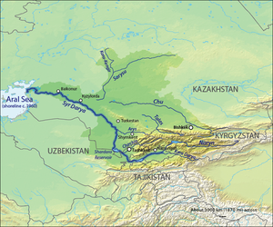
 Course of the Talas | |
| Location | |
| Country | Kyrgyzstan, Kazakhstan |
| Physical characteristics | |
| Source | |
| • location | confluence of the Karakol and Uch-Koshoy |
| • coordinates | 42.4902°N 72.567°E |
| • elevation | 1,497 m (4,911 ft) |
| Mouth | Muyunkum Desert |
• location | Akzhar lakes |
• coordinates | 44.0600°N 69.6600°E |
• elevation | ca 300 m (980 ft) |
| Length | 661 km (411 mi) |
| Basin size | 52,700 km2 (20,300 sq mi) |
Course
It is formed from the confluence of the Karakol and Uch-Koshoy and flows roughly westwards and northwestwards. It runs through the city of Taraz in Zhambyl Province of Kazakhstan and vanishes in the Muyunkum Desert before reaching Lake Aydyn.[1]
The Ili, Chu and Talas are three steppe rivers that flow west and then north-west. The Ili rises in Xinjiang, flows west to a point north of Lake Issyk Kul and then turns north-west to reach Lake Balkash. The Chu rises west of Lake Issyk Kul, flows out into the steppe and dries up before reaching the Syr Darya. The Talas starts west and south of the Chu, flows west and north-west, but dries up before reaching the Chu.
History
During the Battle of Talas (named after the river) in 751, the Abbasid force defeated the Tang Chinese forces led by the General Gao Xianzhi over a dispute regarding a client kingdom in the Fergana Valley. The battle was won by the Abbasids after the Karluks defected.
The Chinese monk Xuanzang arrived from the Chui river to Talas during one of his journeys.[2][3]
References
- Талас (река), Great Soviet Encyclopedia
- The Chinese recorder, Volume 5. American Presbyterian Mission Press. 1874. p. 192. Retrieved 2011-05-08.
- E. Bretschneider (1875). Notes on Chinese mediaeval travellers to the West. American Presbyterian Mission Press. p. 34. Retrieved 2011-05-08.
further to the west we arrived in four days at the T'a-la-su mo-lien [Talas muren] ... The river, which is deep and broad, comes from the east...
Authority control | |
|---|---|
| General |
|
| National libraries | |
На других языках
[de] Talas (Fluss)
Der 661 km lange Fluss Talas (russisch und kasachisch Талас) ist ein Fluss im Norden von Kirgisistan und im Südosten von Kasachstan (Zentralasien).- [en] Talas (river)
[es] Río Talas
El río Talas (en kazajo, Талас өзені, en uzbeko, Талас дарыя) es un importante río del Asia Central, que corre entre Kirguistán y Kazajistán. Tiene una longitud de 661 km y drena una amplia cuenca de 52 700 km².[it] Talas (fiume)
Il Talas è un fiume del Kirghizistan e del Kazakistan.[ru] Талас (река)
Талас (кирг. Талас, каз. Талас) — река, протекающая по территории Киргизии и Казахстана. Длина реки — 661 км, площадь водосборного бассейна — 52 700 км².[источник не указан 896 дней]Другой контент может иметь иную лицензию. Перед использованием материалов сайта WikiSort.org внимательно изучите правила лицензирования конкретных элементов наполнения сайта.
WikiSort.org - проект по пересортировке и дополнению контента Википедии