geo.wikisort.org - River
The Chandalash (Kyrgyz: Чандалаш) is a river in the Pskem Mountains of Chatkal District in Jalal-Abad Region in western Kyrgyzstan. The river is formed at the south west slope of Talas Alatau and flows into the Chatkal. It is 94 kilometres (58 mi) long, and has a drainage basin of 1,157 square kilometres (447 sq mi). The average annual discharge is 11.7 m3/s (410 cu ft/s). The maximum flow is 30.1 m3/s (1,060 cu ft/s) in June, and the minimum - 2.7 m3/s (95 cu ft/s) - 2.8 m3/s (99 cu ft/s) in March. [1][2]
| Chandalash Sandalash | |
|---|---|
 | |
| Native name | Чандалаш (Kyrgyz) |
| Location | |
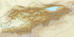
| Country | Kyrgyzstan |
| Region | Jalal-Abad Region |
| District | Chatkal District |
| Physical characteristics | |
| Source | Talas Alatau |
| Mouth | Chatkal |
• coordinates | 41.6820°N 70.8771°E |
| Length | 94 km (58 mi) |
| Basin size | 1,157 km2 (447 sq mi) |
| Discharge | |
| • average | 11.7 m3/s (410 cu ft/s) |
| • minimum | 2.8 m3/s (99 cu ft/s) |
| • maximum | 30.1 m3/s (1,060 cu ft/s) |
| Basin features | |
| Progression | Chatkal→ Chirchiq→ Syr Darya→ North Aral Sea |
| Tributaries | |
| • right | Kaiyng-Suu, |
References
- "Чандалаш" [Chandalash] (PDF). Кыргызстандын Географиясы [Geography of Kyrgyzstan] (in Kyrgyz). Bishkek. 2004. p. 210.
- Ошская область:Энциклопедия [Encyclopedia of Osh Oblast] (in Russian). Bishkek: Chief Editorial Board of Kyrgyz Soviet Encyclopedia. 1987. p. 445.
This Jalal-Abad region location article is a stub. You can help Wikipedia by expanding it. |
На других языках
[de] Tschandalasch
Der Tschandalasch (kirgisisch Чандалаш, auch Сандалаш Sandalasch) ist ein rechter Nebenfluss des Tschatkal im Nordwesten von Kirgisistan.- [en] Chandalash
Текст в блоке "Читать" взят с сайта "Википедия" и доступен по лицензии Creative Commons Attribution-ShareAlike; в отдельных случаях могут действовать дополнительные условия.
Другой контент может иметь иную лицензию. Перед использованием материалов сайта WikiSort.org внимательно изучите правила лицензирования конкретных элементов наполнения сайта.
Другой контент может иметь иную лицензию. Перед использованием материалов сайта WikiSort.org внимательно изучите правила лицензирования конкретных элементов наполнения сайта.
2019-2026
WikiSort.org - проект по пересортировке и дополнению контента Википедии
WikiSort.org - проект по пересортировке и дополнению контента Википедии