geo.wikisort.org - River
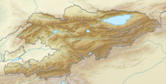
The Avletim (Kyrgyz: Авлетим) is a right tributary of the Kara-Suu in Aksy District of Jalal-Abad Region, Kyrgyzstan. The river takes its rise in the south-east slopes of the Chatkal Range. The Avletim is 35 km (22 mi) long and has a catchment area of 863 km2 (333 sq mi).The average yearly discharge is 10.6 m3/s (370 cu ft/s); the maximum and the minimum discharges are 20 m3/s (710 cu ft/s) and 5.6 m3/s (200 cu ft/s) respectfully. The river is used for irrigation. [1]
| Avletim Aflatun | |
|---|---|
 | |
| Native name | Авлетим (Kyrgyz) |
| Location | |
| Country | Kyrgyzstan |
| Physical characteristics | |
| Mouth | Kara-Suu |
• coordinates | 41°38′29.3″N 72°03′54.3″E |
| Length | 35 km (22 mi) |
| Basin size | 863 km2 (333 sq mi) |
| Discharge | |
| • average | 10.6 m3/s (370 cu ft/s) |
| • minimum | 5.6 m3/s (200 cu ft/s) |
| • maximum | 20 m3/s (710 cu ft/s) |
| Basin features | |
| Progression | Kara-Suu→ Naryn→ Syr Darya→ North Aral Sea |
References
- "Авлетим" [Avletim] (PDF). Кыргызстандын Географиясы [Geography of Kyrgyzstan] (in Kyrgyz). Bishkek. 2004. p. 179.
This Jalal-Abad region location article is a stub. You can help Wikipedia by expanding it. |
На других языках
[de] Awletim
Der Awletim (kirgisisch Авлетим) ist ein rechter Nebenfluss des Karasuu im Gebiet Dschalalabat in Kirgisistan.- [en] Avletim (river)
Текст в блоке "Читать" взят с сайта "Википедия" и доступен по лицензии Creative Commons Attribution-ShareAlike; в отдельных случаях могут действовать дополнительные условия.
Другой контент может иметь иную лицензию. Перед использованием материалов сайта WikiSort.org внимательно изучите правила лицензирования конкретных элементов наполнения сайта.
Другой контент может иметь иную лицензию. Перед использованием материалов сайта WikiSort.org внимательно изучите правила лицензирования конкретных элементов наполнения сайта.
2019-2026
WikiSort.org - проект по пересортировке и дополнению контента Википедии
WikiSort.org - проект по пересортировке и дополнению контента Википедии