geo.wikisort.org - River
The Root River flows for 80 miles (130 km)[1] through the Driftless Area of southeastern Minnesota and is a tributary of the Upper Mississippi River. The Root River is formed by three branches, the North, South and Middle branches of the Root River and the South Fork Root River. It is an excellent river for canoeing and fishing. The gentle to moderate flowing river drops an average of 3.4 ft/mile from Chatfield, Minnesota, to its pour point in the Mississippi River into Navigation Pool 7 just south of La Crosse, Wisconsin and east of Hokah, Minnesota.
| Root River | |
|---|---|
 The North Branch of the Root River in Olmsted County Park | |
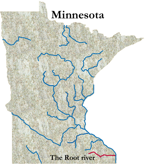 The Root River in Minnesota | |
| Native name | Hokah (Dakota) |
| Location | |
| Country | United States |
| States | Minnesota |
| Counties | Fillmore, Houston, Mower, Olmsted, Winona |
| Cities | Chatfield, Forestville, Hokah, Houston, Lanesboro, Minnesota, Rushford, Peterson, Preston, Stewartville, Whalan |
| Physical characteristics | |
| Source | |
| • coordinates | 43.8066305°N 92.1704397°W |
| Mouth | Mississippi River |
• coordinates | 43.7619120°N 91.2518017°W |
| Length | 80 miles (130 km) |
| Discharge | |
| • location | 43.7619°N 91.2518°W |
| Basin features | |
| River system | Mississippi River |
| Tributaries | |
| • left | Kinney Creek, Lynch Creek, Mill Creek, Money Creek, North Branch Root River, Raaen Creek, Rush Creek, Torkelson Creek, Trout Run |
| • right | Diamond Creek (Root River tributary), Ferndale Creek, Gribben Creek, Middle Fork Root River, Partridge Creek, South Branch Root River, Rice Creek, South Fork Root River |
| Bridges | Moen's Bridge |
History and description
Root River is an English translation of the Dakota-language name Hokah.[2]
The Root River is formed by the merger of its North Branch Root River and Middle Fork Root River in Chatfield, Minnesota. A mile and a half north of Lanesboro, Minnesota it is joined by the South Branch Root River.[2][3][4][5] The South Fork Root River joins the Root River near Houston, Minnesota.[6][7]
The South Branch Root River rises in Mower County as agricultural drainage ditches, which disappear underground, re-emerging as a much cooler stream[8] at Mystery Cave near Preston, Minnesota. The 48°F water creates superb conditions for brook trout.[4][7]
The Root River and its tributaries lie within Minnesota's Driftless Area, a region which missed being glaciated during the last ice age, i.e., the Wisconsinian glaciation.[7]
At Houston, the Root River's discharge was 845.2 cubic feet per second in 1961.[9][10]
Fish and wildlife
Many fish species such as brook trout, rainbow trout, brown trout, smallmouth bass, rock bass, channel catfish, crappies, shorthead redhorse, river redhorse, golden redhorse, silver redhorse, Longnose Sturgeon, greater redhorse, black redhorse, northern hogsuckers, and white suckers inhabit the river. The Root River system provides habitat to a number of bird species. Red-tailed hawks and bald eagles can be found in the area. Blue herons, wild turkeys, and wood ducks are also commonly seen. Numerous mammals can be spotted in the region including deer, gray fox, red fox, coyotes, raccoons, squirrels, and badgers.
Trail
The Root River State Trail is a 42-mile-long (68 km) trail for bicycling, hiking, skating, skiing, etc. It begins in Fountain and continues through Lanesboro, Whalan, Peterson, Rushford, and Houston.
2007 flood
As a result of the 2007 Midwest flooding, the river rose to 19 feet (5.8 m), about a foot short of the height of the dike protecting the town of Houston.[11]
Maps

See also
- List of Minnesota rivers
- List of longest streams of Minnesota
References
- "The National Map". U.S. Geological Survey. Retrieved Feb 9, 2011.
- Upham, Warren (1920). Minnesota Geographic Names: Their Origin and Historic Significance. Minnesota Historical Society. p. 196.
- U.S. Geological Survey Geographic Names Information System: North Branch Root River
- U.S. Geological Survey Geographic Names Information System: South Branch Root River
- U.S. Geological Survey Geographic Names Information System: Middle Branch Root River
- U.S. Geological Survey Geographic Names Information System: South Fork Root River
- "Root River and Tributaries" (PDF). Minnesota DNR. Retrieved March 24, 2021.
- "South Branch Root River". Minnesota Public Radio. 1998. Retrieved July 21, 2007.
- "Search". USGS.
- "ROOT RIVER BELOW SOUTH FORK NEAR HOUSTON, MN". USGS. Retrieved March 24, 2021.
- Meryhew, Richard; Terry Collins; Allie Shah (2007-08-20). "6 reported dead in floods in southeastern Minnesota". Star Tribune. Archived from the original on 2007-08-21. Retrieved 2007-08-24.
External links
- Minnesota DNR canoeing guide for the Root River
- Minnesota DNR trail guide for the Root River State Trail.
Authority control | |
|---|---|
| General |
|
| National libraries | |
На других языках
[de] Root River (Mississippi River)
Der Root River fließt durch das Hügelland im Südosten von Minnesota und ist ein Zufluss des Mississippi Rivers. Aufgrund seines leichten Gefälles von 65 Zentimetern pro Kilometer zwischen Chatfield und seiner Mündung in den Mississippi in dessen Navigationsabschnitt 7 eignet er sich vorzüglich zum Kanufahren.- [en] Root River (Minnesota)
Другой контент может иметь иную лицензию. Перед использованием материалов сайта WikiSort.org внимательно изучите правила лицензирования конкретных элементов наполнения сайта.
WikiSort.org - проект по пересортировке и дополнению контента Википедии