geo.wikisort.org - River
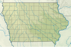
The Little Rock River is a tributary of the Rock River, 74.5 miles (119.9 km) long,[2] in southwestern Minnesota and northwestern Iowa in the United States. Via the Rock, Big Sioux and Missouri rivers, it is part of the watershed of the Mississippi River.
| Little Rock River | |
|---|---|
 Mouth of the Little Rock River | |
| Location | |
| Country | US |
| State | Iowa, Minnesota |
| District | Lyon County, Iowa, Osceola County, Iowa, Nobles County, Minnesota |
| Physical characteristics | |
| Source | |
| • coordinates | 43°36′55″N 95°41′24″W[1] |
| Mouth | Rock River |
• location | Doon, Iowa, US |
• coordinates | 43°15′51″N 96°14′48″W[1] |
• elevation | 1,250[1] ft (380 m) |
It has also been known as "Little Rock Creek".[1]
Course
The Little Rock River rises in Nobles County, Minnesota, 3 miles (5 km) west of the town of Worthington, and flows generally southwestwardly through Osceola and Lyon counties in Iowa, where it passes the towns of Little Rock and George. It flows into the Rock River about 1.5 miles (2.4 km) southwest of Doon.[3]
See also
- List of Iowa rivers
- List of Minnesota rivers
References
- U.S. Geological Survey Geographic Names Information System: Little Rock River
- U.S. Geological Survey. National Hydrography Dataset high-resolution flowline data. The National Map Archived 2012-04-05 at WebCite, accessed March 30, 2011
- Doon, Iowa, 7.5 Minute Topographic Quadrangle, USGS, 1971
- Columbia Gazetteer of North America entry
- DeLorme (1998). Iowa Atlas & Gazetteer. Yarmouth, Maine: DeLorme. ISBN 0-89933-214-5.
- DeLorme (1994). Minnesota Atlas & Gazetteer. Yarmouth, Maine: DeLorme. ISBN 0-89933-222-6.
Текст в блоке "Читать" взят с сайта "Википедия" и доступен по лицензии Creative Commons Attribution-ShareAlike; в отдельных случаях могут действовать дополнительные условия.
Другой контент может иметь иную лицензию. Перед использованием материалов сайта WikiSort.org внимательно изучите правила лицензирования конкретных элементов наполнения сайта.
Другой контент может иметь иную лицензию. Перед использованием материалов сайта WikiSort.org внимательно изучите правила лицензирования конкретных элементов наполнения сайта.
2019-2026
WikiSort.org - проект по пересортировке и дополнению контента Википедии
WikiSort.org - проект по пересортировке и дополнению контента Википедии