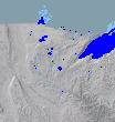
 Topographic map of Minnesota streams, lakes and rivers in blue
 Bois de Sioux River below Lake Traverse dam. Roberts County, South Dakota is at left, and Traverse County, Minnesota is at right.
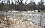
 Buffalo River in Buffalo River State Park


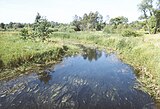
 Cobb River in Blue Earth County
 Cottonwood River in Flandrau State Park
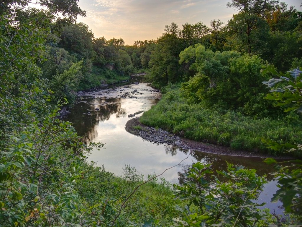
 Crow Wing River in Oylen, Wadena County, Minnesota
 Embarrass River in Winter
 Le Sueur River near Red Jacket trail
 Little Cannon River near Sogn, Minnesota
 Minnesota River Mendota Heights bridge
 Mississippi River source at Lake Itasca
 Mississippi River and Minnesota River confluence near Fort Snelling State Park
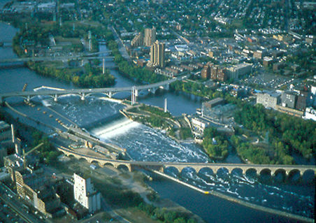
 Mississippi River at St. Anthony Falls in Minneapolis
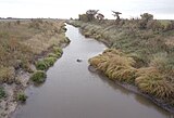 Mustinka River straightened and re-routed section in Redpath Township of Traverse County
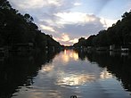
 Partridge River at Bartlett Township, Todd County, Minnesota
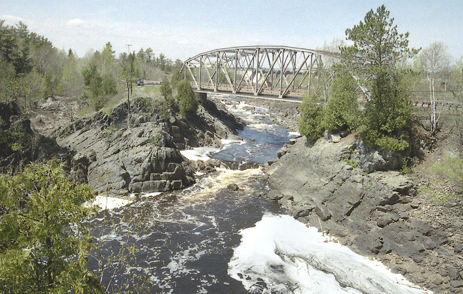
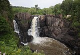 Pigeon River High Falls at Grand Portage State Park
 Red River of the North as viewed from Fargo, North Dakota
 St. Croix River viewed downstream from Stillwater, Minnesota
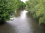
 Vermilion River in St. Louis County
geo.wikisort.org - River
Out of the 6,564 streams that flow through the U.S. State of Minnesota, there are 114 streams that are at least 30 miles long. The second longest river in the United States, the Mississippi River, originates in Minnesota before flowing south to the Gulf of Mexico. The longest river entirely within the state of Minnesota is the Minnesota River. Other rivers over 200 miles long include the Red River of the North, Des Moines River, Cedar River, Wapsipinicon River, Little Sioux River, and Roseau River.[1][2]
| Longest streams of Minnesota | |
|---|---|
 |
Sections of several of the longest rivers define sections of the Minnesota border.[3] The Red River of the North forms the border with North Dakota to the west. The Bois de Sioux River forms the border with South Dakota to the west. The Mississippi River, St. Croix River, and the St. Louis River form the border with Wisconsin to the east. The Rainy River and Pigeon River form the border with Ontario, Canada to the north.
Minnesota contains three major drainage basins/watersheds with waters from Minnesota rivers flowing south, north, or east.[1] These major drainage basins meet in a triple divide point located at the Hill of Three Waters, just north of Hibbing, Minnesota (47°26.863′N 92°56.8′W).[4] The Mississippi River drainage basin with water flowing south (1,151,000 sq mi (2,980,000 km2)) is made up of the Upper Mississippi River watershed (above St. Paul)[note 2], Lower Mississippi River (Below St. Paul), Minnesota River drainage basin (17,000 sq mi (44,000 km2)), St. Croix River drainage basin (7,700 sq mi (20,000 km2)), Des Moines River drainage basin (14,802 sq mi (38,340 km2)), and Missouri River drainage basin (529,350 sq mi (1,371,000 km2)). Water flows southwards, eventually reaching the Gulf of Mexico. Water flows to the north in the Hudson Bay/Artic drainage basin (3,861,400 sq mi (10,001,000 km2)), which includes the Red River of the North drainage basin (111,004 sq mi (287,500 km2)) and Lake of the Woods drainage basin (13,805 sq mi (35,750 km2))—of which 7,285 sq mi (18,870 km2) is in Minnesota. Minnesota water flows northward to the Hudson Bay. The Great Lakes Basin to the east includes the Lake Superior drainage basin in Minnesota and Wisconsin (49,300 sq mi (128,000 km2)).[6] Minnesota water flows eastward through the Great Lakes to the Atlantic Ocean.
Table of longest streams
A sortable table below lists the 114 streams flowing in Minnesota that have a total length of greater than or equal to 30 miles. The stream's tributary and watershed are given. The source or mouth of some streams are in other U.S. states or Canadian provinces. Other than border rivers, the only rivers that originate in other states are the Little Minnesota River (South Dakota), St. Croix River (Wisconsin), and Upper Tamarack River (Wisconsin). The 21 streams that are not entirely within the state are indicated by a ![]() after the order number. The coordinates and location county of the mouth and source of the stream are indicated, as well as the United States Geological Survey (USGS) Geographic Names Information System ID and other references and notes.[note 3] Lengths and elevations are derived from the National Elevation Dataset or reference to it in the USGS GNIS Database.[7] A link to an Open Street Map template is listed at the top of this article that will generate a map showing the source and mouth coordinates of all of these streams. For consistency and accuracy, the sources for this information is primarily data from the USGS GeoNames and National Elevation database, supplemented by other sources.
after the order number. The coordinates and location county of the mouth and source of the stream are indicated, as well as the United States Geological Survey (USGS) Geographic Names Information System ID and other references and notes.[note 3] Lengths and elevations are derived from the National Elevation Dataset or reference to it in the USGS GNIS Database.[7] A link to an Open Street Map template is listed at the top of this article that will generate a map showing the source and mouth coordinates of all of these streams. For consistency and accuracy, the sources for this information is primarily data from the USGS GeoNames and National Elevation database, supplemented by other sources.
| Rank | Stream name | Tributary of | Length | Drainage basin | Mouth elevation | Mouth Location | Mouth coordinates | Source location | Source coordinates | GNIS ID, References, Notes | ||
|---|---|---|---|---|---|---|---|---|---|---|---|---|
| mi | km | ft | m | |||||||||
| 112 |
Pigeon River | Lake Superior | 31.2 | 50.2 | Lake Superior | 602 | 183 | Cook County/Ontario, Pigeon Point | 47°59′57″N 89°34′10″W | Cook County/Ontario, South Fowl Lake | 48°02′23″N 89°59′47″W | 657824[13] |
| 93 | Brule River | Lake Superior | 40 | 65 | Lake Superior | 602 | 183 | Cook County, Marr Island | 47°49′00″N 90°03′00″W | Cook County, Hungry Jack Lake | 48°00′25″N 90°28′20″W | 655530[13] [note 4] [note 5] |
| 97 | Temperance River | Lake Superior | 39 | 63 | Lake Superior | 602 | 183 | Cook County, Tofte | 47°33′12″N 90°52′25″W | Cook County, Brule Lake | 47°55′42″N 90°46′54″W | 658627 [note 4] [note 5] [note 6] |
| 10 |
St. Louis River | Lake Superior | 192 | 309 | Lake Superior | 602 | 183 | St. Louis County, West Duluth | 46°45′N 92°06′W | St. Louis County, Douglas County, Wisconsin [note 7] | 47°30′04″N 91°49′51″W | 662334 [note 5] [note 8][15] |
| 37 | Cloquet River | St. Louis River | 104 | 167 | Lake Superior | 1,201 | 366 | St. Louis County | 46°51′41″N 92°34′13″W | Lake County, Cloquet Lake | 47°25′53″N 91°29′12″W | 661012 [note 4][13] |
| 109 | Little Isabella River | Isabella River | 33 | 53 | Hudson Bay | 1,503 | 458 | Lake County | 47°48′15″N 91°27′17″W | Lake County | 47°36′28″N 91°20′11″W | 657071 [note 4][16][17] |
| 60 | Whiteface River | St. Louis River | 64 | 104 | Lake Superior | 1,250 | 381 | St. Louis County, McCarty River | 46°58′45″N 92°48′41″W | St. Louis County, Whiteface Reservoir | 47°16′53″N 92°11′16″W | 662794[13] |
| 88 | West Swan River | East Swan River | 42 | 68 | Lake Superior | 1,260 | 384 | St. Louis County, Little Swan | 47°15′04″N 92°49′06″W | St. Louis County, Keewatin | 47°24′49″N 93°00′28″W | 662774 |
| 74 | Embarrass River | St. Louis River | 51 | 81 | Lake Superior | 1,329 | 405 | St. Louis County, Gilbert | 47°41′46″N 91°59′50″W | St. Louis County, Babbitt | 47°23′32″N 92°24′52″W | 661216[13] |
| 101 | Partridge River | St. Louis River | 37 | 60 | Lake Superior | 1,394 | 425 | St. Louis County, Turpela Lake | 47°29′36″N 92°13′44″W | St. Louis County, Babbitt | 47°38′16″N 91°59′09″W | 662142 |
| 56 |
Nemadji River | Lake Superior | 71 | 114 | Lake Superior | 602 | 183 | Douglas County, Wisconsin, Superior | 46°24′03″N 92°30′29″W | Pine County, Minnesota, Nickerson | 46°42′12″N 92°01′39″W | 1570172 [note 4] [note 5] [note 9] [note 10] |
| 1 |
Mississippi River | Gulf of Mexico | 2,320 | 3,734 | Mississippi River | 0 | 0 | Louisiana, Pilottown, Plaquemines Parish | 29°09′04″N 89°15′12″W | Clearwater County, Itasca State Park [note 11] | 47°14′23″N 95°12′27″W | 1629903 [note 12][13] |
| 4 | Minnesota River | Mississippi River | 370 | 595 | Mississippi River (Upper) | 696 | 212 | Ramsey County, St. Paul | 44°53′49″N 93°08′57″W | Big Stone County, Ortonville [note 13] | 45°18′10″N 96°27′07″W | 659759[13] |
| 13 |
St. Croix River | Mississippi River | 169 | 272 | Mississippi River (Upper) | 686 | 209 | Dakota County, Hastings | 44°44′45″N 92°48′10″W | Douglas County, Wisconsin, Upper St. Croix Lake | 46°23′19″N 91°45′34″W | 662324 [note 14] |
| 2 |
Red River of the North | Lake Winnipeg | 550 | 885 | Hudson Bay | 715 | 218 | Lake Winnipeg, Manitoba | 50°24′01″N 96°48′00″W | Wilkin County, Minnesota, Richland County, North Dakota, Wahpeton [note 15] | 46°15′52″N 96°35′55″W | 1035890 [note 17] |
| 7 |
Little Sioux River | Missouri River | 258 | 415 | Mississippi River (Lower) | 1,010 | 308 | Harrison County, Iowa, Little Sioux | 41°48′11″N 96°03′58″W | Jackson County, Okabena | 43°39′52″N 95°18′53″W | 657126 |
| 65 |
Ocheyedan River | Little Sioux River | 58 | 93 | Mississippi River (Lower) | 1,306 | 398 | Nobles County, Bigelow | 43°08′10″N 95°09′11″W | Clay County, Iowa, Spencer | 43°32′49″N 95°38′17″W | 459796 |
| 22 |
Rock River | Big Sioux River | 144 | 232 | Mississippi River (Lower) | 1,168 | 356 | Sioux County, Iowa, Hawarden | 43°04′58″N 96°27′16″W | Pipestone County, Rhuthotan | 44°08′13″N 96°07′23″W | 460744 [note 18] |
| 71 |
Split Rock Creek | Big Sioux River | 55 | 89 | Mississippi River (Lower) | 1,280 | 390 | Rock County, Brandon | 43°32′59″N 96°35′51″W | Minnehaha County, South Dakota, Pipestone | 43°59′27″N 96°18′22″W | 652403 |
| 72 | Pipestone Creek | Split Rock Creek | 53 | 86 | Mississippi River (Lower) | 1,506 | 459 | Pipestone County | 43°48′14″N 96°26′28″W | Moody County, South Dakota | 44°01′52″N 96°17′25″W | 649528 |
| 90 | Flandreau Creek | Big Sioux River | 41 | 66 | Mississippi River (Lower) | 1,529 | 466 | Pipestone County | 44°03′30″N 96°33′16″W | Lincoln County | 44°13′53″N 96°17′06″W | 643728 |
| 3 |
Des Moines River | Mississippi River | 525 | 845 | Des Moines River | 597 | 182 | Clark County, Missouri / Lee County, Iowa, near Keokuk, Iowa | 40°22′52″N 91°25′21″W | Murray County [20] | 44°05′02″N 95°41′17″W | 465582 [note 19][21] |
| 61 |
Jack Creek | Des Moines River | 64 | 103 | Des Moines River | 1,401 | 427 | Jackson County | 43°46′02″N 95°17′09″W | Nobles County | 43°47′40″N 95°49′54″W | 645551 |
| 5 |
Cedar River | Mississippi River | 338 | 544 | Mississippi River (Lower) | 594 | 181 | Louisa County, Iowa | 41°16′59″N 91°20′49″W | Dodge County | 43°50′05″N 92°48′28″W | 465058 [note 20] |
| 31 |
Shell Rock River | Mississippi River | 113 | 182 | Mississippi River (Lower) | 869 | 265 | Black Hawk County, Iowa | 42°38′03″N 92°30′05″W | Freeborn County | 43°36′42″N 93°17′37″W | 461563 |
| 48 |
Little Cedar River | Cedar River | 82 | 133 | Mississippi River (Lower) | 945 | 288 | Chickasaw County, Iowa | 42°57′02″N 92°31′39″W | Mower County, Brownsdale | 43°39′16″N 92°45′22″W | 458453 |
| 17 |
Upper Iowa River | Mississippi River | 156 | 251 | Mississippi River (Lower) | 620 | 189 | Allamakee County, Iowa | 43°27′58″N 91°14′02″W | Mower County | 43°37′16″N 92°37′23″W | 462496 [note 21] |
| 6 |
Wapsipinicon River | Mississippi River | 300 | 482 | Mississippi River (Lower) | 574 | 175 | Scott County, Iowa | 41°43′47″N 90°19′11″W | Mower [note 22] | 43°32′55″N 92°38′40″W | 462671 |
| 51 | Root River | Mississippi River | 80 | 129 | Mississippi River (Lower) | 630 | 192 | Houston County | 43°45′43″N 91°15′06″W | Fillmore County, Chatfield | 43°48′24″N 92°10′14″W | 650249[13][23] |
| 59 | Zumbro River | Mississippi River | 65 | 104 | Mississippi River (Lower) | 666 | 203 | Wabasha County | 44°17′30″N 91°55′41″W | Olmsted County | 44°09′10″N 92°28′02″W | 654509 |
| 33 | Cannon River | Mississippi River | 112 | 180 | Mississippi River (Lower) | 666 | 203 | Goodhue County | 44°35′09″N 92°33′25″W | Le Sueur County | 44°21′31″N 93°26′51″W | 640874[13][24] |
| 114 | Little Cannon River | Cannon River | 31 | 49 | Mississippi River (Lower) | 781 | 238 | Goodhue County | 44°30′44″N 92°54′20″W | Rice County | 44°19′04″N 93°04′43″W | 646775 [note 4] |
| 69 | Straight River | Cannon River | 56 | 89 | Mississippi River (Lower) | 961 | 293 | Rice County | 44°18′36″N 93°16′13″W | Freeborn County | 44°30′44″N 92°54′20″W | 652708 [note 4] [24] |
| 64 | Vermillion River | Mississippi River | 60 | 96 | Mississippi River (Lower) | 676 | 206 | Goodhue County | 44°30′44″N 92°54′20″W | Scott County | 44°37′14″N 92°40′01″W | 653634[13] [note 4] |
| 95 | Vermilion River | Rainy River | 40 | 64 | Hudson Bay | 1,112 | 339 | St. Louis County | 48°16′33″N 92°30′23″W | St. Louis County | 47°57′40″N 92°28′33″W | 662718[25] |
| 98 | Sunrise River | St. Croix River | 39 | 63 | St. Croix River | 768 | 234 | Chisago County | 45°34′00″N 92°51′46″W | Washington County | 45°17′24″N 92°58′28″W | 652846 |
| 38 | Snake River | St. Croix River | 104 | 167 | St. Croix River | 797 | 243 | Pine County | 45°49′27″N 92°45′53″W | Aitkin County | 46°17′17″N 93°06′43″W | 658321 |
| 96 | Groundhouse River | Snake River | 40 | 64 | St. Croix River | 948 | 289 | Kanabec County | 45°48′39″N 93°15′44″W | Mille Lacs County | 45°58′31″N 93°34′03″W | 644496 |
| 46 | Kettle River | St. Croix River | 84 | 135 | St. Croix River | 810 | 247 | Pine County | 45°51′28″N 92°44′11″W | Carlton County | 46°41′14″N 92°47′17″W | 646128 |
| 111 | Willow River | Kettle River | 31 | 51 | St. Croix River | 1,020 | 311 | Pine County | 46°19′11″N 92°50′48″W | Pine County | 46°21′54″N 92°28′26″W | 654205[13] |
| 105 | Moose Horn River | Kettle River | 36 | 59 | St. Croix River | 1,020 | 311 | Carlton County | 46°21′54″N 92°28′26″W | Carlton County | 46°40′15″N 92°36′26″W | 648090 |
| 87 | Sand Creek | St. Croix River | 43 | 70 | St. Croix River | 853 | 260 | Pine County | 45°56′03″N 92°38′25″W | Pine County | 46°16′34″N 92°31′56″W | 651137[13] |
| 99 | Lower Tamarack River | St. Croix River | 39 | 63 | St. Croix River | 876 | 267 | Pine County | 46°01′39″N 92°25′10″W | Pine County | 46°18′56″N 92°25′44″W | 647267[13] |
| 113 | Upper Tamarack River | St. Croix River | 31 | 50 | St. Croix River | 886 | 270 | Pine County | 46°04′13″N 92°19′09″W | Douglas County, Wisconsin | 46°20′00″N 92°05′11″W | 1815030 |
| 104 | Sand Creek | Minnesota River | 37 | 59 | Minnesota River | 696 | 212 | Scott County | 44°44′53″N 93°36′50″W | Le Sueur County | 44°28′44″N 93°33′26″W | 651135 |
| 57 | High Island Creek | Minnesota River | 69 | 112 | Minnesota River | 722 | 220 | Sibley County | 44°35′08″N 93°54′05″W | Renville County | 44°38′58″N 94°42′12″W | 644939 |
| 35 | Blue Earth River | Minnesota River | 108 | 174 | Minnesota River | 751 | 229 | Blue Earth County | 44°09′51″N 94°02′13″W | Faribault County | 43°34′20″N 94°06′11″W | 640285[13][26] |
| 34 | Le Sueur River | Blue Earth River | 111 | 178 | Minnesota River | 764 | 233 | Blue Earth County | 44°07′36″N 94°02′52″W | Freeborn County | 43°46′03″N 93°28′13″W | 646550 |
| 50 | Maple River | Le Sueur River | 80 | 129 | Minnesota River | 814 | 248 | Blue Earth County | 44°05′14″N 94°00′55″W | Freeborn County | 43°47′05″N 93°38′28″W | 647499 |
| 53 | Cobb River | Le Sueur River | 79 | 126 | Minnesota River | 810 | 247 | Blue Earth County | 44°04′39″N 94°00′03″W | Freeborn County | 43°45′16″N 93°34′48″W | 641371 |
| 102 | Little Cobb River | Cobb River | 37 | 60 | Minnesota River | 974 | 297 | Blue Earth County | 43°59′31″N 93°55′16″W | Waseca Countyformat=dms| | 43°52′47″N 93°39′29″W | 646783 |
| 30 | Watonwan River | Blue Earth River | 113 | 182 | Minnesota River | 869 | 265 | Blue Earth County | 44°04′13″N 94°07′35″W | Cottonwood County | 44°01′30″N 95°13′12″W | 653842[26] |
| 100 | Perch Creek | Watonwan River | 37 | 60 | Minnesota River | 938 | 286 | Blue Earth County | 44°00′07″N 94°16′54″W | Martin County | 43°48′16″N 94°28′23″W | 649278 |
| 43 | Elm Creek | Blue Earth River | 90 | 144 | Minnesota River | 1,014 | 309 | Faribault County | 43°45′17″N 94°11′48″W | Jackson County | 43°47′05″N 95°02′34″W | 643295 |
| 47 | Little Cottonwood River | Minnesota River | 83 | 133 | Minnesota River | 778 | 237 | Blue Earth County | 44°15′05″N 94°19′47″W | Cottonwood County | 44°02′28″N 95°11′35″W | 646788 |
| 19 | Cottonwood River | Minnesota River | 152 | 245 | Minnesota River | 694 | 212 | Brown County | 44°17′05″N 94°24′55″W | Lyon County | 44°12′06″N 95°56′06″W | 641538 |
| 73 | Sleepy Eye Creek | Cottonwood River | 52 | 83 | Minnesota River | 961 | 293 | Brown County | 44°15′12″N 94°46′22″W | Redwood County | 44°24′12″N 95°31′08″W | 652151 |
| 107 | Plum Creek | Cottonwood River | 35 | 57 | Minnesota River | 1,076 | 328 | Redwood County | 44°16′52″N 95°22′44″W | Murray County | 44°10′33″N 95°36′08″W | 649592 |
| 25 | Redwood River | Minnesota River | 127 | 205 | Minnesota River | 830 | 253 | Redwood County | 44°34′16″N 95°05′18″W | Pipestone | 44°10′03″N 96°10′18″W | 658010 |
| 62 | Hawk Creek | Minnesota River | 62 | 100 | Minnesota River | 869 | 265 | Renville County | 44°44′10″N 95°25′21″W | Kandiyohi County | 45°07′28″N 95°04′30″W | 644736 |
| 36 | Yellow Medicine River | Minnesota River | 107 | 173 | Minnesota River | 666 | 203 | Yellow Medicine County | 44°44′21″N 95°25′43″W | Lincoln County | 44°24′41″N 96°21′05″W | 654416 |
| 108 | Spring Creek | Yellow Medicine River | 33 | 54 | Minnesota River | 1,030 | 314 | Yellow Medicine County | 44°42′38″N 95°40′23″W | Yellow Medicine County | 44°47′25″N 96°08′07″W | 652432 |
| 18 | Chippewa River | Minnesota River | 153 | 246 | Minnesota River | 919 | 280 | Chippewa County | 44°56′05″N 95°44′00″W | Douglas County | 45°59′17″N 95°38′44″W | 641167 |
| 79 | Shakopee Creek | Chipppewa River | 49 | 78 | Minnesota River | 919 | 280 | Swift County | 45°12′17″N 95°39′49″W | Kandiyohi County | 45°18′13″N 95°02′50″W | 651899 |
| 91 | Little Chippewa River | Chippewa River | 41 | 66 | Minnesota River | 1,106 | 337 | Pope County | 45°35′33″N 95°41′00″W | Pope County | 45°43′48″N 95°30′59″W | 641167 |
| 28 | Lac qui Parle River | Minnesota River | 118 | 190 | Minnesota River | 935 | 285 | Lac qui Parle County | 45°35′33″N 95°41′00″W | Lincoln County | 44°30′17″N 96°26′06″W | 646304 |
| 26 | Pomme de Terre River | Minnesota River | 125 | 200 | Minnesota River | 942 | 287 | Swift County | 45°10′33″N 96°05′13″W | Otter Tail County | 46°11′55″N 95°51′20″W | 649622 |
| 55 |
Little Minnesota River | Minnesota River | 71 | 115 | Minnesota River | 968 | 295 | Big Stone County | 45°33′14″N 96°47′43″W | Roberts County, South Dakota | 45°50′09″N 97°21′21″W | 646859 |
| 20 | Rum River | Mississippi River | 151 | 243 | Mississippi River (Upper) | 827 | 252 | Anoka County | 45°11′23″N 93°23′26″W | Mille Lacs County | 46°07′47″N 93°46′52″W | 650382[13] |
| 16 | North Fork Crow River | Crow River | 158 | 253 | Mississippi River (Upper) | 906 | 276 | Wright County | 45°04′53″N 93°45′45″W | Pope County | 45°36′07″N 95°10′16″W | 648637[13] |
| 83 | Middle Fork Crow River | Crow River | 45 | 73 | Mississippi River (Upper) | 1,099 | 335 | Meeker County | 45°15′09″N 94°36′08″W | Stearns County | 45°26′05″N 94°59′11″W | 647809 |
| 29 | South Fork Crow River | Crow River | 116 | 187 | Mississippi River (Upper) | 614 | 187 | Wright County | 45°04′53″N 93°45′45″W | Kandiyohi County | 45°03′26″N 94°55′18″W | 663175 |
| 44 | Buffalo Creek | South Fork Crow River | 84 | 136 | Mississippi River (Upper) | 948 | 289 | Carver County | 44°51′16″N 93°59′52″W | Kandiyohi County | 44°55′07″N 94°59′25″W | 663168 |
| 45 | Elk River | Mississippi River | 84 | 135 | Mississippi River (Upper) | 850 | 259 | Sherburne County | 45°17′53″N 93°34′21″W | Benton County | 45°49′09″N 93°55′40″W | 643267 |
| 52 | St. Francis River | Elk River | 79 | 127 | Mississippi River (Upper) | 915 | 279 | Sherburne County | 45°21′33″N 93°44′14″W | Benton County | 45°48′29″N 93°53′31″W | 650587[13] |
| 86 | Clearwater River | Mississippi River | 43 | 70 | Mississippi River | 938 | 286 | Stearns County | 45°25′22″N 94°02′57″W | Meeker County | 45°21′22″N 94°25′43″W | 641322 [note 23] |
| 27 | Sauk River | Mississippi River | 122 | 196 | Mississippi River (Upper) | 991 | 302 | Stearns County | 45°35′30″N 94°10′35″W | Todd County | 45°53′45″N 95°05′45″W | 651237[13] |
| 70 | Platte River | Mississippi River | 55 | 89 | Mississippi River (Upper) | 1,020 | 311 | Benton County | 45°46′45″N 94°16′45″W | Crow Wing County | 46°12′02″N 93°54′13″W | 649544 |
| 106 | Skunk River | Patte River | 36 | 58 | Mississippi River (Upper) | 1,099 | 335 | Morrison County | 45°56′09″N 94°13′24″W | Morrison County | 46°07′35″N 93°51′42″W | 652139 |
| 103 | Swan River | Mississippi River | 37 | 60 | Mississippi River (Upper) | 1,083 | 330 | Morrison County | 45°55′10″N 94°23′08″W | Todd County | 45°54′27″N 94°44′46″W | 652909 |
| 82 | Nokasippi River | Mississippi River | 47 | 75 | Mississippi River (Upper) | 1,142 | 348 | Crow Wing County, Clear Water Lake | 46°10′39″N 94°21′53″W | Crow Wing County, Fort Ripley | 46°24′47″N 93°54′41″W | 648568 |
| 32 | Crow Wing River | Mississippi River | 113 | 182 | Mississippi River (Upper) | 1,148 | 350 | Cass County | 46°16′16″N 94°20′23″W | Hubbard County | 47°00′07″N 94°44′29″W | 655896[13][28] |
| 40 | Long Prairie River | Crow Wing River | 96 | 154 | Mississippi River (Upper) | 1,204 | 367 | Morrison County | 46°19′27″N 94°36′46″W | Douglas County | 45°58′58″N 95°19′59″W | 647141[29] |
| 110 | Partridge River | Crow Wing River | 33 | 52 | Mississippi River (Upper) | 1,240 | 378 | Wadena County | 46°25′11″N 94°49′36″W | Todd County | 46°12′22″N 95°02′49″W | 649176 |
| 85 | Leaf River | Crow Wing River | 44 | 70 | Mississippi River (Upper) | 1,240 | 378 | Wadena County | 46°25′47″N 94°48′51″W | Otter Tail County | 46°24′08″N 95°25′36″W | 646564 |
| 54 | Redeye River | Leaf River | 73 | 117 | Mississippi River (Upper) | 1,260 | 384 | Wadena County | 46°29′10″N 94°53′06″W | Becker County | 46°49′17″N 95°25′06″W | 649894 |
| 80 | Wing River | Leaf River | 48 | 78 | Mississippi River (Upper) | 1,280 | 390 | Wadena County | 46°28′48″N 94°58′49″W | Otter Tail County | 46°14′33″N 95°17′31″W | 654255 |
| 81 | Shell River | Crow Wing River | 48 | 77 | Mississippi River (Upper) | 1,362 | 415 | Wadena County | 46°48′26″N 94°53′16″W | Becker County | 46°56′50″N 95°24′39″W | 651945 |
| 67 | Pine River | Mississippi River | 57 | 92 | Mississippi River (Upper) | 1,175 | 358 | Crow Wing County | 46°33′50″N 94°02′12″W | Cass County | 46°48′17″N 94°31′26″W | 659997 [note 24] |
| 66 | Rice River | Mississippi River | 57 | 92 | Mississippi River (Upper) | 1,194 | 364 | Aitkin County | 46°35′23″N 93°38′04″W | Aitkin County | 46°22′58″N 93°19′03″W | 650053[13] |
| 84 | Willow River | Mississippi River | 45 | 72 | Mississippi River (Upper) | 1,201 | 366 | Aitkin County | 46°40′22″N 93°35′33″W | Cass County | 47°05′27″N 93°50′44″W | 659024 |
| 63 | Swan River | Mississippi River | 60 | 97 | Mississippi River (Upper) | 1,227 | 374 | Aitkin County | 47°00′33″N 93°15′50″W | Itasca County | 47°17′21″N 93°11′54″W | 658570 |
| 8 |
Roseau River | Red River of the North | 214 | 344 | Red River of the North | 758 | 231 | Kittson County | 49°09′00″N 97°14′59″W | Lake of the Woods County | 48°31′44″N 95°12′17″W | 659936[13] [note 25] |
| 49 | Tamarac River | Red River of the North | 82 | 132 | Red River of the North | 771 | 235 | Marshall County | 48°29′23″N 97°07′50″W | Marshall County | 48°30′10″N 96°27′23″W | 652994 |
| 42 | Snake River | Red River of the North | 91 | 146 | Red River of the North | 771 | 235 | Marshall County | 48°25′59″N 97°07′26″W | Polk County | 48°21′21″N 96°27′40″W | 652198[13] |
| 89 | Grand Marais Creek | Red River of the North | 41 | 66 | Red River of the North | 794 | 242 | Polk County | 48°04′12″N 97°05′49″W | Polk County | 47°49′09″N 96°48′20″W | 644325 |
| 9 | Red Lake River | Red River of the North | 193 | 311 | Red River of the North | 797 | 243 | Polk County | 47°55′21″N 97°01′17″W | Beltrami County | 47°57′35″N 95°16′28″W | 649867[13] |
| 21 | Clearwater River | Red Lake River | 147 | 237 | Red River of the North | 948 | 289 | Red Lake County | 47°53′38″N 96°16′58″W | Mahnomen County | 47°28′50″N 95°34′08″W | 641321 |
| 39 | Sand Hill River | Red River of the North | 101 | 163 | Red River of the North | 840 | 256 | Polk County | 47°35′55″N 96°51′21″W | Mahnomen County | 47°30′55″N 95°44′52″W | 655066 |
| 77 | Marsh River | Red River of the North | 50 | 80 | Red River of the North | 827 | 252 | Norman County | 47°28′12″N 96°51′37″W | Norman County | 47°17′23″N 96°28′18″W | 647559 |
| 12 | Wild Rice River | Red River of the North | 183 | 295 | Red River of the North | 850 | 259 | Norman County | 47°19′05″N 96°50′14″W | Clearwater County | 47°23′03″N 95°18′30″W | 654136[13] |
| 23 | Buffalo River | Red River of the North | 139 | 224 | Red River of the North | 853 | 260 | Clay County | 47°05′17″N 96°48′58″W | Becker County | 46°55′11″N 95°41′06″W | 660006 |
| 11 | Otter Tail River | Red River of the North | 192 | 309 | Red River of the North | 951 | 290 | Wilkin County | 46°15′52″N 96°35′55″W | Becker County | 47°01′39″N 95°32′40″W | 657701 |
| 92 |
Bois de Sioux River | Red River of the North | 41 | 66 | Red River of the North | 951 | 290 | Wilkin County | 46°15′52″N 96°35′55″W | Roberts County, South Dakota | 45°51′42″N 96°34′23″W | 640348 |
| 24 |
Rainy River | Lake of the Woods | 137 | 220 | Lake of the Woods | 1,060 | 323 | Lake of the Woods County | 48°50′55″N 94°41′30″W | Koochiching County | 48°36′54″N 93°21′12″W | 657974 |
| 14 | Big Fork River | Rainy River | 168 | 270 | Lake of the Woods | 1,079 | 329 | Koochiching County | 48°31′00″N 93°43′01″W | Itasca County | 47°45′23″N 94°02′32″W | 655362[13][30] |
| 15 | Little Fork River | Rainy River | 160 | 257 | Lake of the Woods | 1,083 | 330 | Koochiching County | 48°31′39″N 93°35′17″W | Saint Louis County | 47°49′13″N 92°27′59″W | 661740[13][31] |
| 41 | Middle River | Snake River | 96 | 154 | Red River of the North | 794 | 242 | Marshall County | 48°22′17″N 97°04′47″W | Marshall County | 48°24′44″N 96°00′54″W | 647817[13] |
| 75 | Prairie River | Mississippi River | 50 | 80 | Mississippi River | 1,243 | 379 | Itasca County | 47°12′54″N 93°28′57″W | Itasca County | 47°35′39″N 93°10′52″W | 657937[13] |
| 68 | Rapid River | Rainy River | 56 | 90 | Rainy River | 1,063 | 324 | Lake of the Woods County | 48°41′41″N 94°26′10″W | Koochiching County | 48°22′12″N 95°08′42″W | 659998[13] |
| 78 | Turtle River | Mississippi River | 49 | 79 | Mississippi River | 1,302 | 397 | Beltrami County | 47°29′46″N 94°32′08″W | Beltrami County | 47°38′18″N 94°57′34″W | 658778[13] |
| 76 | Caldwell Brook | Mississippi River | 50 | 80 | Mississippi River | 1,214 | 370 | Koochiching County | 47°58′50″N 93°49′06″W | Itasca County | 47°52′36″N 94°13′23″W | 655592[13] |
| 58 | Mustinka River | Lake Traverse | 68 | 109 | Hudson Bay | 978 | 298 | Traverse County | 45.7650°N 96.6176°W | Otter Tail County | 46.2124597°N 96.1045034°W | 648407[18][32] |
| 94 | Thief River | Red Lake River | 40 | 65 | Hudson bay | 115 | 35 | Marshall County | 48°07′27″N 96°10′10″W | Pennington County | 48°29′18″N 95°57′00″W | 653128[33] |
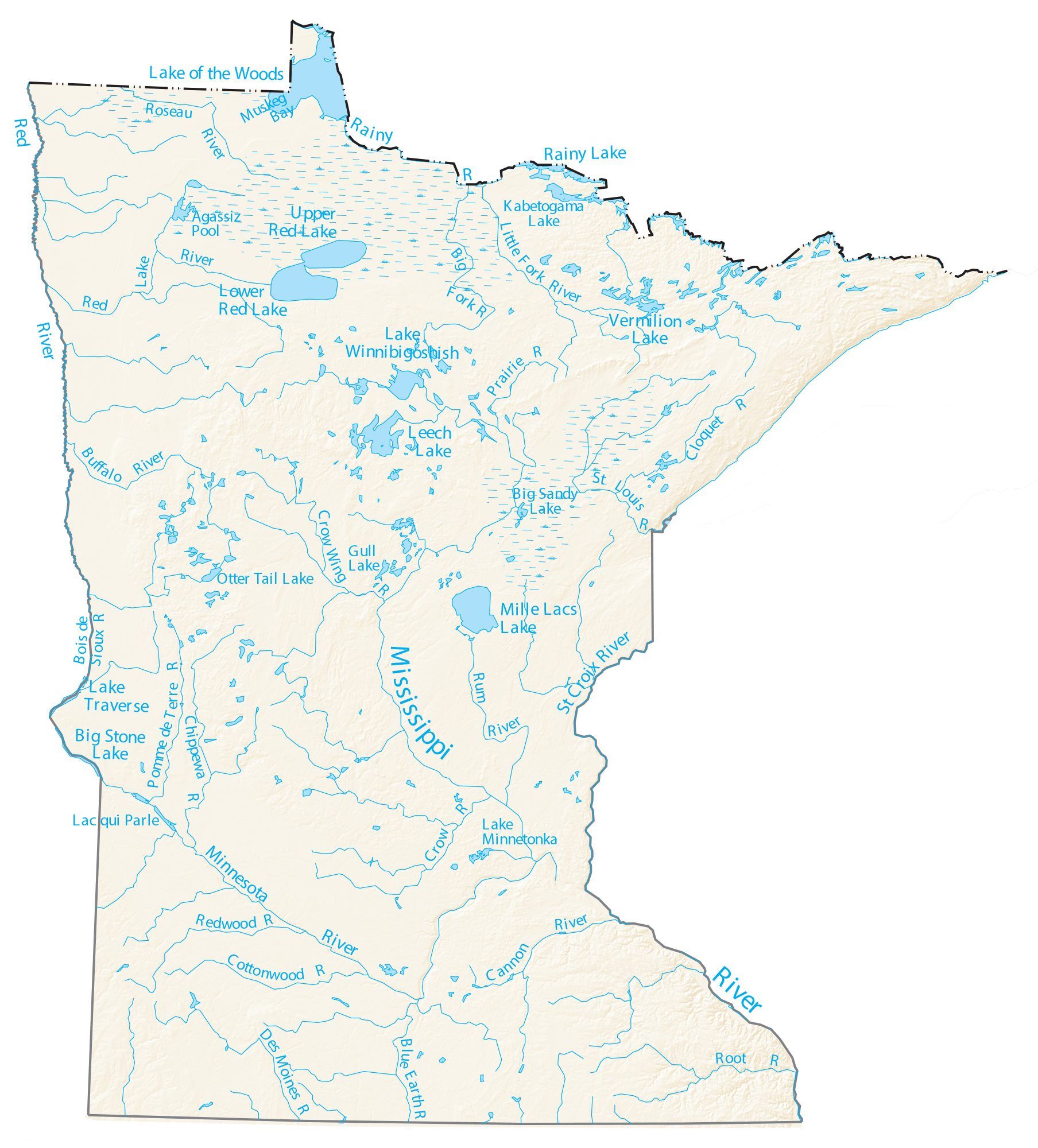
Map of Minnesota streams and lakes
The map below shows the major streams and lakes in Minnesota.[34]
Gallery
Images of selected Minnesota rivers


See also
| Wikimedia Commons has media related to Rivers of Minnesota. |
- Geography of Minnesota
- List of longest rivers in the United States by state
- List of rivers of Minnesota
- List of rivers of Iowa
- List of rivers of North Dakota
- List of rivers of South Dakota
- List of rivers of Wisconsin
- List of lakes of Minnesota
Notes
- In North America, the term watershed is commonly used to mean a drainage basin, though in other English-speaking countries, it is used only in its original sense, that of a drainage divide.
- The Mississippi River drainage basin from Lake Itasca to Hastings, Minnesota consist of 20,105 sq mi (52,070 km2)[5]
- The state is given for non-Minnesota counties
- Portions of the Brule (31.5 mi), Cloquet (29.9), Little Cannon (12.5 mi), Little Isabella (33.17), Nemadji (13.44 mi), Temperance (24.56 mi), and Vermillion (22.8) rivers, are Minnesota DNR designated trout streams.[14]
- Length is an average of the 2013 lengths
- The USGS National dataset lists the elevation of the Temperance River as 597 ft (182 m)
- The St. Louis River forms the border between St. Louis County, Minnesota and Douglas County, Wisconsin before it discharges into Lake Superior.
- The USGS National dataset lists the elevation of the St. Louis River as 597 ft (182 m)
- 32.8 miles of the Nemadji River flows through Minnesota.[18]
- The USGS National dataset lists the elevation Nemadji River as 597 ft (182 m)
- The Mississippi River at its source has an elevation of 1,475 ft (450 m)
- The Mississippi River flows for 680 mi (1,090 km) within Minnesota.[1]
- The elevation of the Minnesota River is 964 ft (294 m) at its source
- 129.2 miles of the St. Croix River flow either on the Minnesota border or within Minnesota.[18]
- The Red River of the North enters the United States in Pembina County, North Dakota.[19]
- The source elevation of the Red River of the North is 948 ft (289 m)
- According to the Minnesota Department of Natural Resources, 394 mi (634 km) of the Red River of the North are in the United States. This amounts to about 72 percent of the main-stem length.[19][18]
- The Rock River flows for 88.9 mi (143.1 km) within Minnesota.[18]
- The Des Moines River flows for 68 mi (109 km) within Minnesota.[21]
- The Cedar River flows for a little over 25 mi (40 km) within Minnesota.[22]
- The Upper Iowa River flows for 50.4 mi (81.1 km) in Minnesota.[18]
- Wapsipinicon River has a source elevation of 1,348 ft (411 m)
- The Clearwater River is a MN DNR designated trout stream.[27][13]
- The Pine River (Mississippi River tributary) should not be confused with the Pine River (Minnesota–Ontario) or Pine River (Saint Louis River tributary), both of which are less than 30 miles long.
- The Roseau River flows for 116.6 mi (187.6 km) in Minnesota[18]
References
- "Lakes, rivers & wetlands". MN Facts. Minnesota Department of Natural Resources. 2003. Retrieved September 16, 2006.
- "The longest rivers in Minnesota". World Atlas. Retrieved April 23, 2021.
- Kaul, Greta (March 8, 2019). "Minnesota eastern border: a river runs through it except this one part". Minnesota Post.
- "Hill of Three Waters or Triple Divide". Historical Markers Database. Retrieved December 22, 2021.
- "Our Mississippi River" (PDF). Minnesota Pollution Control Agency. Retrieved May 18, 2021.
- "Great Lakes Factos". EPA. Archived from the original on 2010-10-29. Retrieved May 17, 2021.
- "National Elevation Dataset". USGS.
- Waters, Thomas F. (1977). Streams and Rivers of Minnesota. Minneapolis: University Of Minnesota Press. ISBN 0816609608.
- The mouth coordinates, mouth elevation, and source coordinates are from the Geographic Names Information System (United States Geological Survey) listing for each river except for the source coordinates of the rivers originated in Canada, which are from the Canadian Geographical Names Data Base.
- When locations are not otherwise available, locations are derived from searching Google Maps using Geographic Names Information System (GNIS) source or mouth coordinates.
- "Minnesota stream search". USGS GNIS Database.
- Lengths and elevations are derived from the "National Elevation Dataset". USGS. or reference to it in the USGS GNIS Database
- "Minnesota Rivers". National Park Service. Retrieved April 11, 2021.
- "Trout Opportunities in Minnesota". MN DNR. Retrieved May 2, 2021.
- "Great Lakes Water Levels" (PDF). United States Army Corps of Engineers. Archived from the original (PDF) on April 18, 2013. Retrieved June 27, 2013. The link also has daily elevations for the current month.
- "Little Isabella River Campground". fs.usda.gov. Retrieved 2017-09-11.
- "Little Isabella River". MN DNR. Retrieved May 3, 2021.
- "Longest Rivers in Minnesota". Minnesota Fun Facts. Retrieved April 6, 2021.
- "Red River of the North: A Water Trail Guide" (PDF). Minnesota Department of Natural Resources. 2010. Retrieved February 19, 2011.
- The Des Moines River has a source elevation of 1,483 ft (452 m)
- "Des Moines River State Water Trail Map" (PDF). MN DNR. Retrieved April 27, 2021.
- "Cedar River State Water Trail Map" (PDF). MN DNR. Retrieved April 27, 2021.
- "Root River State Water Trail Map" (PDF). MN DNR. Retrieved April 27, 2021.
- "Cannon and Straight State Water Trail Map" (PDF). MN DNR. Retrieved April 27, 2021.
- Waters, Thomas F. (1977). Streams and Rivers of Minnesota. Minneapolis: University Of Minnesota Press. pp. 84–85. ISBN 0816609608.
- "Blue Earth State Water Trail Map" (PDF). MN DNR. Retrieved April 27, 2021.
- "Clearwater River". MN DNR. Retrieved May 1, 2021.
- "Crow Wing River State Water Trail Map" (PDF). MN DNR. Retrieved April 27, 2021.
- "Long Prairie State Water Trail Map" (PDF). MN DNR. Retrieved April 27, 2021.
- "Big Fork River State Water Trail Map" (PDF). MN DNR. Retrieved April 27, 2021.
- "Little Fork River State Water Trail Map" (PDF). MN DNR. Retrieved April 27, 2021.
- Waters, Thomas F. (1977). Streams and Rivers of Minnesota. Minneapolis: University Of Minnesota Press. p. 119. ISBN 0816609608.
- Waters, Thomas F. (1977). Streams and Rivers of Minnesota. Minneapolis: University Of Minnesota Press. p. 107. ISBN 0816609608.
- "Map of Minnesota Rivers" (PDF). U.S. Department of Interior, U.S. Geological Survey. Retrieved December 16, 2021.
General references
- Mary E. Renwick; Susanna Eden. "Minnesota Rivers, a Primer" (PDF). Water Resources Center, University of Minnesota.
- "Current Conditions for Minnesota: Streamflow -- 149 site(s) found". USGS. Retrieved April 27, 2021.
- Waters, Thomas F. (2010). The Rivers of Minnesota: Recreation and Conservation. Riparian Press. ISBN 978-0963761620.
- Waters, Thomas F. (1980). Streams and Rivers of Minnesota. Univ Of Minnesota Press. ISBN 0816609608.
Текст в блоке "Читать" взят с сайта "Википедия" и доступен по лицензии Creative Commons Attribution-ShareAlike; в отдельных случаях могут действовать дополнительные условия.
Другой контент может иметь иную лицензию. Перед использованием материалов сайта WikiSort.org внимательно изучите правила лицензирования конкретных элементов наполнения сайта.
Другой контент может иметь иную лицензию. Перед использованием материалов сайта WikiSort.org внимательно изучите правила лицензирования конкретных элементов наполнения сайта.
2019-2026
WikiSort.org - проект по пересортировке и дополнению контента Википедии
WikiSort.org - проект по пересортировке и дополнению контента Википедии