geo.wikisort.org - River
The River Nore (Irish: An Fheoir [ənʲ ˈoːɾʲ])[2] is one of the principal rivers (along with the River Suir and River Barrow) in the South-East Region of Ireland. The 140-kilometre-long (87 mi) river drains approximately 2,530 square kilometres (977 sq mi) of Leinster and Munster,[4][5] that encompasses parts of three counties (Tipperary, Laois, Kilkenny). Along with the River Suir and River Barrow, it is one of the constituent rivers of the group known as the Three Sisters.
| River Nore | |
|---|---|
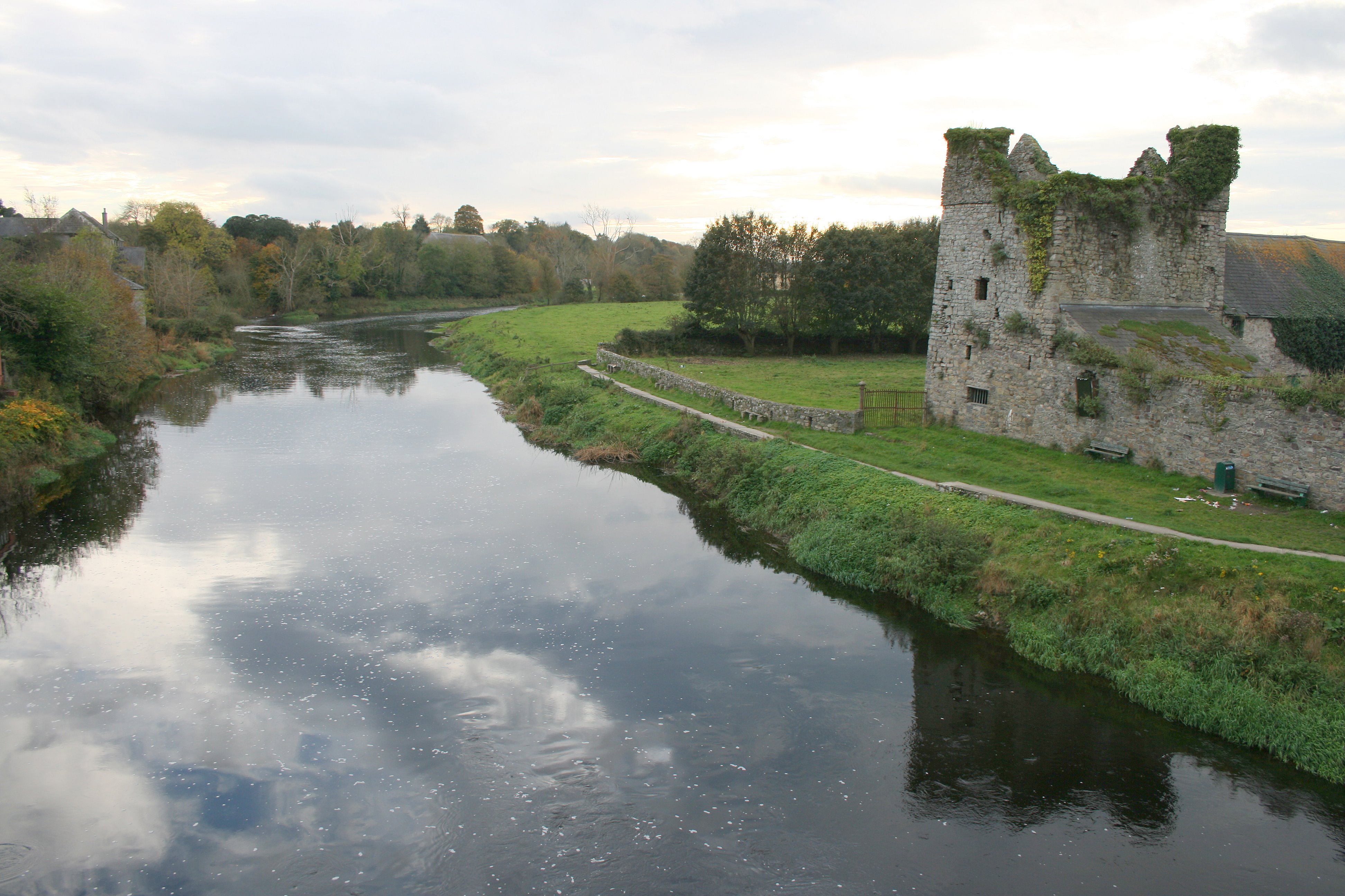
 River Nore in the City of Kilkenny. | |
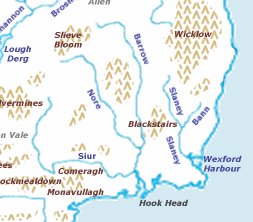 Map of the Nore's course | |
| Etymology | Old Irish: Eoir[1] |
| Native name | An Fheoir (Irish)[2] |
| Location | |
| State | Republic of Ireland |
| Region | Leinster |
| Counties | Tipperary, Laois, Kilkenny, Waterford |
| Physical characteristics | |
| Source | Devil's Bit Mountain |
| • location | County Tipperary |
| Mouth | River Barrow |
• location | New Ross, County Wexford |
| Length | 140 km (87 mi) |
| Basin size | 2,595 km2 (1,002 sq mi)[3] |
| Discharge | |
| • average | 42.9 m3/s (1,510 cu ft/s) |
| Basin features | |
| River system | Three Sisters |
| Tributaries | |
| • left | River Suir |
Starting in the Devil's Bit Mountain, County Tipperary, the river flows generally southeast, and then south, before its confluence with the River Barrow at Ringwood, and the Barrow railway bridge at Drumdowney, County Kilkenny, which empties into the Celtic Sea at Waterford Harbour, Waterford.
The long term average flow rate of the River Nore is 42.9 cubic metres per second (m3/s)[5] The river is home to the only known extant population of the critically endangered Nore freshwater pearl mussel, and much of its length is listed as a Special Area of Conservation.[6]
Name
The river is known in Irish as An Fheoir. The River Nore was mentioned in the Martyrology of Oengus the Culdee (Félire Óengusso Céli Dé), published before 824. He spoke, in Old Irish, of re taeb Eoire uarglaine or "the cold-pure Nore."[7] A Middle Irish reference, from before 1420, refers to "The fair wide plain of the Feoir" (Fiond-chlár fairsing na Feoire).[8]
The name is believed to derive from Irish feora "green bank, edge or shore of sea, lake or river"; the Old Irish feórann means "green bank or shoreland."[9]
Course

The Nore rises on the eastern slopes of the Devil's Bit Mountain in the townland of Borrisnoe, County Tipperary. It then flows south-eastwards to County Laois and County Kilkenny before joining the River Barrow just north of New Ross near the Barrow Bridge.[10] The river passes near Durrow, County Laois then through Ballyragget, the city of Kilkenny and then the villages of Bennettsbridge and Thomastown. Further south, it forms a picturesque V-shaped river valley, particularly notable near the village of Inistioge, the tidal limit. Major tributaries of the Nore include the Dinan, the Breagagh at Kilkenny City, the King's River, the Little Arrigle and the Black Water.
List of places along the river.
- Devil's Bit Mountain (begins)
- Castletown
- Durrow, County Laois (near)
- Ballyragget
- Kilkenny
- Bennettsbridge
- Thomastown
- Inistioge
List of tributaries
- River Erkina
- River Dinan (Dinin, Deen)
- White Horse (Mountrath River)
- Breagagh
- King's River
- Little Arrigle
- Black Water
Geology and morphology
The Nore rises on a sandstone base but the catchment soon turns to limestone and remains so to the sea. The countryside is one of mixed farming, with some tillage, quite a bit of pasture and dairying and some bloodstock. The river has a fairly steep gradient but the flow is checked by innumerable weirs and it is probably true to say that shallow glides are the pre-dominant feature.[4]
History
In pre-Famine years, there were many water-powered industries in the Nore valley, particularly in the ten-mile (16 km) stretch between Kilkenny City and Thomastown, including breweries, woolen mills, sawmills, marble works, distillaries and grain mills. Flax and linen were produced just north of Kilkenny City.
Recreation
Kilkenny fishing club has extensive fishing rights on the River Nore and its tributary, the River Dinan. Popular with anglers, it holds brown trout and salmon.[citation needed][4]
Some of these weirs along the river have good playboating qualities. The river is long and mostly flat and dotted with weirs at most of the villages it passes through.[11]
Salmon runs on the river Nore were interrupted in 2005 and 2006 by a flood relief scheme in Kilkenny city carried out by the Office of Public Works. Initially budgeted at €13.1 million, the scheme was delivered at a cost in excess of €48 million[12] and did not contain suitable fish passes. This oversight has since been rectified at additional expense and salmon can now ascend the river upstream of Kilkenny city.
See also
References
Footnotes
- Ó Cíobháin 2007.
- (Fiontar 2008, An Fheoir/River Nore (river))
- (Environmental Protection Agency 2016, Catchment: Nore, Environmental Protection Agency 2018, Nore Catchment Assessment 2010-2015 (HA 15))
- "Irishfisheries River Nore Fishing". Archived from the original on 17 November 2007. Retrieved 11 September 2008.
- South Eastern River Basin District Management System. Page 38 Archived 2016-03-03 at the Wayback Machine
- River Barrow and River Nore (IE0002162). Site Synopsis Archived 2007-12-19 at the Wayback Machine - National Parks and Wildlife Service, Republic of Ireland. Natura 2000 (data set Archived 28 December 2017 at the Wayback Machine) - European Environment Agency.
- dil.ie/42762.
- Archive.org, "The topographical poems of John O'Dubhagain and Giolla na naomh O'Huidhrin," modern translation by John O’Donovan published in 1862.
- "EDIL - Irish Language Dictionary".
- Hughes 1863.
- "Irish whitewater river guide to the Nore". Archived from the original on 30 October 2009. Retrieved 11 September 2008.
- "Kilkenny flood costs lead to cuts". Archived from the original on 27 September 2011.
Further reading
- Environmental Protection Agency (2016). "EPA Catchments". Archived from the original on 21 December 2019. Retrieved 21 December 2019.
- Environmental Protection Agency (2018). "Nore Catchment (HA 15)". catchments.ie. Environmental Protection Agency of the Government of Ireland. Archived from the original on 21 December 2019. Retrieved 21 December 2019.
- Fiontar (2008). "Placenames Database of Ireland". logainm.ie. Department of Arts, Heritage, Regional Rural and Gaeltacht Affairs of the Government of Ireland. Archived from the original on 22 April 2010. Retrieved 2 May 2015.
- Gibb, John S. (2005) [1948], "A tour on the Upper Nore", Facsimile edition of Old Kilkenny Review 1946-51, vol. Issue 1, 2, 3 & 4, Kilkenny: Kilkenny Archaeological Society, pp. 25–30, OCLC 232332372.
- Hughes, William (1863), The geography of British history, Oxford University: Longman, Green, Longman, Roberts, & Green, p. 22, archived from the original on 19 May 2016, retrieved 25 September 2016
- Ó Cíobháin, Breandán (2007), "The River Nore - An Fheoir", Old Kilkenny Review 2007, vol. Issue 59, Kilkenny: Kilkenny Archaeological Society, pp. 69–70.
- Ó Drisceoil, Cóilín (2011), River Nore Kilkenny Heritage Audit report vol.1 phase 1 Archived 24 September 2021 at the Wayback Machine
External links
| Wikimedia Commons has media related to River Nore. |
| Wikisource has the text of the 1920 Encyclopedia Americana article Nore. |
- "Irishfisheries River Nore Fishing", irishfisheries.com
- "Salmon Ireland, information on the Salmon rivers of Ireland", salmonireland.com, archived from the original on 9 June 2011
- "Nore River Guide (canoeing and kayaking)", irishwhitewater.com
- Song: "Floraline Shore" on IMSLP
| Authority control |
|
|---|
На других языках
[de] River Nore
Der River Nore (irisch: An Fheoir oder Abhainn na Feoire) ist ein Fluss in Irland.- [en] River Nore
[es] Río Nore
El Nore es uno de los ríos conocidos en Irlanda como las tres hermanas, que desemboca en el mar cerca de Waterford. Su longitud total es de 140 km, y es famoso por la pesca del salmón y la trucha. El Nore nace en las montañas del Condado de Tipperary y discurre a través de los condados de Laois y Kilkenny antes de unirse al Río Barrow al norte de New Ross. El río atraviesa la ciudad de Kilkenny y otras localidades menores como Bennettsbridge y Thomastown. Más al sur, forma un pintoresco valle en forma de V, cerca del pueblo de Inistiogue. Los principales afluentes del Nore son el Dinin, el Kings y el Black Water.[it] Nore (fiume)
Il Nore (irl. An Fheoir) è un fiume che scorre nella parte centro-meridionale dell'Irlanda.[ru] Нор (река)
Нор (ирл. An Fheoir) — река в Ирландии. Протяжённость — 140 км.Другой контент может иметь иную лицензию. Перед использованием материалов сайта WikiSort.org внимательно изучите правила лицензирования конкретных элементов наполнения сайта.
WikiSort.org - проект по пересортировке и дополнению контента Википедии