geo.wikisort.org - River
The River Mole a tributary of the River Taw in Devon which rises on the southwestern border of Exmoor. The river takes its name from the market towns of North and South Molton. The river used to be known as the Nymet.[1]
| River Mole | |
|---|---|
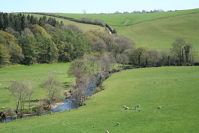 The River Mole below its confluence with the River Yeo. | |
 Location within Devon | |
| Location | |
| Country | England |
| Counties | Devon |
| District | North Devon |
| Towns | North Molton, South Molton |
| Physical characteristics | |
| Source | North Molton Ridge |
| • location | Twitchen, North Devon, Devon |
| • coordinates | 51°5′6.5″N 3°44′25″W |
| • elevation | 360 m (1,180 ft) |
| Mouth | River Taw |
• location | Junction Pool, Devon |
• coordinates | 50°56′30″N 03°54′24″W |
• elevation | 6 m (20 ft) |
| Discharge | |
| • location | Woodleigh |
| • average | 8.70 m3/s (307 cu ft/s) |
| • minimum | 0.20 m3/s (7.1 cu ft/s)27 August 1976 |
| • maximum | 188.0 m3/s (6,640 cu ft/s)9 January 1968 |
Tributaries
- River Yeo
- Crooked Oak
- River Bray
- Little Silver Stream
See also
References
- "NDAS Place_Names". www.ndas.org.uk. Archived from the original on 28 August 2008.
External links
Devon Portal | |
| Unitary authorities | |
| Boroughs or districts | |
| Major settlements |
|
| Rivers |
|
| Topics |
|
This Devon location article is a stub. You can help Wikipedia by expanding it. |
Текст в блоке "Читать" взят с сайта "Википедия" и доступен по лицензии Creative Commons Attribution-ShareAlike; в отдельных случаях могут действовать дополнительные условия.
Другой контент может иметь иную лицензию. Перед использованием материалов сайта WikiSort.org внимательно изучите правила лицензирования конкретных элементов наполнения сайта.
Другой контент может иметь иную лицензию. Перед использованием материалов сайта WikiSort.org внимательно изучите правила лицензирования конкретных элементов наполнения сайта.
2019-2026
WikiSort.org - проект по пересортировке и дополнению контента Википедии
WikiSort.org - проект по пересортировке и дополнению контента Википедии