geo.wikisort.org - River
The East Dart River is one of the two main tributaries of the River Dart in Devon, England.
| East Dart | |
|---|---|
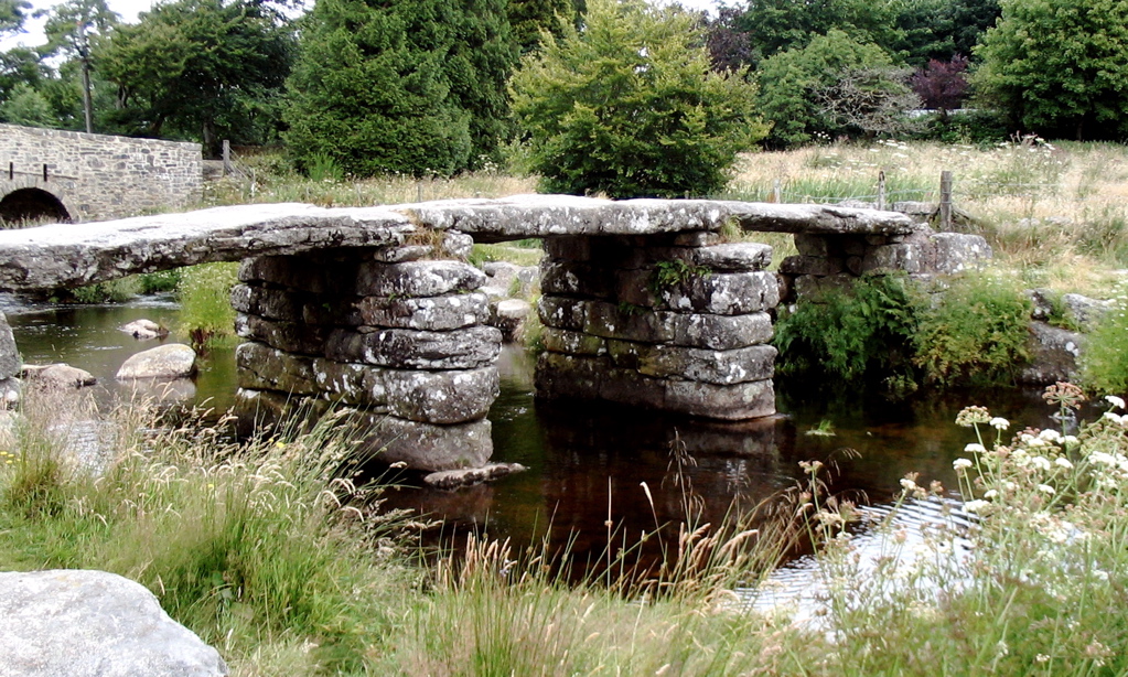 The clapper bridge crossing of the East Dart, at Postbridge | |
| Location | |
| Country | England |
| County | Devon |
| Physical characteristics | |
| Source | |
| • location | Kit Rock, Whinney's Down |
| • elevation | 510 m (1,670 ft) |
| Mouth | Dartmeet |
• coordinates | 50.5428°N 3.8756°W |
• elevation | 210 m (690 ft) |
| Length | 16.3 km (10.1 mi) |
Its source is to the west of Whitehorse Hill and slightly south of Cranmere Pool on Dartmoor. It flows south and then south-west for around 9 km to reach the village of Postbridge where it is spanned by a well-known clapper bridge.
Just above Postbridge the river drops around 2 metres in a short distance and the point is referred to as "Waterfall".

It continues south past Bellever to Dartmeet where it joins the West Dart.[1]
References
- Okehampton and North Dartmoor (Landranger Map 191) (D ed.), Ordnance Survey, 2007, ISBN 978-0-319-22864-7
Devon Portal | |
| Unitary authorities |
|
| Boroughs or districts |
|
| Major settlements |
|
| Rivers |
|
| Topics |
|
This Devon location article is a stub. You can help Wikipedia by expanding it. |
На других языках
- [en] East Dart River
[ru] Ист-Дарт
Ист-Дарт (англ. East Dart) — река на вересковых пустошах Дартмура в графстве Девон, Юго-Западной Англии. Один из двух главных притоков реки Дарт. Исток располагается к западу от холма Уайтхорс-Хилл и немного южнее Кранмирского бассейна[en]. Река течёт в южном направлении, а затем в юго-западном около 9 км до селения Постбридж[en]. Далее продолжает течь на юг мимо селения Бэлвер[en] в Дартмит[en], где соединяется с Уэст-Дартом формируя Дарт.Текст в блоке "Читать" взят с сайта "Википедия" и доступен по лицензии Creative Commons Attribution-ShareAlike; в отдельных случаях могут действовать дополнительные условия.
Другой контент может иметь иную лицензию. Перед использованием материалов сайта WikiSort.org внимательно изучите правила лицензирования конкретных элементов наполнения сайта.
Другой контент может иметь иную лицензию. Перед использованием материалов сайта WikiSort.org внимательно изучите правила лицензирования конкретных элементов наполнения сайта.
2019-2026
WikiSort.org - проект по пересортировке и дополнению контента Википедии
WikiSort.org - проект по пересортировке и дополнению контента Википедии