geo.wikisort.org - River
The River Holford is located in the east Quantock Hills Area of Outstanding Natural Beauty in Somerset England.
| River Holford | |
|---|---|
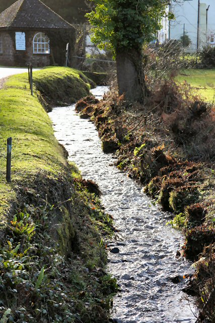 The River Holford in Holford Combe | |
| Location | |
| Country | England |
| County | Somerset |
| City | Holford |
| Physical characteristics | |
| Source | Lady's Fountain Spring, Frog Combe |
| • location | Halsway, Quantock Hills, Somerset, England |
| • coordinates | 51°8′20″N 3°12′56″W |
| • elevation | 820 ft (250 m) |
| Mouth | |
• location | Kilve, Somerset, England |
• coordinates | 51°11′34″N 3°13′37″W |
• elevation | 0 ft (0 m) |
| Length | 4.5 mi (7.2 km) |
It is approximately 4.5 miles (7 km) long. Its source is at Lady's Fountain Spring, Frog Combe which is near Halsway and 820 feet (250 m) above sea level[1] before flowing past Holford towards its mouth at Kilve.[2]
The river is used as an outdoor classroom for students of Fluvial Geomorphology.[3]
The geology of the river consists of three different rock types. At the top of the river there is the Devonian Quartzite (Metamorphic), in the middle of the river there is the Permo-Triassic Marl (Sedimentary) and the lower part of the river consists of Jurassic Limestone (Sedimentary). The first two rock types are impermeable meaning there is little drainage for the river but the river depth becomes smaller as the water flows over the permeable limestone which will allow water to pass through. Quartzite is also very resistant to chemical weathering and can form ridges.
References
- "CORE Day 1 - Understanding Fluvial Systems". Field Studies Council. Retrieved 16 November 2007.
- "River Holford". Somerset Rivers. Retrieved 2 September 2011.
- "Fluvial Geomorphology (River Holford)". Field Studies Council. Archived from the original on 19 December 2007. Retrieved 16 November 2007.
External links
Somerset Portal | |
| Unitary authorities |
|
| Boroughs or districts |
|
| Major settlements |
|
| Rivers |
|
| Topics |
|
Другой контент может иметь иную лицензию. Перед использованием материалов сайта WikiSort.org внимательно изучите правила лицензирования конкретных элементов наполнения сайта.
WikiSort.org - проект по пересортировке и дополнению контента Википедии