geo.wikisort.org - River
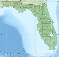
The Little Wekiva River is a stream in Greater Orlando area of Florida in the United States. The 15-mile (24 km) long, northward flowing stream is a tributary of the Wekiva River, which later joins the St. Johns River, the longest river in the state of Florida. The Little Wekiva drainage basin is about 42 square miles (110 km2) located in the urbanized area north and west of Downtown Orlando.[1]
| Little Wekiva River | |
|---|---|
| Location | |
| Country | United States |
| State | Florida |
| Counties | Orange and Seminole |
| Cities | Orlando, Altamonte Springs, Longwood, Florida |
| City | Longwood, Florida |
| Physical characteristics | |
| Source | Lake Lawne |
| • location | Orlando, Florida |
| • coordinates | 28°34′2″N 81°26′19″W |
| 2nd source | Spring Lake |
| • location | Altamonte Springs, Florida |
| • coordinates | 28°39′7″N 81°23′53″W |
| Mouth | Confluence with Wekiva River |
• location | Longwood, Florida |
• coordinates | 28°45′20.5″N 81°24′58.2″W |
| Length | 15 mi (24 km) |
| Basin size | 42 sq mi (110 km2) |
| Basin features | |
| Tributaries | |
| • left | Starbuck Spring Run |
| • right | Spring Lake Run, Sanlando Springs Run, Palm Springs Run, Ginger Ale Springs Run, Pegasus Springs Run |
| Progression : Little Wekiva River-Wekiva River- St. Johns River-Atlantic Ocean | |
As of 2021, much of the Little Wekiva River has silted up.[2]
Sources
Little Wekiva is part of the middle basin of the St. Johns River. The St. Johns River Water Management District place the headwater of the creek at Lake Lawne, about 5 miles (8.0 km) northwest of downtown Orlando.[1] The Geographic Names Information System (GNIS), though, list the source of the river at Spring Lake, an 84-acre (34 ha) spring-fed lake in Altamonte Springs, Florida.[3][4]
References
- "Little Wekiva River" Archived 2013-08-22 at the Wayback Machine. St. Johns River Water Management District. Retrieved on 2013-04-22.
- Pittman, Craig (2021-06-24). "Cracking the case of who smothered a Florida river". Florida Phoenix. Retrieved 2021-06-28.
- "Feature Detail Report for: Little Wekiva River". USGS Geographic Names Information System. Retrieved on 2013-04-25.
- (2000-06-06). "Spring Lake (Altamonte Springs)". Seminole County WaterAtlas. Retrieved on 2013-04-25.
Другой контент может иметь иную лицензию. Перед использованием материалов сайта WikiSort.org внимательно изучите правила лицензирования конкретных элементов наполнения сайта.
WikiSort.org - проект по пересортировке и дополнению контента Википедии

