geo.wikisort.org - River
The Bogotá River is a major river of the Cundinamarca department of Colombia. A right tributary of the Magdalena River, the Bogotá River crosses the region from the northeast to the southwest and passing along the western limits of Bogotá. The large population and major industrial base in its watershed have resulted in extremely severe pollution problems for the river.
| Bogotá River | |
|---|---|
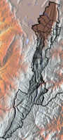
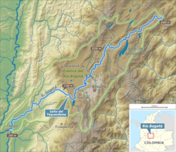 Map of Bogotá River and its drainage basin | |
| Native name | Río Bogotá (Spanish) |
| Location | |
| Country | Colombia |
| Department | Cundinamarca |
| Provinces |
|
| Physical characteristics | |
| Source | Guacheneque Páramo |
| • location | Villapinzón |
| • coordinates | 5°13′19.3″N 73°32′03.5″W |
| • elevation | 3,300 m (10,800 ft) |
| Mouth | Magdalena River |
• location | Girardot |
• coordinates | 4°17′19.2″N 74°47′47″W |
| Length | 375 km (233 mi) |
| Basin size | 6,000 km2 (2,300 sq mi) |
| Discharge | |
| • average | 31–41 m3/s (1,100–1,400 cu ft/s) |
| Basin features | |
| River system | Magdalena Basin Caribbean Sea |
| Tributaries | |
| • left | Teusacá Torca Juan Amarillo Fucha Tunjuelo Soacha |
| • right | Neusa Río Frío Bojacá Subachoque Apulo |
Etymology
The Bogotá River is named after Muyquytá, which is derived from Chibcha and means "(Enclosure) outside of the farm fields".[1] In historical texts, and today the upstream part of, the Bogotá River is also called Funza River.[2]
Course
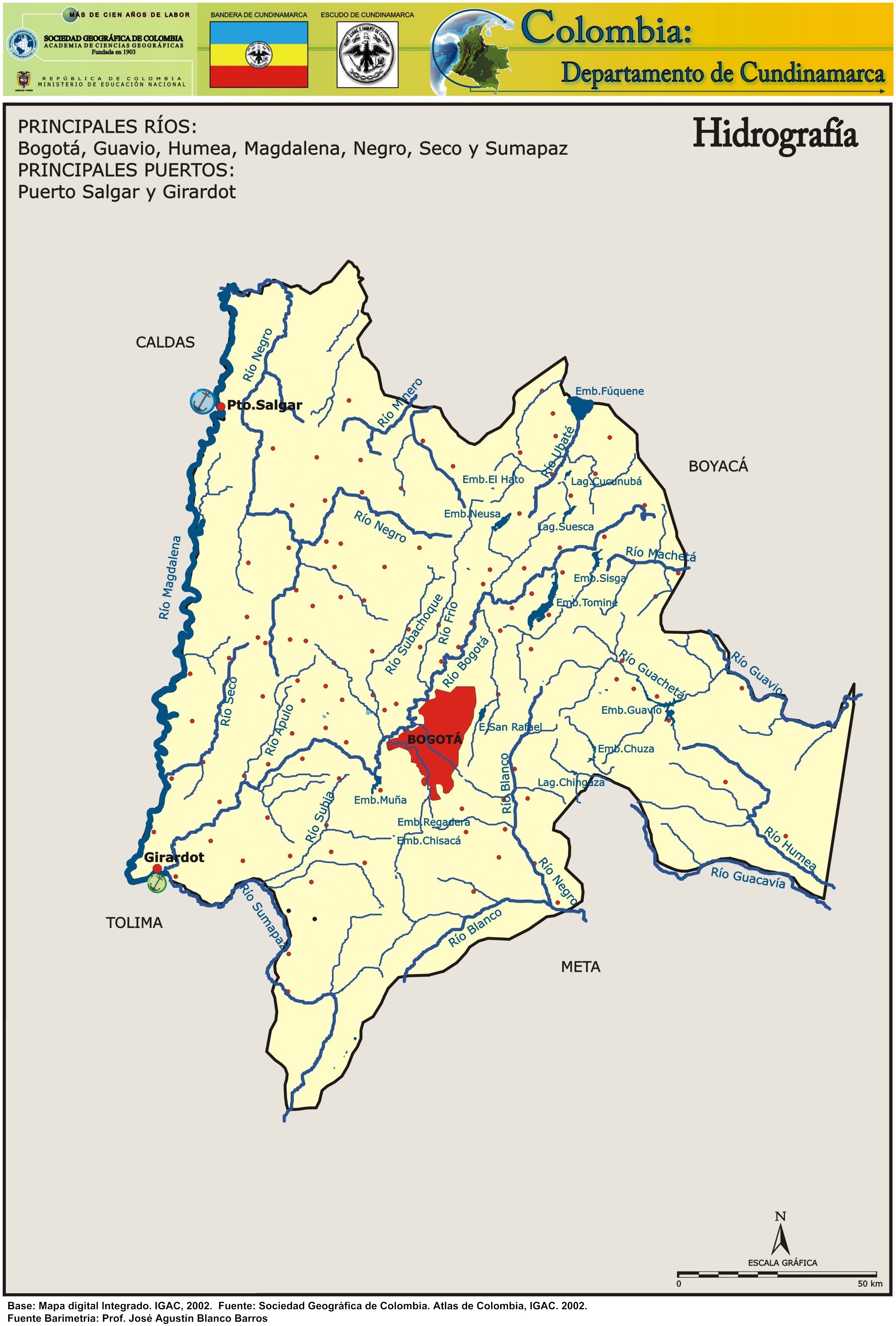
Main tributaries of the Bogotá River are the Teusacá, Torca, Juan Amarillo, Fucha, Tunjuelo, Soacha (left) and Neusa, Río Frío, Bojacá and Subachoque Rivers (right).

N – Neusa River
Te – Teusacá River
RF – Río Frío
To – Torca River
JA – Juan Amarillo River
F – Fucha River
Tu – Tunjuelo River
B – Bojacá River
S – Soacha River
A – Apulo River
The headwaters of the Bogotá River are in the municipality of Villapinzón, in the northeastern part of Cundinamarca near the limits with Boyacá. It has a course of about 150 kilometres (93 mi) as it crosses the Bogotá savanna, passing through Zipaquirá and eleven small municipalities, before reaching the city of Bogotá. As it runs along the western border of the city, the river forms the outlet for the heavily polluted Salitre, Fucha and Tunjuelito Rivers. After passing through the municipality of Soacha, the Bogotá River plunges off the savanna at the Tequendama Falls. It then follows a steep course, falling about 2,000 metres (6,600 ft) in 50 kilometres (31 mi), to join the Magdalena River at Girardot.
Temperature
The temperature average ranges from 24 to 27 °C (75 to 81 °F).
Gallery
 Bogotá River close to Zipaquirá
 Bogotá River in Briceño
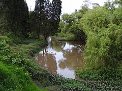
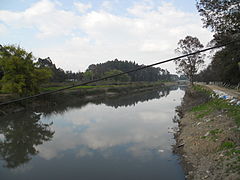 Bogotá River in Engativá
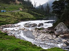 Bogotá River close to Tequendama
 Tequendama Falls in the Bogotá River


See also
- List of rivers of Colombia
- Bogotá savanna, Tequendama – archaeological site, earliest inhabitation along the Bogotá River
- Tequendama Falls
References
- (in Spanish) Etymology Bacatá – Banco de la República
- (in Spanish) A orillas del Río – El Tiempo
External links
| Wikimedia Commons has media related to Río Bogotá. |
- (in Spanish) Sistema Hídrico, Bogotá
- (in Spanish) Hidrografía Río Bogotá
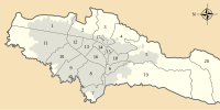
 | Administrative subdivision in 20 localities |
|  |
|---|---|---|---|
| Metropolitan Area |
| ||
| Geography |
| ||
| |||
Muisca | |||||||||||||||||||||||||||
|---|---|---|---|---|---|---|---|---|---|---|---|---|---|---|---|---|---|---|---|---|---|---|---|---|---|---|---|
| |||||||||||||||||||||||||||
| |||||||||||||||||||||||||||
| |||||||||||||||||||||||||||
| |||||||||||||||||||||||||||
| |||||||||||||||||||||||||||
| |||||||||||||||||||||||||||
| |||||||||||||||||||||||||||

Authority control | |
|---|---|
| General |
|
| National libraries | |
| Other |
|
На других языках
[de] Río Bogotá
Der Río Bogotá ist ein Nebenfluss des Río Magdalena. Er entspringt nördlich von Bogotá und passiert die Kleinstadt Suesca am Nordrand der Savanne von Bogotá. Der weitere Verlauf in südlicher Richtung führt durch den Westen der Städte Bogotá und Soacha.- [en] Bogotá River
[es] Río Bogotá
El río Bogotá es uno de los ríos mas importantes del departamento de Cundinamarca, ubicado en el centro de Colombia. Es el principal cauce fluvial de la sabana de Bogotá. Se considera navegable aunque no posee un amplio caudal. Desemboca en el río Magdalena, que a su vez desemboca en el mar Caribe. A lo largo de su cuenca habitan unos 9.000.000 de personas, de los cuales 8.500.000 pertenecen a la ciudad de Bogotá. Cuenta con una longitud aproximada de 380 km. Presenta altísimos niveles de contaminación. Aunque la contaminación se da desde muy cerca de su yacimiento, la mayor parte de materiales tóxicos y desechos industriales y urbanos los recibe en la ciudad de Bogotá. Desde hace varias décadas se han desarrollado programas e iniciativas para descontaminarlo.[ru] Богота (река)
Богота́ (исп. Río Bogotá) — река на северо-западе Южной Америки, протекает по территории департамента Кундинамарка в западной части Колумбии, а также через столичный регион. Длина реки составляет 380[1] км. Бассейн охватывает территорию в 5891,43 км²[2]Другой контент может иметь иную лицензию. Перед использованием материалов сайта WikiSort.org внимательно изучите правила лицензирования конкретных элементов наполнения сайта.
WikiSort.org - проект по пересортировке и дополнению контента Википедии