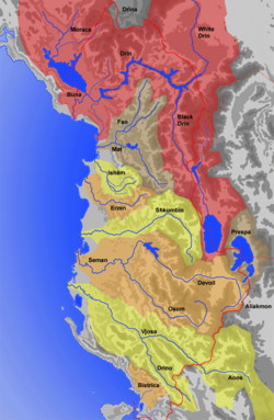
geo.wikisort.org - River
Bistricë (definite: Bistrica) is a river in southwestern Albania. It ends in the Ionian Sea.
| Bistricë | |
|---|---|
 View from the artificial lake on rivers' basin | |
| Location | |
| Country | Albania |
| Physical characteristics | |
| Source | |
| • location | Syri i Kaltër, Vlorë County, Albania |
| Mouth | |
• location | Ionian Sea |
• coordinates | 39°50′38″N 20°1′52″E |
| Length | 25 km (16 mi) |
| Discharge | |
| • average | 40.4–66.4 m3/s (1,430–2,340 cu ft/s) (August–Winter) |
Etymology
The name Bistrica comes from Slavic, meaning "clear (water)". Other toponyms including "Bistrica" in Balkan countries indicate the Slavic origin of the toponym.
Geography
Bistricë starts from Mali i Gjerë (also known as Sopot) in Finiq municipality directing initially versus south-west. The main source is near Krongj ("The Blue Eye" source), also gathering other sources from the nearby villages of Pecë, Kardhikaq, Velahovë, and other smaller brooks.[1] It passes through Mesopotam and Finiq municipalities, parallel with the Sarandë-Gjirokastër road.
Initially the river ended in Lake Butrint, which connects with the Ionian sea through the Vivar channel. In 1958, it was deviated to Çukë channel.
The river is 25 km long.
Economy and tourism
The river is not navigable. There is an artificial lake with the same name (Albanian: Liqeni i Bistricës) built on its basin, and three hydro-power stations built in the '60.[2] The river's waters are used to a certain extent as a supply for the nearby fields of Vurg area. All the stations passed through the privatization process from 2010 with plenty of controversies.[3][4]
A well known touristic place is the "Azure Eye", often referred as "Blue Eye" (Albanian: Syri i Kaltër), a spring tributary to Bistrica river near the village named Krongj, with a rich flora and fauna.
See also
- List of rivers in Albania
- List of lakes of Albania
- Tourism in Albania
- Hydroelectricity in Albania
Sources
- Sjöberg, Örjan. "A Contribution to the Geography of Hydro-Electric Power Generation in Albania", Osterreichische Osthefte [Vienna], 29, No. 1, 1987, 5-27. ISSN 0029-9375
- Mevlan Kabos; Eshref Pumo; Farudin Krutaj. "Gjeografia fizike e Shqipërisë : në dy vëllime", Qendra e Studimeve Gjeografike (Akademia e Shkencave e RPS të Shqipërisë), 1990–1991, 112. OCLC 38055712
References
- Vlore County - official page Archived 2013-11-05 at the Wayback Machine
- KESH - History of Energy in Albania (in Albanian) Archived January 12, 2014, at the Wayback Machine
- Qeveria i shiti hidrocentralin e Bistricës një mashtruesi, arrestohet nga FBI në Qipro [The government sold the hydropower station to an impostor, arrested by FBI in Cyprus] (in Albanian), AMA News, 2010-08-08, retrieved 11 January 2014
- Privatizimi i HEC-ve Bistrica 1 dhe Bistrica 2, qeveria miraton ofertën e "Kurum" [Bistrica-1 and Bistrica-2 through privatization, the government accepts the offer from Kurum] (in Albanian), 9 January 2013, retrieved 12 January 2014
External links
На других языках
[de] Bistrica (Ionisches Meer)
Die Bistrica (albanisch auch Bistricë) ist ein rund 25 Kilometer langer, nicht schiffbarer Fluss im Süden Albaniens. Sie ist der einzige nennenswerte Fluss des Landes, der nicht in die Adria, sondern ins Ionische Meer mündet.- [en] Bistricë (river)
[it] Bistrica (fiume Albania)
Bistrica è il nome di un fiume lungo circa 25 km situato nella parte sudoccidentale dell'Albania.[ru] Бистрица (река, впадает в Ионическое море)
Би́стрица[1] (алб. Lumi i Bistricës) — река в южной Албании. Берёт исток у перевала Музина[de] на склоне хребта Малит-те-Гере[en][2][3], у села Кронги[en] впадает в водохранилище Бистрица (Liqeni i Bistricës), которое питается известным источником Сюри-и-Кальтер. Далее по трём деривационным трубопроводам вода отводится к станционному узлу ГЭС Бистрица 1. Раньше река впадала в озеро Бутринти, которое соединяется каналом Бутринти[en] с проливом Керкира[en] Ионического моря[1]. В 1958 году был построен канал Чука (Kanali i Çukës), по которому река впадает в пролив Керкира южнее города Саранда[1].Другой контент может иметь иную лицензию. Перед использованием материалов сайта WikiSort.org внимательно изучите правила лицензирования конкретных элементов наполнения сайта.
WikiSort.org - проект по пересортировке и дополнению контента Википедии