geo.wikisort.org - River
Bell Creek (also known as Escorpión Creek) is a 10-mile-long (16 km)[2] tributary of the Los Angeles River, in the Simi Hills of Ventura County and the San Fernando Valley of Los Angeles County and City, in Southern California.
| Bell Creek | |
|---|---|
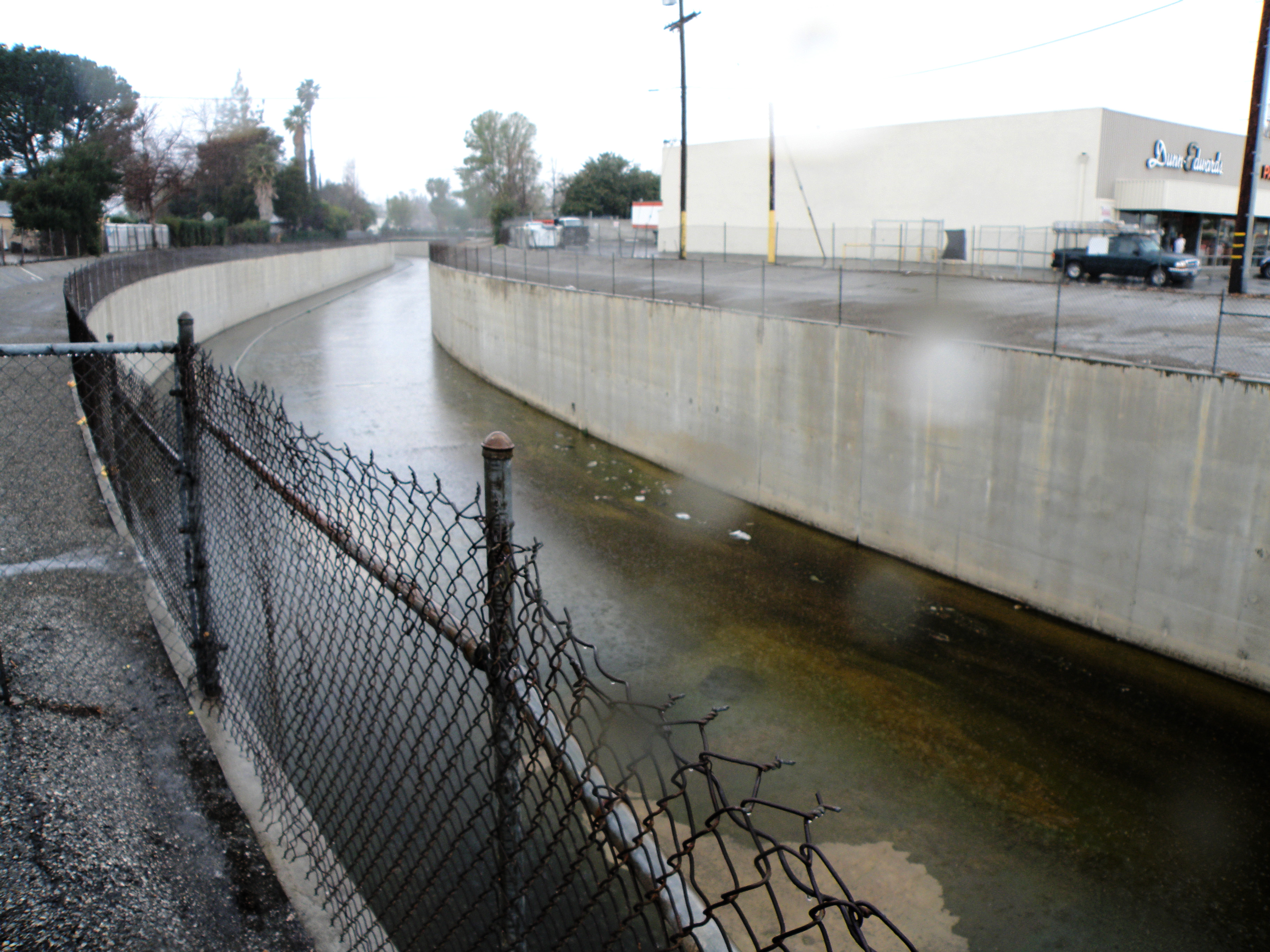 Looking west from Topanga Canyon Blvd. | |
| Location | |
| Country | United States |
| Physical characteristics | |
| Source | |
| • location | Simi Hills, California |
| Mouth | |
• location | Los Angeles River, California |
• coordinates | 34°11′43″N 118°36′07″W[1] |
| Basin size | Simi Hills, western San Fernando Valley |
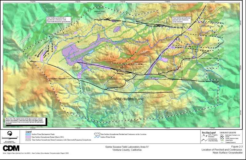
The confluence marks the "headwaters" of the Los Angeles River, 34.1952°N 118.601838°W.t) and Bell Creek (right) join to form the Los Angeles RiverThe initial headwater feeder-streams begin in the Simi Hills in Ventura County from 90% of the Rocketdyne Santa Susana Field Laboratory (SSFL) property as its watershed, leaving the site with toxic substances and radionuclide contamination via culvert outfalls, aquifer seeps and springs, and surface runoff.[3][4] It then flows as a creek southeast through Bell Canyon (the community and geographic feature), Bell Canyon Park, and El Escorpión Park in a natural stream bed. It then is altered to flow in a concrete channel. Moore Creek joins in from the west, and then it flows east, channelized through West Hills, where it is joined by the South Fork and South Branches of the same name and by Dayton Creek. Then on through Canoga Park to join Arroyo Calabasas (Calabasas Creek) and becoming the Los Angeles River.
Bell Creek begins as a free-flowing stream until passing Escorpión Peak (Castle Peak) in Bell Canyon Park. At Bell Canyon Road and Elmsbury Lane it becomes encased in a concrete flood control channel. It then passes under Valley Circle Boulevard, flowing just south of Highlander Road through former Rancho El Escorpión-current West Hills, and further eastward parallel to (and south of) Sherman Way in Canoga Park. There, it joins Arroyo Calabasas, directly east of Canoga Park High School beside Vanowen Street. The confluence marks the "headwaters" of the Los Angeles River, 34.1952°N 118.601838°W.
Crossings
From mouth to source (year built in parentheses):[5]
Bell Creek
|
South Branch Bell Creek
South Fork Bell Creek
|
See also
- Source (river or stream) - a.k.a. watershed and headwaters
- Confluence - a.k.a. "headwaters"
- Drainage basin - a.k.a. "watershed"
- Urban runoff
References
- U.S. Geological Survey Geographic Names Information System: Bell Creek
- U.S. Geological Survey. National Hydrography Dataset high-resolution flowline data. The National Map Archived 2012-03-29 at the Wayback Machine, accessed March 16, 2011
- http://www.enviroreporter.com/images/ESADA/2003-SSFL-surface%20water-map.jpg SSFL Watersheds Map (access date: 4/11/2010)
- http://www.enviroreporter.com/2010/02/goo-ology/ EnviroReporter.com. "Goo-ology." access date:5/5/2010
- "National Bridge Inventory Database". Archived from the original on 2013-10-31. Retrieved 2009-10-30.
External links
- Bell Canyon photo gallery: 'Nature' sections.
| |||||||||||||||||||||||||||||||||||||||||||||||


Другой контент может иметь иную лицензию. Перед использованием материалов сайта WikiSort.org внимательно изучите правила лицензирования конкретных элементов наполнения сайта.
WikiSort.org - проект по пересортировке и дополнению контента Википедии