geo.wikisort.org - River
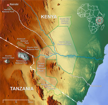
The Athi-Galana-Sabaki River is the second longest river in Kenya (after the Tana River). It has a total length of 390 kilometres (240 mi), and drains an area of 70,000 square kilometres (27,000 sq mi).[citation needed] The river rises in the Gatamaiyo Forest as the Athi River and enters the Indian Ocean as the Galana River (also known as the Sabaki River).
Flow
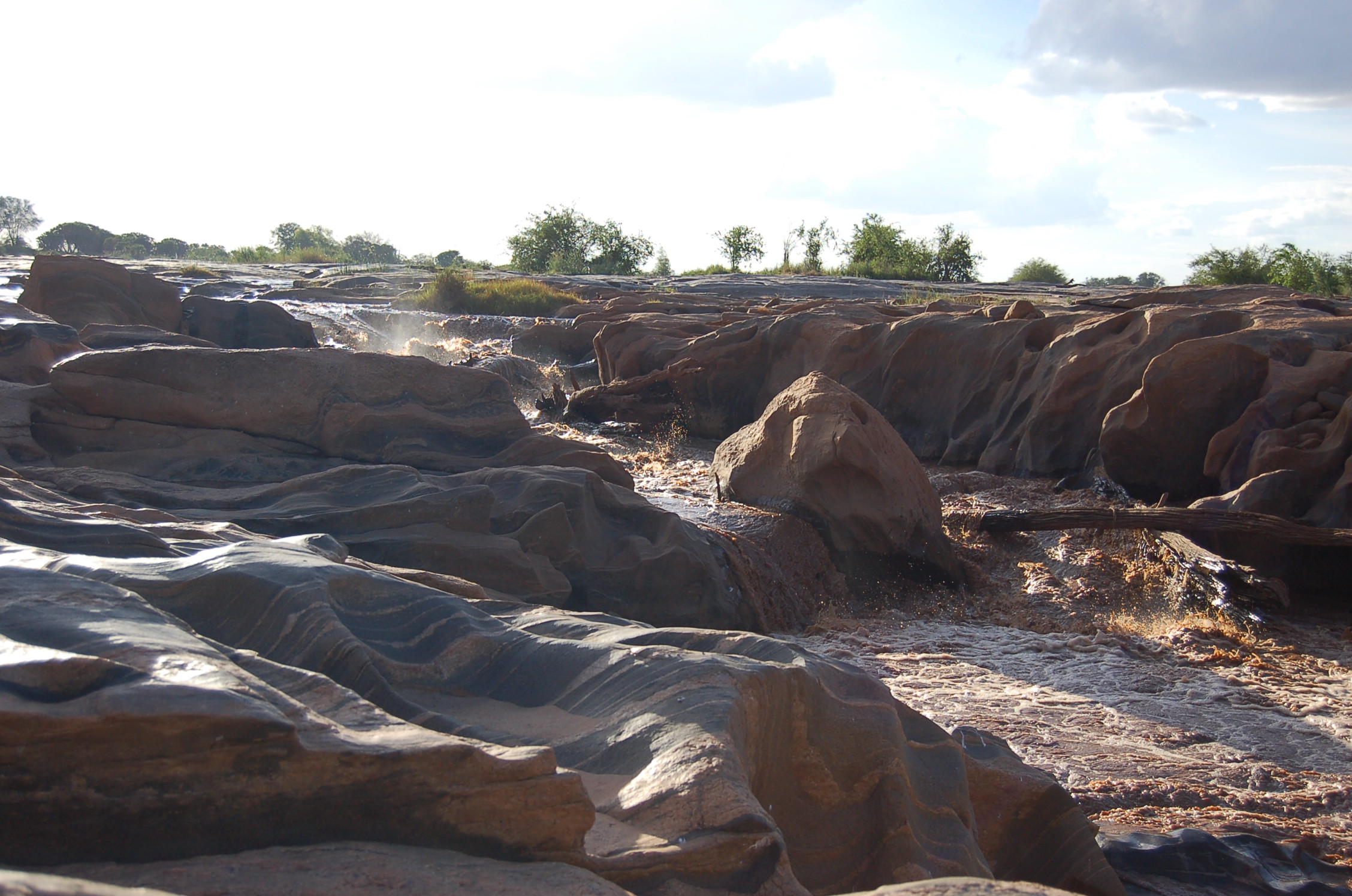
The Athi River flows across the Kapote and Athi plains, through Athi River town, then takes a northeast direction where it is met by the Nairobi River. Near Thika the river forms the Fourteen Falls and turns south-south-east under the wooded slopes of the Yatta ridge, which shuts in its basin on the east. Apart from the numerous small feeders of the upper river, almost the only tributary is the Tsavo River, from the east side of Kilimanjaro, which enters at about 3° S. It then turns east, and in its lower course is known as the Sabaki (or Galana) River, which traverses the sterile quartz-land of the outer plateau. The valley is low and flat, covered with forest and scrub, containing small lakes and backwaters connected to the river during the rainy season. During the rainy season, the river rises as much as 10 metres (33 ft) in places, now strongly flowing with a turbid yellow colour; navigation is interrupted by the Lugard falls, actually a series of rapids. Flowing east, it enters the Indian Ocean 10 kilometres (6.2 mi) north of Malindi.[1]
 View of the Galana River in Kenya
 The Fourteen Falls near Thika
 A drongo at Sabaka River


Wildlife
The river flows through the Tsavo East National Park and attracts diverse wildlife, including hippopotamus and crocodiles. Famously, in the 2009 case of Ben Nyaumbe, the region is also home to pythons. Millions of Kenyans rely on the river for drinking water and irrigation.
Development
Thwake Dam
References
- One or more of the preceding sentences incorporates text from a publication now in the public domain: Chisholm, Hugh, ed. (1911). "Sabaki". Encyclopædia Britannica. Vol. 23 (11th ed.). Cambridge University Press. p. 958.
- Otieno, Jullias. "Uhuru: Thwake Dam construction will be complete by June next year". The Star. Retrieved 2021-07-27.
{{cite web}}: CS1 maint: url-status (link) - "Thwake Multi-purpose Dam project timeline and all you need to know". Construction Review Online. 2021-07-13. Retrieved 2021-07-27.
- Koech, Gilbert (25 October 2020). "Nema shifts focus to Athi after Nairobi River cleaned up". The Star. Retrieved 2021-07-27.
{{cite web}}: CS1 maint: url-status (link) - "Kenya - Thwake Multi-purpose Water Development Program – Phase I". projectsportal.afdb.org. Retrieved 2021-07-27.
На других языках
[de] Sabaki
Der Athi-Galana-Sabaki ist, nach dem Tana, der zweitlängste Fluss in Kenia. Er hat eine Gesamtlänge von 625 Kilometern (gemessen vom längsten Quellfluss mit den Koordinaten 1°21'56"S/36°42'01"O), und sein Einzugsgebiet umfasst 70.000 km². Da weitere neun Quellflüsse zusammen noch eine beträchtliche Anzahl an Kilometern ergeben, beträgt die Länge des Athi weit über 700 km. Der Fluss beginnt als Athi und mündet in den Indischen Ozean als Fluss Galana (auch bekannt als Fluss Sabaki).- [en] Athi-Galana-Sabaki River
[it] Athi-Galana-Sabaki
Il fiume Athi-Galana-Sabaki è il secondo corso d'acqua più lungo del Kenya dopo il Tana. Ha una lunghezza complessiva di 390 km e un bacino di 70.000 km². La parte alta del fiume viene chiamata Athi; quella bassa, Galana o Sabaki.[ru] Галана
Гала́на[1][2][3] (англ. Galana River) — вторая по значению река Кении[3] после Таны[4]. Длина 350 км (547 км[5]), площадь бассейна — 43 000 км²[4] (44 000 км²[5]). В верхнем и среднем течении называется А́ти[6][2][7][4][5] (англ. Athi River). Верхнее и среднее течение реки проходит по гористой местности, на этом её отрезке встречается много порогов и водопадов[5]. За водопадом Лугардс река выходит на низменные равнины под названием Сабаки (Sabaki River). Впадает в Индийский океан[6][3] севернее города Малинди[4][5].Другой контент может иметь иную лицензию. Перед использованием материалов сайта WikiSort.org внимательно изучите правила лицензирования конкретных элементов наполнения сайта.
WikiSort.org - проект по пересортировке и дополнению контента Википедии