geo.wikisort.org - Reservoir
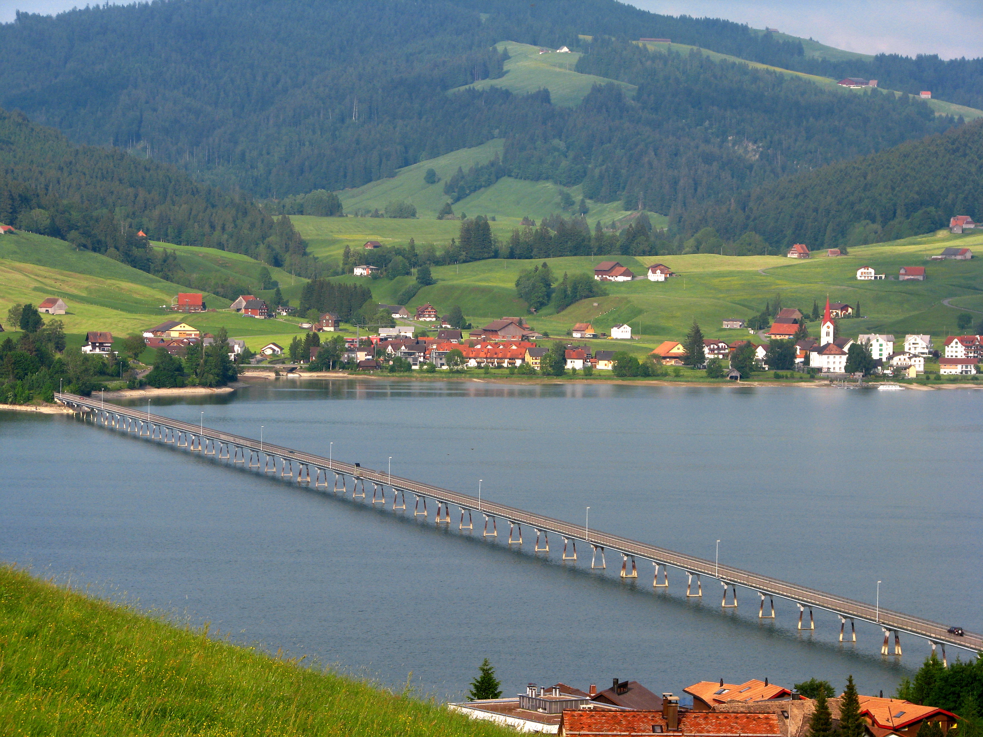
The Sihlsee (in English sometimes called Lake Sihl) is an artificial lake in the Swiss canton of Schwyz, near the town of Einsiedeln. The lake was created by damming the river Sihl and flooding a section of the upper Sihl Valley.[1]
| Sihlsee | |
|---|---|
 | |
Sihlsee  Sihlsee  Sihlsee | |
 Map | |
| Location | Canton of Schwyz |
| Coordinates | 47°07′N 8°47′E |
| Type | reservoir |
| Primary inflows | Sihl, Minster |
| Primary outflows | Sihl |
| Basin countries | Switzerland |
| Max. length | 8.5 kilometres (5 mi) |
| Max. width | 2.5 kilometres (2 mi) |
| Surface area | 11.3 km2 (4.4 sq mi) |
| Max. depth | 17 metres (56 ft) |
| Water volume | 96 million cubic metres (78,000 acre⋅ft) |
| Surface elevation | 889 metres (2,917 ft) |
| Settlements | Gross, Willerzell, Birchli, Euthal |
 | |
The lake feeds the Etzelwerk power station, which is located 5 kilometres (3 mi) to the north-east in Altendorf on the upper section of Lake Zürich (the Obersee) and which supplies electricity to the Swiss Federal Railways (SBB). Its concrete dam is 33 metres (108 ft) high and 124 metres (407 ft) m long. The lake is the largest artificial lake of Switzerland in terms of surface with a maximum length of 8.5 kilometres (5 mi) and maximum width of 2.5 kilometres (2 mi). The maximum depth is 17 metres (56 ft), and the lake has an approximate volume of 96,000,000 m3 (3.4×10⁹ cu ft).[citation needed]
The power plant project started in 1932. A concrete dam and two viaducts over the lake were built before 1937 when the valley was flooded. As a result 107 farms disappeared completely and 1762 persons had to leave their homes.[2]
A failure of the dam could lead, according to studies, to an 8-metre (26 ft) high flood wave through the lower Sihl Valley reaching the Altstadt of the city of Zürich, the biggest city in Switzerland, within 2 hours. This threat has led the City of Zürich to develop, publish and test evacuation plans for the affected areas of the city, and especially the area around Zürich Hauptbahnhof railway station.[3]
Gallery
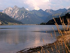 Sihlsee with Fluebrig behind
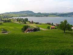 The northern shore


References
- map.geo.admin.ch (Map). Swiss Confederation. Retrieved 2015-06-04.
- "Sihlsee" (in German). Schweizerische Gesellschaft fur Volkskunde. Retrieved 13 January 2017.
- "Wasseralarm Sihlsee" (PDF) (in German). Stadt Zürich. Retrieved 4 June 2015.
External links
 Media related to Sihlsee at Wikimedia Commons
- Information about the Sihlsee
Lakes of Switzerland | ||
|---|---|---|
| Major lakes |
|  |
| Lists | ||
Authority control | |
|---|---|
| General |
|
| National libraries | |
| Other | |
На других языках
[de] Sihlsee
Der Sihlsee ist ein Stausee im Hochtal von Einsiedeln. Er wird von der Sihl durchflossen und durch eine 33 Meter hohe und 124 Meter lange Staumauer gestaut. Der See weist eine Fläche von 10,72 km² auf und ist damit der flächenmässig grösste Stausee der Schweiz bei einer maximalen Länge von 8,5 km und einer maximalen Breite von 2,5 km. Die grösste Tiefe beträgt 23 Meter.- [en] Sihlsee
[es] Lago del Sihl
El lago del Sihl (en alemán: Sihlsee) es un lago artificial o embalse situado en el centro de Suiza, concretamente en el cantón de Schwyz. Ubicado en las proximidades de la localidad de Einsiedeln, tiene una longitud máxima de 8,5 km y una anchura máxima de 2,5 km. La profundidad máxima es de 17 m. Con 11,3 km² es el embalse de mayor superficie en toda Suiza. Su afluente más importante es el río Sihl, que es a su vez el desagüe.[fr] Lac de Sihl
Le lac de Sihl (en allemand Sihlsee) est une retenue artificielle située à l'est d'Einsiedeln en Suisse, dans le canton de Schwytz.[ru] Зильзе
Зильзе (нем. Sihlsee), (фр. Lac de Sihl) — искусственное озеро в Швейцарии.Другой контент может иметь иную лицензию. Перед использованием материалов сайта WikiSort.org внимательно изучите правила лицензирования конкретных элементов наполнения сайта.
WikiSort.org - проект по пересортировке и дополнению контента Википедии