geo.wikisort.org - Reservoir
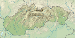
Orava (Slovak: Oravská priehrada) is a reservoir in northernmost Slovakia, forming the largest lake in Slovakia (35.2 km2).
This article needs additional citations for verification. (January 2014) |
| Orava | |
|---|---|
 | |
 Orava | |
| Coordinates | 49°23′59″N 19°32′44″E |
| Lake type | reservoir |
| Primary outflows | Orava river |
| Basin countries | Slovakia, Poland |
| Surface area | 35.2 km2 (13.6 sq mi) |
History
It was created by the construction of a dam between 1941 and 1953 on the former two sources of the Orava river. Several former villages had to be inundated for this purpose, including Hamri, Oszada, and Usztye.[1] Probably the best known of them was Slanica, Today, the reservoir is protected by the Horná Orava Protected Landscape Area.
The average depth of the reservoir is 15 meters.
Islands
Vtáčí ostrov
In the northeastern extension of the reservoir lies Vtáčí ostrov ("Bird Island"), a government ornithological reservation with Protected Bird Area status. The nature reserve in and around the island is also part of the Horná Orava Protected Landscape Area.
Waterfowl species inhabiting the Bird Island reserve include herons, great cormorants, spoonbills and several others. The wetlands around the Orava reservoir are also regarded as some of the most important in Europe. The protection of the forests skirting the Orava Reservoir has helped prevent erosion.[2]
Slanický ostrov
Slanický ostrov ("Slanica Island") is the largest island of the reservoir and one of the largest lake islands of any water reservoir in Slovakia. The island is mildly forested with a series of groves, and includes some of the last architectural remnants of the defunct Oravan village of Slanica, the birthplace of 18th century Slovak intellectual, cleric and linguist Anton Bernolák (Antonius Bernolacius). The centrepiece of the surviving architecture is the original church of Slanica. A new building constructed after the creation of the Orava reservoir and the island is an art gallery. Slanica Island is the only island in Slovakia to house a museum of art or art gallery, with the gallery serving as its main tourist attraction, along with the preserved church.
Gallery
Orava reservoir and its shores
 A bird's eye view of the Oravská priehrada reservoir (from Babia Góra National Park in Poland)
 The forested shores of the Orava reservoir
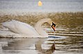 A swan swimming in the Orava reservoir
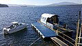 A small dock at the Orava Reservoir
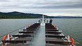 The reservoir from the observation deck of a tour boat
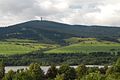 Oravská Magura mountains surrounding the valleys of the Orava Reservoir
 Oravská Magura mountains surrounding the valleys of the Orava Reservoir


Slanický ostrov
 Slanica Island from a bird's eye view, during lower water levels in the reservoir
 Slanica Island seen from the shores of the reservoir
 The panorama of Slanica Island
 Church on Slanica island, the last surviving major building of the village of Slanica
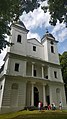 Tourists visiting church on Slanica island
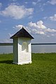 Remnant chapel of the Slanica village calvary on the island
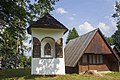 Remnant chapel of the Slanica village calvary on the island


History and construction
 The construction of the Orava Dam and Orava reservoir on a 1953 Czechoslovak banknote

References
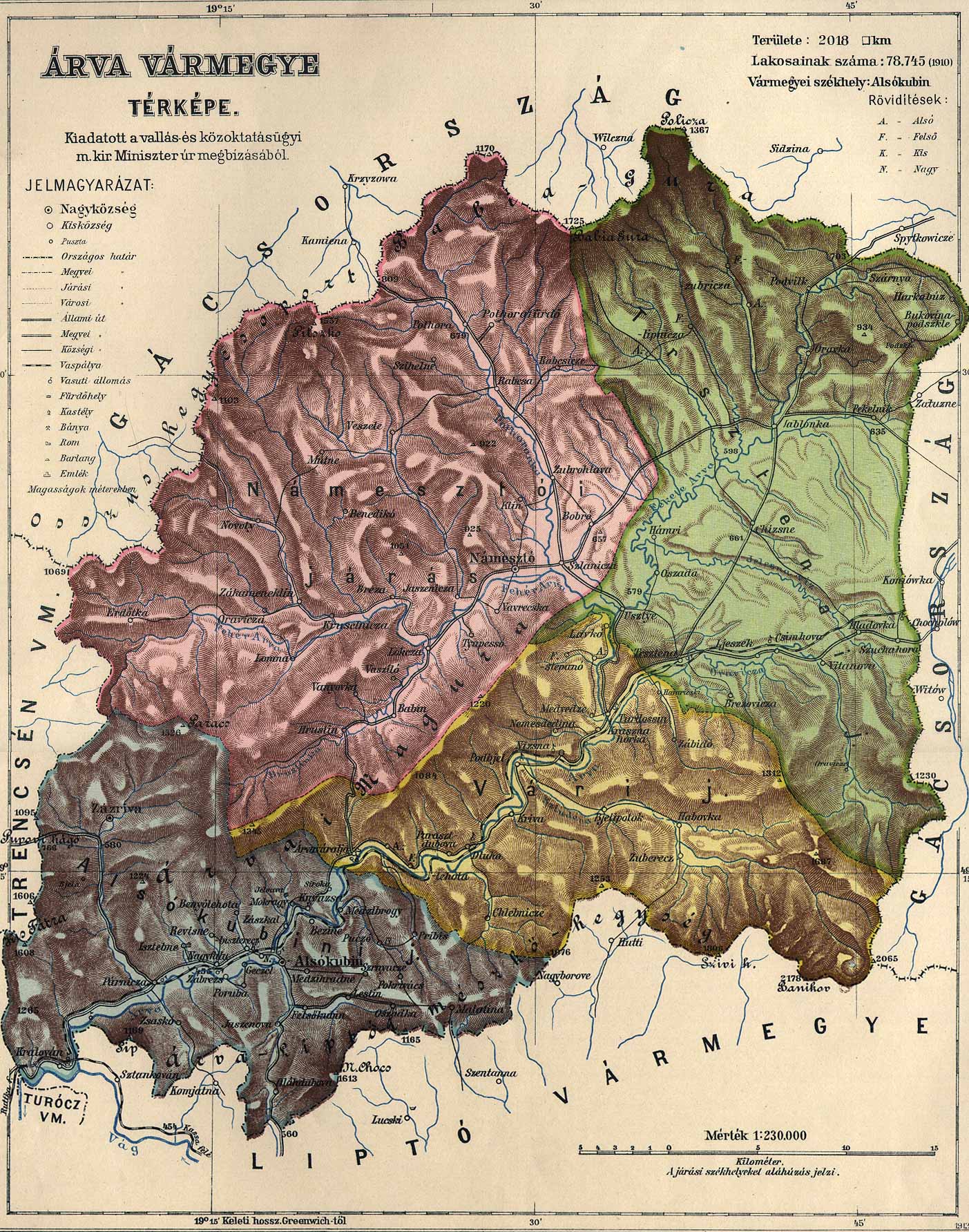
- http://lazarus.elte.hu/hun/maps/1910/arva.jpg [bare URL image file]
- "Orava Reservoir". Tourist Information Center of Orava. Retrieved 9 July 2013.
Hydrography of Slovakia | ||||||||||||
|---|---|---|---|---|---|---|---|---|---|---|---|---|
| Rivers |
|  | ||||||||||
| Lakes |
| |||||||||||
| Reservoirs |
| |||||||||||
| River islands | ||||||||||||
Authority control | |
|---|---|
| General |
|
| National libraries | |
На других языках
[de] Orava-Stausee
Der Orava-Stausee (slowakisch Oravská priehrada, polnisch: Jezioro Orawskie) ist ein Stausee in der nördlichen Slowakei. Er ist mit 35,2 km² das größte Gewässer des Landes. Der Stausee wurde zur Elektrizitätsgewinnung zwischen 1941 und 1953 angelegt, indem die beiden Quellflüsse der Orava (deutsch Arwa) durch einen Damm angestaut wurden, wobei einige ehemalige Ortschaften (Slanica, Osada, Oravské Hámre, Lavkovo und Ústie nad Oravou) überflutet wurden. Der Stausee reicht im Norden bis unmittelbar an die Grenze zu Polen.- [en] Orava (reservoir)
[ru] Орава (водохранилище)
О́рава[2][3], ранее — О́равское водохрани́лище[3] (словацк. Údolná Nádrž Orava) — водохранилище, являющееся частью речной системы Оравы, построено в месте слияния двух рек Чарна-Орава и Бьела-Орава. Расположено в северной части Словакии.Другой контент может иметь иную лицензию. Перед использованием материалов сайта WikiSort.org внимательно изучите правила лицензирования конкретных элементов наполнения сайта.
WikiSort.org - проект по пересортировке и дополнению контента Википедии