geo.wikisort.org - Reservoir
Lake Sebu (Tboli: Lanaw Sbù,[1] /sbuʔ/; Hiligaynon: Linaw sg Sëbu, /səˈbuʔ/; Filipino: Lawa ng Sëbu) is a natural lake located in the municipality of Lake Sebu, South Cotabato within the Alah Valley region.[2] The Philippine government has recognized it as one of the country's most important watersheds.[3] Lake Sebu is one of the many bodies of water supplying important irrigation to the provinces of Sultan Kudarat and South Cotabato.
| Lake Sebu | |
|---|---|
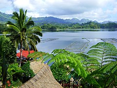
 The lake taken at the Punta Isla Lake Resort | |
 Lake Sebu Location within the Philippines | |
| Location | South Cotabato, Mindanao |
| Coordinates | 6°13′45″N 124°42′21″E |
| Native name | Lanaw Sbù (Tboli) |
| Basin countries | Philippines |
| Surface area | 354 ha (3.54 km2) |
| Max. depth | 34 m (111.55 ft) |
| Surface elevation | 1,000 m (3,280.84 ft) |
| Islands | 11 islets/islands |
The villages around the lake have been turned into an independent municipality called Lake Sebu after being a former village of Surallah.
Ancestral domain
The T'boli and Ubo tribes have been the traditional dwellers of the lake. The Department of Environment and Natural Resources has recognized, through Department Administrative Order (DAO) No. 2, Series of 1993, the claim of these tribes that the lake and its surroundings are under their ancestral domain.[4]
Tourism
The Department of Tourism and the local government unit of Lake Sebu has promoted the lake as one of the prime eco-tourism destinations in the municipality. The Mindanao Development Authority is closely coordinating with the DOT in the development and enhancement of Lake Sebu, as it is also identified as one of the priority sites under the BIMP-EAGA Tourism cluster.[5][6]
Gallery
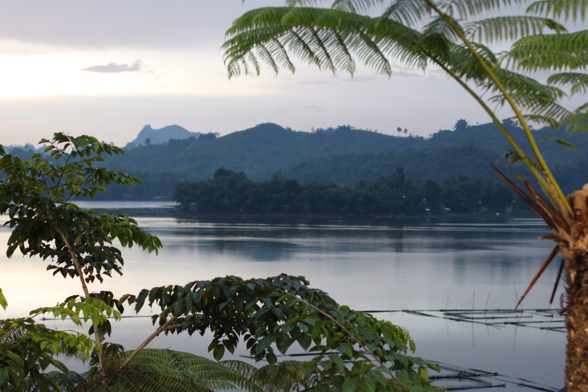
 Lake Sebu, as seen from Punta Isla
 The lake is one of the most important watershed areas in the Philippines
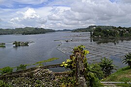 Another view of the lake in South Cotabato.
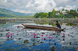 Traditional owong dugout canoes in Lake Sebu
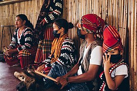 Indigenous people thriving near Lake Sebu


References
- "Tboli Dictionary » Search Results » sbu".
- Bagnol, Raquel C. (2004-08-09). "Postscripts from Lake Sebu". Sunstar. Retrieved 2008-10-10.
- Estabillo, Allen V. (2008-09-26). "SouthCot moves to save Lake Sebu". MindaNews. Archived from the original on 2010-04-13. Retrieved 2008-10-10.
- Logong, Datu Ontog. "Experiences and Challenges of the Indigenous People in Co-managing Forest Resources: The Lake Sebu Ancestral Domain Community Association". FAO. Retrieved 2008-10-10.
- "SunStar: DOT pushes eco-tourism projects in Lake Sebu". GMA 7. 2007-06-03. Retrieved 2008-10-10.
- "DOT pushes eco-tourism projects in Lake Sebu". Sunstar. 2007-06-03. Retrieved 2008-10-10.
External links
| Wikimedia Commons has media related to Lake Sebu. |
 Geographic data related to Lake Sebu at OpenStreetMap
- LakeSebu.com
- Lake Sebu Guide
| Major | |
|---|---|
| Minor |
|
| Artificial | |
This article about a location in the Philippines is a stub. You can help Wikipedia by expanding it. |
На других языках
[de] Sebu-See
Der Sebu-See (engl.: Lake Sebu) ist ein Binnensee auf der Insel Mindanao in den Philippinen. Er liegt ca. 53 km südöstlich der Gemeinde Rajah Buayan in der Provinz South Cotabato auf dem Gebiet der Gemeinde Lake Sebu. Der See bedeckt eine Fläche von 3,50 km² auf dem zerklüfteten Tiruray-Plateau, das am Fuße des bis zu 2.083 Meter hohen Daguma-Gebirges liegt. In dem bis zu 45 Meter tiefen See liegen die zwei kleineren Inseln Tugayo und Rom’s.- [en] Lake Sebu
[es] Lago Sebú
El lago Sebú (en Tboli, Lanaw Sbù,[1] [sbuʔ]; en hiligueino, Linaw sg Sëbû, [səˈbuʔ]; en filipino, Lawà ng Sëbû; en inglés, Lake Sebu) es un lago natural ubicado en la localidad filipina de Sebú, en la provincia de Cotabato del Sur. El lago se ha reconocido por el gobierno filipino como una de las cuencas hidrográficas más importantes del país.[2]Другой контент может иметь иную лицензию. Перед использованием материалов сайта WikiSort.org внимательно изучите правила лицензирования конкретных элементов наполнения сайта.
WikiSort.org - проект по пересортировке и дополнению контента Википедии