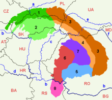
geo.wikisort.org - Mountains
Serbian Carpathians (Serbian: Српски Карпати / Srpski Karpati) is a mountain range in eastern Central Serbia, located in Central Europe. It presents an extension of proper Carpathian Mountains across the Danube, connecting them with the Balkan Mountains in the southeast. They stretch in north-south direction in eastern Serbia, east of the Great Morava valley and west of the White Timok Valley and north of the Nišava Valley. The mountains are 800–1500 m high, and dominated by karst limestone geologic features, the highest one being Rtanj Mountain (1,565 m).
Definitions
Under the strict definition (as defined by the Serbian Academy of Sciences and Arts and adopted by the Carpathian Convention), Serbian part of the Carpathian Mountains covers only 732 km², or less than 1% of the total Carpathian area. That part encompasses the southern bank of the Iron Gate and the area of Đerdap National Park. The extreme points of so defined Carpathian area in Serbia are Tekija 44°43′N 22°28′E in the north, 44°22′N 22°06′E in the south, Golubac 44°40′N 21°36′E in the west and 44°39′N 22°33′E in the east (Iron Gate dam). It covers northern rims of northern Kučaj, Šomrda, Liskovac, Veliki Greben and Miroč mountains, in municipalities of Golubac, Majdanpek and Kladovo[1]
However, in Serbian geography, the epithet "Carpathian" is traditionally also given to the whole northern part of the Carpatho-Balkan arc, which connects the Carpathians proper with the Balkan Mountains. It refers to the following mountains:[1]

- Šomrda
- Liškovac
- Veliki Greben
- Miroč
- Homolje Mountains
- Veliki Krš
- Mali Krš
- Stol
- Deli Jovan
- Beljanica
- Kučaj Mountains
- Rtanj
- Tupižnica
- Devica
- Ozren
There are incentives to incorporate the whole wider Serbian Carpathian region into the framework of the Carpathian Convention.[1] Serbia ratified the Convention in November 2007.[2]
Geology
The entire part of Serbia east of the Great and South Morava rivers is referred to as "Carpatho-Balkan arc" in geotectonic terminology. The region is composed of rocks of Proterozoic to Quaternary age. Limestones and dolomites (in a lesser extent) of Jurassic (J2, J3) and Lower Cretaceous (K1+2, K3+4) age whose thickness can be more than 1,000 m. The structures are generally oriented in north-south direction, which bend on northern and southern parts, forming a C-shaped arc.[3]
Though those mountains are related to the Carpathians from the geological point of view, they have been included to them by the scientists only at the end of the 20th century. In the past, those mountains were included by mistake to the Balkan mountains.[citation needed]
Demographics
Eastern Serbia is one of the most sparsely populated areas of the Balkans. A large portion of the population is engaged in nomadic sheep-breeding. The population is mixed of Serbs and Vlachs. It is underdeveloped, with sparse infrastructure and long distances between towns.[4] The region is subject to further depopulation: between censuses of 1991 and 2002, municipalities of Bor and Majdanpek lost 3,500 residents each, Negotin lost 5,500, Zaječar lost 5,000, and Knjaževac 6,500.[5]
See also
References
- Upitnik za procenu nacionalne politike, legalnih i i institucionalnih okvira koji se odnose na Karpatsku konvenciju (PDF) (in Serbian), EURAC, 2006-09-11, retrieved 2010-08-27[permanent dead link]
- Zakon o potvrđivanju Okvirne konvencije o zaštiti i održivom razvoju Karpata, National Assembly of Serbia, archived from the original on 2010-08-03
- Milena Zlokolica-Mandić, Structural-Tectonic Elements as a Factor in Cave Development, SANU, archived from the original on 2011-07-27, retrieved 2010-11-03
- Lazarev kanjon, National Geographic serbia, 2007-08-01, archived from the original on 2008-03-15
- Branislav Radivojša (2002-08-01), Naselja U Srbiji - Rezultati Popisa (2), Politika
External links
Divisions, Groups, and Ranges of the Carpathian Mountains | ||||||
|---|---|---|---|---|---|---|
| Western Carpathians |
|  | ||||
| Eastern Carpathians |
| |||||
| Southern Carpathians | ||||||
| Western Romanian Carpathians | ||||||
| Serbian Carpathians | ||||||
| Adjacent regions |
| |||||
| Grouping by country |
| |||||
Authority control | |
|---|---|
| General |
|
| National libraries | |
На других языках
[de] Serbische Karpaten
Die Serbischen Karpaten (serbisch-kyrillisch Српски Карпати, Srpski Karpati; veraltet auch Serbisches Erzgebirge) sind ein Gebirge im östlichen Serbien und der südlichste Teil des Karpatenbogens.- [en] Serbian Carpathians
[fr] Carpates serbes
Les Carpates serbes (en serbe : Karpatske planine) sont, avec les monts du Banat, parfois considérées comme constituant la partie méridionale des Carpates[réf. nécessaire].[it] Carpazi Serbi
I Carpazi Serbi (in serbo Karpatske planine) sono una parte della catena montuosa dei Carpazi e, precisamente, quella collocata in Serbia.[ru] Восточно-Сербские горы
Восточно-Сербские горы (Сербские Карпаты) — низко- и средневысотный (до 1500 м) горный массив на востоке Сербии, представляет собой часть Карпато-Балканской горной дуги - юго-западные отроги Карпат и крайнюю западную оконечность Западной Стара-Планины, расположенной в основном на болгарской территории.Другой контент может иметь иную лицензию. Перед использованием материалов сайта WikiSort.org внимательно изучите правила лицензирования конкретных элементов наполнения сайта.
WikiSort.org - проект по пересортировке и дополнению контента Википедии