geo.wikisort.org - Mountains
Rushan Range is a mountain range in south-western Pamir in Tajikistan, trending in the south-westerly direction from Sarez Lake toward Khorog, between Gunt River to the south and Bartang River to the north. About 120 km long, it reaches its highest elevation of 6,083 m at Patkhor Peak.[1]
| Rushan Range Рушанский хребет | |
|---|---|
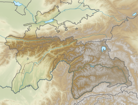  Location in Tajikistan | |
| Highest point | |
| Peak | Patkhor Peak |
| Elevation | 6,083 m (19,957 ft) |
| Coordinates | 37°54′0″N 72°10′0″E |
| Dimensions | |
| Length | 120 km (75 mi) NE/SW |
| Width | 35 km (22 mi) NW/SE |
| Geography | |
| Country | Tajikistan |
| Parent range | Pamir Mountains |
| Geology | |
| Age of rock | Paleozoic |
| Type of rock | Granite, schist, quartzite, sandstone, limestone and gneiss |
See also
- List of mountains in Tajikistan
References
 Gorno-Badakhshan Autonomous Region Gorno-Badakhshan Autonomous Region  | ||
|---|---|---|
Capital: Khorugh | ||
| Districts |
|  |
| Main cities and towns |
| |
| Geography | ||
| Rivers | ||
 | This Tajikistan location article is a stub. You can help Wikipedia by expanding it. |
На других языках
[de] Ruschankette
Die Ruschankette (russisch Руша́нский хребе́т) ist ein Gebirgszug im westlichen Pamir in Tadschikistan.- [en] Rushan Range
[fr] Chaînon Rushan
Le chaînon Rushan est un massif montagneux situé au Tadjikistan, dans le Pamir. Il culmine à 6 083 mètres d'altitude au pic Patkhor.[ru] Рушанский хребет
Руша́нский хребе́т — горный хребет на западе Памира, в Таджикистане, между реками Гунт и Бартанг. На востоке сочленяется с Северо-Аличурским хребтом.Текст в блоке "Читать" взят с сайта "Википедия" и доступен по лицензии Creative Commons Attribution-ShareAlike; в отдельных случаях могут действовать дополнительные условия.
Другой контент может иметь иную лицензию. Перед использованием материалов сайта WikiSort.org внимательно изучите правила лицензирования конкретных элементов наполнения сайта.
Другой контент может иметь иную лицензию. Перед использованием материалов сайта WikiSort.org внимательно изучите правила лицензирования конкретных элементов наполнения сайта.
2019-2026
WikiSort.org - проект по пересортировке и дополнению контента Википедии
WikiSort.org - проект по пересортировке и дополнению контента Википедии