geo.wikisort.org - Mountains
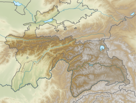
Ishkoshim Range, also Ishkashim Range (Russian: Ишкашимский хребет), is a mountain range in Pamir Mountains in Tajikistan, in the extreme southwest corner of the Gorno-Badakhshan Autonomous Province (Ishkoshim District).
| Ishkoshim Range Ишкашимский хребет | |
|---|---|
 Location in Tajikistan | |
| Highest point | |
| Peak | Mayakovsky Peak |
| Elevation | 6,096 m (20,000 ft) |
| Coordinates | 37°0′N 71°40′E |
| Geography | |
| Country | Tajikistan |
| Parent range | Pamir Mountains |
| Geology | |
| Age of rock | Paleozoic |
| Type of rock | sedimentary and metamorphic rocks |
The range is about 90 km long, running along the right bank of the Panj River and the eastern border of Ishkoshim District with Roshtqal'a District. It contains the Ishkashim Important Bird Area. The mountains rise in the south to a maximum altitude of 6,096 m at Mayakovsky Peak, located at the junction of Ishkoshim Range with the east–west Shakhdara Range. There is an abundance of hot springs in these mountains, including the Gharm-Chashma thermal spa.[1]
References
- Ишкашимский хребет in the Great Soviet Encyclopedia, 1969–1978 (in Russian)
External links
На других языках
[de] Ischkaschimkette
Die Ischkaschimkette (russisch Ишкашимский хребет) ist ein Teilgebirge im Südwesten der Schachdarakette in Tadschikistan.- [en] Ishkoshim Range
[ru] Ишкашимский хребет
Ишкаши́мский хребе́т — горный хребет в юго-западной части Памира, западная часть Шахдаринского хребта. Административно расположен на территории Горно-Бадахшанской автономной области Таджикистана.Текст в блоке "Читать" взят с сайта "Википедия" и доступен по лицензии Creative Commons Attribution-ShareAlike; в отдельных случаях могут действовать дополнительные условия.
Другой контент может иметь иную лицензию. Перед использованием материалов сайта WikiSort.org внимательно изучите правила лицензирования конкретных элементов наполнения сайта.
Другой контент может иметь иную лицензию. Перед использованием материалов сайта WikiSort.org внимательно изучите правила лицензирования конкретных элементов наполнения сайта.
2019-2025
WikiSort.org - проект по пересортировке и дополнению контента Википедии
WikiSort.org - проект по пересортировке и дополнению контента Википедии
