geo.wikisort.org - Mountains
Karl Marx Peak (Russian: Пик Карла Маркса; Tajik: Қуллаи Карл Маркс) rises to 6,723 m (22,057 ft) in the Shakhdara Range in Pamir Mountains, in the south-west of Tajikistan's Gorno-Badakhshan Autonomous Province (eastern part of Ishkoshim district), just north of the Panj River and the Afghanistan border.[2][3][4] It was named after the German philosopher Karl Marx whose theories were the basis of communism and socialism. The highest summit in the Shakhdara Range, it was discovered and named in 1937 by Soviet geologist and explorer of South-West Pamir Sergey Klunnikov.[5] The ascent was delayed by the outbreak of World War II, and Karl Marx Peak was first climbed in 1946 by a group of Soviet alpinists led by Evgeniy Beletskiy.[6]
| Karl Marx Peak | |
|---|---|
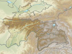 Karl Marx Peak Location in Tajikistan | |
| Highest point | |
| Elevation | 6,723 m (22,057 ft)[1] |
| Prominence | 2,693 m (8,835 ft)[1] |
| Listing | Ultra |
| Coordinates | 37°09′45″N 72°28′54″E[1] |
| Geography | |
| Location | GBAO, Tajikistan |
| Parent range | Shakhdara Range (Pamirs) |
| Climbing | |
| First ascent | 1946 by Evgeniy Beletskiy et al. |
References
- "The Central Asian Republics - Ultra Prominence Page" Peaklist.org. Listed as "Pik Karla Marksa". Retrieved 2011-12-11.
- Big Soviet Encyclopedia, on-line edition (in Russian).
- "Pik Karl Marx" in Encarta World Atlas. Archived June 29, 2006, at the Wayback Machine
- "Pik Karl Marx, Tajikistan" Peakbagger.com. Retrieved 2011-12-11.
- Discovery of Karl Marx Peak (in Russian).
- First ascent (in Russian).
External links
- "Karl Marx Peak". Peakware.com. Archived from the original on 2016-03-04.
Capital: Khorugh | ||
| Districts |
|  |
| Main cities and towns |
| |
| Geography | ||
| Rivers | ||
This Tajikistan location article is a stub. You can help Wikipedia by expanding it. |
На других языках
[de] Pik Karl Marx
Der Pik Karl Marx ist ein Berg im zentralasiatischen Hochgebirge Pamir.- [en] Karl Marx Peak
[es] Pico Karl Marx
El pico Karl Marx (en tayiko Қуллаи К. Маркс) se eleva a 6.726 msnm en la cordillera de Pamir, al suroccidente de la Provincia Autónoma de Alto Badajshán de Tayikistán, cerca del río Panj en la frontera con Afganistán.[1][2] Fue descubierto y bautizado es 1937 por el geólogo y explorador Sergey Klunnikov.[3] El ascenso se pospuso debido a la Segunda Guerra Mundial. El pico Karl Marx fue escalado en 1946, por un grupo de montañistas rusos dirigidos por Evgeniy Beletskiy.[4][fr] Pic Karl Marx
Le pic Karl Marx est un sommet du Tadjikistan s'élevant à 6 726 mètres[1] d'altitude dans le chaînon Shakhdara, dont il constitue le point culminant, dans le Pamir. Il se situe dans la province autonome du Haut-Badakhchan, à la limite des districts d'Ishkashim et de Roshtkala, juste au nord du Piandj et de la frontière avec l'Afghanistan[2].[ru] Пик Карла Маркса
Пик Ка́рла Ма́ркса, Пик Ма́ркса (тадж. Қуллаи Карл Маркс) — высшая точка Шахдаринского хребта, расположенного на юго-западе Памира в Таджикистане (6726 м). Общая площадь ледников, расположенных на вершине, составляет 120 км². Первое восхождение на вершину пика было совершено советскими альпинистами в 1946 году (Е. Белецкий, Е. Абалаков, А. Багров, Е. Иванов, П. Семёнов, А. Сидоренко и А. Угаров)[2].Другой контент может иметь иную лицензию. Перед использованием материалов сайта WikiSort.org внимательно изучите правила лицензирования конкретных элементов наполнения сайта.
WikiSort.org - проект по пересортировке и дополнению контента Википедии