geo.wikisort.org - Mountains
Radohima (Albanian: Maja e Radohimës) is a mountain within the Albanian Alps in northern Albania.
| Radohima | |
|---|---|
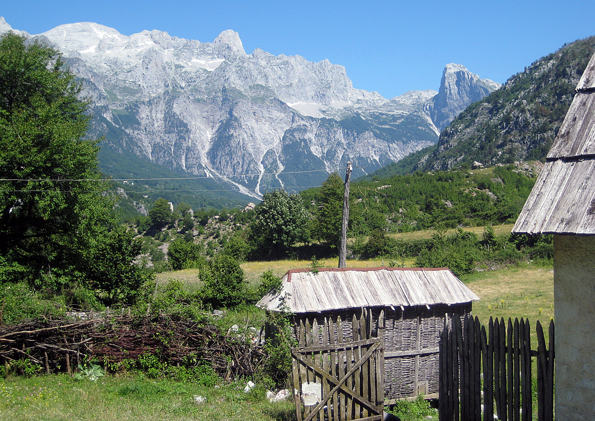 Radohima seen from Theth | |
| Highest point | |
| Elevation | 2,568 m (8,425 ft)[1][2] |
| Listing | Ultra |
| Coordinates | 42°25′38″N 19°43′33″E |
| Geography | |
 Radohima Kukës, Albania | |
| Parent range | Albanian Alps |
| Geology | |
| Age of rock | Triassic |
| Mountain type | Limestone |
 | |
Radohima rises between the Shala and Cem Valley. The massif of the Radohima has several other peaks with Maja e Radohimës at 2,568 metres (8,425 ft) being the highest peak of the massif. To the east, the mountain drops steeply over 1,500 metres into the valley of River Shala. The other peaks of the Radohima massif include Maja Tat 2,543 metres (8,343 ft), Maja Visens 2,517 metres (8,258 ft), Maja Reshkullit 2,496 metres (8,189 ft), and Maja Kuc 2,496 metres (8,189 ft).[3]
 |
 |
 |
See also
| Wikimedia Commons has media related to Radohima. |
- Albanian Alps
- Theth National Park
- Geography of Albania
- Mountains of Albania
References
- "ALBANIAN ALPS GEOTOPES" (PDF). lib.icimod.org. p. 8.
- "TREGUES SIPAS QARQEVE INDICATORS BY PREFECTURES" (PDF). Archived from the original (PDF) on 2011-07-24. Retrieved 2011-01-12.
- "Maja Radohines". summitpost.org.
На других языках
[de] Radohima
Die Radohima (albanisch Maja e Radohimës) ist ein Berg in den Albanischen Alpen im Norden Albaniens. Mit einer Höhe von 2568,3 m ü. A.[1][Anmerkung 1] zählt sie zu den höchsten Bergen Albaniens hinter dem Korab (2764 m ü. A.) und Nebengipfeln, der nahegelegenen Jezerca (2694 m ü. A.) mit Nebengipfel und dem Poplluk (2578 m ü. A.), ebenfalls im Jezerca-Massiv. Die Radohima ist Teil des eindrücklichen Bergpanoramas von Theth und liegt im Nationalpark Theth.- [en] Radohima
[es] Radohima
Radohima (en albanés: Maja e Radohimës) es un macizo montañoso dentro de los montes Prokletije en el norte de Albania.[fr] Maja e Radohimës
Le Maja e Radohimës est un sommet du Nord de l'Albanie situé dans le massif du Prokletije, ce dernier constituant une partie des Alpes dinariques. Il culmine à 2 570 mètres d'altitude.Текст в блоке "Читать" взят с сайта "Википедия" и доступен по лицензии Creative Commons Attribution-ShareAlike; в отдельных случаях могут действовать дополнительные условия.
Другой контент может иметь иную лицензию. Перед использованием материалов сайта WikiSort.org внимательно изучите правила лицензирования конкретных элементов наполнения сайта.
Другой контент может иметь иную лицензию. Перед использованием материалов сайта WikiSort.org внимательно изучите правила лицензирования конкретных элементов наполнения сайта.
2019-2026
WikiSort.org - проект по пересортировке и дополнению контента Википедии
WikiSort.org - проект по пересортировке и дополнению контента Википедии