geo.wikisort.org - Mountains
This article comprises four sortable tables of mountain summits of Central America that are the higher than any other point north or south of their latitude or east or west their longitude in the region.
The summit of a mountain or hill may be measured in three principal ways:
- The topographic elevation of a summit measures the height of the summit above a geodetic sea level.[1]
- The topographic prominence of a summit is a measure of how high the summit rises above its surroundings.[2][3][1]
- The topographic isolation (or radius of dominance) of a summit measures how far the summit lies from its nearest point of equal elevation.[4]
Northernmost high summits
| Rank | Mountain Peak | Country | Mountain range | Elevation | Prominence | Isolation | Location |
|---|---|---|---|---|---|---|---|
| 5 | Doyle's Delight[5][lower-alpha 1][lower-alpha 2] | Yucatán Peninsula | 1174 m 3,852 ft | 500 m 1,640 ft | 138.3 km 85.9 mi |
16.4941°N 89.0456°W | |
| 4 | Pico Bonito[6][lower-alpha 3] | Cordillera Nombre de Dios | 2450 m 8,038 ft | 1710 m 5,610 ft | 151 km 93.8 mi |
15.5575°N 86.8756°W | |
| 3 | Alto Cuchumatanes[7][lower-alpha 4] | Huehuetenango | 3837 m 12,589 ft | 1877 m 6,158 ft | 65.2 km 40.5 mi |
15.5182°N 91.5445°W | |
| 2 | Volcán Tacaná[8][9][lower-alpha 5] | Sierra de Istatan | 4067 m 13,343 ft | 1037 m 3,402 ft | 24.1 km 14.99 mi |
15.1323°N 92.1084°W | |
| 1 | Volcán Tajumulco[10][lower-alpha 6][lower-alpha 7] | Sierra de las Nubes | 4220 m 13,845 ft | 3990 m 13,091 ft | 722 km 448 mi |
15.0430°N 91.9037°W |
Southernmost high summits
| Rank | Mountain Peak | Country | Mountain range | Elevation | Prominence | Isolation | Location |
|---|---|---|---|---|---|---|---|
| 6 | Cerro Hoya[11][lower-alpha 8] | Azuero Peninsula | 1559 m 5,115 ft | 500 m 1,640 ft | 135.7 km 84.3 mi |
7.3179°N 80.6810°W | |
| 5 | Cerro Tacarcuna[12][lower-alpha 9] | Darién | 1875 m 6,152 ft | 1770 m 5,807 ft | 174.4 km 108.3 mi |
8.1659°N 77.2959°W | |
| 4 | Volcán Barú[13][lower-alpha 10][lower-alpha 11] | Chiriquí | 3474 m 11,398 ft | 1324 m 4,344 ft | 74.2 km 46.1 mi |
8.8088°N 82.5427°W | |
| 3 | Chirripó Grande[14][lower-alpha 12][lower-alpha 13] (Cerro Chirripó) |
Cordillera de Talamanca | 3819 m 12,530 ft | 3755 m 12,320 ft | 878 km 546 mi |
9.4843°N 83.4889°W | |
| 2 | Volcán Acatenango[15][lower-alpha 14] | Chimaltenango | 3975 m 13,041 ft | 1835 m 6,020 ft | 125.9 km 78.2 mi |
14.5016°N 90.8755°W | |
| 1 | Volcán Tajumulco[10][lower-alpha 6][lower-alpha 7] | Sierra de las Nubes | 4220 m 13,845 ft | 3990 m 13,091 ft | 722 km 448 mi |
15.0430°N 91.9037°W |
Easternmost high summits
| Rank | Mountain Peak | Country | Mountain range | Elevation | Prominence | Isolation | Location |
|---|---|---|---|---|---|---|---|
| 5 | Cerro Tacarcuna[12][lower-alpha 9] | Darién | 1875 m 6,152 ft | 1770 m 5,807 ft | 174.4 km 108.3 mi |
8.1659°N 77.2959°W | |
| 4 | Volcán Barú[13][lower-alpha 10][lower-alpha 11] | Chiriquí | 3474 m 11,398 ft | 1324 m 4,344 ft | 74.2 km 46.1 mi |
8.8088°N 82.5427°W | |
| 3 | Chirripó Grande[14][lower-alpha 12][lower-alpha 13] (Cerro Chirripó) |
Cordillera de Talamanca | 3819 m 12,530 ft | 3755 m 12,320 ft | 878 km 546 mi |
9.4843°N 83.4889°W | |
| 2 | Volcán Acatenango[15][lower-alpha 14] | Chimaltenango | 3975 m 13,041 ft | 1835 m 6,020 ft | 125.9 km 78.2 mi |
14.5016°N 90.8755°W | |
| 1 | Volcán Tajumulco[10][lower-alpha 6][lower-alpha 7] | Sierra de las Nubes | 4220 m 13,845 ft | 3990 m 13,091 ft | 722 km 448 mi |
15.0430°N 91.9037°W |
Westernmost high summits
Volcán Tacaná and Volcán Tajumulco are the two highest summits of Central America.
| Rank | Mountain Peak | Country | Mountain range | Elevation | Prominence | Isolation | Location |
|---|---|---|---|---|---|---|---|
| 2 | Volcán Tacaná[8][9][lower-alpha 5] | Sierra de Istatan | 4067 m 13,343 ft | 1037 m 3,402 ft | 24.1 km 14.99 mi |
15.1323°N 92.1084°W | |
| 1 | Volcán Tajumulco[10][lower-alpha 6][lower-alpha 7] | Sierra de las Nubes | 4220 m 13,845 ft | 3990 m 13,091 ft | 722 km 448 mi |
15.0430°N 91.9037°W |
Gallery
 Volcán Tajumulco is the highest summit of Guatemala and all of Central America.
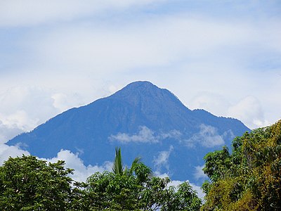 Volcán Tacaná on the border between Guatemala and México is the second highest major summit of Central America.


See also
- List of mountain peaks of North America
- List of mountain peaks of Greenland
- List of mountain peaks of Canada
- List of mountain peaks of the Rocky Mountains
- List of mountain peaks of the United States
- List of mountain peaks of México
- List of mountain peaks of Central America
- List of the ultra-prominent summits of Central America
- List of extreme summits of Central America
- List of mountain peaks of the Caribbean
- Central America
- Geography of Central America
- Geology of Central America
- Category:Mountains of Central America
- Physical geography
- Topography
- Topographic elevation
- Topographic prominence
- Topographic isolation
- Topography
Notes
- The summit of Doyle's Delight is the highest point of Belize and the Yucatán Peninsula.
- Doyle's Delight is the northernmost 1000-meter (3281-foot) summit of Central America.
- Pico Bonito is the northernmost 2000-meter (6562-foot) summit of Central America.
- Alto Cuchumatanes is the northernmost 3000-meter (9843-foot) summit of Central America.
- Volcán Tacaná on the international border with Guatemala is the highest point of Estado Libre y Soberano de Chiapas.
- The summit of Volcán Tajumulco is the highest point of the Sierra de las Nubes, the Republic of Guatemala, and all of Central America.
- Volcán Tajumulco is the southernmost and easternmost 4000-meter (13,123-foot) summit of greater North America.
- Cerro Hoya is the southernmost 1000-meter (3281-foot) summit of Central America and greater North America.
- Cerro Tacarcuna is the southernmost ultra-prominent summit of Central America and greater North America.
- The summit of Volcán Barú is the highest point of the Republic of Panama.
- Volcán Barú is the southernmost 3000-meter (9843-foot) summit of Central America and greater North America.
- The summit of Chirripó Grande is the highest point of the Republic of Costa Rica.
- Chirripó Grande is the southernmost and easternmost summit of its elevation in Central America and greater North America.
- Volcán Acatenango is the southernmost and easternmost summit of its elevation in Central America and greater North America.
References
- If the elevation or prominence of a summit is calculated as a range of values, the arithmetic mean is shown.
- The topographic prominence of a summit is the topographic elevation difference between the summit and its highest or key col to a higher summit. The summit may be near its key col or quite far away. The key col for Denali in Alaska is the Isthmus of Rivas in Nicaragua, 7642 kilometers (4749 miles) away.
- This article defines a significant summit as a summit with at least 100 meters (328.1 feet) of topographic prominence, and a major summit as a summit with at least 500 meters (1640 feet) of topographic prominence. All summits in this article have at least 500 meters of topographic prominence. An ultra-prominent summit is a summit with at least 1500 meters (4921 feet) of topographic prominence.
- The topographic isolation of a summit is the great-circle distance to its nearest point of equal elevation.
- "Doyle's Delight". Peakbagger.com. Retrieved 5 May 2016.
- "Pico Bonito". Peakbagger.com. Retrieved 5 May 2016.
- "Alto Cuchumatanes". Peakbagger.com. Retrieved 5 May 2016.
- "Volcán Tacaná". Peakbagger.com. Retrieved 5 May 2016.
- "Volcán Tacaná". Bivouac.com. Retrieved 5 May 2016.
- "Volcán Tajumulco". Peakbagger.com. Retrieved 5 May 2016.
- "Cerro Hoya". Peakbagger.com. Retrieved 5 May 2016.
- "Cerro Tacarcuna". Peakbagger.com. Retrieved 5 May 2016.
- "Volcán Barú". Peakbagger.com. Retrieved 5 May 2016.
- "Chirripó Grande". Peakbagger.com. Retrieved 5 May 2016.
- "Volcán Acatenango". Peakbagger.com. Retrieved 5 May 2016.
External links
Central America | ||
|---|---|---|
| Sovereign states |
| |
Текст в блоке "Читать" взят с сайта "Википедия" и доступен по лицензии Creative Commons Attribution-ShareAlike; в отдельных случаях могут действовать дополнительные условия.
Другой контент может иметь иную лицензию. Перед использованием материалов сайта WikiSort.org внимательно изучите правила лицензирования конкретных элементов наполнения сайта.
Другой контент может иметь иную лицензию. Перед использованием материалов сайта WikiSort.org внимательно изучите правила лицензирования конкретных элементов наполнения сайта.
2019-2025
WikiSort.org - проект по пересортировке и дополнению контента Википедии
WikiSort.org - проект по пересортировке и дополнению контента Википедии