geo.wikisort.org - Mountains
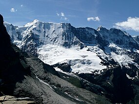
The Ebnefluh, also known as the Äbeni Flue and the Ebenefluh, (3,962 m) is a mountain of the Bernese Alps, located on the border between the Swiss cantons of Bern and Valais. It lies towards the eastern end of the Lauterbrunnen Wall.
| Ebnefluh | |
|---|---|
 The Ebnefluh (left-centre) from the north | |
| Highest point | |
| Elevation | 3,962 m (12,999 ft) |
| Prominence | 198 m (650 ft)[1] |
| Parent peak | Gletscherhorn |
| Isolation | 1.2 km (0.75 mi) |
| Coordinates | 46°30′29″N 7°57′11″E |
| Geography | |
| Location | Bern/Valais, Switzerland |
| Parent range | Bernese Alps |
| Climbing | |
| Easiest route | From Hollandia Hut |
References
- Retrieved from the Swisstopo topographic maps. The key col is the Gletscherjoch (3,764 m).
External links
| Wikimedia Commons has media related to Ebnefluh. |
На других языках
[de] Äbeni Flue
Die Äbeni Flue (auch Ebnefluh) ist ein 3961 m ü. M. hoher Berg in den Berner Alpen. Über seinen Gipfel verläuft die Grenze zwischen den Schweizer Kantonen Bern und Wallis.- [en] Ebnefluh
[fr] Äbeni Flue
L'Äbeni Flue, aussi appelé Ebnefluh et Ebenefluh, est un sommet des Alpes bernoises. Situé à la frontière des cantons du Valais et de Berne, il culmine à 3 961 mètres d'altitude.[it] Äbeni Flue
L'Äbeni Flue (3962 m s.l.m. - detto anche Ebnefluh e Ebenefluh) è una montagna delle Alpi Bernesi che si trova lungo la linea di confine tra gli svizzeri Canton Berna e Canton Vallese.Текст в блоке "Читать" взят с сайта "Википедия" и доступен по лицензии Creative Commons Attribution-ShareAlike; в отдельных случаях могут действовать дополнительные условия.
Другой контент может иметь иную лицензию. Перед использованием материалов сайта WikiSort.org внимательно изучите правила лицензирования конкретных элементов наполнения сайта.
Другой контент может иметь иную лицензию. Перед использованием материалов сайта WikiSort.org внимательно изучите правила лицензирования конкретных элементов наполнения сайта.
2019-2025
WikiSort.org - проект по пересортировке и дополнению контента Википедии
WikiSort.org - проект по пересортировке и дополнению контента Википедии
